Mount Davidson: San Francisco's Summit
Discover panoramic views and a tranquil escape at San Francisco's highest natural point, where history and nature intertwine amidst eucalyptus forests and iconic landmarks.
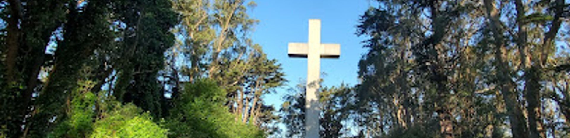
Mount Davidson, the highest natural point in San Francisco, offers a unique blend of urban escape and historical intrigue. Rising 928 feet above sea level, this hilltop park provides panoramic views of the city, the bay, and beyond. Explore winding trails through eucalyptus forests, discover hidden staircases, and visit the iconic 103-foot Mount Davidson Cross, a landmark with a rich and sometimes controversial past. Whether you're seeking a peaceful hike, a stunning vista, or a glimpse into San Francisco's history, Mount Davidson promises a memorable experience. The park's diverse flora and fauna, coupled with its central location, make it a convenient and rewarding destination for both locals and tourists alike. Don't miss the opportunity to stand atop San Francisco and soak in the beauty of this urban oasis.
A brief summary to Mt. Davidson
- Myra Way, San Francisco, Sherwood Forest, California, 94127, US
- +1415-831-6331
- Visit website
- Monday 5 am-12 am
- Tuesday 5 am-12 am
- Wednesday 5 am-12 am
- Thursday 5 am-12 am
- Friday 5 am-12 am
- Saturday 5 am-12 am
- Sunday 5 am-12 am
Local tips
- Dress in layers, as the weather on Mount Davidson can change rapidly, especially due to fog.
- Explore the various trails beyond the main fire road for a more secluded and immersive experience.
- Visit during sunrise or sunset for breathtaking views of the city and the bay.
- Take public transportation (Muni 36) to avoid parking hassles, especially on weekends.
- Look for the bronze plaque at the base of the cross, commemorating the victims of the Armenian Genocide.
Getting There
-
Public Transport
From Forest Hill Station, a major Muni Metro hub, take the 36 Teresita bus towards Chavez & Valencia. Get off at the Dalewood/Myra Way stop. The trailhead is directly adjacent to the bus stop. The Muni fare is approximately $2.50 per ride, payable with a Clipper card or the MuniMobile app.
-
Walking
From the intersection of Portola Drive and O'Shaughnessy Boulevard, walk south on Dalewood Way for approximately 0.3 miles. The trailhead will be on your left, near the intersection of Dalewood Way, Myra Way, and Lansdale Avenue. This is a moderately uphill walk.
-
Taxi/Ride-Share
A taxi or ride-share from West Portal Station to the intersection of Dalewood Way and Myra Way will cost approximately $10-$15, depending on traffic and demand. From there, it's a short walk to the trailhead.
-
Driving
Driving directly to Mt. Davidson is possible, but parking is limited to street parking on the surrounding residential streets (e.g., Dalewood Way, Myra Way). Be mindful of street cleaning schedules to avoid tickets. There are no parking fees. Check posted signs for restrictions. Closest parking is located at 450 Myra Way SF.


