Background

Twin Peaks: San Francisco's Panoramic Vista

Experience San Francisco's most breathtaking panoramic views from Twin Peaks, offering iconic sights of the city, bay, and beyond.

★★★★★4.7 (13025)

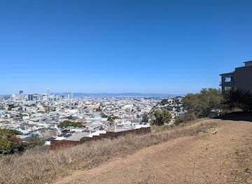
Twin Peaks, rising 925 feet above San Francisco, offer unparalleled 360-degree views of the city, bay, and ocean. A must-see for tourists and locals alike, these iconic hills provide a stunning perspective of the Golden Gate Bridge, Alcatraz, and the sprawling cityscape.

Plan your visit

A brief summary to Twin Peaks

Opening times, essentials, and a few local tips gathered into one calmer, easier-to-scan planning section.

Plan your visit

📍
501 Twin Peaks Blvd, San Francisco, Twin Peaks, California, 94114, US
Monday
5 am-12 am
Tuesday
5 am-12 am
Wednesday
5 am-12 am
Thursday
5 am-12 am
Friday
5 am-12 am
Saturday
5 am-12 am
Sunday
5 am-12 am

Explore places near Twin Peaks

    See all →

    Unlock the Best of Twin Peaks

    Find tickets, tours with entry, and experiences available for this location.

    Buy tickets

    No tickets available

    Book tours with entry

    No tours with entry available

    Book tours without entry

    No tours without entry available

    Getting There

    Driving

    The easiest way to reach Twin Peaks by car is via Portola Drive. From downtown, take Market Street southwest until it turns into Portola. Turn right onto Twin Peaks Boulevard and follow the road to the summit. Parking is free at the main lot, Christmas Tree Point, but it can fill up quickly. There is also a smaller parking lot between the two peaks. Expect heavy traffic during peak hours and on weekends. There are no tolls on this route.

    Public Transport

    To reach Twin Peaks by public transport, take the Muni Metro to Forest Hill Station (lines K, L, or M). From there, transfer to the 36 Corbett bus to the Marview Way & Skyview Way stop. From there, it's a walk up to Twin Peaks. A single Muni fare is $3. Alternatively, take the 37 Corbett bus from 14th St & Church St to Corbett Ave & Iron Aly, but this option still requires a significant uphill hike to the summit.

    Walking

    For a more active approach, you can hike to Twin Peaks. From the Castro District, walk uphill along Market Street and then onto Twin Peaks Boulevard. The walk is approximately 2.8 miles and takes about 55 minutes. Be prepared for a steep climb and wear comfortable shoes. There are no costs associated with walking, but bring water and snacks.

    Local tips

    Dress warmly, as Twin Peaks is often windy and cooler than other parts of San Francisco.
    Visit early in the morning or late in the afternoon for the best light and fewer crowds.
    Bring a camera to capture the stunning panoramic views of the city and bay.
    Consider hiking to the top for a more immersive experience of the natural surroundings.
    Check the weather forecast before you go, as fog can obscure the views.

    Discover more about Twin Peaks

    Twin Peaks, located near the geographic center of San Francisco, are two prominent hills offering breathtaking panoramic views. Known originally as "Los Pechos de la Chola" by Spanish settlers, the peaks were later renamed Twin Peaks. Today, they stand as the second and third highest natural points in the city, after Mount Davidson. Visitors can drive, hike, or bike to the summit to experience the 360-degree views. From the top, landmarks like the Golden Gate Bridge, Bay Bridge, Alcatraz Island, and the Transamerica Pyramid are visible. The peaks also offer a unique perspective on the city's diverse neighborhoods and the Pacific Ocean. The best times to visit are early morning or late afternoon to catch the sunrise or sunset. Be prepared for windy conditions, as the peaks are exposed to strong winds and fog. The area around Twin Peaks is a 64-acre natural area, home to diverse wildlife and hiking trails. The Twin Peaks Natural Area is also one of the remaining habitats for the endangered Mission Blue Butterfly.

    A brief summary to Twin Peaks

    Use Tower Bridge as your starting point for nearby food, family ideas, nightlife, and more local discoveries.

    Mobile App
    Get the app

    Your all‑in‑one travel companion app

    Explore expert travel guides, compare and book tours, experiences, hotels, and more—all from the palm of your hand. Download now for seamless trip planning wherever your wanderlust takes you.

    File:Lake Merritt, Oakland CA - panoramio.jpg - Wikimedia Commons

    More about Oakland

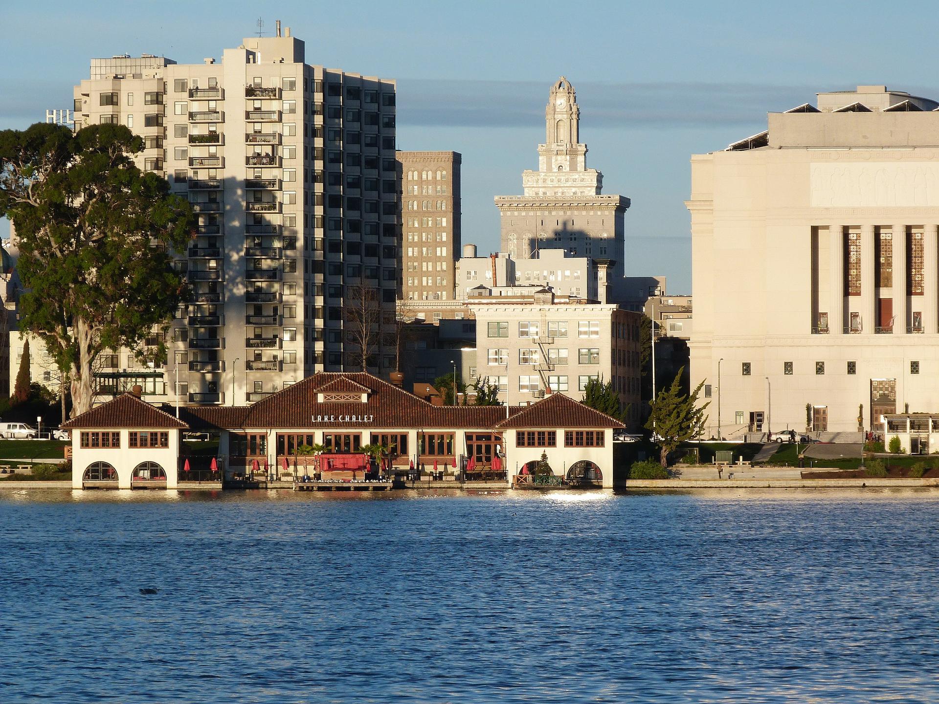
    Discover Oakland, California: A dynamic city with a rich cultural tapestry, stunning waterfront, vibrant neighborhoods, and lush parks. Your perfect Bay Area getaway awaits.

    Tell me more about Oakland

    Select Currency

    Choose the currency you want prices to display in.