Ute Trail: A Journey Through Alpine Tundra
Hike the Ute Trail in Rocky Mountain National Park for panoramic views and a journey through alpine tundra with historical significance.
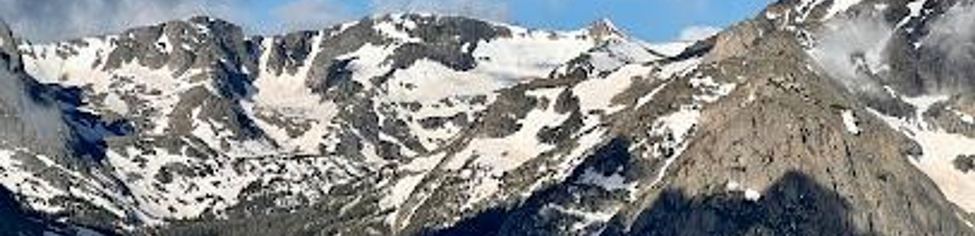
The Ute Trail provides hikers with expansive views and alpine tundra scenery without demanding a strenuous climb. Trekking entirely above the treeline, the trail offers panoramic views along the entire route. This path was historically used by Arapaho and Ute Indians on their journeys between winter and summer hunting grounds on the Great Plains. According to Rocky Mountain National Park: A History, Native Americans likely traveled across the national park using several east-west routes, including Forest Canyon, Flattop Mountain, Fall River, and this route, known as Trail Ridge. The Ute Trail begins from the Ute Crossing Trailhead, roughly 9.9 miles west of Deer Ridge Junction on Trail Ridge Road. The trail crosses Tombstone Ridge, with the highest point reaching roughly 11,660 feet, before gradually descending. Hikers can enjoy views of Longs Peak to the south and Forest Canyon and the Big Thompson River to the southwest. Most hikers choose to end their journey at Timberline Pass, approximately two miles from the trailhead, which offers outstanding views of Longs Peak, Moraine Park, and Estes Park. Be prepared for sun and wind exposure, and the possibility of afternoon thunderstorms.
Local tips
- Arrive early, especially during peak season, as the parking lot at the Ute Crossing Trailhead is small and fills up quickly.
- Be prepared for high-altitude conditions; bring water, sunscreen, and layers of clothing, as the weather can change rapidly.
- Check the weather forecast before heading out, as afternoon thunderstorms are common in the mountains.
- Consider hiking to Timberline Pass for the best panoramic views of Longs Peak, Moraine Park, and Estes Park.
A brief summary to Ute Trail
- Colorado, 80517, US
Getting There
-
Driving
From Estes Park, drive west on Highway 36, then turn north onto Highway 34 (Trail Ridge Road). Continue for approximately 48 miles to the Ute Crossing Trailhead, located about a mile east of the Forest Canyon Overlook. Parking is limited, with space for only about 8 vehicles in the main lot and 10 more in nearby turnouts. Arriving early is highly recommended.
-
Public Transport
While there is no direct public transportation to the Ute Crossing Trailhead, the park's shuttle system may provide access to nearby points along Trail Ridge Road during the summer season. From these points, you may need to walk along the road to reach the trailhead. Check the Rocky Mountain National Park website for shuttle schedules and routes. Park entrance fees apply.


