Background

Kikkebjerg: Fanø's Iconic Viewpoint

Historic maritime lookout offering sweeping views across Fanø's northern landscape and Wadden Sea.

4.6

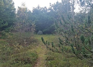
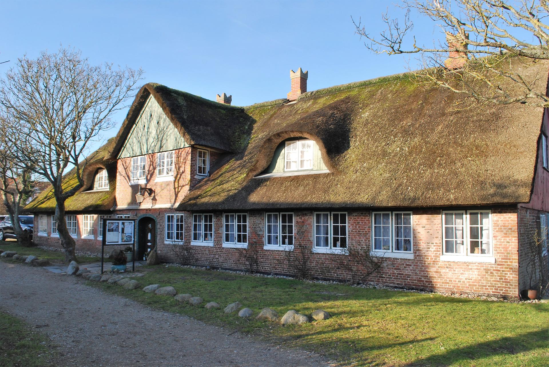
Kikkebjerg is one of Fanø's five highest points at 17 meters elevation, offering panoramic views across the northern tip of the island, Nordby village, and the Esbjerg coastline. This historic vantage point once served as a lookout post for maritime pilots monitoring shipping routes through Grådyb. The site sits within the Kikkebjerg Plantation, a forested area featuring marked walking trails that wind through varied landscapes of woodland, heathland, and open grassland, with glimpses of the expansive Grønningen salt marsh and distant wind turbines.

A brief summary to Kikkebjerget

  • Nørrebjergevej 9, Fanø, 6720, DK
  • Visit website
  • Duration: 0.75 to 2.5 hours
  • Free
  • Environment icon Outdoor
  • Mobile reception: 4 out of 5

Local tips

  • Visit early morning or late afternoon for optimal lighting and fewer visitors. The summit's exposure means wind can be significant; bring a windproof layer even in mild weather.
  • Combine your visit with the marked yellow trail loop through Kikkebjerg Plantation for a complete 2-kilometer walk. The varied terrain showcases Fanø's ecological diversity.
  • Explore the nearby Fanø Nord Flakbatteri bunker complex for historical context. The detour adds 20–30 minutes to your visit but provides insight into World War II heritage.
  • Bring binoculars for birdwatching. The Grønningen salt marsh and surrounding areas attract migratory waterfowl, particularly during spring and autumn passage.
  • Check weather conditions before visiting. Clear skies reveal views extending to Esbjerg and across the Wadden Sea; overcast conditions reduce visibility significantly.
widget icon

Getting There

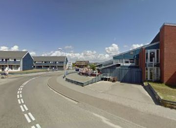
  • Car from Nordby village

    Drive south from Nordby toward Sønderho on the main island road. Turn onto Kikkebjergvej, a narrow country lane that leads directly to the plantation entrance and parking area. Travel time approximately 5–10 minutes depending on starting point. Free parking available at the trailhead. The road is narrow but well-maintained; standard vehicles are suitable.

  • Walking from Nordby

    From Nordby village center, follow local signage toward Kikkebjerg Plantation. The walk covers approximately 2–3 kilometers over mixed terrain including country lanes and forest paths, requiring 30–45 minutes. The route is relatively flat with some gentle inclines. Suitable for most fitness levels, though sturdy footwear is recommended.

  • Bicycle from Fanø Bad or Rindby

    Fanø has an extensive network of cycling paths. From Fanø Bad or Rindby Strand, cycle north toward Nordby, then follow signage to Kikkebjergvej. Journey time 20–35 minutes depending on starting location. Bicycle parking available at the plantation entrance. The route is relatively flat with some sandy sections.

  • Bus from Esbjerg

    Regional bus services connect Esbjerg to Fanø via ferry. Journey time approximately 45–60 minutes including ferry crossing. Buses serve Nordby and other villages; from Nordby, use walking or cycling options to reach Kikkebjerg. Service frequency varies seasonally; check local schedules before traveling. Approximate cost 80–120 DKK for ferry and bus combined.

Kikkebjerget location weather suitability

  • Weather icon Clear Skies
  • Weather icon Mild Temperatures
  • Weather icon Any Weather

Unlock the Best of Kikkebjerget

Buy tickets

    No tickets available

Book tours with entry

    No tours available

Book tours without entry

    No tours available

q

Discover more about Kikkebjerget

A Historic Sentinel of the Sea

Kikkebjerg stands as one of Fanø's most significant natural landmarks, rising 17 meters above the surrounding landscape. During the era of sailing ships, this elevated position served a crucial purpose: maritime pilots, known as lodgers, stationed themselves here to monitor the treacherous shipping routes passing through Grådyb, the narrow channel separating Fanø from the mainland. A small keeper's house once crowned the summit, its windows trained on the horizon to track incoming vessels and guide them safely through dangerous waters. Today, visitors who climb to the top experience the same commanding perspective that guided centuries of maritime traffic.

Panoramic Vistas Across Northern Fanø

From the summit, the view unfolds in all directions. To the north lies the entire northern tip of Fanø, with Nordby village nestled below and the industrial landscape of Esbjerg visible across the water. Westward, the gaze sweeps across the Grønningen, a vast 3-square-kilometer salt marsh that once served as communal grazing land for Nordby's residents. Sheep still graze here today, their presence a living link to centuries of pastoral tradition. Modern wind turbines punctuate the horizon, a contemporary addition to this layered historical landscape. The open vistas reward visitors with a sense of place and scale that few locations on Fanø can match.

Walking Through Varied Woodland and Heath

Kikkebjerg Plantation surrounds the summit, offering a network of marked trails that reveal the island's ecological diversity. The primary yellow-marked loop trail extends nearly 2 kilometers, guiding walkers through a mosaic of environments: dense coniferous forest alternates with open heathland, small wetlands punctuate the route, and sudden clearings provide unexpected views of the surrounding landscape. The plantation's varied terrain reflects deliberate land management spanning generations, creating habitat for diverse plant and animal communities. Few tourists venture into this quieter corner of Fanø, making it an ideal destination for those seeking solitude and connection with nature.

Remnants of World War II

A short detour from the main trail leads to Fanø Nord Flakbatteri, a substantial German bunker complex constructed during World War II as part of the Atlantic Wall defensive system. Here, the Wehrmacht installed large anti-aircraft cannons to protect against Allied bombing raids. The concrete structures remain largely intact, offering tangible evidence of the island's wartime occupation and the broader European conflict. The bunker complex provides historical context that enriches understanding of Fanø's twentieth-century experience.

Gateway to Fanø's Five Peaks

Kikkebjerg ranks among the Big Five—Fanø's five highest points—each offering distinctive perspectives on the island's natural character. The designation reflects the island's gently rolling topography, where even modest elevations provide significant visual advantage. Visitors who explore multiple peaks gain a comprehensive understanding of Fanø's landscape, from coastal marshes to inland plantations. Kikkebjerg's accessibility and historical significance make it an ideal starting point for this broader exploration.

Busiest months of the year

Busiest hours of the day

Popular Experiences near Kikkebjerget

Popular Hotels near Kikkebjerget

Select Currency