Background

Bispehuen

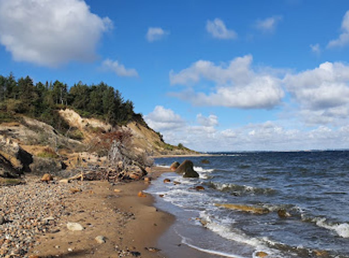
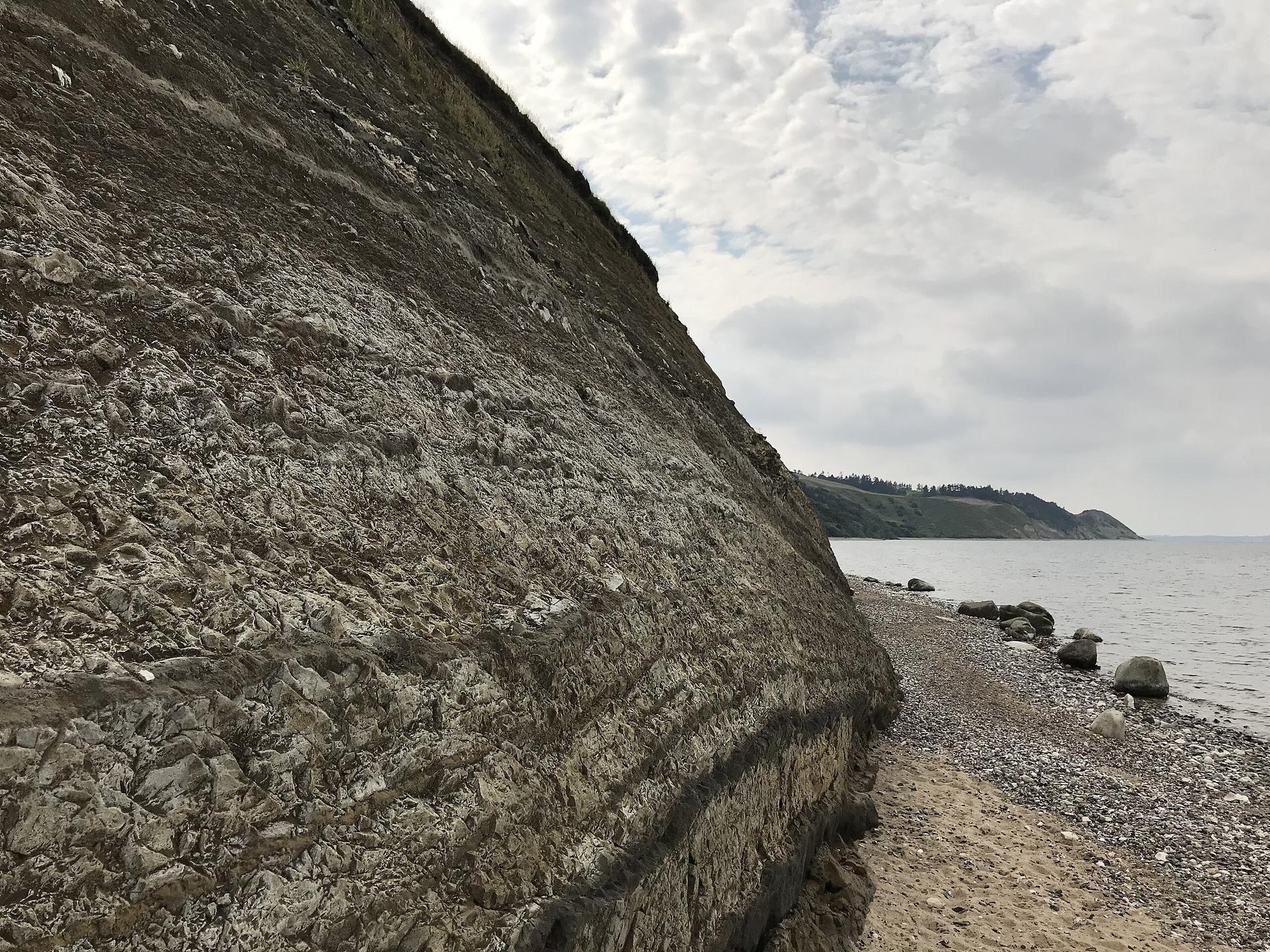
A dramatic folded column of volcanic ash and clay, shaped like a bishop's hat, rising from Fur's largest quarry.

4.5

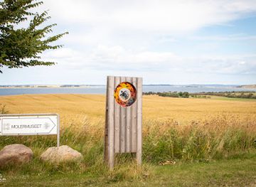
Bispehuen is a striking geological landmark on the Danish island of Fur, featuring a spectacular column of folded diatomite (moler) preserved within the Stendal Quarry. Named for its distinctive bishop's hat shape, this natural formation rises dramatically from the exposed cliff face, revealing layers of volcanic ash and clay that tell the story of the landscape's original height. Nearby stands the bronze sculpture Molermanden, which gazes across the quarry, fjord, and distant island of Livø, creating a unique blend of geological significance and artistic interpretation.

A brief summary to Bispehuen

  • Fur, 7884, DK
  • Visit website
  • Duration: 0.75 to 2 hours
  • Free
  • Environment icon Outdoor
  • Mobile reception: 4 out of 5

Local tips

  • Visit during golden hour (sunrise or sunset) when the folded layers of the column are illuminated dramatically, revealing the geological stratification most vividly and creating exceptional photography opportunities.
  • Read the information boards near Molermanden before exploring the quarry to understand the geological history and the significance of the preserved column within the context of Fur's landscape restoration.
  • Combine your visit with a hike along Fur's northwestern coast to see Knudeklinten and other exposed cliff formations, which showcase similar geological layers in their natural, unmined state.
  • Bring binoculars to spot Livø island across Limfjorden from the viewpoint near Molermanden, and observe how the quarry's man-made landscape contrasts with the natural terrain beyond.
widget icon

Getting There

  • Car Ferry from Branden

    Drive to Branden port on the Salling mainland (approximately 15–20 km from Skive town center). Board the car ferry to Fur, which operates with departures every 15 minutes between 05:00–19:00, every 30 minutes from 19:00–01:00, and hourly from 01:00–05:00. The crossing takes 3–4 minutes. Cost: 120 DKK per car including all passengers. Upon arrival at Fur Havn, follow Rødstenvej north approximately 2 km to reach Bispehuen and the Stendal Quarry parking area.

  • Bicycle from Branden

    Take the car ferry from Branden (20 DKK per person, departures every 15 minutes 05:00–19:00). Cycling takes 3–4 minutes on the ferry. Upon arrival at Fur Havn, cycle north along Rødstenvej for approximately 2 km to reach Bispehuen. The route is flat and well-suited for casual cycling. Bicycle rentals are available at Fur Tourist Information if needed.

  • Public Transport and Walking from Skive

    Take a train to Skive station. From Skive, board a bus departing hourly to Branden port (journey approximately 20–25 minutes). Board the car ferry to Fur (20 DKK per person, 3–4 minute crossing). Walk north from Fur Havn along Rødstenvej for approximately 2 km to reach Bispehuen. Total journey time from Skive: approximately 1 hour 15 minutes to 1 hour 30 minutes.

  • Walking from Fur Havn

    From Fur Havn ferry terminal, walk north along Rødstenvej for approximately 2 km (25–30 minutes on flat terrain). The route is straightforward and well-marked. Bispehuen is located within the Stendal Quarry complex, with parking and information facilities nearby. This walk offers views of Fur's landscape and can be combined with other northern island attractions.

Bispehuen location weather suitability

  • Weather icon Clear Skies
  • Weather icon Any Weather

Unlock the Best of Bispehuen

Buy tickets

    No tickets available

Book tours with entry

    No tours available

Book tours without entry

    No tours available

Discover more about Bispehuen

A Geological Marvel Born from Mining

Bispehuen stands as one of Fur's most distinctive natural features, located within the Stendal Quarry—the island's largest and most accessible diatomite extraction site. When commercial mining operations began on Fur, this remarkable column of folded moler was deliberately preserved due to its unique geological structure. The formation consists of intricately knotted layers of volcanic ash and diatomite, materials that accumulated over millions of years and now serve as a tangible record of the landscape's original elevation before quarrying reshaped the terrain. The name Bispehuen, meaning "The Bishop's Hat," derives directly from the column's distinctive silhouette. This whimsical nomenclature reflects how the folded geological layers create a shape that resembles the ceremonial headwear of a bishop, making it instantly recognizable and memorable to visitors exploring the quarry.

Layers of Time and Volcanic History

Fur's geology is exceptional within Denmark, consisting primarily of alternating strata of volcanic ash and a specialized clay called moler. These materials were deposited during ancient periods when volcanic activity and marine sedimentation shaped the region. At Bispehuen, the exposed cliff face reveals these layers with striking clarity, allowing visitors to read the island's geological narrative directly from the rock face. The volcanic ash layers, in particular, represent periods of intense geological activity, while the moler deposits reflect quieter phases of marine clay accumulation. The preservation of Bispehuen within an active quarry creates an unusual and valuable educational opportunity. Rather than being hidden beneath soil or inaccessible, the formation remains visible and interpretable, offering both casual visitors and geology enthusiasts direct access to understanding the processes that shaped this distinctive landscape.

Molermanden: Art Meets Geology

Standing sentinel above Bispehuen is Molermanden, a bronze sculpture that adds an artistic dimension to this geological site. The figure gazes outward across the man-made quarry landscape, the natural terrain beyond, the waters of Limfjorden, and the distant silhouette of Livø island. This sculptural presence transforms Bispehuen from a purely scientific curiosity into a place where human creativity and natural history intersect. The sculpture invites contemplation of how humans have reshaped the landscape through resource extraction while simultaneously preserving and celebrating the geological wonders that mining has exposed.

Landscape Restoration and Preservation

Bispehuen exemplifies thoughtful landscape management in the context of industrial resource extraction. Rather than removing the column as an obstacle to mining operations, the decision to preserve it demonstrates recognition of its scientific and aesthetic value. This approach transformed what could have been merely an extractive site into a destination that educates visitors about both geology and sustainable land use. Information boards and picnic tables positioned near Molermanden and on the hillside opposite the quarry provide facilities for visitors to pause, reflect, and absorb the significance of their surroundings.

A Window into Fur's Unique Geology

Fur itself is renowned throughout Denmark for its distinctive geological composition and fossil-rich deposits. Bispehuen serves as the island's most prominent geological landmark, embodying the characteristics that make Fur special: the visible stratification of volcanic ash and moler, the dramatic exposed cliff faces, and the ongoing dialogue between human activity and natural preservation. The site connects visitors to broader themes of the island's identity, from its use as a source of diatomite and other industrial materials to its recognition as a place of scientific and natural significance.

Busiest months of the year

Busiest hours of the day

Popular Experiences near Bispehuen

Popular Hotels near Bispehuen

Select Currency