Background

Havmøllen Skanse

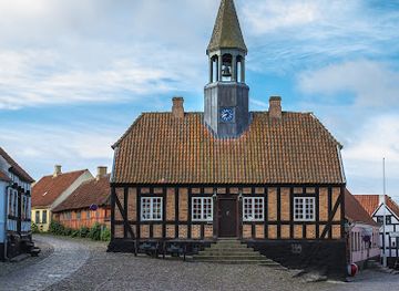
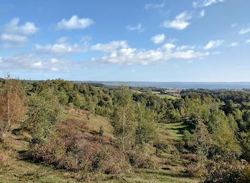
Grassy earthworks, open Kattegat views and a hint of Danish coastal war history on a quiet stretch of shore just south of Ebeltoft.

4.6

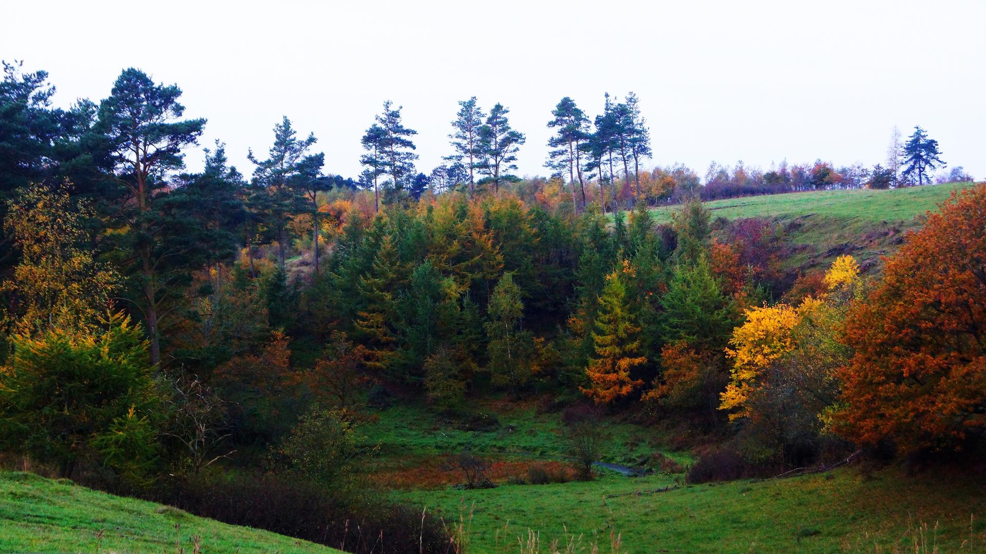
Havmøllen Skanse is a quiet coastal fortification site south of Ebeltoft, set where forested slopes meet a broad, windswept beach. Once part of Denmark’s coastal defenses during the early 1800s wars with Britain, only low earthen ramparts and traces of gun positions remain, now softened by grass and wildflowers. The skanse sits within the wider Mols Bjerge landscape, offering a mix of maritime history, open sea views toward the Kattegat and Hjelm, and easy access to shoreline walks and birdlife along this relatively undeveloped stretch of Djursland coast.

A brief summary to Havmøllen Skanse

  • Ebeltoft, Ebeltoft, 8400, DK
  • Duration: 0.5 to 2 hours
  • Free
  • Environment icon Outdoor
  • Mobile reception: 4 out of 5

Local tips

  • Wear sturdy shoes; the grassy ramparts and paths can be uneven, especially after rain.
  • Bring a windproof layer, as the coastal location can feel breezy even on sunny days.
  • Allow extra time to walk along the beach and enjoy the sea views toward Hjelm.
  • In summer, check if Havmøllen’s café and farm shop are open to combine history with a local lunch.
widget icon

Getting There

  • Car from Ebeltoft town

    From central Ebeltoft, driving to the Havmøllen area typically takes around 15–20 minutes, using local country roads through the southern outskirts of town. The route is straightforward but narrow in places, and can feel busy in peak summer. Parking is usually available at a small coastal parking area signposted for Havmøllen and the beach, from where you continue on foot across gently sloping ground. There is no parking fee at present, but spaces can fill up on sunny weekend afternoons.

  • Regional bus from Ebeltoft

    A regional bus route runs between Ebeltoft and smaller coastal settlements to the south, with a stop close to Havmøllen. The trip generally takes 20–30 minutes depending on the timetable and day of the week. Expect standard regional bus fares of roughly 20–35 DKK one way for an adult ticket. Services are less frequent in the evenings and on Sundays, so it is worth checking departure times in advance. From the bus stop, you walk on country lanes and paths for around 10–15 minutes to reach the skanse.

  • Bicycle from Ebeltoft and Mols Bjerge

    Cycling from Ebeltoft or nearby parts of Mols Bjerge to Havmøllen Skanse is a pleasant option in good weather, taking around 30–45 minutes from the town centre. The ride uses low-traffic rural roads with some gentle hills, suitable for moderately fit cyclists and families with older children. There are no dedicated bike lanes for much of the way, so riders should be comfortable sharing the road with cars. You can leave bicycles at informal spots near the parking area or by the beach, as there are no formal racks.

Havmøllen Skanse location weather suitability

  • Weather icon Clear Skies
  • Weather icon Mild Temperatures
  • Weather icon Windy Conditions
  • Weather icon Hot Weather
  • Weather icon Cold Weather
  • Weather icon Any Weather

Unlock the Best of Havmøllen Skanse

Buy tickets

    No tickets available

Book tours with entry

    No tours available

Book tours without entry

    No tours available

q

Discover more about Havmøllen Skanse

Coastal stronghold on the edge of Djursland

Havmøllen Skanse lies just south of Ebeltoft, where rolling hills drop down to a wide, often windswept beach facing the Kattegat. The site occupies a low rise between sea and farmland, with the surf almost always audible in the background. From the grassy embankments you look out across open water, and on clear days the island of Hjelm appears on the horizon, a reminder of how closely this coast has always been tied to the sea. Although today it feels remote and quietly scenic, the position was chosen for hard-nosed strategic reasons: the skanse sits in the gap between other coastal defenses further up and down the bay, guarding a valuable local loading place where timber and other goods once left Djursland by ship.

Earthen ramparts from the age of cannon

What you see now are low, rounded earthworks rather than towering stone walls. In the early 1800s, as England and Denmark faced each other during the so‑called English Wars, lines of such earth fortifications appeared all along the Jutland coast. At Havmøllen, two related positions were built, one close to the mill and one slightly to the south; traces of the larger southern work are most visible today. The skanse was armed with cannon and manned by local men conscripted into a coastal militia. The idea was simple: make any British raid on shipping in Ebeltoft Vig costly by forcing attacking vessels to face fire from several angles. The guns here were never known to fire in anger, but their presence formed part of a wider defensive chain that reshaped Denmark’s coastline during this turbulent period.

Reading the landscape of defense

Walking around the site, the military layout emerges gradually from what first looks like natural undulations. Low banks define a roughly curved outline, creating sheltered interior spaces where gun crews and ammunition could be protected. Depressions and levelled areas hint at former gun platforms and working areas. Simple, weather-resistant information boards explain the function of the skanse and place it in the wider pattern of coastal fortifications along Ebeltoft Bay. Because the structures are made of earth rather than masonry, they blend into the fields and rough grass. In summer, tall grasses and wildflowers soften the lines, while in winter the bare ground makes the shapes more legible. The lack of modern constructions allows you to picture how the site might have looked when only the guns and a few wooden shelters broke the horizon.

Between mill stream, beach and national park

Just inland stands Havmøllen itself, historically a watermill and now a restored complex used for events, with a seasonal café and small farm shop in the old farm buildings. During summer weeks and selected weekends in spring and autumn, the café serves simple meals, drinks and local produce, linking the area’s agricultural past with its present-day role as a rural gathering place. The skanse also forms part of the richer natural setting of Mols Bjerge National Park. Nearby hills, patches of woodland and open meadows create a mosaic of habitats, while the shoreline attracts wading birds and occasional birds of prey. It is easy to combine a short historical pause at the fortifications with a longer coastal or forest walk.

Quiet walks and wide horizons

Most visits to Havmøllen Skanse revolve around slow exploration. A short loop around the ramparts, perhaps with a climb onto the higher banks for a better view, rarely takes more than an hour. The broad, gently sloping beach below invites longer walks along the water’s edge, especially in calm weather when the Kattegat can feel almost lake-like. There is usually ample space, so it is a comfortable stop for families, couples or solo walkers seeking a low-key outing. Simple wayfinding and the absence of heavy infrastructure mean the experience remains close to the landscape itself: a fusion of maritime horizon, rural quiet and a subtle but tangible layer of Danish military history.

Busiest months of the year

Busiest hours of the day

Popular Experiences near Havmøllen Skanse

Popular Hotels near Havmøllen Skanse

Select Currency