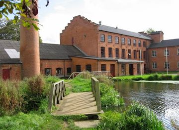
Bruunshaab Gamle Papfabrik
Bruunshaab Gamle Papfabrik

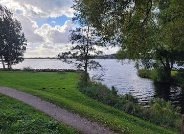
Subtle Viking‑age earthworks on a quiet rise above the Nørreå valley, where soft contours and big skies tell the story of an early fort in rural Jutland.
Tapdrup Trælleborg is a small, atmospheric Viking‑age site on the edge of the village of Tapdrup near Viborg in central Jutland. Set in gently rolling farmland above the ice‑age Nørreå valley, the grassy earthworks hint at an early medieval fortification that once controlled movement through the landscape. Today it is a quiet, open green space where you can trace low banks, imagine timber palisades and enjoy broad rural views, making it an appealing detour for historically minded travelers exploring the Viborg area.
Opening times, essentials, and a few local tips gathered into one calmer, easier-to-scan planning section.
Car from Viborg city centre
Driving from central Viborg to Tapdrup Trælleborg typically takes about 15–20 minutes, following local roads east through the countryside. The route is straightforward, with paved roads all the way, and there is usually informal roadside parking near the site rather than a marked car park. The drive does not involve tolls, and fuel costs within Denmark for such a short return trip are modest, usually under 50–70 DKK depending on your vehicle’s consumption.
Bicycle from Viborg
Cycling from Viborg to the Tapdrup area takes around 30–45 minutes each way, depending on your pace. The terrain is gently rolling with some mild inclines but no demanding hills, and much of the way uses minor rural roads where traffic is light. There is no dedicated bike parking infrastructure at the fort itself, so you will need to secure your bike to a fence or lay it off the path. Renting a bicycle in Viborg generally costs about 100–200 DKK per day, and this option is best in dry, daylight conditions.
Bus plus short rural walk
From Viborg, regional buses serve villages in the direction of Tapdrup, with travel times typically 15–25 minutes depending on the specific line and stops. A standard adult single ticket within the local zone system usually costs around 20–30 DKK. Services may be less frequent in the evenings and on weekends, and the bus stop is likely to be in the village rather than directly at the fort, so expect a short walk on village streets and farm tracks over mostly level ground. This option is more practical in good weather and for those comfortable with basic rural walking surfaces.
Catch the right light and the right mood, whether you want a bright city moment or a more cinematic evening visit.


Use Tower Bridge as your starting point for nearby food, family ideas, nightlife, and more local discoveries.
A quick look at seasonal patterns and peak visiting hours.

Explore expert travel guides, compare and book tours, experiences, hotels, and more—all from the palm of your hand. Download now for seamless trip planning wherever your wanderlust takes you.
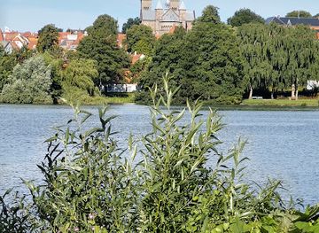
Discover Viborg, Denmark's hidden gem where medieval history, stunning nature, and vibrant culture converge for an unforgettable travel experience.
Tell me more about Viborg