Background

Hochwassermarken: A Chronicle of Floods

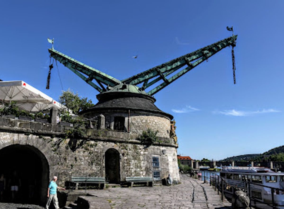
Explore Würzburg's flood history etched in stone along the Main River, witnessing centuries of resilience against nature's power at the historic Hochwassermarken.

4.5

The Hochwassermarken (Flood Markers) in Würzburg serve as a stark reminder of the Main River's power and the city's enduring battle against its floods. Etched into the Kranenkai embankment, these markers document centuries of high-water events, some reaching alarming heights. More than just historical records, they represent the resilience and adaptability of the Würzburg community. Walking along the Kranenkai, visitors can trace the timeline of these natural disasters, gaining a profound appreciation for the forces that have shaped the city's landscape and the ongoing efforts to manage and mitigate flood risks. The markers offer a tangible connection to the past, inviting reflection on the delicate balance between human settlement and the natural world, making it a unique and thought-provoking attraction.

A brief summary to Hochwassermarken

  • Kranenkai, Würzburg, Altstadt, 97070, DE

Local tips

  • Combine your visit with a stroll along the scenic Kranenkai, enjoying views of the Main River and the Marienberg Fortress.
  • Look for the highest flood marker to appreciate the potential scale of flooding in Würzburg.
  • Visit after rainfall to better imagine the river's potential to rise.
widget icon

Getting There

  • Walking

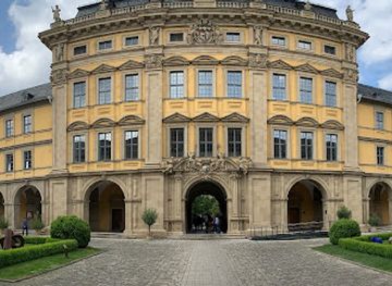
    From the Würzburg Residenz, walk towards the Main River and head east along Domstraße, which becomes Karmelitenstraße. Continue onto Kranenkai. The Hochwassermarken are located along the embankment, a short walk from the Old Main Bridge (Alte Mainbrücke). The walk is approximately 15 minutes and offers scenic views of the city. No costs are associated with this approach.

  • Public Transport

    From Würzburg Hauptbahnhof (main train station), take tram line 1, 3, or 5 to the 'Dom' stop. From there, walk east along Domstraße, then Karmelitenstraße, to Kranenkai. The Hochwassermarken will be on your left. A single tram fare is €3.10. Alternatively, take bus 9 from Juliuspromenade to the 'Congress Centrum' stop, which is right next to Kranenkai.

  • Taxi/Ride-Share

    A taxi or ride-share from Würzburg Hauptbahnhof to Kranenkai will cost approximately €8-€12, depending on traffic. The journey takes around 5-10 minutes. Ask to be dropped off near the Congress Centrum for easy access to the Hochwassermarken.

  • Driving

    If driving, parking is available at the Congress Centrum parking lot (Kranenkai 2) or the Kranengarage (Kranenkai 3), both directly adjacent to the Hochwassermarken. Parking fees at these locations are approximately €1.50 per hour. Alternatively, the Talavera parking lot offers free parking and is a 7-minute walk away. From either parking location, walk towards the river; the Hochwassermarken are along the Kranenkai embankment.

Unlock the Best of Hochwassermarken

Buy tickets

    No tickets available

Book tours with entry

    No tours available

Book tours without entry

    No tours available

Discover more about Hochwassermarken

The Hochwassermarken, or flood markers, along the Kranenkai in Würzburg, are more than just lines etched in stone; they are a historical narrative etched into the very fabric of the city. These markers serve as a visual testament to the power of the Main River and the enduring struggle of Würzburg's inhabitants against its recurrent floods. Spanning centuries, the Hochwassermarken document the high-water levels reached during significant flood events, offering a sobering glimpse into the city's past and the challenges it has faced. Located on the Kranenkai, a historic embankment along the Main River, the flood markers are easily accessible and integrated into the urban landscape. As you stroll along the waterfront, you'll encounter these unassuming yet powerful reminders of nature's force. Each marker represents a specific flood event, with the year and the corresponding water level carefully inscribed. Some markers indicate relatively minor floods, while others depict catastrophic events that inundated large portions of the city. The history of the Hochwassermarken is intertwined with the history of Würzburg itself. The city's location on the banks of the Main River has always made it vulnerable to flooding. Over the centuries, Würzburg has experienced numerous major floods, some of which have caused widespread damage and loss of life. The earliest documented floods date back to the Middle Ages, with particularly devastating events recorded in 1342, 1595, 1784 and 1845. These floods not only impacted the city's infrastructure and economy but also left a lasting impression on its collective memory. The most notable flood marker commemorates the infamous "Magdalenenhochwasser" of July 1342, considered one of the most extreme flood events in Central European history. This catastrophic flood was caused by a combination of heavy rainfall and snowmelt, resulting in widespread devastation across the region. In Würzburg, the floodwaters reached unprecedented levels, inundating much of the city and causing immense damage. The marker serves as a chilling reminder of the sheer scale of this natural disaster. Another significant marker commemorates the flood of February 1784, a winter flood caused by a rapid thaw following a period of extreme cold and heavy snowfall. This flood was particularly destructive due to the presence of ice floes, which exacerbated the damage to buildings and infrastructure. The 1784 flood is also notable for the extensive documentation that survives, providing valuable insights into the social and economic impacts of the disaster. The Hochwassermarken are not merely historical records; they also serve as a reminder of the ongoing need for flood protection measures. Over the centuries, the city has implemented various strategies to mitigate the risk of flooding, including the construction of dikes, levees, and flood walls. The modern flood protection system, completed in 2008, is designed to protect the city against a 100-year flood event. However, the Hochwassermarken serve as a constant reminder that the risk of flooding can never be entirely eliminated. Visiting the Hochwassermarken offers a unique opportunity to reflect on the relationship between humans and the natural environment. The markers invite contemplation on the power of nature, the vulnerability of human settlements, and the importance of sustainable development practices. They also provide a tangible connection to the past, allowing visitors to appreciate the resilience and adaptability of the Würzburg community in the face of adversity. Beyond their historical and educational value, the Hochwassermarken also contribute to the aesthetic appeal of the Kranenkai. The markers are integrated into the design of the embankment, adding a unique element to the waterfront promenade. Walking along the Kranenkai, visitors can admire the picturesque views of the Main River, the Marienberg Fortress, and the surrounding vineyards, while also gaining a deeper understanding of the city's history and its ongoing relationship with the river. The Hochwassermarken are a testament to Würzburg's history, resilience, and commitment to preserving its cultural heritage. They offer a unique and thought-provoking experience for visitors, inviting reflection on the forces that have shaped the city's landscape and the ongoing efforts to manage and mitigate flood risks. As you stand before these markers, take a moment to appreciate the power of nature, the vulnerability of human settlements, and the enduring spirit of the Würzburg community.

Popular Experiences near Hochwassermarken

Popular Hotels near Hochwassermarken

Select Currency