

Golis Mountains Travel Guide - Free Web & App
Your ultimate guide to Golis Mountains. Discover top landmarks, proposed trips, and local tips. Free on the web or via the Evendo companion app.


Golis Mountains in Somalia offer rugged highlands, juniper forests, Gulf of Aden views, pastoral culture and rare mountain wildlife for carefully planned journeys.
A Mountain Range Above the Gulf of Aden
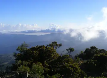
The Golis Mountains form a long, broken belt of escarpments and highlands across northern Somalia, rising behind the Gulf of Aden coast and extending through areas associated with Somaliland and Puntland. The name is used broadly, and geographic descriptions vary; in the eastern and central sections, the range is closely connected with the Cal Madow uplands of Sanaag. Its slopes shift from dry coastal plains and thorn scrub to cooler plateaux, rocky valleys and, in the wetter highlands, stands of juniper and other upland vegetation. Shimbiris, commonly identified as the highest summit in the Golis or Cal Madow system, reaches roughly 2,460 metres.Read more about Golis Mountains
Landscape, Wildlife and Pastoral Life
Remote Exploration and Practical Limits
When is the best time to visit Golis Mountains?
Best: January–February, July · 26–27°C| Month | High (°C) | Rainfall (mm) |
|---|---|---|
| January (best) | 27 | 0 |
| February (best) | 27 | 0 |
| March | 28 | 0 |
| April | 28 | 0 |
| May | 28 | 2 |
| June | 27 | 7 |
| July (best) | 26 | 10 |
| August | 27 | 9 |
| September | 27 | 5 |
| October | 28 | 2 |
| November | 28 | 0 |
| December | 28 | 0 |
Getting to and around Golis Mountains
How to get there
Transportation
Best attractions in Golis Mountains
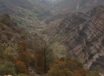
The principal attractions of the Golis Mountains are landscapes rather than developed visitor sites. In the western range, the ascent towards the Sheikh highlands reveals steep escarpments, dry valleys and broad views over the coastal plain, while the more elevated Cal Madow country in Sanaag contains cooler uplands and remnant juniper woodland. Daallo Mountain is associated with the eastern highlands and is noted for its vegetation and expansive outlooks, although access is remote and security-sensitive. Shimbiris, commonly described as the highest summit in the Golis or Cal Madow system, appeals chiefly to experienced, locally accompanied explorers rather than casual walkers. Seasonal watercourses, limestone outcrops, pastoral settlements and frankincense-growing areas provide further insight into the region’s geography and economy. The coastal cities of Berbera and Bosaso function as gateways rather than attractions within the mountain range itself, and travel between them and upland areas should never be treated as a standard sightseeing excursion.
-
Tourist attraction
Dawga Sheekh
Explore Dawga Sheekh in Laaleys, Somalia: A captivating tourist attraction with stunning landscapes and rich cultural experiences.
-
Hiking area
Sheikh Mountains
Discover the breathtaking Sheikh Mountains in Somaliland, a paradise for hiking enthusiasts and nature lovers seeking adventure and tranquility.
-
Tourist attraction
Sheikh Mountain View
Experience the breathtaking beauty of Sheikh Mountain View in Somalia, where stunning landscapes and adventure await every traveler.
-
 Hiking area
Sheikh beertii Apo
Discover the breathtaking hiking trails of Sheikh Beertii Apo in Shiikh, where nature's beauty meets adventure in every step.


Best landmarks in Golis Mountains
The defining landmark of the Golis Mountains is the great escarpment itself, rising sharply above northern Somalia’s coastal plains and creating a powerful meeting point between arid lowlands and cooler uplands. Shimbiris is the range’s best-known high summit, while Daallo Mountain and the Cal Madow highlands are recognised for their elevation, forest remnants and broad views towards the Gulf of Aden. Sheikh is an important human landmark on the western uplands, associated with a cooler agricultural setting and the historic development of education and transport routes. Across the range, limestone ridges, seasonal ravines, isolated plateaux and frankincense landscapes are more characteristic than castles, monuments or formal museums. These features reflect the region’s geological relief, pastoral economy and long connection between the interior and coastal trading ports.
-
Mountain peak
Qar Golis
Explore Qar Golis Mountain Peak: A Hidden Gem in Somalia, Perfect for Adventurers and Nature Lovers Alike.

Explore Golis Mountains on the map
Plan your trip on one map. See where the top attractions, landmarks, restaurants and hotels are, and book hotels and experiences in a few clicks.
Best hotels in Golis Mountains
Best bars in Golis Mountains
The Golis Mountains do not have a conventional nightlife scene, and alcohol is inappropriate and often prohibited in this predominantly Muslim region. Evenings in rural areas are quiet, shaped by household hospitality, tea, conversation and the practical demands of travel rather than by commercial entertainment. In towns such as Sheikh, Berbera or Bosaso, visitors may find cafés, hotel lounges or family-oriented restaurants, but opening arrangements and security conditions vary and should be checked locally. Hargeisa and other larger urban centres offer more public evening activity than the mountain settlements, although they remain outside the range itself. Remote camps or roadside stops should not be treated as leisure venues, and movement after dark requires particular caution because roads, communications and security support are limited.
-
Mountain peak
Golis Mountains
Explore the breathtaking Golis Mountains, a natural wonder rich in wildlife and cultural heritage, perfect for adventure and tranquility.

Best nightclubs in Golis Mountains
The Golis Mountains do not have a conventional nightlife scene, and alcohol is inappropriate and often prohibited in this predominantly Muslim region. Evenings in rural areas are quiet, shaped by household hospitality, tea, conversation and the practical demands of travel rather than by commercial entertainment. In towns such as Sheikh, Berbera or Bosaso, visitors may find cafés, hotel lounges or family-oriented restaurants, but opening arrangements and security conditions vary and should be checked locally. Hargeisa and other larger urban centres offer more public evening activity than the mountain settlements, although they remain outside the range itself. Remote camps or roadside stops should not be treated as leisure venues, and movement after dark requires particular caution because roads, communications and security support are limited.
-
Mountain peak
Golis Mountains
Experience the breathtaking beauty and rich biodiversity of the Golis Mountains in Somalia, a must-visit destination for adventure seekers and nature lovers.

Best shops in Golis Mountains
Shopping opportunities in the Golis Mountains are limited to small local provisions and goods exchanged in settlements rather than an organised visitor retail sector. In gateway towns, travellers may find Somali textiles, woven items, practical handicrafts, frankincense, myrrh and other aromatic resins, although authenticity, provenance and availability should be assessed carefully. Markets in Berbera, Bosaso, Hargeisa and smaller regional centres provide everyday food, clothing and household goods, while coastal towns generally offer a wider choice than remote upland settlements. Purchasing directly from producers can support local livelihoods when conducted respectfully, but visitors should not remove plants, resin, rocks or archaeological objects from the landscape. Supplies for a mountain journey, including water, food, fuel and basic equipment, should be obtained before leaving a well-serviced town.
-
Mountain peak
Golis Mountains
Discover the breathtaking beauty and cultural richness of the Golis Mountains, a majestic mountain range in Somalia perfect for adventure seekers and nature lovers.
-
Shopping mall
Shop Maxmed Faandhiye
Immerse yourself in local culture at Shop Maxmed Faandhiye, a vibrant shopping mall in Burco, showcasing unique crafts, delicious cuisine, and lively interactions.
-
Store
Towfiiq Shop Canjeex
Discover unique Somali crafts and local treasures at Towfiiq Shop Canjeex in Shiikh, a must-visit destination for cultural enthusiasts and savvy shoppers.
-
Store
CASAAN SHOP
Explore authentic local crafts at Casaaan Shop in Shiikh, a treasure trove showcasing the artistry and heritage of the region.


Get your free copy of our complete guide to Golis Mountains, delivered straight to you.
Everything on this page, from attractions and restaurants to essentials and local phrases, in one PDF you can read offline, print or share.
Already have an account? Sign in
Your Golis Mountains guide is ready.
We'll send it to · Not you? Sign out

Getting your guide ready…
We are putting together a fresh copy of the Golis Mountains guide. This can take up to a minute.
This can take a few moments. If your browser asks, choose Allow so the download can start. You'll find the guide in your Downloads folder.
Nothing happened? Download it again
Sorry, the guide is taking longer than usual. Please try again in a minute, or get it by email instead.
Golis Mountains essentials
Currency and Payment
Safety
Emergency Situations
Do's and Don'ts
Local Tips
From Eve
Local phrases worth knowing
You don't need to get them perfect. A few words go a long way, and locals appreciate the effort.
Basics
| English | Local | Say it |
|---|---|---|
| Hello | Salaam | [sah-lahm] |
| Goodbye | Nabad gelyo | [nah-bahd gehl-yoh] |
| Yes | Haa | [hah] |
| No | Maya | [mah-yah] |
| Please/You're welcome | Fadlan | [fad-lahn] |
| Thank you | Mahadsanid | [mah-had-sah-need] |
| Excuse me/Sorry | Iscus | [ees-choos] |
| How are you? | Sidee tahay? | [see-day tah-hay] |
| Fine. And you? | Waa fiican. Idinka waa? | [wah fee-chan. ee-deen-kah wah] |
| Do you speak English? | Ma ku hadlaa Ingiriis? | [mah koo hahd-lah een-gee-rees] |
| I don't understand | Ma fahminin | [mah fahm-mee-neen] |
Eating & Drinking
| English | Local | Say it |
|---|---|---|
| I'd like to see the menu, please | Waan arki karaa menuka, fadlan | [wahn ar-kee kah-rahah men-oo-kah, fad-lahn] |
| I don't eat meat | Aniga miyaaan cunin hilib? | [ah-nee-gah mee-yahahn choo-neen hee-leeb] |
| Cheers! | Dabaqo! | [dah-bah-koh] |
| I would like to pay, please | Waan rabaa inaan bixiyo, fadlan | [wahn rah-bah ah-nahn bix-yoh, fad-lahn] |
Emergencies
| English | Local | Say it |
|---|---|---|
| Help! | Caawin! | [chah-wean] |
| Go away! | Tuu ka bax! | [too kah bakh] |
| Call the Police! | Waa la soo wac Police! | [wah lah soh wahch Po-leece] |
| Call a doctor! | Waa la soo wac doktarka! | [wah lah soh wahch dohk-tahr-kah] |
| I'm lost | Waan geeyaa | [wahn gay-yah] |
| I'm ill | Waan jecelahay | [wahn je-chel-ah-hi] |
Shopping
| English | Local | Say it |
|---|---|---|
| I'd like to buy... | Waan isticmaali lahaa... | [wahn is-teech-mah-lee lah-hah] |
| I'm just looking | Waan arkayaa | [wahn ar-kah-yah] |
| How much is it? | Qaddiyadu waa sidee tahay? | [kahd-dee-yah-doo wah see-day tah-hay] |
| That's too expensive | Tani waa dhiman | [tah-nee wah thee-mahn] |
| Can you lower the price? | Ma rabtaa inaad hoos u dhigto qiimaha? | [mah rahb-tahah een-ahd hohs oo dheeg-toh kee-mah-hah] |
Time & Numbers
| English | Local | Say it |
|---|---|---|
| What time is it? | Waa sidee saacadu? | [wah see-day sah-ah-chah-doo] |
| It's one o'clock | Waa saacad gudaheed | [wah sah-ah-chahd goo-dah-hee] |
| Half past (10) | Dabadeed (10) | [dah-bah-deed (10)] |
| Morning | Subax | [soo-bah] |
| Afternoon | Galab | [gah-lahb] |
| Evening | Cadow | [chah-doh] |
| Yesterday | Shalay | [shah-lie] |
| Today | Maanta | [mah-ahn-tah] |
| Tomorrow | Berri | [bear-ree] |
| 1 | Kow | [kohw] |
| 2 | Laba | [lah-bah] |
| 3 | Saddex | [sahd-dekh] |
| 4 | Afar | [ah-fahr] |
| 5 | Shan | [shahn] |
| 6 | Lix | [leex] |
| 7 | Toddobaad | [tohd-doh-bahd] |
| 8 | Sideed | [see-deed] |
| 9 | Sagaal | [sah-gahl] |
| 10 | Toban | [toh-bahn] |
Transport & Directions
| English | Local | Say it |
|---|---|---|
| Where's a/the...? | Halkaa...? | [hal-kah] |
| What's the address? | Cinwaanka waa sidee tahay? | [cheen-wahn-kah wah see-day tah-hay] |
| Can you show me (on the map)? | Ma rabtaa inaad ii tuso (khariidada)? | [mah rahb-tahah een-ahd ee tuh-soh (khah-ree-dah-dah)] |
| When's the next (bus)? | Marka ugu dambeeya... | [mahr-kah oo-goo dahm-bee-yah] |
| A ticket (to ....) | Tikiti (ila ...) | [tee-kee-tee (ee-lah ...)] |
History of Golis Mountains
Uplifted Escarpments and Highland Ecology
The Golis Mountains are part of the elevated northern Somali margin, where highlands rise markedly above the Gulf of Aden and the interior plains. Their geological character is expressed in long escarpments, limestone country, stony plateaux and valleys cut by seasonal runoff. Rainfall is irregular, but higher elevations can support vegetation that is markedly different from the arid coast. In the Cal Madow sector, upland forests and other plant communities have attracted scientific interest because they contain flora adapted to isolated mountain environments. This geological and ecological setting, rather than a single historic monument, is the foundation of the range’s distinct identity.
Pastoral Communities and Mountain Trade
For centuries, Somali pastoral communities have moved livestock through the seasonal grazing grounds surrounding and crossing the mountain belt. Access to water, pasture and sheltered valleys has shaped settlement patterns, while customary systems of land use and local authority remain important to daily life. The mountains also belong to an older trading landscape linking the interior with ports and coastal markets. Frankincense and myrrh from the northern Horn of Africa were valued commodities in regional and wider commerce, and the dry uplands remain associated with the collection and movement of aromatic resins. Much of this history survives through livelihood practices rather than monumental architecture.
Coastal Gateways and Colonial-Era Routes
The Golis escarpment stands behind a coast that became increasingly important to Indian Ocean trade and imperial administration during the nineteenth and early twentieth centuries. Berbera developed as a major port and commercial gateway, while routes over or around the mountains connected coastal markets with inland settlements. Sheikh, on the western highlands, became associated with education, agriculture and a cooler upland environment under British Somaliland administration. These developments did not turn the mountains into an intensively settled area; instead, they reinforced the importance of passes, wells, caravan routes and a small number of linked towns.
Conflict, Political Change and Conservation Concerns
The twentieth century brought the end of colonial rule, the formation of the Somali Republic in 1960, state collapse and prolonged conflict, all of which affected movement, administration and livelihoods in the northern regions. Political authority is now divided between administrations and local power structures, and the same mountain landscape may be described differently according to regional usage. Security concerns have restricted tourism and scientific access. At the same time, pressure from charcoal production, grazing, drought and habitat loss has increased interest in conserving the remaining highland forests and biodiversity of the Golis and Cal Madow areas, although protection and enforcement are uneven.
Golis Mountains in Photos
Browse through our photo collection highlighting the charm and character of the destination.
Neighbouring destination travel guides
The closest destinations to Golis Mountains, if you have time for more than one.
-

-
-

-
-


Swipe for more destinations
Explore more

Explore more of Togdheer
Togdheer introduces visitors to Burao, pastoral traditions, open drylands and the changing landscapes of Somaliland’s inland north.
Explore Togdheer
Explore more of Somalia
Explore Somalia: Discover its untouched beaches, ancient ruins, and rich cultural heritage in a land of resilient people and breathtaking landscapes.
Explore Somalia