Mull Hill and the Meayll Circle: Isle of Man’s Neolithic Enigma
Discover Mull Hill’s ancient Neolithic chambered cairn and WWII relics, set amid breathtaking southern Isle of Man vistas.
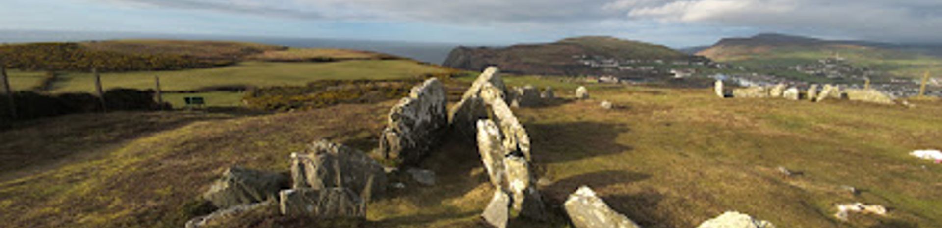
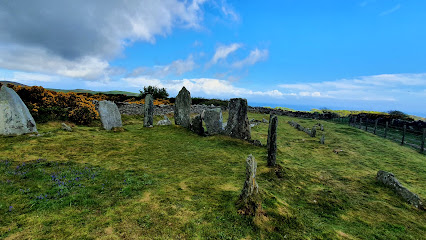
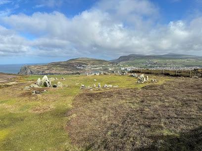
Mull Hill, also known as Meayll Hill, is a small but historically rich hill at the southern tip of the Isle of Man near Cregneash. It hosts the unique Meayll Circle, a Neolithic chambered cairn with twelve burial chambers arranged in pairs within an 18-foot ring. The site also features remnants of a World War II radar station and offers panoramic views of the island’s southern coastline, blending ancient heritage with natural beauty.
A brief summary to Mull Hill
- Isle of Man, IM
- Duration: 1 to 3 hours
- Free
-
 Outdoor
- Mobile reception: 4 out of 5
Local tips
- Wear sturdy footwear as the walk up Mull Hill is moderately steep and can be slippery in wet conditions.
- Visit on a clear day to fully enjoy panoramic views of the southern Isle of Man coastline.
- Explore the nearby World War II radar station remains for a contrasting historical experience.
- Bring a camera to capture the unique stone arrangements and scenic vistas.
For the on-the-go comforts that matter to you
- Restrooms
- Seating Areas
- Information Boards
Getting There
-
Bus
Take the local bus service from Douglas to Port Erin, which runs approximately every 30 minutes and takes around 1 hour. From Port Erin, a taxi or a 20-minute walk uphill to Mull Hill is required. Bus fare ranges from £3 to £5 GBP one way.
-
Car
Driving from Douglas to Mull Hill takes about 40-50 minutes via the A5 and A7 roads. Parking is available near the village of Cregneash, but spaces are limited and the final ascent to the hill is on foot. No parking is available at the summit.
-
Walking
For active visitors, a scenic 2-3 hour hike from Port Erin to Mull Hill is possible via marked trails. The terrain is moderately steep and uneven in places, so suitable footwear and good weather are recommended.
Mull Hill location weather suitability
-
 Any Weather
-
 Clear Skies
-
 Rain / Wet Weather
-
 Windy Conditions
-
 Mild Temperatures
Discover more about Mull Hill
A Hill Steeped in History and Mystery
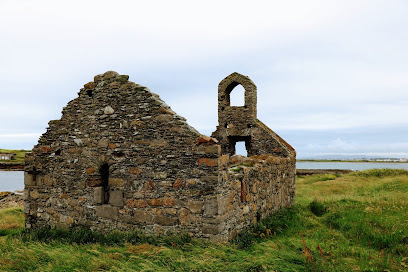
Mull Hill, or Meayll Hill in Manx Gaelic, meaning "bald hill," is a modest elevation located just outside the village of Cregneash at the Isle of Man’s southern end. Despite its small stature, it is a site of profound archaeological and cultural significance. The hill is crowned by the Meayll Circle, a remarkable Neolithic chambered cairn dating back approximately 5,000 years to around 3500 BC. This ancient monument is unlike typical stone circles; it comprises twelve burial chambers arranged in six pairs around a roughly 23 by 20-meter circular cairn, each pair accessed by short, T-shaped passages.Architectural Uniqueness of the Meayll Circle
The Meayll Circle’s design is exceptional within the British Isles, combining elements of passage graves and chambered cairns. Each burial chamber was constructed from large, irregular slabs of Manx stone, with six entrance passages leading into pairs of chambers forming a distinctive T-shaped layout. Excavations have uncovered ornate pottery shards, charred bones, flint tools, and white quartz pebbles, artifacts that reveal the sophisticated craftsmanship and ritual practices of the Neolithic inhabitants. The cairn was originally covered by a stone mound, parts of which remain visible, and the entire structure likely served as a communal burial and ceremonial site.Legends and Hauntings Surrounding the Site
Local folklore imbues Mull Hill with a mysterious aura. Stories tell of sudden disorientation, strange moving lights, and eerie sounds reminiscent of galloping horses. One particularly evocative legend speaks of a ghostly army of horsemen riding around the stone ring. These tales contribute to the hill’s enigmatic character, blending archaeology with myth and adding a layer of intangible heritage to the physical remains.World War II Legacy on the Summit
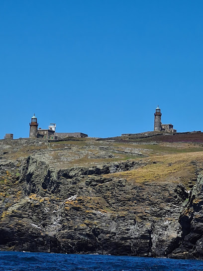
Near the summit of Mull Hill, visitors can also find the remnants of a World War II Chain Home Low RDF (radar) station. This mid-20th-century military installation was part of the island’s early warning system against aerial threats, linking the site’s ancient past with more recent history. The juxtaposition of the Neolithic cairn and wartime ruins offers a unique perspective on the hill’s strategic and symbolic importance through millennia.Panoramic Views and Natural Setting
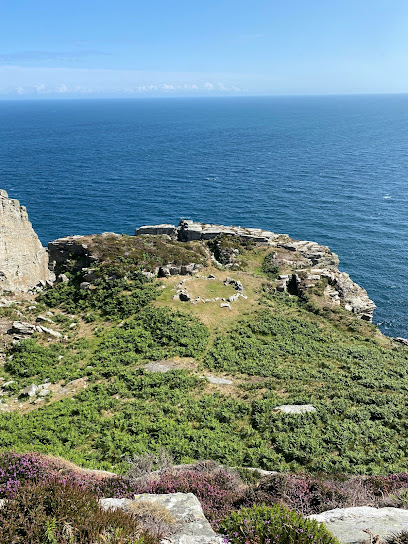
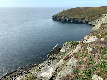
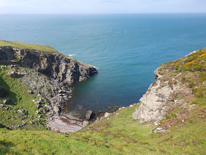
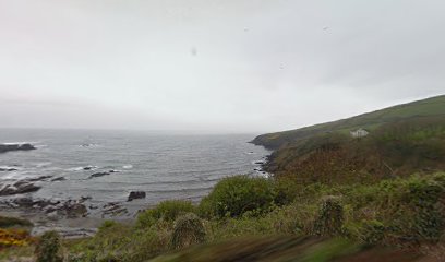
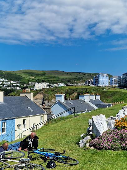
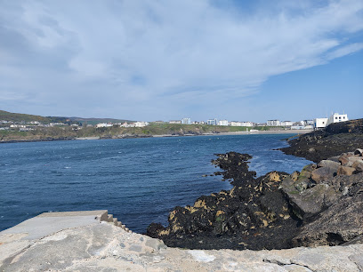
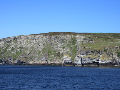
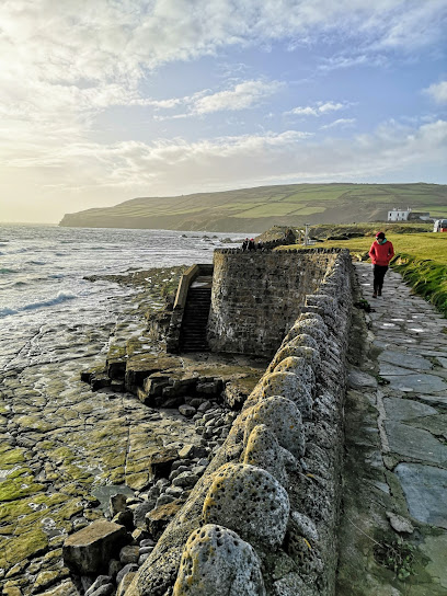
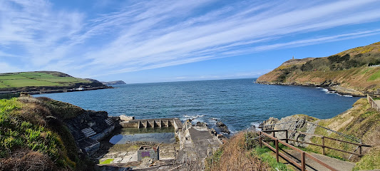
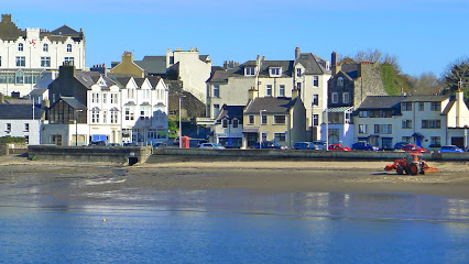
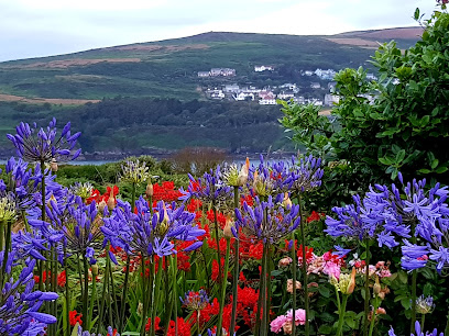
The hill’s location affords stunning views across the southern Isle of Man, including the nearby towns of Port Erin and Port St Mary, as well as the surrounding sea and coastline. The landscape is characterized by heather-covered slopes and gorse, typical of the Manx countryside. The site’s terrace position below the summit was likely chosen deliberately to frame specific sightlines, linking the monument to the sea and other notable landmarks such as Bradda Hill and the Calf of Man.Preservation and Visitor Experience
Although repeated excavations and natural erosion have reduced much of the original cairn, the standing stones and layout remain clearly visible, allowing visitors to appreciate the monument’s scale and complexity. Artifacts recovered from the site, including decorated pottery and tools, are displayed at the Manx Museum, providing further insight into the Neolithic culture. The walk to Mull Hill is moderately steep but rewarding, with well-marked paths and the chance to explore both ancient and modern history in a tranquil rural setting.Iconic landmarks you can’t miss
Breagle Glen Bed & Breakfast
1.2 km
Experience the serene beauty of Port Erin at Breagle Glen Bed & Breakfast, where comfort meets local charm in the heart of the Isle of Man.

Cronk Karran
1.2 km
Explore the rich history and stunning landscapes at Cronk Karran, a captivating landmark on the Isle of Man's scenic terrain.
The Stable At Glendown Farm
1.4 km
Experience the beauty of the Isle of Man at The Stable at Glendown Farm, your charming self-catering retreat surrounded by nature.
Go-Mann Adventures
1.4 km
Discover the breathtaking landscapes and rich heritage of the Isle of Man with Go-Mann Adventures, your premier tour operator for unforgettable outdoor experiences.
Raglan Pier
1.5 km
Explore the captivating Raglan Pier, a historic landmark in the Isle of Man, where maritime history meets stunning coastal views.

Glendown Farm Campsite
1.5 km
Discover the beauty of nature at Glendown Farm Campsite in Port St Mary, a perfect getaway for outdoor lovers on the Isle of Man.
Shona Boat Trips from Port Erin
1.5 km
Discover the stunning coastline of the Isle of Man with Shona Boat Trips, where adventure meets breathtaking scenery and unforgettable wildlife encounters.
Port Erin Bed & Breakfast
1.5 km
Experience the charm of Port Erin with cozy accommodations and stunning coastal views at this welcoming bed & breakfast.
Seaside Cottages
1.5 km
Experience the charm of Port Erin at Seaside Cottages, a perfect self-catering retreat with stunning sea views and easy access to local attractions.
Port Erin Paddleboards Isle of Man
1.5 km
Experience the breathtaking beauty of the Isle of Man with thrilling paddleboarding adventures at Port Erin Paddleboards.
Athol Park Guest House
1.5 km
Experience the charm of Port Erin at Athol Park Guest House, your cozy retreat for exploring the Isle of Man’s stunning coastal landscapes.
Palm Villa
1.5 km
Experience the serene beauty of Port Erin with a stay at Palm Villa, your ideal holiday apartment rental on the Isle of Man.
7th Wave
1.5 km
Experience the thrill of sailing at 7th Wave, the Isle of Man's premier sailing school and boat rental service with stunning coastal views.
Falcon's Nest Hotel
1.6 km
Experience the charm of Port Erin at Falcon's Nest Hotel, where comfort meets breathtaking coastal views on the Isle of Man.
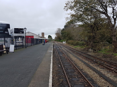
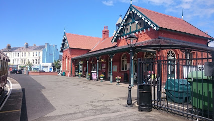
Port Erin Railway Station
1.6 km
Discover the charm of Port Erin Railway Station, a historic gem of the Isle of Man where vintage steam trains and stunning landscapes await.
Unmissable attractions to see
Meayll Circle
0.2 km
Discover the ancient mysteries of Meayll Circle on the Isle of Man, a captivating archaeological site surrounded by breathtaking landscapes.
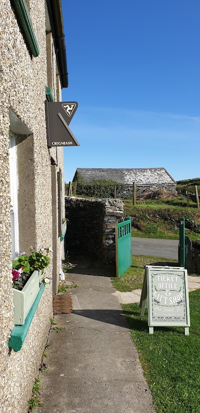
Cregneash
0.4 km
Explore Cregneash, Isle of Man - a historical gem with stunning landscapes and traditional Manx architecture. Experience heritage like never before.
The Chasms
1.2 km
Discover the awe-inspiring Chasms on the Isle of Man, where stunning cliffs meet the Atlantic Ocean in a breathtaking natural spectacle.
Port Erin to Sound Coastal Walk
1.3 km
Experience the captivating beauty of the Isle of Man along the Port Erin to Sound Coastal Walk, where nature and stunning scenery await.
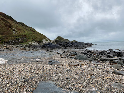
Perwick Beach
1.4 km
Explore Perwick Beach, a breathtaking hiking area on the Isle of Man, where stunning coastal views and nature await every visitor.
Athol Park Glen
1.5 km
Explore the natural beauty of Athol Park Glen in Port Erin, a serene escape perfect for leisurely strolls, picnics, and family fun amidst stunning landscapes.
Childrens Park
1.6 km
Experience the joy and tranquility of Childrens Park, a family-friendly escape in Port Erin, Isle of Man, perfect for relaxation and play.
Isle of Man Steam Railway Museum
1.6 km
Explore the rich history of rail travel at the Isle of Man Steam Railway Museum, featuring vintage locomotives and engaging exhibits for all ages.
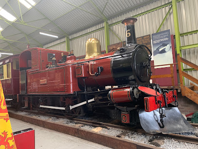
Isle of Man Steam Railway - (Port Erin, Station)
1.6 km
Explore the enchanting Isle of Man Steam Railway, a historic journey through breathtaking landscapes and charming coastal villages.
Port Erin Paddleboards
1.7 km
Explore the serene waters of Port Erin Paddleboards on the Isle of Man, where adventure and relaxation meet in a stunning coastal paradise.
Port Erin
1.7 km
Experience the serene beauty of Port Erin, a captivating coastal village in the Isle of Man, perfect for relaxation and adventure amidst stunning landscapes.
Port Erin Beach Huts
1.8 km
Discover the enchanting Port Erin Beach Huts on the Isle of Man—where stunning coastal views meet cozy charm and outdoor adventure.
Southernmost Point Of Isle Of Man
2.0 km
Explore the Southernmost Point of the Isle of Man, where stunning coastal views and rich maritime history await every traveler.
TSS Mona's Queen III Anchor Memorial
2.2 km
Discover the TSS Mona's Queen III Anchor Memorial in Port St Mary, a touching tribute to maritime history and a serene spot for reflection.
Bradda Glen
2.2 km
Discover the breathtaking landscapes and scenic trails of Bradda Glen, a tranquil park on the Isle of Man, perfect for nature lovers and adventurers.
Essential places to dine
Breagle Glen Indian Restaurant
1.3 km
Discover authentic Indian flavors at Breagle Glen Indian Restaurant in Port Erin – where culinary tradition meets breathtaking coastal beauty.

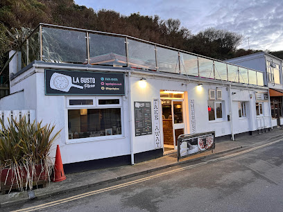
La Gusto Pizza (Isle of Man)
1.3 km
Discover La Gusto Pizza in Port Erin – where authentic Italian flavors meet convenience and affordability for every pizza lover.
Byron's
1.3 km
Experience authentic Italian pizza at Byron's in Port Erin, Isle of Man – where flavor meets stunning coastal views.
Bay Hotel
1.3 km
Experience warm hospitality and delicious local cuisine at Bay Hotel in Port Erin, your cozy retreat on the Isle of Man's stunning coastline.
Hawkins Barbecue
1.4 km
Discover mouthwatering smoked meats at Hawkins Barbecue in Port Erin - A culinary delight on the Isle of Man.
Athol Park Chinese Restaurant
1.5 km
Discover authentic Chinese flavors at Athol Park Chinese Restaurant in Port Erin – where every dish tells a story.
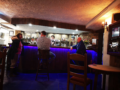
The Riddler under the Nest
1.6 km
Experience coastal charm at The Riddler under the Nest - your perfect bar escape in Port Erin with stunning views and exceptional service.
Water Refill Point
1.6 km
Discover sustainability at the Water Refill Point in Port Erin - your eco-friendly oasis on the Isle of Man.
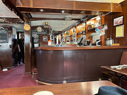
The Station
1.6 km
Discover The Station in Port Erin - where delicious food meets friendly service in a vibrant pub setting.
Port Erin Chippy & Diner
1.7 km
Experience authentic British fish and chips at Port Erin Chippy & Diner, where fresh flavors meet cozy seaside charm.
Mandarin
1.7 km
Experience the vibrant tastes of authentic Chinese cuisine at Mandarin Takeout in Port Erin, Isle of Man.
Cafe Red
1.7 km
Discover the charm of Cafe Red in Port Erin – where delicious flavors meet cozy ambiance for an unforgettable dining experience.
Subway
1.8 km
Experience deliciously fresh sandwiches at Subway in Port Erin—perfect for quick meals amidst your Isle of Man adventures.
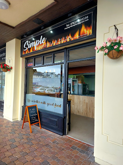
Simple -Chargrill and Pizza
1.8 km
Indulge in delicious pizzas, juicy burgers, and savory kebabs at Simple - Chargrill and Pizza in Port Erin.
Andrea's Italian Restaurant
2.0 km
Experience authentic Italian flavors at Andrea's Italian Restaurant in Isle of Man – where every dish tells a story!
Markets, malls and hidden boutiques
Cregneash Café
0.4 km
Discover the charm of Cregneash Café, a cozy tea house in the Isle of Man, where delightful teas and homemade cakes await you in stunning surroundings.
Angelica Belle
1.4 km
Discover artisanal candles and creative cooking classes at Angelica Belle in Port St Mary, Isle of Man - where craftsmanship meets coastal charm.

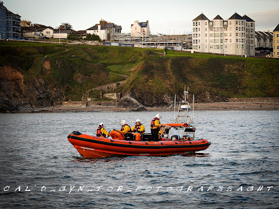
RNLI Port Erin Lifeboat Station & Shop
1.4 km
Discover the RNLI Port Erin Lifeboat Station & Shop, where community spirit meets maritime safety on the scenic Isle of Man.
Life Without Limits with Sophie
1.4 km
Explore handcrafted jewelry and unique treasures at Life Without Limits with Sophie in Port Erin, Isle of Man—where artistry meets elegance.
Bridge Bookshop
1.5 km
Explore a treasure trove of books, art supplies, and music at Bridge Bookshop, a charming gift shop in Port Erin, Isle of Man.
Scoops
1.5 km
Indulge in delicious ice cream at Scoops, a vibrant ice cream shop on the Isle of Man offering a variety of flavors for every sweet tooth.

P D West
1.6 km
Explore P D West in Port Erin, your go-to destination for DJ supplies, vinyl records, and a taste of the local music scene on the Isle of Man.
Age Concern Isle of Man
1.6 km
Uncover unique finds and support a great cause at Age Concern Isle of Man, a charming thrift store in Port Erin.

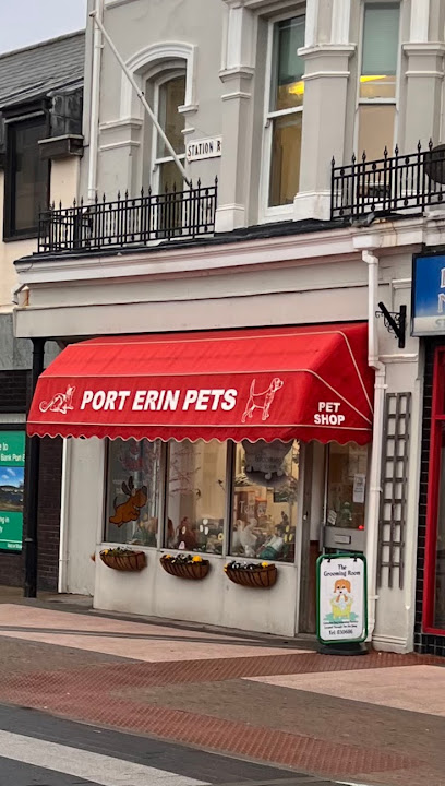
Port Erin Pets
1.6 km
Discover Port Erin Pets, the ultimate destination for pet supplies and friendly advice in the heart of Port Erin, Isle of Man.
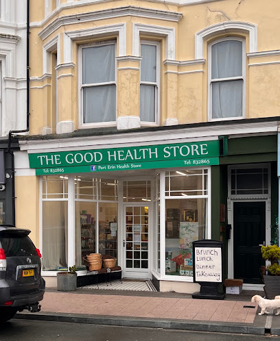
Good Health Store
1.6 km
Explore the Good Health Store in Port Erin for a wide selection of organic foods, supplements, and health products on the Isle of Man.
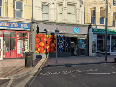
Co-op Food - Port Erin
1.6 km
Discover local flavors and convenience at Co-op Food in Port Erin, your essential stop for groceries on the Isle of Man.
Mantons Cards
1.6 km
Discover joy and imagination at Mantons Cards, Port Erin's beloved toy store offering an array of toys, gifts, and enchanting cards for all ages.

Whistlestop Coffee Shop
1.6 km
Discover the charm of Whistlestop Coffee Shop at Port Erin's Railway Station, where great coffee meets local hospitality in a cozy atmosphere.
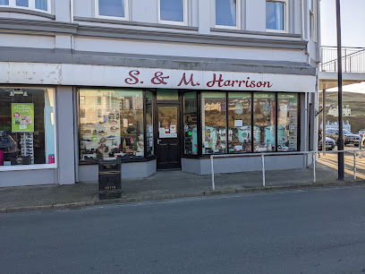
Harrison S & M
1.6 km
Experience the best in local footwear at Harrison S & M, a charming shoe store in Port Erin, Isle of Man, where quality meets comfort.
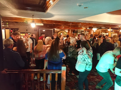
The Haven
1.6 km
Experience local hospitality at The Haven, a charming pub in Port Erin offering a delightful menu and a selection of Isle of Man's finest brews.
Essential bars & hidden hideouts
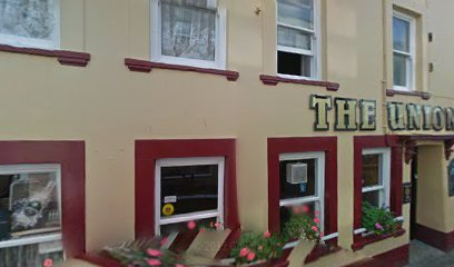
Union Hotel
7.5 km
Discover the welcoming Union Hotel in Castletown, Isle of Man - your perfect blend of comfort and local charm.
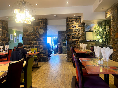
Garrison
7.6 km
Discover Garrison in Castletown, where local flavors meet exquisite dining for an unforgettable culinary experience.
Leonardo's Restaurant
7.6 km
Experience authentic Italian cuisine at Leonardo's Restaurant in Castletown, where each dish is a flavorful journey through Italy's culinary traditions.
The Castle Arms
7.6 km
Experience the charm of Castletown at The Castle Arms, a cozy pub on the quayside, offering local ales and heartfelt hospitality.
Kizuna
7.6 km
Experience the art of Japanese dining at Kizuna, Castletown's premier restaurant offering a delightful menu and authentic flavors.
The Sidings
7.9 km
Discover the warmth of Isle of Man hospitality at The Sidings, a cozy pub in Castletown, offering local brews and traditional cuisine.
The Viking Hotel
7.9 km
Experience the warm hospitality and local flavors at The Viking Hotel, a top pub destination in Castletown, Isle of Man.
Rendezvous Executive Lounge
9.0 km
Discover the perfect blend of comfort and elegance at Rendezvous Executive Lounge, your serene escape at Ronaldsway Airport.
The Abbey Restaurant
9.3 km
Indulge in exquisite dishes at The Abbey Restaurant, where heritage meets modern cuisine in the heart of the Isle of Man.
The Whitestone Inn
9.5 km
Experience the warmth and charm of The Whitestone Inn, a traditional pub on the Isle of Man offering local cuisine and a cozy atmosphere.
Bay Green Restaurant
10.3 km
Experience the best of Isle of Man's cuisine at Bay Green Restaurant, where local flavors meet stunning views in a charming setting.

Baltic Inn
13.8 km
Discover the vibrant atmosphere of Baltic Inn, a beloved bar on the Isle of Man, perfect for savoring local drinks and connecting with fellow travelers.
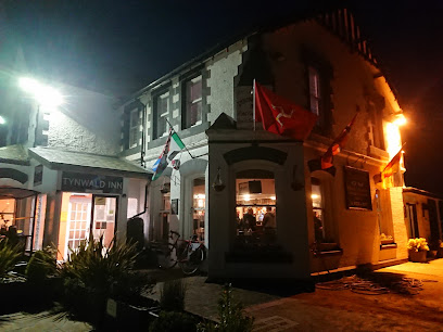
Tynwald Hill Inn
16.7 km
Discover the heart of the Isle of Man at Tynwald Hill Inn, a cozy pub offering traditional meals and local charm in St John's.
The Hawthorn
17.3 km
Experience the perfect blend of traditional pub charm and modern dining at The Hawthorn in Greeba, Isle of Man.
White House Hotel
17.3 km
Experience the warmth and charm of the White House Hotel in Peel, Isle of Man – a cozy pub with local brews and traditional dishes.
Nightclubs & after hour spots
Cregneash Car Park
0.3 km
Explore the beauty of the Isle of Man from Cregneash Car Park, your gateway to scenic trails and rich cultural heritage.
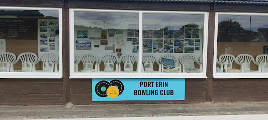
Port Erin Bowling Club
1.3 km
Experience the welcoming atmosphere of Port Erin Bowling Club, a community hub for bowling enthusiasts amidst the stunning Isle of Man scenery.
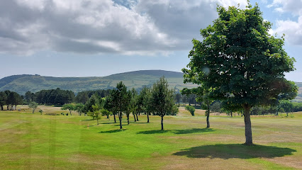
Rowany Golf Club
2.1 km
Discover Rowany Golf Club – a stunning golfing paradise on the Isle of Man, where breathtaking views and lush landscapes await every golfer.
Castletown Rifle Club
7.3 km
Discover the excitement of shooting sports at Castletown Rifle Club, the Isle of Man's premier destination for adventure and fun.
Castletown Football Club
7.3 km
Discover the excitement of local football culture at Castletown Football Club, where community spirit meets sporting passion on the Isle of Man.
Castletown Youth Centre
7.4 km
Experience the heart of youth culture at Castletown Youth Centre, where creativity, community, and fun come together in a vibrant environment.
The Cue Zone IOM
8.4 km
Experience the thrill of pool billiards at The Cue Zone IOM, the Isle of Man's premier destination for players of all skill levels.
Manx Flyers Aero Club
10.2 km
Discover the vibrant nightlife at Manx Flyers Aero Club, where aviation meets unforgettable experiences on the Isle of Man.
Glen Maye Beach
12.9 km
Experience the breathtaking beauty and tranquility of Glen Maye Beach on the Isle of Man, a hidden gem perfect for relaxation and exploration.
Peel Golf Club
17.0 km
Discover the breathtaking Peel Golf Club, where stunning landscapes meet a top-notch golfing experience on the Isle of Man.
Royal Hotel
17.4 km
Discover the Royal Hotel, a lively pub in Peel, Isle of Man, known for local brews, friendly service, and a vibrant atmosphere perfect for unwinding.
The Central Peel
17.4 km
Experience the vibrant atmosphere and local charm at The Central Peel, a must-visit pub in the heart of Peel, Isle of Man.
The Miller’s T’Ale
17.4 km
Discover the charm of Peel’s local pub scene at The Miller’s T’Ale, where great ales and delicious food await you.
The Highwayman
17.5 km
Discover The Highwayman, a charming pub in Peel, Isle of Man, offering delicious food and a warm atmosphere for every visitor.
The Peveril
17.5 km
Experience the warmth and charm of The Peveril bar in Peel, Isle of Man, offering local brews and crafted cocktails in a cozy atmosphere.
For the vibe & atmosphere seeker
- Tranquil
- Scenic
- Unique
- Relaxing
For the design and aesthetic lover
- Rustic Designs
For the architecture buff
- Historic
- Landmarks
For the view chaser and sunset hunter
- Iconic Views
- Panoramas
For the social media creator & influencer
- Instagrammable
- Photo Spots
- Selfie Spots
For the eco-conscious traveler
- Low Impact
- Public-Transport Accessible
- Leave-No-Trace Critical
For the kind of experience you’re after
- Cultural Heritage
- Myth & Legends
- Nature Escape
- Day Trip
- Photowalk
For how adventurous you want the journey to be
- Easy Access
Location Audience
- Family Friendly
- Senior Friendly
- Child Friendly
- Teen Friendly
- Wheelchair Access
- Solo Friendly
- Couple Friendly
- Solo Female Friendly


