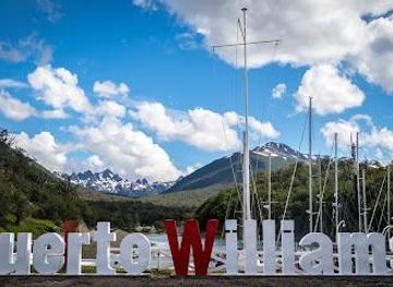
Background

Dientes de Navarino: Trekking at the End of the World

Hike the Dientes de Navarino: A challenging, remote Patagonian trek through stunning subantarctic wilderness at the world's end.

4.8

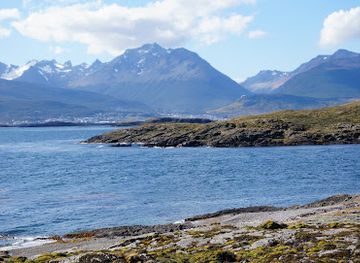
The Dientes de Navarino are a jagged mountain range on Navarino Island in southern Chile, offering a challenging and remote trekking experience. The circuit around these 'teeth' takes adventurers through stunning subantarctic landscapes, far from typical tourist trails.

A brief summary to Dientes de navarino

  • 284H+CJ, Puerto Williams, Cabo de Hornos, Magallanes and Chilean Antarctica, CL

Local tips

  • Be prepared for extreme and rapidly changing weather conditions, even during the summer months (December to February).
  • Carry a map, GPS, and compass, and download offline maps on your smartphone, as the trail can be poorly marked in sections.
  • Register with the local police in Puerto Williams before starting the trek for safety reasons.
  • Pack appropriate gear, including waterproof clothing, sturdy hiking boots, a warm sleeping bag, and a reliable tent.
  • Consider hiring an experienced guide, especially if you have limited experience in remote trekking or navigating in challenging weather.
widget icon

Getting There

  • Walking

    The Dientes de Navarino trek starts near Puerto Williams. From the town center, walk approximately 3.5 km along a gravel road to reach the trailhead at Río Róbalo. Alternatively, arrange a transfer from your accommodation to the trailhead. The initial ascent involves a steep path through lenga forest, leading to Cerro Bandera with views of the Beagle Channel.

  • Taxi/Transfer

    Arrange a taxi or transfer from Puerto Williams to the trailhead at Río Róbalo, approximately 3.5 km from the town center. A typical taxi fare for this short trip is around 5,000-7,000 CLP. Contact local services like Transfer Puerto Williams / Mr. Eduardo Cid (+56 9 4267 5015) for pre-arranged transportation.

Unlock the Best of Dientes de navarino

Buy tickets

    No tickets available

Book tours with entry

    No tours available

Book tours without entry

    No tours available

Discover more about Dientes de navarino

The Dientes de Navarino (Teeth of Navarino) are a dramatic mountain range on Navarino Island, the southernmost point of Chile, near Cape Horn. The range gets its name from its unique, jagged peaks that resemble teeth. This challenging trekking circuit attracts experienced hikers seeking a remote and wild Patagonian adventure. The Dientes de Navarino trek is considered the southernmost trekking circuit in the world. The full circuit covers approximately 40-50 kilometers and typically takes 4-5 days to complete. The trail winds through diverse terrains, including peat bogs, dense forests, rocky summits, and alongside pristine lagoons. The trek's difficulty arises from the unpredictable subarctic climate, which can bring strong winds, snow, rain, and rapidly changing conditions, even in summer. Navigation can also be challenging as the trail is not always well-marked. Despite the challenges, the Dientes de Navarino offer unparalleled solitude and breathtaking views of the Beagle Channel, surrounding islands, and the Southern Ocean. The trail was initially mapped out in the 1980s by Australian climber and author Clem Lindenmayer, who worked for Lonely Planet. Some geographical features along the route, such as Cerro Clem and Montes Lindenmayer, were named in his honor by the Chilean Ministry of Natural Resources in 2001. Navarino Island has a history stretching back 10,000 years, with significant Yahgan archaeological sites. In more recent times, the introduction of Canadian beavers in the 1940s has dramatically altered the island's ecosystem, with extensive beaver dams and felled trees visible throughout the landscape.

Popular Experiences near Dientes de navarino

Popular Hotels near Dientes de navarino

Select Currency