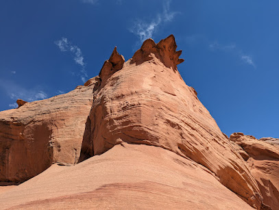
Wahweap Creek: A Utah Oasis
Discover Utah's hidden gem: hike through red rock canyons and explore the otherworldly Wahweap Hoodoos along the serene Wahweap Creek.
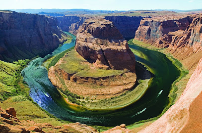
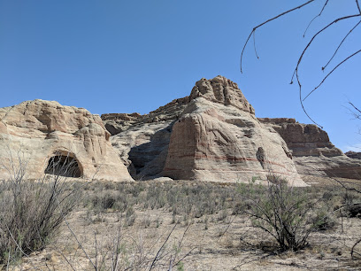
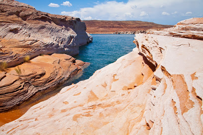
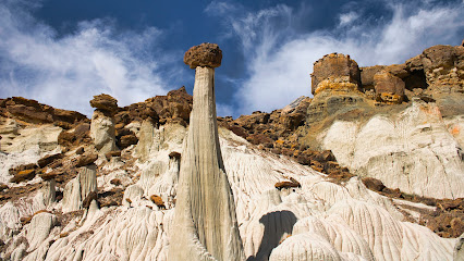
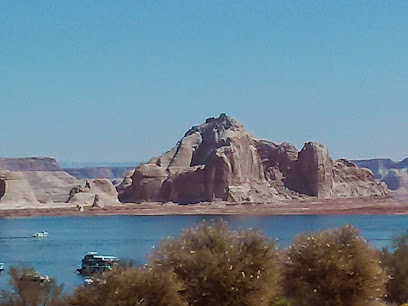
Wahweap Creek, a tributary of the Colorado River, flows through Utah's stunning red rock canyons, offering a serene escape into nature. It's known for unique geological formations and the popular Wahweap Hoodoos trail, making it ideal for hiking and photography.
A brief summary to Wahweap Creek
- Utah, US
Local tips
- Hike early in the morning or late in the afternoon for the best light and to avoid the heat, as the trail offers little shade.
- Bring plenty of water (2-3 liters), sunscreen, and a hat, as the desert environment can be harsh.
- Check the weather forecast before heading out, as Wahweap Creek is prone to flash floods.
- Wear sturdy hiking shoes suitable for walking in sand and potentially slippery creek beds.
- Download a trail map or carry a GPS device, as the trail is not always well-marked.
Getting There
-
Driving
From Page, Arizona, take US-89 N towards Kanab, Utah. After approximately 14.4 miles (measured from the Glen Canyon Visitor Center), turn right onto Ethan Allen Road in Big Water. Continue 0.6 miles and turn left onto Fish Hatchery Road. Drive 2 miles to the Fish Hatchery, where Fish Hatchery Road becomes Nipple Canyon Road. After 0.5 miles, Nipple Canyon Road becomes BLM327/Nipple Creek Road. Continue 0.2 miles to Wahweap Creek. If you have a 2WD vehicle, park before crossing the creek. 4WD vehicles can cross the creek and continue 0.5 miles to the 4WD trailhead. There are no parking fees.
-
Walking
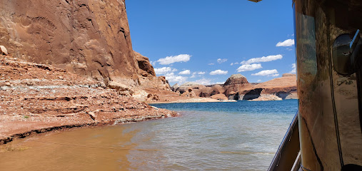
From the 2WD parking area, hike along the Nipple Creek Road until you reach Wahweap Creek. Carefully cross the creek (when dry) and continue along the road until you reach the 4WD parking area. From the 4WD parking area, follow the BLM trail sign north along a sandy path that drops you into Wahweap Creek. From here, choose your own path as you make your way up the broad creek bed. The hike to the hoodoos is approximately 4 miles each way. Be prepared for a long, exposed hike in a sandy wash.
Discover more about Wahweap Creek
Iconic landmarks you can’t miss
Wahweap Creek
0.0 km
Discover Utah's hidden gem: hike through red rock canyons and explore the otherworldly Wahweap Hoodoos along the serene Wahweap Creek.

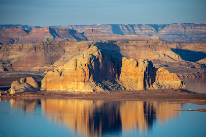
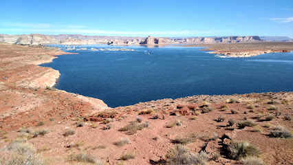
Wahweap Bay
6.8 km
Explore the heart of Lake Powell at Wahweap Bay: boating, canyons, and stunning desert scenery await!
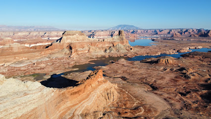
Glen Canyon National Recreation Area, Utah, USA
9.3 km
Explore the stunning landscapes and endless adventures of Glen Canyon National Recreation Area, from the waters of Lake Powell to the desert canyons.
The New Wave
12.9 km
Discover the surreal beauty of The Wave, a world-famous sandstone formation in the Vermilion Cliffs National Monument. Permits required.
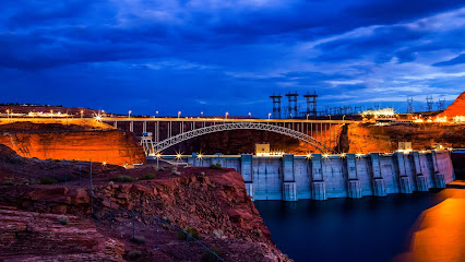
Glen Canyon Dam Bridge
13.8 km
Experience breathtaking views from the Glen Canyon Dam Bridge, a historic landmark offering a unique perspective of the Colorado River and Lake Powell.
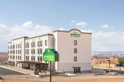
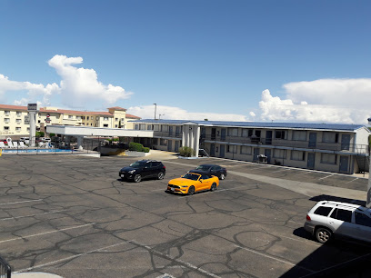
Wingate by Wyndham Page Lake Powell
15.5 km
Comfortable hotel in Page, Arizona, offering easy access to Lake Powell, Antelope Canyon, and Horseshoe Bend.
Grandview Inn Bed and Breakfast
15.6 km
Experience Southwestern charm and stunning views at Grandview Inn B&B, your perfect gateway to Lake Powell, Antelope Canyon, and Horseshoe Bend.
Sunset 89
15.8 km
Experience Island Pacific Rim cuisine with breathtaking views of Lake Powell and Glen Canyon Dam at Sunset 89 in Page, Arizona.
Hyatt Place Page / Lake Powell
15.9 km
Explore Lake Powell and Antelope Canyon from this comfortable and convenient hotel in Page, Arizona. Your adventure starts here!
Best Western View of Lake Powell Hotel
16.1 km
Enjoy panoramic views and comfortable accommodations at the Best Western View of Lake Powell Hotel, your gateway to adventure in Page, Arizona.
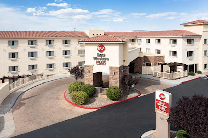
Best Western Plus At Lake Powell
16.2 km
Comfortable hotel in Page, AZ, offering easy access to Lake Powell, Antelope Canyon, and other natural attractions.
Rose Walk Inn Bed & Breakfast
16.4 km
Experience warm hospitality and comfortable lodging at this centrally located Page, Arizona bed and breakfast, perfect for exploring nearby attractions.
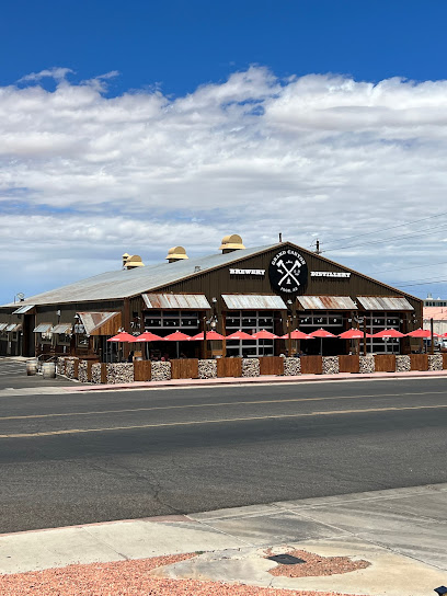
Grand Canyon Brewing +Distillery
16.4 km
Experience craft brews and spirits in a unique firehouse setting, just a stone's throw from Horseshoe Bend and other Page attractions.
Papillon Grand Canyon Helicopters - Page, AZ
16.5 km
Soar above the breathtaking landscapes of the Grand Canyon and Lake Powell with Papillon Helicopters in Page, Arizona. Unforgettable aerial adventures await!
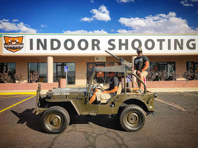
Gunfighter Canyon Indoor Shooting Experience and Gun Store
16.6 km
Experience the thrill of indoor shooting in Page, Arizona, with a wide selection of firearms and expert instruction for all skill levels.
Unmissable attractions to see
Welcome To Arizona Sign
4.1 km
Capture the essence of Arizona at the Welcome to Arizona Sign, a vibrant landmark inviting you to explore the beauty of the Grand Canyon State.
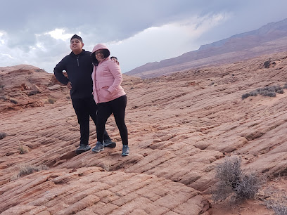
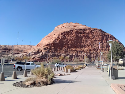
Stud Horse Point
6.0 km
Experience the breathtaking vistas of Stud Horse Point, a stunning natural wonder near Page, Arizona, perfect for photography and exploration.
Wahweap Window
6.7 km
Discover Wahweap Window, a stunning natural rock formation near Page, Utah, offering breathtaking views of Lake Powell and the surrounding desert landscape.
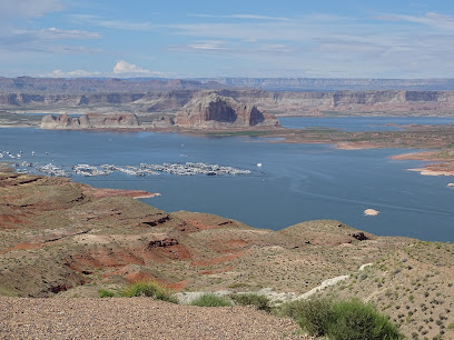
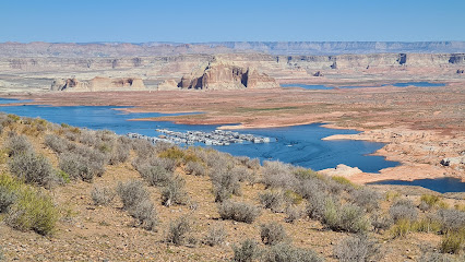
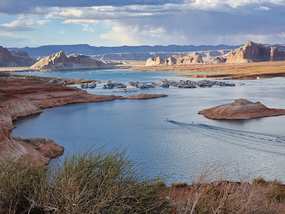
Wahweap Marina
9.2 km
Explore the beauty of Lake Powell at Wahweap Marina, offering boat rentals and stunning views of red rock canyons.
Wahweap Overlook
10.0 km
Discover the stunning vistas of Lake Powell at Wahweap Overlook, a must-visit destination for breathtaking views and unforgettable moments in nature.
Powell lake look out point
10.0 km
Explore the stunning vistas of Lake Powell and Glen Canyon Dam at Powell Lake Lookout Point, a must-visit historical landmark in Arizona.
Wahweap Viewpoint
10.2 km
Discover the stunning vistas at Wahweap Viewpoint, a scenic gem in Page, Arizona, showcasing Lake Powell and Glen Canyon's breathtaking landscapes.
Navajo Mountain Viewpoint
10.8 km
Discover breathtaking vistas at the Navajo Mountain Viewpoint, a scenic gem showcasing the beauty of Lake Powell and the Colorado Plateau.
The Chains
12.8 km
Discover the breathtaking hiking trails and stunning vistas of The Chains in Page, Arizona, a must-visit destination for nature lovers and adventurers.
Shiva-Nandi Rock
12.8 km
Explore the stunning rock formations at Shiva-Nandi Rock in Page, Arizona, a must-visit tourist attraction for nature lovers and photographers alike.
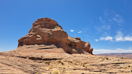
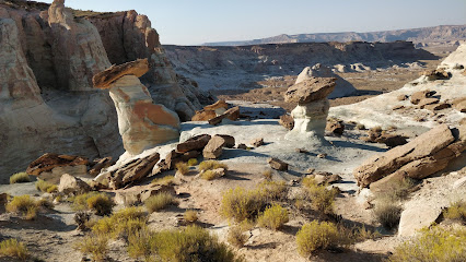
Wahweap Hoodoos Trailhead
13.3 km
Explore the breathtaking natural beauty of Wahweap Hoodoos in Utah, featuring unique geological formations and unforgettable hiking trails.
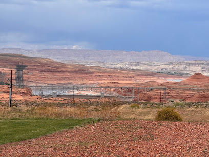
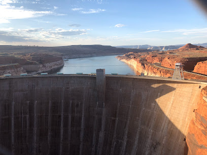
Glen Canyon Dam
13.6 km
Discover the breathtaking Glen Canyon Dam, where engineering brilliance meets stunning natural beauty in Page, Arizona.
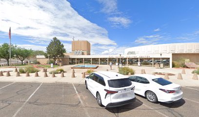
Carl Hayden Visitor Center
13.6 km
Explore the stunning Glen Canyon landscapes and rich history at the Carl Hayden Visitor Center in Page, Arizona – a must-visit for every traveler.
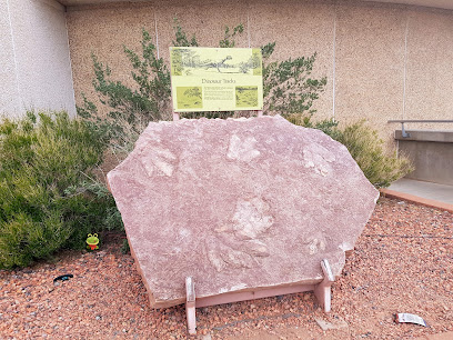
Dinosaur Tracks
13.7 km
Discover the fascinating Dinosaur Tracks in Page, Arizona, where ancient footprints reveal the mysteries of the prehistoric world.
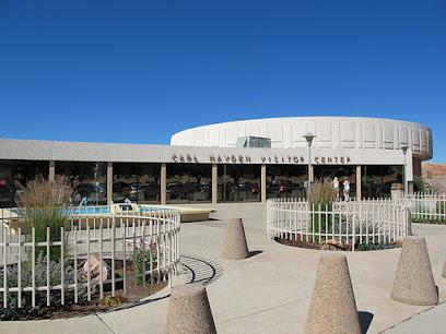
Glen Canyon National Recreation Area Visitor Center
13.7 km
Your adventure starts here! Discover Lake Powell and the canyonlands at the Glen Canyon National Recreation Area Visitor Center in Page, Arizona.
Essential places to dine
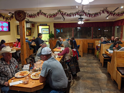
Driftwood Lounge
8.9 km
Experience mouthwatering American cuisine with breathtaking views at Driftwood Lounge by Lake Powell.
Rainbow Room
8.9 km
Experience exquisite American cuisine with stunning views of Lake Powell at the Rainbow Room in Page, Arizona.

Latitude 37
9.4 km
Experience exquisite dining with breathtaking views at Latitude 37 by Lake Powell - where culinary delight meets stunning landscapes.
Antelope Point Marina Restaurant
15.0 km
Experience exquisite American dining at Antelope Point Marina Restaurant with stunning views of Lake Powell's enchanting landscape.
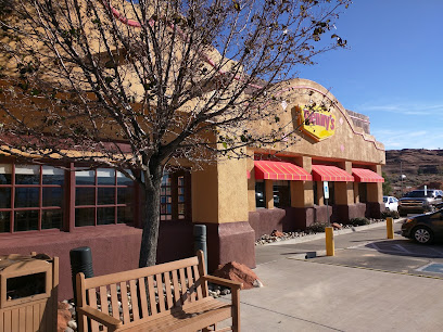
Denny's
15.4 km
Experience classic American breakfast favorites at Denny's in Page, Arizona – perfect for fueling your adventures!
Pepper's
15.5 km
Experience delightful dining at Pepper's in Page, Arizona – where local flavors meet cozy ambiance.
Mulligan's Pub & Patio
15.8 km
Discover Mulligan's Pub & Patio: where delectable American dishes meet stunning views in Page, Arizona.
Prickly Pear Kitchen
15.9 km
Discover exquisite Southwestern cuisine at Prickly Pear Kitchen inside Hyatt Place Page Lake Powell – where every meal is a taste of adventure.
Rimview
16.1 km
Experience delightful cuisine and breathtaking views at Rimview in Page, Arizona - where every meal becomes an unforgettable memory.
The Bowl
16.4 km
Experience delicious grill delights and exciting bowling at The Bowl in Page, Arizona – perfect for family fun after exploring nature's wonders.
Bonkers Restaurant
16.4 km
Experience the perfect blend of Italian and American cuisines at Bonkers Restaurant in Page, AZ – where every meal is a celebration of flavor.
Ranch House Grille
16.4 km
Experience authentic Southwestern flavors at Ranch House Grille in Page, Arizona—perfect for breakfast or lunch amidst stunning natural beauty.
Burger King
16.5 km
Savor delicious flame-grilled burgers and quick bites at Burger King in Page - your go-to spot for fast food on your Arizona adventure.
KFC
16.5 km
Savor delicious fried chicken at KFC in Page, AZ - the perfect fast-food stop near stunning natural attractions.
Strombolli’s Italian Restaurant & Pizzeria
16.5 km
Discover authentic Italian cuisine at Strombolli's in Page, AZ – where every meal feels like a trip to Italy.
Markets, malls and hidden boutiques
Slippers One
8.4 km
Discover the perfect blend of style and comfort at Slippers One, your premier shoe store in the stunning landscapes of Page, Arizona.
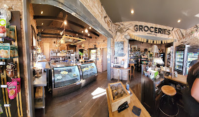
CASTLE ROCK OUTLET STORE
8.9 km
Discover unbeatable deals and unique treasures at Castle Rock Outlet Store in the heart of Arizona's stunning landscapes.
Lake Powell Massage & Spa Boutique
16.1 km
Discover the ultimate relaxation experience at Lake Powell Massage & Spa Boutique with expert treatments and a serene atmosphere in Page, Arizona.

Fred's Liquor Store
16.4 km
Discover a diverse selection of beverages at Fred's Liquor Store in Page, Arizona—your go-to spot for all your drink needs.
Lake Powell Rentals and Retail
16.4 km
Discover Lake Powell Rentals and Retail - Your ultimate adventure hub for unforgettable experiences in the breathtaking landscapes of Lake Powell.
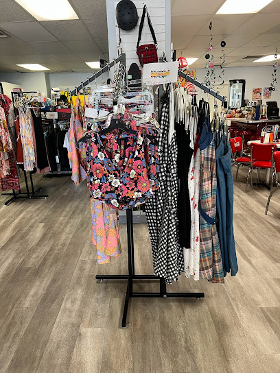
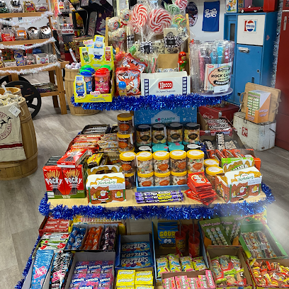
Kelly's Sugar House
16.4 km
Explore Kelly's Sugar House in Page, AZ: A candy store with trendy clothing, unique gifts, and delightful treats for every traveler.
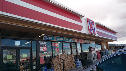
Circle K
16.5 km
Explore Page, AZ with ease at Circle K – your one-stop convenience store for snacks, fuel, and essentials.
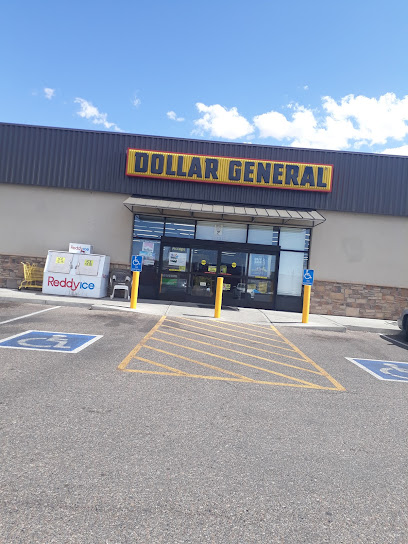
Dollar General
16.5 km
Discover Dollar General in Page, Arizona - your affordable shopping destination for essentials, unique gifts, and seasonal finds.
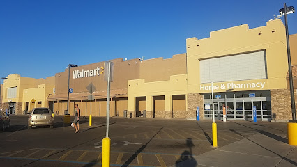
Walmart Supercenter
16.6 km
Discover the ultimate shopping experience at Walmart Supercenter in Page, AZ, with groceries, clothing, electronics, and more all in one place.
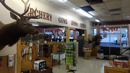
Stix Liquor & Sporting Goods
16.6 km
Explore the best of Page, Arizona at Stix Liquor & Sporting Goods, your go-to for liquor and fishing supplies.
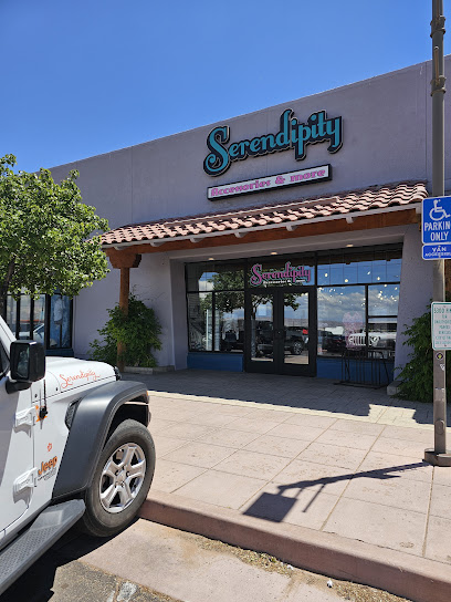
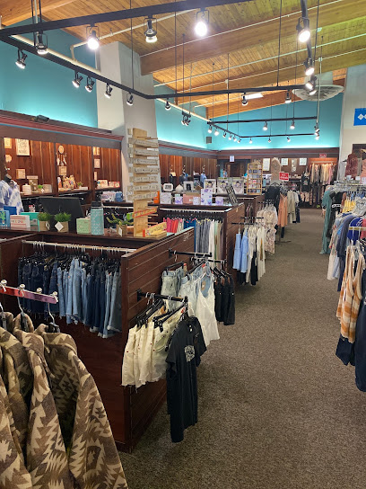
Serendipity
16.6 km
Explore Serendipity, Page's premier fashion accessories store, featuring unique items that embody the spirit of Arizona.
Dam Outlet
16.6 km
Explore fashionable finds at Dam Outlet, Page's premier clothing store offering trendy styles and a warm shopping experience.
House of Remmus
16.6 km
House of Remmus – Your ultimate skateboard shop in Page, Arizona, where passion meets community and adventure awaits.

Antelope Canyon Gift Shop
16.6 km
Explore the Antelope Canyon Gift Shop for unique souvenirs and local crafts that celebrate the beauty of Arizona.

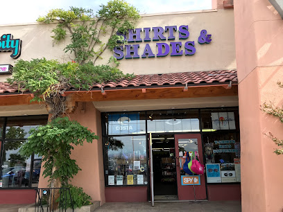
Shirts & Shades
16.6 km
Discover unique fashion and accessories at Shirts & Shades, a boutique store in Page, Arizona, perfect for tourists seeking style and quality.
Essential bars & hidden hideouts
Blue Bar & Wine
16.6 km
Experience the vibrant atmosphere and exquisite wine selection at Blue Bar & Wine, the perfect retreat for travelers in Page, Arizona.
Starlite Chinese & American
16.7 km
Savor the best of both worlds at Starlite Chinese & American, where authentic Chinese cuisine meets American comfort food in Page, Arizona.
Sonic Drive-In
16.7 km
Experience the nostalgic charm of Sonic Drive-In in Page, Arizona, offering a delicious fast-food menu and classic drive-in service.
Slackers
16.7 km
Discover the ultimate burger experience at Slackers in Page, Arizona, where delicious flavors and a lively atmosphere await every visitor.
K-POP Kitchen
16.8 km
Experience authentic Korean cuisine at K-POP Kitchen in Page, Arizona, where delicious food and a lively atmosphere await.
Dara Sushi & Roll
16.8 km
Experience the authentic taste of Japan at Dara Sushi & Roll, where fresh ingredients meet traditional flavors in Page, Arizona.
Mongolian BBQ Grill
16.8 km
Experience the unique flavors of Mongolia at Mongolian BBQ Grill in Page, Arizona, where you create your own stir-fry masterpiece!
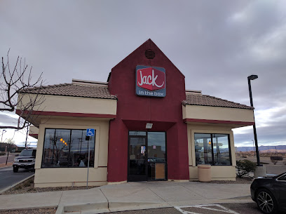
Jack in the Box
16.8 km
Experience the fast food charm of Jack in the Box in Page, AZ, featuring a diverse menu of burgers, breakfast items, and delightful desserts.
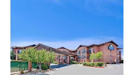
Days Inn & Suites by Wyndham Page Lake Powell
16.8 km
Experience the stunning landscapes of Lake Powell from the comfortable Days Inn & Suites, your gateway to nature's wonders in Page, Arizona.
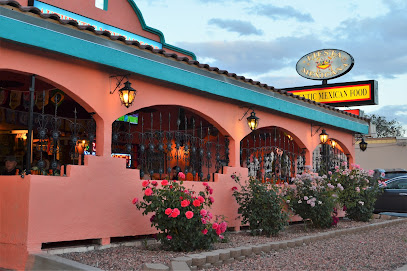
Fiesta Mexicana Restaurant
16.9 km
Experience the vibrant flavors of authentic Mexican cuisine at Fiesta Mexicana Restaurant in Page, Arizona.
R D's Drive-In
17.0 km
Experience the flavors of America at R D's Drive-In, a fast food haven in Page, AZ, perfect for families and adventure seekers alike.

Nightclubs & after hour spots
DJ Cody Inc
17.3 km
DJ Cody Inc: Elevate your event with top-notch DJ services for unforgettable celebrations filled with music and joy.
Page Shores Amphitheater
19.2 km
Discover the enchanting Page Shores Amphitheater in Arizona, a perfect blend of nature and entertainment for an unforgettable outdoor experience.
Cowboy Country Inn
81.5 km
Discover the rustic charm and natural beauty at Cowboy Country Inn, your perfect base for exploring Escalante, Utah's breathtaking landscapes.
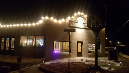
4th West Pub
81.5 km
Experience the local flavors and cozy atmosphere at 4th West Pub, the perfect bar and grill in Escalante, Utah.
Circle D Restaurant
81.5 km
Experience the essence of American comfort food at Circle D Restaurant in Escalante, where every meal is a memorable occasion.
Circle D Motel
81.5 km
Experience tranquility and adventure at Circle D Motel - your gateway to explore Escalante's stunning landscapes and outdoor activities.
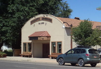
Historic Escalante Showhouse
81.5 km
Experience the vibrant live music scene at the Historic Escalante Showhouse, a cultural hub in the heart of Utah's picturesque Escalante.
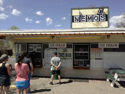
Nemo's Drive Thru
81.6 km
Discover delicious burgers and local flavors at Nemo's Drive Thru, a must-visit dining spot in the heart of Escalante, Utah.
Esca-latte Restaurant
81.6 km
Experience the best of Escalante with fresh, local flavors at Esca-latte Restaurant, the perfect café for travelers seeking comfort and delicious meals.
Prospector Inn
81.6 km
Experience the charm of Escalante at Prospector Inn, your cozy retreat for exploring Utah's stunning natural landscapes.
The INN of Escalante
81.6 km
Discover the charm of The INN of Escalante, your perfect base to explore Utah's stunning natural landscapes and outdoor adventures.
Entrada Escalante Lodge
81.7 km
Discover comfort and adventure at Entrada Escalante Lodge, your ideal base for exploring Utah's breathtaking landscapes.
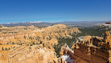
Bryce Canyon National Park Sunset Point
83.8 km
Experience the stunning beauty of Bryce Canyon National Park's Sunset Point, where vibrant sunsets and unique geological formations await.
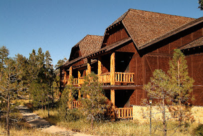
The Lodge at Bryce Canyon
84.1 km
Discover the enchanting beauty of Bryce Canyon National Park from the comfort of The Lodge, your gateway to adventure and nature.
Escobar's Mexican Restaurant
84.2 km
Indulge in authentic Mexican cuisine at Escobar's Mexican Restaurant in Kanab, where vibrant flavors and a warm atmosphere await.