Jean E. Pigott Monument
Jean E. Pigott Monument: A Tribute to Ottawa's Visionary
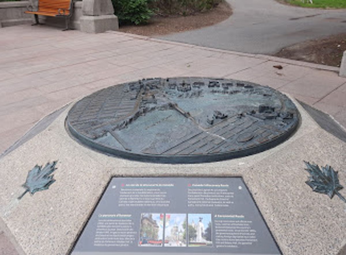
Explore Ottawa's downtown core in miniature with this detailed bronze map on Mackenzie Avenue, offering a unique city perspective.
The Confederation Table Map is a detailed, three-dimensional bronze map of downtown Ottawa and Gatineau. Located on Mackenzie Avenue, it offers a unique perspective of the city's landmarks and layout, providing an engaging way to explore the area's geography and history.
Opening times, essentials, and a few local tips gathered into one calmer, easier-to-scan planning section.
Walking
From the ByWard Market, walk south on Mackenzie Avenue. The Confederation Table Map will be on your right, a short distance from the National Gallery of Canada. The walk is generally flat and takes only a few minutes. No costs involved.
Public Transport
If arriving by bus, disembark at the Mackenzie Avenue stop near the National Gallery of Canada. The Confederation Table Map is a short walk from the bus stop. OC Transpo bus fares are typically around $3.70 CAD for a single ride.
Taxi/Ride-share
Ask your driver to take you to 482 Mackenzie Ave, near the National Gallery of Canada. From downtown Ottawa, a taxi or ride-share will likely cost between $10 and $15 CAD, depending on traffic.
Parking
Paid parking is available in the ByWard Market and at the National Gallery of Canada. Parking rates vary, but expect to pay around $6 CAD per hour. Availability can be limited, especially during peak tourist season. Consider using parking apps like SpotHero to reserve a spot in advance.
Use Confederation Table Map as your starting point for nearby food, family ideas, nightlife, and more local discoveries.

Explore expert travel guides, compare and book tours, experiences, hotels, and more—all from the palm of your hand. Download now for seamless trip planning wherever your wanderlust takes you.
Discover Ottawa: Canada's capital city, where history meets modernity, and nature blends seamlessly with urban charm. A perfect destination for every traveler.
Tell me more about Ottawa