Ejer Bavnehøj
Ejer Bavnehøj & Genforeningstårnet

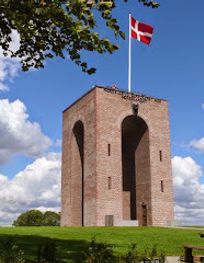
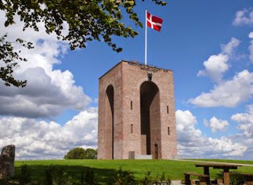
Denmark's third-highest peak crowned by a historic 1924 tower with sweeping views across moraine landscape and distant islands.
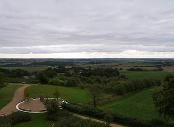
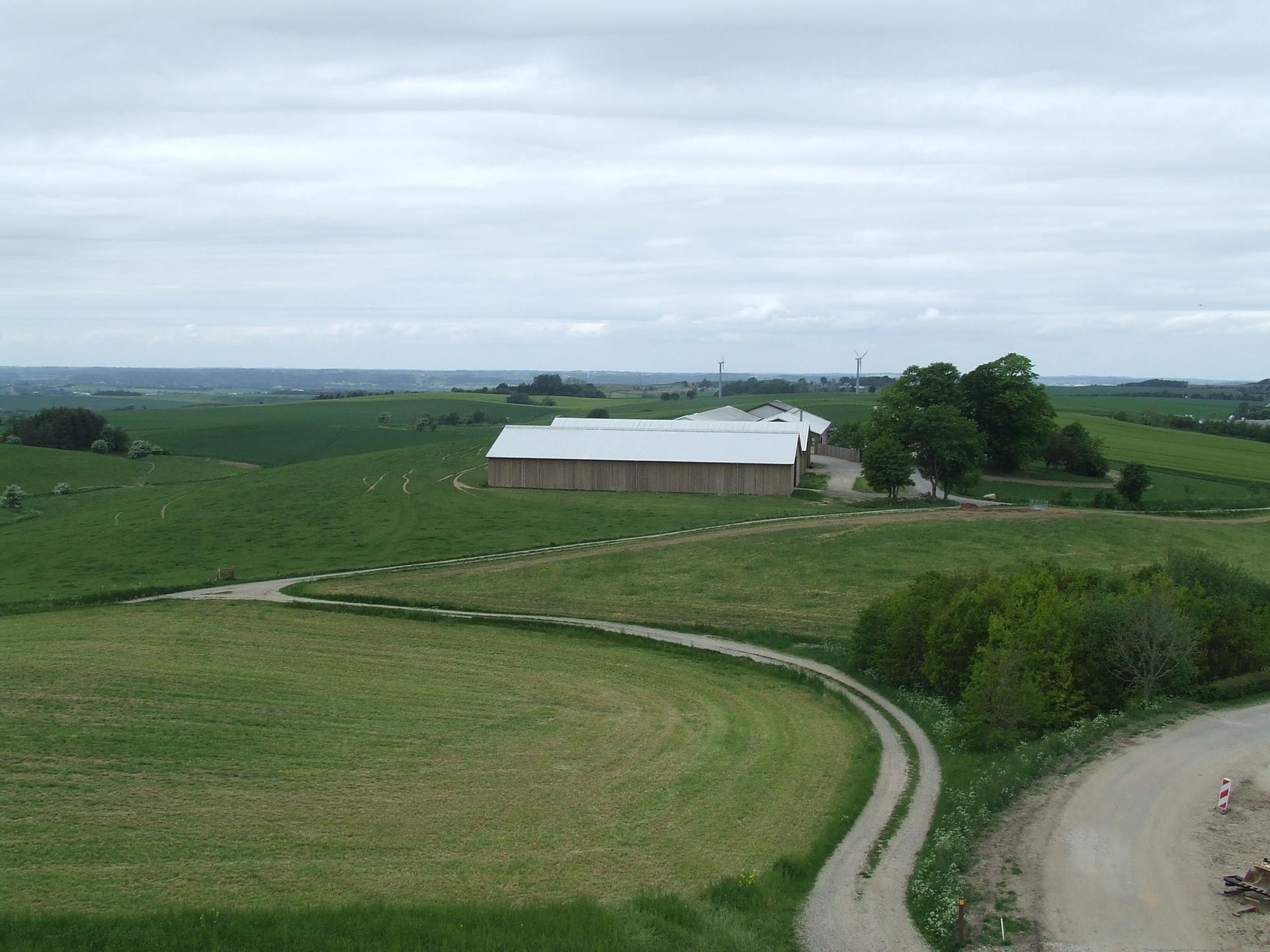
Ejer Bavnehøj stands at 170.35 meters as Denmark's third-highest natural point, crowned by the iconic 12.5-meter Genforeningstårn tower built in 1924 to commemorate South Jutland's reunification with Denmark. From the summit, visitors enjoy panoramic views across the Ejer Bjerge landscape, and on clear days can see as far as Samsø and the Lillebælts Bridge. The site offers free parking, picnic facilities, and the challenging 1.5-kilometer Sporet ved Ejer hiking trail through varied terrain.
Opening times, essentials, and a few local tips gathered into one calmer, easier-to-scan planning section.
By Car from Skanderborg
From Skanderborg town center, drive south on Route 16 toward the E45 motorway. Take the E45 southbound and exit at Junction 54 marked 'Ejer Bavnehøj.' Follow local road signs through the village of Ris toward Ejer Bavnehøj. The journey takes approximately 15–20 minutes depending on traffic. Free parking is available at the summit with no time restrictions. The site is accessible year-round.
By Car from E45 Motorway
If traveling on the E45 motorway between Vejle and Aarhus, exit at Junction 54 'Ejer Bavnehøj' (located south of Skanderborg). Follow directional signs through the village of Ris. The drive from the motorway exit to the summit takes approximately 5–10 minutes. This makes Ejer Bavnehøj an ideal rest stop for long-distance travelers.
Walking from Ris Village
From the village of Ris (approximately 2 kilometers away), a walking route leads uphill toward Ejer Bavnehøj through open countryside. The walk takes 25–35 minutes depending on fitness level and exact starting point. The terrain is moderately steep in sections. This option suits those seeking a more immersive approach to the summit and avoiding parking concerns.
By Bus from Skanderborg
Local bus services connect Skanderborg town center to the Ejer Bavnehøj area, though service frequency is limited. Journey time is approximately 20–30 minutes depending on route and stops. Check current schedules with Midtjyllands Trafikselskab (local transit authority) before traveling, as service may vary seasonally.
Use Genforeningstårn på Ejer Bavnehøj as your starting point for nearby food, family ideas, nightlife, and more local discoveries.


A quick look at seasonal patterns and peak visiting hours.

Explore expert travel guides, compare and book tours, experiences, hotels, and more—all from the palm of your hand. Download now for seamless trip planning wherever your wanderlust takes you.
Experience the serene beauty and panoramic views of Møllehøj, Denmark's highest natural point, perfect for nature lovers and photographers alike.
Tell me more about Mollehoj