Fort Myers Beach (Fort Myers) Travel Guide - Free
Explore Fort Myers Beach in Fort Myers with Evendo's free guide. Find the best shops, historic streets, restaurants, and gems on web or mobile.


Fort Myers Beach, Florida, pairs Gulf beaches, Estero Island sunsets, Matanzas Pass Preserve, local seafood and a resilient coastal history near Fort Myers.
Island Setting and Coastal Character
Fort Myers Beach occupies the narrow barrier island of Estero Island on Florida’s Gulf Coast, a separate municipality from the City of Fort Myers despite sharing the city name used in many travel addresses. The community stretches between the Gulf of Mexico and Estero Bay, with broad sandy beaches, tidal waterways and a main north–south road linking its residential, commercial and public spaces. Its identity is shaped by water: morning beach walks, boat traffic in the back bays, salt-air sunsets and the changing shoreline after major storms.Read more about Fort Myers Beach
Public Spaces and Local History
Life After the Storms
Best attractions in Fort Myers Beach
Fort Myers Beach’s attractions are closely tied to its shoreline and estuarine setting. The broad Gulf beach provides space for swimming, shelling, walking and sunset watching, while the Times Square area offers the island’s most concentrated mixture of public waterfront, small businesses and beach access. At the northern end, Bowditch Point Park combines Gulf views with trails through coastal vegetation and access to quieter bay-side scenery. Matanzas Pass Preserve leads visitors through mangrove and maritime-hammock habitat on boardwalks and sandy paths, offering a change from the open beach. The Mound House is the island’s principal historic and archaeological attraction, built around a Calusa shell mound and interpreted through exhibits and guided programming. The public pier site and surrounding waterfront remain significant points of orientation, although access and facilities have been affected by Hurricane Ian recovery and should be checked before visiting.
-
Tourist attraction
Ancient Pier Fort Myers Beach
Discover the serene beauty of the Ancient Pier at Fort Myers Beach, a historic attraction offering stunning views and a peaceful retreat by the Gulf.
7 min drive · 2.2 km from neighbourhood centre

Best landmarks in Fort Myers Beach
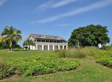
The Mound House is Fort Myers Beach’s most distinctive historic landmark, standing on a Calusa shell mound and connecting the modern municipality with the Indigenous history of south-west Florida. The site’s raised position and interpretive displays make the mound itself as important as the building. Times Square functions as a commercial and symbolic landmark at the northern end of the developed beach corridor, marking the relationship between Estero Boulevard, the Gulf shoreline and the former pier approach. The island’s bridges and causeways are also central to its identity, because they define the arrival from mainland Fort Myers and the visual transition from city to barrier island. Matanzas Pass Preserve and Bowditch Point Park are natural landmarks rather than monuments, protecting mangrove, dune and coastal-hammock landscapes within a heavily visited environment. Public waterfront structures and beach access points remain significant but have changed through Hurricane Ian damage and ongoing reconstruction.
-
Museum
Mound House
Explore Mound House, an archaeological treasure in Fort Myers Beach, where history and nature intertwine to unveil the legacy of the Calusa people.
7 min drive · 2.2 km from neighbourhood centre
Explore Fort Myers Beach on the map
A handpicked selection of must-see spots in Fort Myers Beach, mapped for you.
Best hotels in Fort Myers Beach
Best bars in Fort Myers Beach
Fort Myers Beach has an informal, coastal evening scene rather than a dense nightclub district. Times Square and the nearby waterfront traditionally form the main gathering area after dark, with casual bars, restaurants serving drinks, live entertainment and places oriented towards sunset and holiday socialising. Elsewhere along Estero Boulevard, nightlife is scattered through accommodation and restaurant areas rather than concentrated in a single late-night quarter. Hurricane Ian altered the location and operation of many businesses, so the current choice of venues and performances can change. The neighbourhood is better suited to relaxed drinks, music and an evening walk than to a metropolitan club circuit. Visitors should be mindful that residential properties sit close to commercial premises, use established routes after dark and check current information for any venue or event rather than relying on pre-storm descriptions.
-
American
Junkanoo Below Deck
Discover the vibrant vibes of Junkanoo Below Deck, a beachside American restaurant and bar in Fort Myers Beach, perfect for relaxing and enjoying delicious food.
13 min walk · 1.0 km from neighbourhood centre

Best shops in Fort Myers Beach
Shopping on Fort Myers Beach is concentrated along Estero Boulevard, especially around Times Square and the busier beach-access areas. The retail character is practical and holiday-focused: beachwear, sandals, sun protection, souvenirs, shell-themed gifts, small artworks, snacks and casual resort goods are more prominent than large-scale fashion or specialist shopping. Independent shops and galleries have historically given the island’s commercial strips a local element, although premises and stock have changed considerably during post-Ian rebuilding. There is no major enclosed shopping centre within the neighbourhood, and visitors looking for a full supermarket range, department stores or extensive specialist retail will find broader choice on the mainland. The best way to browse locally is to combine short stretches of Estero Boulevard with the beach and waterfront, checking which businesses are currently open rather than assuming that older directories remain accurate.
-
Shopping mall
Santini Marina Plaza Shops
Experience a unique shopping oasis in Fort Myers Beach with diverse boutiques, dining options, and scenic views at Santini Marina Plaza Shops.
7 min drive · 2.3 km from neighbourhood centre
-
Gift shop
The Islander, Gift Gallery & Boutique
Explore The Islander, Gift Gallery & Boutique for unique gifts and stylish clothing that embody the spirit of Fort Myers Beach.
7 min drive · 2.3 km from neighbourhood centre
-
Art gallery
Island Girl
Explore local artistry at Island Girl, an art gallery in Fort Myers Beach, showcasing unique handcrafted works and accessories.
7 min drive · 2.3 km from neighbourhood centre


Fort Myers Beach essentials
Getting There
Getting Around
Safety
Emergency Situations
Do's and Don'ts
Local Tips

From Eve
Local phrases worth knowing
You don't need to get them perfect. A few words go a long way, and locals appreciate the effort.
Basics
| English | Local | Say it |
|---|---|---|
| Hello | Hey y'all | [Hey y'all] |
| Goodbye | Catch ya later | [Catch ya later] |
| Yes | Yeah | [Yeah] |
| No | Nah | [Nah] |
| Please/You're welcome | Please/No problem | [Please/No problem] |
| Thank you | Thanks | [Thanks] |
| Excuse me/Sorry | Pardon me/My bad | [Pardon me/My bad] |
| How are you? | How's it going? | [How's it going?] |
| Fine. And you? | Good. How 'bout you? | [Good. How 'bout you?] |
| Do you speak English? | Ya speak English? | [Ya speak English?] |
| I don't understand | I don't get it | [I don't get it] |
Eating & Drinking
| English | Local | Say it |
|---|---|---|
| I'd like to see the menu, please | Can I check out the menu, please | [Can I check out the menu, please] |
| I don't eat meat | I don't do meat | [I don't do meat] |
| Cheers! | Cheers! | [Cheers!] |
| I would like to pay, please | I'll take the check, please | [I'll take the check, please] |
Emergencies
| English | Local | Say it |
|---|---|---|
| Help! | Help! | [Help!] |
| Go away! | Get lost! | [Get lost!] |
| Call the Police! | Call the cops! | [Call the cops!] |
| Call a doctor! | Get a doc! | [Get a doc!] |
| I'm lost | I'm turned around | [I'm turned around] |
| I'm ill | I'm under the weather | [I'm under the weather] |
Shopping
| English | Local | Say it |
|---|---|---|
| I'd like to buy... | I wanna buy... | [I wanna buy...] |
| I'm just looking | Just browsing | [Just browsing] |
| How much is it? | How much does it cost? | [How much does it cost?] |
| That's too expensive | That's steep | [That's steep] |
| Can you lower the price? | Can you give me a deal? | [Can you give me a deal?] |
Time & Numbers
| English | Local | Say it |
|---|---|---|
| What time is it? | What's the time? | [What's the time?] |
| It's one o'clock | It's one | [It's one] |
| Half past (10) | Ten-thirty | [Ten-thirty] |
| Morning | Mornin' | [Mornin'] |
| Afternoon | Afternoon | [Afternoon] |
| Evening | Evenin' | [Evenin'] |
| Yesterday | Yest'day | [Yest'day] |
| Today | Today | [Today] |
| Tomorrow | Tomorrah | [Tomorrah] |
| 1 | One | [One] |
| 2 | Two | [Two] |
| 3 | Three | [Three] |
| 4 | Four | [Four] |
| 5 | Five | [Five] |
| 6 | Six | [Six] |
| 7 | Seven | [Seven] |
| 8 | Eight | [Eight] |
| 9 | Nine | [Nine] |
| 10 | Ten | [Ten] |
Transport & Directions
| English | Local | Say it |
|---|---|---|
| Where's a/the...? | Where's the...? | [Where's the...?] |
| What's the address? | What's the addy? | [What's the addy?] |
| Can you show me (on the map)? | Can you point it out (on the map)? | [Can you point it out (on the map)?] |
| When's the next (bus)? | When's the next (bus)? | [When's the next (bus)?] |
| A ticket (to ....) | A ticket (to ....) | [A ticket (to ....)] |
History of Fort Myers Beach
Calusa Shoreline and Shell Mounds
The island’s earliest known human history is associated with the Calusa, a powerful Indigenous society whose settlements and waterways extended across south-west Florida. The Mound House preserves a shell midden on Estero Island, offering tangible evidence of long-term habitation and the importance of estuarine resources. Shell, fish, mangrove and tidal channels shaped life in the region long before the modern resort community emerged. The mound is not simply an elevated landscape feature but a cultural and archaeological record, linking the present neighbourhood to the ancient coastal environment of Estero Bay.
Early Settlement on Estero Island
Modern settlement developed gradually on the barrier island, whose isolation made transport by water central to everyday life. In the late nineteenth and early twentieth centuries, small-scale agricultural, fishing and residential uses appeared alongside the natural shoreline. The name Fort Myers Beach reflects the community’s relationship with the larger mainland city, although the beach municipality developed its own civic identity. Roads, bridges and ferry connections gradually made the island more accessible, changing it from a relatively remote coastal setting into a seasonal destination.
Bridges, Tourism and the Gulf Resort
Improved road access and bridge connections accelerated tourism during the twentieth century. Motels, holiday cottages, restaurants and recreational businesses grew along the island’s main corridor, while fishing, boating and beach leisure became central to its economy. Times Square emerged as the best-known commercial and social focus near the northern end, and the public pier became a recognisable waterfront feature. Despite this development, mangroves, tidal flats and undeveloped stretches remained important parts of the island’s character, particularly around the preserve lands and Estero Bay.
Municipal Identity and Coastal Conservation
Fort Myers Beach incorporated as a town in 1995, formalising local government separate from the City of Fort Myers while retaining the shared regional name. The municipality’s later development balanced visitor accommodation and waterfront commerce with concerns about beach nourishment, storm exposure, habitat and building scale. Natural areas such as Matanzas Pass Preserve and Bowditch Point Park became important public counterweights to the more intensively developed beach corridor. The Mound House likewise connected tourism with interpretation of the island’s Indigenous and environmental past.
Hurricane Ian and Rebuilding
Hurricane Ian made landfall in south-west Florida on 28 September 2022 and caused catastrophic damage on Fort Myers Beach. Storm surge and wind destroyed or severely damaged homes, businesses, roads, utilities and waterfront structures, reshaping the physical appearance and economic life of the community. Recovery has involved debris removal, infrastructure reconstruction, property redevelopment and continuing decisions about the public shoreline. The storm is now a defining chapter in local history, not only because of the immediate destruction but because rebuilding continues to influence how the island accommodates residents, businesses, visitors and future storms.
Fort Myers Beach in Photos
Browse through our photo collection highlighting the charm and character of the destination.
Neighbourhoods near Fort Myers Beach
The closest neighbourhoods to Fort Myers Beach, if you have time for more than one stop.

Swipe for more neighbourhoods
Explore more

Explore more of Fort Myers
Fort Myers blends Edison-era history, Gulf Coast landscapes, riverfront culture, seafood, museums and easy access to Southwest Florida adventures.
Explore Fort Myers