Wicklow Way
Wicklow Way: Ireland's First Waymarked Trail

Hike Ireland's first National Waymarked Trail: a 131km journey through Wicklow's stunning mountains, valleys, and historic landscapes.
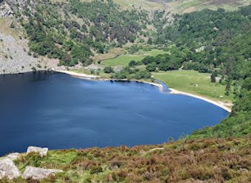
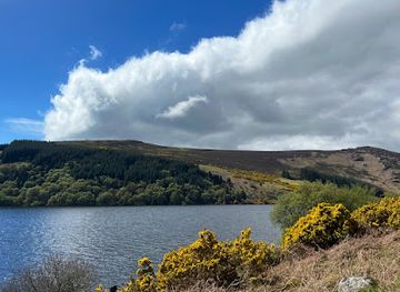
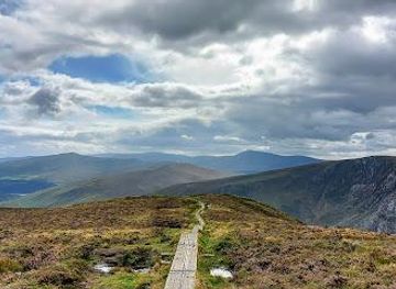
The Wicklow Way, a 131-kilometer trail through the Wicklow Mountains, offers a varied landscape of forests, valleys, and moorland. Opened in 1980, it was Ireland's first official long-distance walking route and remains popular with hikers seeking a multi-day adventure.
Opening times, essentials, and a few local tips gathered into one calmer, easier-to-scan planning section.
Public Transport
To reach the northern trailhead at Marlay Park from Dublin city center, take Dublin Bus route No. 16 from O'Connell Street. The bus stop is conveniently located near the park entrance. A single fare is approximately €3.30, payable with a Leap Visitor Card or in cash.
Car
If driving to Marlay Park, be aware of the car park's opening hours (10:00 AM) and variable seasonal closing times. Parking is available at the North car park near Marlay House and Craft Centre. Parking is free. Crone car park is another option, and it provides access to trails with views of Powerscourt Waterfall, but it also closes for the night.
Wicklow Way Bus
The Wicklow Way Bus provides services to several points along the trail, including Laragh, Glendalough, Glenmalure, Iron Bridge and Tinahely. This is useful for shortened versions of the walk. For example, a one-way ticket from Rathdrum Station to Glendalough/Glenmalure costs €8. Bookings should be made at least 24 hours in advance.
Use Tower Bridge as your starting point for nearby food, family ideas, nightlife, and more local discoveries.

Explore expert travel guides, compare and book tours, experiences, hotels, and more—all from the palm of your hand. Download now for seamless trip planning wherever your wanderlust takes you.
Discover the rich history, vibrant culture, and stunning landscapes of County Dublin, Ireland's dynamic capital region.
Tell me more about County Dublin