

Skagsvola T-marked hike Travel Guide
Free Guide: Discover the stunning landscapes and diverse wildlife of the Skagsvola T-marked hike in Trysil, Norway's premier hiking destination.


A brief summary of Skagsvola T-marked hike
Discover the stunning landscapes and diverse wildlife of the Skagsvola T-marked hike in Trysil, Norway's premier hiking destination.
The Skagsvola T-marked hike in Trysil offers breathtaking views and an unforgettable adventure for outdoor enthusiasts. This scenic trail, known for its stunning landscapes and diverse flora and fauna, is perfect for both seasoned hikers and families looking to connect with nature. With a well-marked path, it's an ideal destination for tourists seeking a memorable hiking experience in Norway's beautiful wilderness.
Opening hours
- Every dayOpen 24 hours
Opening hours as listed on the venue’s Google Business Profile. Hours can change for services and special events, so check with the venue before you go.
- Address
- 2430 Trysil
Getting there
Car
Public Transportation
Walking
Discover more about Skagsvola T-marked hike
Overview
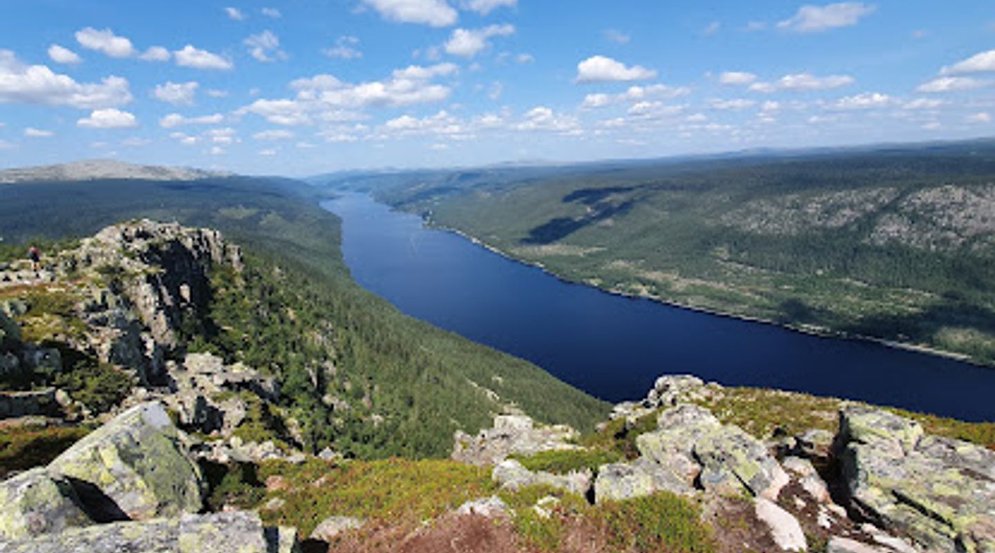
The Skagsvola T-marked hike is a remarkable outdoor adventure located in the picturesque region of Trysil, Norway. This hiking area is renowned for its stunning vistas, offering hikers the chance to immerse themselves in the breathtaking natural beauty that characterizes this part of the world. The trail is well-marked, making it accessible for hikers of different skill levels, from beginners to more experienced trekkers. The route meanders through lush forests, alongside sparkling streams, and up towards panoramic viewpoints that showcase the majestic Norwegian landscape.As you embark on your hike, take a moment to appreciate the diverse flora and fauna that thrive in this stunning environment. Keep your eyes peeled for local wildlife, such as deer and various bird species, adding a touch of excitement to your journey. The trail is particularly enchanting during spring and summer when the wildflowers bloom, painting the landscape in vibrant colors. The Skagsvola hike is not just a physical challenge; it's a sensory experience that allows you to connect with nature.Plan your hike according to the weather and the season, as conditions can vary. Early mornings often provide the best light for photography, and the cooler temperatures make for a more comfortable trek. Whether you are seeking solitude or a shared experience with friends or family, the Skagsvola T-marked hike promises an unforgettable adventure in one of Norway's most beautiful hiking areas.
Evendo Review Centre
 Google
Guest reviews
Explore Skagsvola T-marked hike on the map
A handpicked selection of must-see spots near Skagsvola T-marked hike, mapped for you.
Get your free copy of our complete guide to Skagsvola T-marked hike, delivered straight to you.
Everything on this page, from opening hours and how to get there to Eve’s tips and the best time to go, in one PDF you can read offline, print or share.
Already have an account? Sign in
Your Skagsvola T-marked hike guide is ready.
We'll send it to · Not you? Sign out

Getting your guide ready…
We are putting together a fresh copy of the Skagsvola T-marked hike guide. This can take up to a minute.
This can take a few moments. If your browser asks, choose Allow so the download can start. You'll find the guide in your Downloads folder.
Nothing happened? Download it again
Sorry, the guide is taking longer than usual. Please try again in a minute, or get it by email instead.
Other nearby places you may find interesting
The closest places of the same kind, if this one is not quite what you had in mind.
-
-
-
-
-


Swipe for more places
More to explore near Skagsvola T-marked hike
-
 Best experiences near Skagsvola T-marked hike
-
 Best hotels near Skagsvola T-marked hike
-
 Best landmarks near Skagsvola T-marked hike
-
 Best attractions near Skagsvola T-marked hike
-
 Best shops near Skagsvola T-marked hike
-
 Best restaurants near Skagsvola T-marked hike
-
 Best bars near Skagsvola T-marked hike


Do you manage this location?
Take control to get all the benefits, like improved information, better appearance, and stronger visibility across AI-powered discovery.
Explore more

Explore more of Trysil
Discover Trysil, Norway's premier destination for skiing, hiking, and year-round outdoor adventures in a stunning natural setting.
Explore Trysil
Explore more of Norway
Explore Norway's spectacular fjords, vibrant cities, and natural wonders. Experience the Northern Lights, Midnight Sun, and rich cultural heritage in this Scandinavian gem.
Explore Norway
