Discover the Heart of Puerto Rico at its Geographical Center
Explore the Centro Geográfico de Puerto Rico, a historical landmark that reveals the island's unique geographical significance and stunning landscapes.
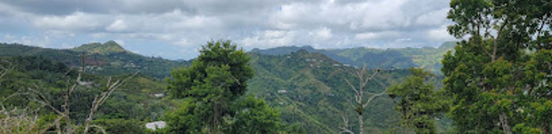
The Centro Geográfico de Puerto Rico, located in Orocovis, is a fascinating historical landmark that embodies the spirit of the island. Nestled amidst breathtaking landscapes, this site offers tourists a unique glimpse into Puerto Rico’s geographical significance, making it a must-visit for anyone exploring the island's rich heritage.
A brief summary to Centro Geográfico de Puerto Rico
- 6HC9+WR8, Unnamed Road, Orocovis, Orocovis, 00720, PR
Local tips
- Bring a camera; the views are breathtaking and perfect for photography.
- Wear comfortable shoes to explore the surrounding trails.
- Check the weather beforehand to make the most of your visit.
- Visit early in the morning or late afternoon for the best light and fewer crowds.
- Take time to read the educational signs; they provide a wealth of information about the site's significance.
Getting There
-
Car
If you're traveling by car, start from any point in the Central Mountain Range and navigate toward Orocovis. Use GPS coordinates 18.2222755, -66.4304118 to reach Centro Geográfico de Puerto Rico. Once you enter Orocovis, look for signs directing you to the Centro Geográfico. You will find it on an unnamed road off the main routes. Parking is available nearby, but make sure to check for any posted regulations.
-
Public Transportation
To reach Centro Geográfico de Puerto Rico using public transportation, take a bus to Orocovis from San Juan or Ponce. Once you arrive at the Orocovis bus terminal, you will need to take a local taxi or rideshare service to the Centro Geográfico. If you choose a taxi, confirm the fare beforehand, as it may vary depending on the distance. The Centro Geográfico is located approximately 15 minutes away by car from the bus terminal.


