Map of Africa: A Scenic Marvel in Wilderness
Explore the breathtaking Map of Africa in Wilderness, a stunning natural landmark resembling the continent, perfect for nature lovers and photographers.
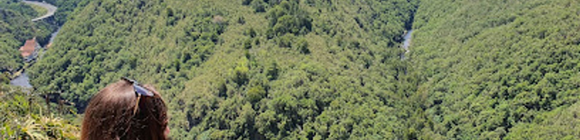
Nestled in the heart of Wilderness, the Map of Africa offers a breathtaking view that resembles the continent itself, with lush greenery and a winding river, making it a must-see for every tourist. This stunning natural formation provides a unique perspective of the land, perfect for photography enthusiasts and nature lovers alike.
A brief summary to Map of Africa
- Hoekwil, Wilderness, Wilderness, Hoekwil, ZA
- Visit website
Local tips
- Visit early in the morning or late afternoon for the best lighting for photographs.
- Bring a picnic to enjoy in the tranquil surroundings.
- Wear comfortable shoes for exploring nearby hiking trails.
- Check local weather conditions to ensure a clear view of the landmark.
- Consider visiting other nearby attractions in Wilderness for a full day of adventure.
Getting There
-
Car
If you are traveling by car, start from the nearest major city in North West, such as Rustenburg or Mafikeng. Take the N4 highway heading south towards Pretoria. Merge onto the N1 towards Bloemfontein. After approximately 220 km, take the exit onto the N12 towards George. Continue on the N12 until you reach the R62 and follow the signs towards Wilderness. Upon entering Wilderness, follow the local signs to Hoekwil. The Map of Africa viewpoint is located along the R102 road. Ensure to park in designated areas.
-
Public Transportation
If you are using public transportation, take a Greyhound or Intercape bus from your location in North West to George. The journey can take several hours. Upon arrival in George, transfer to a local taxi or shuttle service heading to Wilderness. In Wilderness, you may need to hire a taxi or arrange a ride to take you to the Map of Africa viewpoint located in Hoekwil. Be sure to confirm the fare with the driver before starting your journey.
-
Combination of Car and Walking
If you have access to a car but prefer to walk the last part of the journey, drive to the parking area at the Map of Africa viewpoint. The parking area is easily accessible from the R102 road. After parking, a short walk will lead you to the scenic viewpoint where you can enjoy the stunning view of the valley shaped like Africa. Remember to carry water and wear comfortable shoes for your walk.


