المثلث الامازيغي بمطماطة
Discover the Enigmatic Al-Mazighi Triangle in Taoujout

Discover the serene hiking trails of Taztine in Zeraoua, a perfect getaway for nature lovers and adventure seekers in Tunisia.
Nestled in the serene landscapes of Zeraoua, Taztine is a hiker's paradise offering stunning vistas, diverse flora, and a peaceful escape into nature. With well-marked trails, it caters to both novice and experienced hikers, making it an ideal spot for anyone looking to immerse themselves in the natural beauty of Tunisia.
Opening times, essentials, and a few local tips gathered into one calmer, easier-to-scan planning section.
Car
If you're driving from Matmata, start on Route 1 towards Zeraoua. Continue on this road for approximately 20 kilometers. Look for signs towards Zeraoua and take the exit when you see HR6G+FHC Ez. Once you reach Zeraoua, navigate towards the coordinates 33.561179, 9.8263904. There is parking available near the hiking area, but be prepared for a short walk to the main site.
Public Transportation
To reach تزتين via public transportation, you can take a shared taxi (known as 'louage') from Matmata to Zeraoua. The taxi stand is located near the center of Matmata. The fare is usually around 10-15 Tunisian Dinars per person. The ride will take approximately 30 minutes. Once you arrive in Zeraoua, you can either walk or take a local taxi to the coordinates 33.561179, 9.8263904. Make sure to confirm the exact drop-off point with the driver, as not all drivers might be familiar with the hiking area.
Walking
If you prefer to walk after reaching Zeraoua, head towards the coordinates 33.561179, 9.8263904. The distance from the town center to the hiking area is about 2 kilometers. Follow the main road until you reach the sign for the hiking area. Be aware that the path may not be clearly marked, so it's advisable to ask locals for directions if needed.
Use Tower Bridge as your starting point for nearby food, family ideas, nightlife, and more local discoveries.

Explore expert travel guides, compare and book tours, experiences, hotels, and more—all from the palm of your hand. Download now for seamless trip planning wherever your wanderlust takes you.
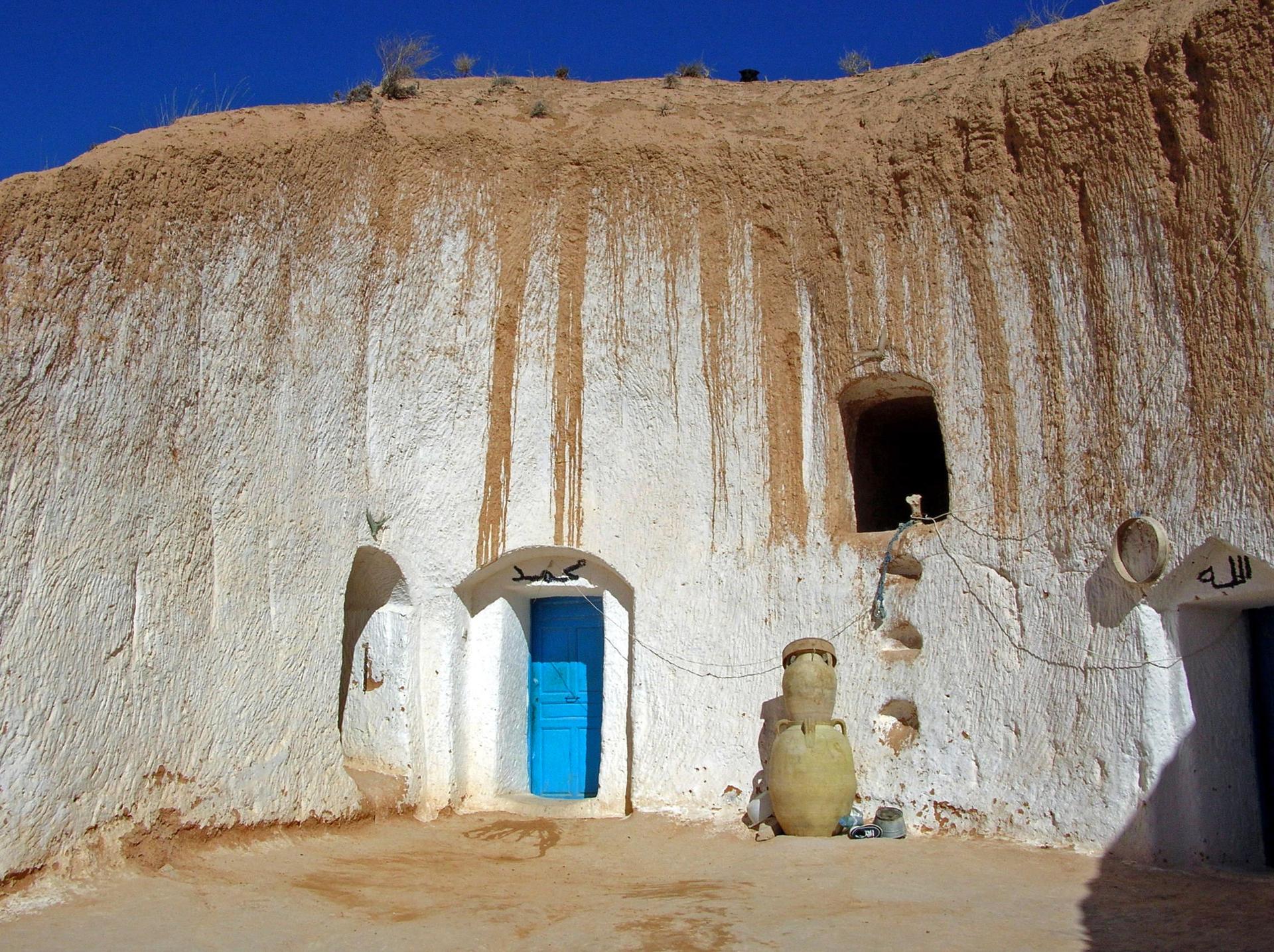
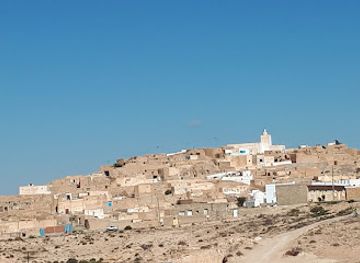
Explore the ancient troglodyte homes and cinematic history of Matmata, Tunisia, where Berber traditions and Star Wars legends converge in a stunning desert landscape.
Tell me more about Matmata