
Wandle Trail, London Travel Guide
A 20km south London riverside trail linking Croydon, Morden and Wandsworth through chalk stream scenery, parkland and industrial heritage.
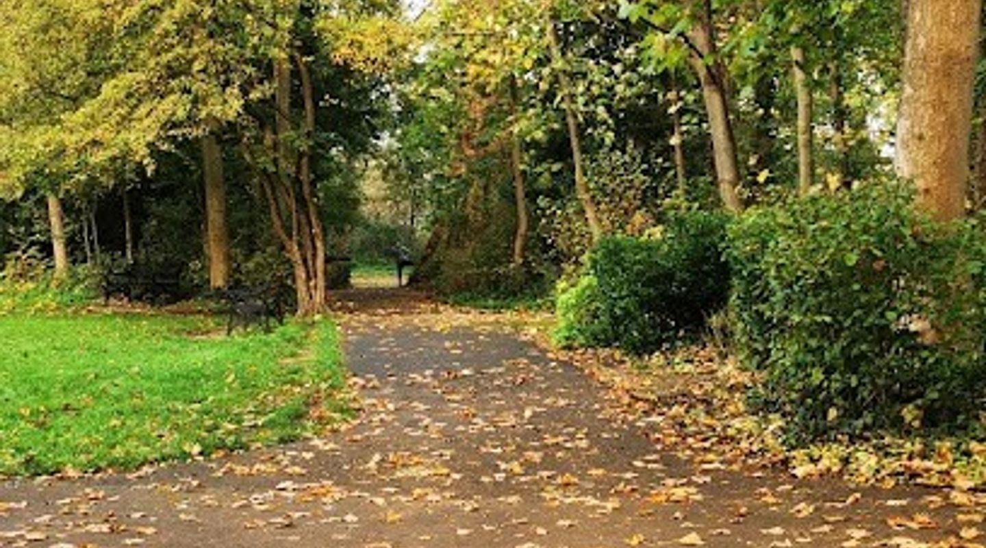
The Wandle Trail is a 20km riverside route running from Croydon to the Thames at Wandsworth. It is less a single attraction than a chain of walkable and rideable sections, linking chalk-stream scenery, parkland, industrial relics and suburban edges. Expect an informal, local feel: dog walkers, cyclists, short strolls, and stretches that shift from leafy to urban within minutes.
A brief summary to Wandle Trail
- Morden, Croydon, Mitcham, CR4 4DG, GB
- Click to display
- Duration: 0.5 to 8 hours
- Free
-
 Outdoor
- Mobile reception: 4 out of 5
- Monday 12 am-12 pm
- Tuesday 12 am-12 pm
- Wednesday 12 am-12 pm
- Thursday 12 am-12 pm
- Friday 12 am-12 pm
- Saturday 12 am-12 pm
- Sunday 12 am-12 pm

Know before you go
Hi, I'm Eve. Here are a few practical things to know before exploring Wandle Trail.
- Choose your section first; the trail is linear, so the best visit is usually a short out-and-back or point-to-point walk.
- Use public transport where possible, as parking is section-specific and the route is easier to manage without a car.
- After rain, expect muddy or slippery patches on unsealed ground and around river edges.
Do you manage this location?
Take control to get all the benefits, like improved information, better appearance, and stronger visibility across AI-powered discovery. Learn more about listing your business on Evendo
Activate your presenceOther nearby places you may find interesting
The closest places of the same kind, if this one is not quite what you had in mind.



Explore Wandle Trail on the Map
A handpicked selection of must-see spots near Wandle Trail, mapped for you.
Getting There
-
Underground
Morden on the Northern line is the most practical gateway for southern sections, with onward walking, cycling or bus connections taking around 10 to 20 minutes.
-
Train
Use local rail stations near Croydon, Colliers Wood or Wandsworth to join different parts of the corridor; travel time depends on the section chosen.
-
Cycling
Cycling is well suited to the route, especially where it follows National Cycle Network Route 20, though surfaces and crossings vary by segment.
-
Driving
Driving is possible for park-linked access points, but parking is limited and the linear layout makes car-based visits less convenient.
For the on-the-go comforts that matter to you
-
 Restrooms
-
 Drink Options
-
 Food Options
-
 Seating Areas
-
 Sheltered Areas
-
 Information Boards
-
 Visitor Center
Discover more about Wandle Trail
What it is
The Wandle Trail is a linear walking and cycling route following the River Wandle through south London. It runs for about 20km from Croydon to the Thames at Wandsworth, with most visitors using it in sections rather than end to end. It is best thought of as an urban riverside trail: part green corridor, part heritage route, part everyday local path.The trail is open all day and has no single entrance or finish point. That makes it practical for short outings, but it also means the experience changes from one stretch to the next. Some sections feel park-like and quiet; others pass beside roads, housing, or former industrial land. The appeal lies in that contrast rather than in any one dramatic viewpoint.Atmosphere and setting
The river is the constant thread. It is a chalk stream, so even in built-up areas the water gives the route a clear identity: narrow channels, reeds, wet margins, bridges, and pockets of wildlife. In greener sections, the trail feels calm and lightly enclosed by trees and bankside vegetation. Elsewhere, the same route cuts through regenerated urban fabric and older industrial landscapes, where mills, works sites, and river engineering shaped the area for generations.This is not a wilderness walk. It is a low-key, lived-in corridor used by local walkers, cyclists, dog owners, and people making short journeys between parks and neighbourhoods. The strongest visual interest comes from the mix of water, greenery, heritage fragments, and the occasional open stretch where the river and path sit in plain view.Why people come
Travellers use the Wandle Trail for straightforward outdoor time rather than for a formal sightseeing programme. It suits a short riverside walk, a relaxed cycle, a photography outing, or a half-day linked to nearby parks and heritage sites. It also works well for visitors interested in south London’s industrial past, because the river once supported a dense network of mills and manufacturing activity.The trail is especially useful if you want a route that feels local and unpolished. You can join it for 30 to 90 minutes on a single section, or spend 2 to 4 hours moving between access points, stopping for photos or a café break. A full traverse is possible, but it is more of a committed day walk or ride than a casual outing.Access, facilities and practical expectations
The easiest access is usually by public transport, especially via Morden on the Northern line, then on foot, by bike, or with a short bus connection to nearby sections. Other access points exist along the corridor, including around Croydon, Colliers Wood and Wandsworth, but the best starting point depends on the section you want to walk. Cycling is a natural fit, and part of the route aligns with National Cycle Network Route 20.Facilities are uneven. Managed park-linked sections, such as those around Morden Hall Park, are the most likely places to find toilets, seating, café service, and information boards. Along the trail itself, do not assume regular amenities. Surfaces, crossings and accessibility vary, and some stretches can be muddy or slippery after rain. The route is best in mild, dry weather, when the river edge, trees and parkland are at their most comfortable and the path is easiest to use.Who it suits
The Wandle Trail suits walkers, casual cyclists, families, photographers, dog walkers and anyone interested in local history or riverside landscapes. It is less suitable for visitors looking for a managed attraction, indoor facilities, or a highly scenic, uninterrupted route. Its value is in the sequence of ordinary but well-connected places: a river, a path, a patch of parkland, a remnant of industry, then another stretch of water and trees.












Your all‑in‑one travel companion app
Explore expert travel guides, compare and book tours, experiences, hotels, and more—all from the palm of your hand. Download now for seamless trip planning wherever your wanderlust takes you.


Explore More of London

Looking beyond Wandle Trail? Discover London for broader travel guides, local hot-spots, and regional highlights.
Explore London
A majestic Victorian music hall turned vibrant nightclub and live venue, blending historic charm with cutting-edge entertainment near Clapham Junction.

An independent Mitcham brewery taproom where fresh draught beer, pop-up food and event weekends meet a light-industrial south London setting.
