Ladybower Reservoir
A vast Peak District reservoir famous for its dramatic ‘plugholes’, drowned villages and Dambusters history, surrounded by moorland walks and cycling trails.
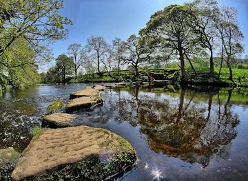
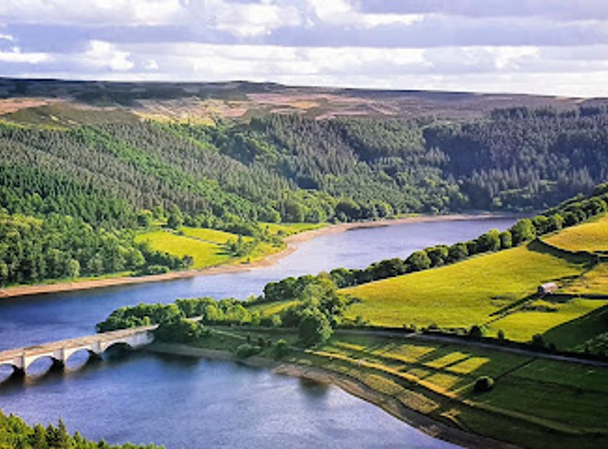
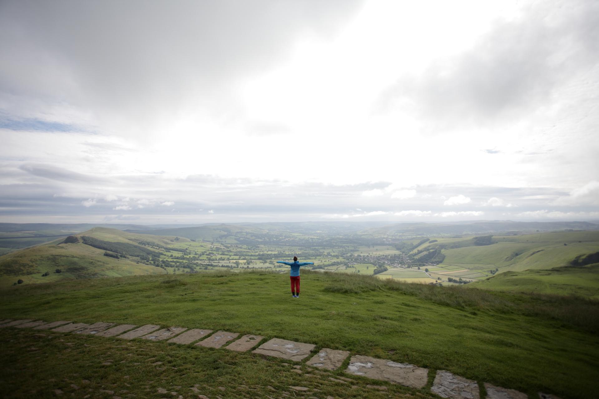
Engineering and the ‘Plugholes’
Ladybower Reservoir is a major feat of 20th-century civil engineering, built between 1935 and 1943 to supply water to the East Midlands. Its most eye-catching feature is the pair of massive bellmouth spillways, commonly known as the ‘plugholes’. Each is around 24 metres in diameter and drops about 20 metres, designed to safely channel excess water from the reservoir through tunnels into the River Derwent. When the reservoir is full, especially after heavy rain or snowmelt, water spirals dramatically into these concrete funnels, creating a powerful vortex that draws visitors from across the region. These spillways are not just functional; they have become a focal point of local interest and a popular photo opportunity. The sight of water cascading into the plugholes is most impressive in the wetter months, though even when dry they remain an impressive example of industrial design. The dam itself is a clay-cored earth embankment, distinct from the masonry dams of the older Howden and Derwent reservoirs upstream.History Beneath the Water
The creation of Ladybower Reservoir required the flooding of the villages of Derwent and Ashopton, a decision that transformed the landscape and displaced communities. Derwent Woodlands church and Derwent Hall once stood in what is now the reservoir’s basin, and during periods of exceptionally low water, the remains of Derwent village can sometimes be glimpsed. The story of these ‘drowned villages’ adds a poignant, almost ghostly layer to the area, inviting reflection on the trade-offs between progress and heritage. The reservoir also played a role in World War II, serving as a practice site for the famous Dambusters (617 Squadron), who tested their bouncing bomb techniques on the nearby Derwent Dam. This wartime legacy is woven into the identity of the Upper Derwent Valley, making the area not just a place of natural beauty but also of historical significance.Exploring the Reservoir and Surrounds
Today, Ladybower Reservoir is a hub for outdoor recreation in the Peak District. A well-maintained network of paths circles the reservoir, offering walks of varying lengths and difficulty, from gentle strolls suitable for families to longer hikes up to Bamford Edge or Win Hill for panoramic views. The perimeter route is relatively flat and accessible, making it ideal for walkers, runners and those with pushchairs or mobility aids. Cycling is also popular, with traffic-free sections and bike hire available at Fairholmes Visitor Centre. Anglers come for fly fishing in the reservoir’s clear waters, while kayakers, canoeists and paddleboarders enjoy the calm surface. Birdwatchers find rich pickings here too, with waterfowl on the reservoir and raptors soaring over the surrounding moorland.Visitor Experience and Practicalities
The reservoir is open year-round and free to access, though parking at the main car parks, such as Fairholmes and Heatherdene, is chargeable. Fairholmes Visitor Centre, managed by the Peak District National Park Authority, provides toilets, a takeaway kiosk, information boards and a small gift shop, making it a convenient starting point for most visits. The area is busiest in spring and summer, when the weather is mild and the landscape is at its greenest, but autumn brings stunning colours and winter offers a quieter, more atmospheric experience. The plugholes are most dramatic after prolonged wet weather, so checking recent conditions can help plan a visit for the best spectacle. Whether you’re here for a short walk, a full circuit, or simply to stand by the dam and watch the water swirl into the plugholes, Ladybower Reservoir offers a powerful blend of nature, engineering and history.Local tips
- Visit after a period of heavy rain or snowmelt to see the plugholes in full flow; during dry spells they may be dry or only trickling.
- Start at Fairholmes Visitor Centre for toilets, food, bike hire and information; arrive early in peak season to secure parking.
- Combine a reservoir walk with a climb up Bamford Edge or Win Hill for panoramic views over the Upper Derwent Valley.
- Look out for the remains of the drowned villages of Derwent and Ashopton when water levels are very low, and follow the ‘Lost Village Trail’ for historical context.
- Bring binoculars for birdwatching and a camera for the dramatic plugholes, moorland scenery and reflections on the water.
A brief summary to Ladybower Reservoir
- Ladybower Reservoir, Peak District National Park,, Hope Valley, Hope Valley, GB
- Monday 12 am-12 am
- Tuesday 12 am-12 am
- Wednesday 12 am-12 am
- Thursday 12 am-12 am
- Friday 12 am-12 am
- Saturday 12 am-12 am
- Sunday 12 am-12 am
Getting There
-
Car
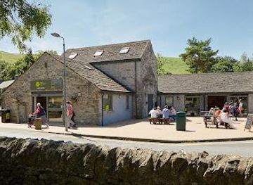
From Sheffield or Manchester, take the A57 Snake Pass into the Peak District and follow signs for Ladybower Reservoir. Parking is available at Fairholmes Visitor Centre and Heatherdene car park, with a small fee for all-day use. Roads can be narrow and busy in peak season, so allow extra time.
-
Public Transport
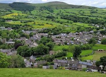
Take a train to Sheffield or Manchester, then a local bus to the village of Bamford. From Bamford, it’s a 30–40 minute walk along the A6013 and A57 to the reservoir and Fairholmes Visitor Centre. Services are infrequent, so check timetables in advance.
-
Walking
From Bamford village, follow the signed footpaths along the A6013 and A57 for about 3 km to Fairholmes Visitor Centre. The route is mostly on quiet roads and paths, with some elevation gain, and takes roughly 40–50 minutes for a reasonably fit walker.
-
Cycling
From Bamford or nearby villages, cycle along the A6013 and A57 to Fairholmes Visitor Centre. The route includes some busy sections and climbs, so it’s best suited to confident cyclists. Bike hire is available at Fairholmes for those without their own.