

Peak District Travel Guide - Free Web & App
Your ultimate guide to Peak District. Discover top landmarks, proposed trips, and local tips. Free on the web or via the Evendo companion app.


Peak District, United Kingdom: explore limestone dales, gritstone edges, historic villages, stately homes and scenic walking routes in a national park.
Landscapes of Stone and Water
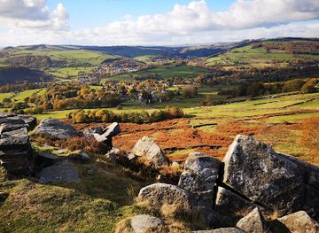
The Peak District occupies a broad upland area at the southern end of the Pennines, chiefly within Derbyshire but extending into Cheshire, Greater Manchester, South Yorkshire and Staffordshire. Its character changes markedly across the national park. The Dark Peak in the north is a high, open landscape of peat moorland, gritstone edges and sweeping reservoirs, while the White Peak to the south is shaped by pale limestone, green valleys, dry-stone walls and villages built from local stone. Kinder Scout, Mam Tor, Stanage Edge and the Upper Derwent Valley provide some of the region’s most recognisable scenery, although quieter dales and wooded valleys reveal a gentler side.Read more about Peak District
Villages, Heritage and Country Estates
Walking, Cycling and Rural Character
When is the best time to visit Peak District?
Best: June–August · 22–25°C| Month | High (°C) | Rainfall (mm) |
|---|---|---|
| January | 8 | 65 |
| February | 8 | 60 |
| March | 10 | 55 |
| April | 13 | 50 |
| May | 18 | 46 |
| June (best) | 22 | 41 |
| July (best) | 25 | 37 |
| August (best) | 24 | 38 |
| September | 21 | 43 |
| October | 16 | 47 |
| November | 11 | 52 |
| December | 8 | 58 |
Getting to and around Peak District
How to get there
Transportation
Best attractions in Peak District
The Peak District’s attractions are spread across contrasting landscapes rather than concentrated in one centre. In the Dark Peak, Kinder Scout, Mam Tor, the Edale Valley, Stanage Edge and the Upper Derwent Valley offer high moors, gritstone escarpments and reservoir scenery. The White Peak is defined by limestone dales such as Dovedale, Monsal Dale, Lathkill Dale and Chee Dale, where walking routes pass beneath wooded slopes and beside clear rivers. Castleton combines village streets with the dramatic Hope Valley and nearby show caves, while Bakewell provides a market-town base for exploring the southern dales. Chatsworth House and its estate bring historic architecture, art and formal landscapes into the countryside, and Eyam offers a poignant insight into village history during the plague of 1665. Buxton, on the western fringe, adds spa heritage, gardens and cultural venues, while former railway routes such as the Monsal Trail provide accessible ways to experience valleys and viaducts.
-
Manor house
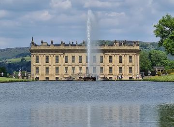
Chatsworth House
Explore the grandeur, gardens, and festive charm of Chatsworth House, a historic estate nestled in England’s Peak District.
-
Manor house
Chatsworth House
Explore the grandeur of Chatsworth House, a historic manor with stunning gardens and rich cultural heritage in England’s Peak District.
-
Arena
AO Arena
Manchester’s biggest indoor arena for concerts, sports, and spectacular live shows, right next to Victoria Station.
-
Country park
Trentham Estate
Explore 725 acres of award-winning gardens, woodland adventures, and charming shopping at Trentham Estate, a year-round destination for all ages.



Best landmarks in Peak District
Kinder Scout is the Peak District’s best-known high point and a symbol of the access movement, while Mam Tor forms a distinctive elevated viewpoint above the Edale and Hope valleys. Stanage Edge and other gritstone edges define the Dark Peak’s northern character, contrasting with the limestone gorge of Dovedale, the ravines of Monsal Dale and the cave country around Castleton in the White Peak. The Upper Derwent Valley’s reservoirs are major landscape features as well as important water-supply infrastructure. Among the human landmarks, Chatsworth House and its estate are central to the region’s architectural and cultural identity, while the historic spa architecture of Buxton reflects the town’s long association with mineral waters and fashionable tourism. The Monsal Head viaduct, now part of the Monsal Trail, illustrates how railway engineering and later recreation have been absorbed into the scenery.
-
Bridge
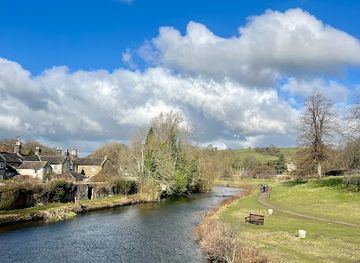
Bakewell Bridge
A stunning 14th-century stone bridge over the River Wye, Bakewell Bridge is a historic and scenic landmark at the heart of Derbyshire’s Peak District.
-
Historical landmark
Nine Ladies Stone Circle
Explore the ancient Bronze Age Nine Ladies Stone Circle on Stanton Moor—a mystical site of legend, ritual, and timeless beauty in Derbyshire.
-
Historical landmark
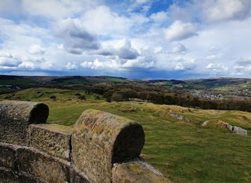
Solomon’s Temple
Explore the historic Victorian folly atop Grin Low Hill, offering breathtaking panoramic views of Buxton and the Peak District’s stunning landscapes.
-
Tourist attraction
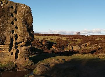
Eagle Stone
A dramatic gritstone outcrop on Baslow Edge, offering sweeping Peak District views and a touch of ancient legend.
Explore Peak District on the map
Plan your trip on one map. See where the top attractions, landmarks, restaurants and hotels are, and book hotels and experiences in a few clicks.
Best hotels in Peak District
Best restaurants in Peak District
Dining in the Peak District reflects a farming landscape, historic market towns and a strong pub tradition. Menus commonly draw on Derbyshire lamb, locally produced cheeses, seasonal vegetables, game where available, and beers from regional breweries, while Derbyshire oatcakes are a traditional regional food. Bakewell is associated with the Bakewell pudding, a distinct pastry-based dessert from the town rather than the more widely marketed tart. Village pubs, country inns, cafés and tearooms are found in established settlements such as Bakewell, Castleton, Hathersage, Tideswell and Edale, while Buxton and Matlock offer a broader choice of restaurants and cafés on the park’s edges. Farm shops and estate or village food producers can provide local provisions, but options thin out rapidly in remote valleys and on open moorland, where walkers should not expect regular places to eat.
-
Restaurant
Ye Olde Nags Head
Historic 17th-century coaching inn in Castleton offering cozy pub vibes, hearty British fare, and a lively community atmosphere.
-
Inn
Ye Olde Cheshire Cheese Inn
Historic village inn and pub in Castleton offering cozy rooms, hearty English fare, and a warm welcome in the heart of the Peak District.
-
Restaurant
The Bulls Head
A beloved village pub in Monyash serving hearty British classics with generous portions in a warm, rustic setting.
-
Inn
Old Hall Inn
A charming Georgian inn in the Peak District offering refined pub dining, cozy rooms, and a warm welcome amid stunning countryside.


Best bars in Peak District
Evenings in the Peak District are generally quiet and social rather than club-oriented. Traditional pubs and country inns in villages such as Castleton, Edale, Hathersage, Tideswell and Bakewell are the most characteristic places for local ales, food and conversation, with some offering a base for walkers as well as a rural meeting place. Buxton provides the widest evening choice, including established pubs, restaurants and cultural entertainment associated with its spa-town setting, while Matlock and larger surrounding towns offer further options outside the national park. Seasonal village gatherings, concerts and community events may add variety, but their timing is not constant. Remote valleys and moorland areas have no nightlife infrastructure, and visitors staying in secluded accommodation should plan evening transport and dining rather than assume nearby venues will be open.
-
Pub
The Peacock At Barlow
Charming country pub with stunning Peak District views, refined British cuisine, and cozy accommodation near Sheffield.
-
Inn
Ladybower Inn
A cozy 3-star inn in Hope Valley offering hearty pub meals, friendly hospitality, and scenic access to Ladybower Reservoir and Peak District trails.
-
Pub
The Royal Oak | Peak District
A cosy country pub in Hurdlow offering hearty British fare, local ales, and a warm welcome in the scenic Peak District.
-
Pub
The Rambler Inn
Cozy stone-built pub and inn in Edale, offering hearty fare, local ales, and a warm welcome for Peak District hikers.


Best nightclubs in Peak District
Evenings in the Peak District are generally quiet and social rather than club-oriented. Traditional pubs and country inns in villages such as Castleton, Edale, Hathersage, Tideswell and Bakewell are the most characteristic places for local ales, food and conversation, with some offering a base for walkers as well as a rural meeting place. Buxton provides the widest evening choice, including established pubs, restaurants and cultural entertainment associated with its spa-town setting, while Matlock and larger surrounding towns offer further options outside the national park. Seasonal village gatherings, concerts and community events may add variety, but their timing is not constant. Remote valleys and moorland areas have no nightlife infrastructure, and visitors staying in secluded accommodation should plan evening transport and dining rather than assume nearby venues will be open.
-
Nightclub
Bar Fever Derby
Experience Derby’s vibrant nightlife at Fever Derby, a dynamic three-floor nightclub with diverse music, lively bars, and exclusive VIP areas.
-
Nightclub
The Viper Rooms
A stylish and vibrant nightclub in Sheffield City Centre offering eclectic music, creative cocktails, and a trendy atmosphere for memorable nights out.
-
Nightclub
Mosh
Derby’s vibrant three-floor nightclub with diverse music, student-friendly nights, and affordable drinks in the heart of the city.
-
Nightclub
Level 2
Buxton’s vibrant two-floor nightclub with diverse music, lively bars, and themed nights, perfect for an energetic night out.




Best shops in Peak District
Shopping is concentrated in the Peak District’s market towns and larger villages rather than in dedicated retail districts. Bakewell has independent food shops, cafés and retailers associated with the town’s pudding tradition, while Buxton and Matlock provide broader selections of everyday goods, outdoor equipment, galleries and independent businesses on the national park’s margins. Village shops in places such as Castleton, Hathersage and Tideswell are useful for provisions, although opening patterns and ranges vary. Visitors may find locally made cheeses, preserves, chocolates, beers, pottery, artwork, woollens and small craft products through farm shops, galleries and specialist producers, but these are individual businesses rather than a single uniform regional craft industry. Outdoor clothing and walking equipment are particularly practical purchases in a landscape where weather and terrain make preparation important.
-
Book Shop
High Peak Bookstore and Cafe
A charming independent bookstore and cozy café nestled in the scenic Peak District near Buxton, perfect for book lovers and casual visitors alike.
-
Outdoor clothing and equipment shop
Outside.co.uk
Your essential outdoor clothing and equipment shop in Hathersage, offering expert gear and a cozy café for Peak District adventurers.
-
Gift shop
Derbyshire Gift Centre
A charming family-run gift shop and café in Hope Valley offering seasonal treasures and homemade delights in the Peak District.
-
Gift shop
Punnydukes
Whimsical gift shop brimming with unique treasures across multiple enchanting floors.


Get your free copy of our complete guide to Peak District, delivered straight to you.
Everything on this page, from attractions and restaurants to essentials and local phrases, in one PDF you can read offline, print or share.
Already have an account? Sign in
Your Peak District guide is ready.
We'll send it to · Not you? Sign out

Getting your guide ready…
We are putting together a fresh copy of the Peak District guide. This can take up to a minute.
This can take a few moments. If your browser asks, choose Allow so the download can start. You'll find the guide in your Downloads folder.
Nothing happened? Download it again
Sorry, the guide is taking longer than usual. Please try again in a minute, or get it by email instead.
Peak District essentials
Currency and Payment
Safety
Emergency Situations
Do's and Don'ts
Local Tips
From Eve
Local phrases worth knowing
You don't need to get them perfect. A few words go a long way, and locals appreciate the effort.
Basics
| English | Local | Say it |
|---|---|---|
| Hello | Ey up | [ay up] |
| Goodbye | Ta-ra | [ta-ra] |
| Yes | Aye | [ai] |
| No | Nah | [nah] |
| Please/You're welcome | Please | [pleez] |
| Thank you | Cheers | [cheers] |
| Excuse me/Sorry | Sorry | [sor-ree] |
| How are you? | Ow do? | [ow do?] |
| Fine. And you? | Reet. An thee? | [reet. an thee?] |
| Do you speak English? | D'ye speak English? | [d'ye speak English?] |
| I don't understand | I dun't get it | [i dun't get it] |
Eating & Drinking
| English | Local | Say it |
|---|---|---|
| I'd like to see the menu, please | Can I see the menu, please? | [can I see the menu, pleez?] |
| I don't eat meat | I don't eat meat | [i don't eat meat] |
| Cheers! | Cheers! | [cheers!] |
| I would like to pay, please | Can I pay, please? | [can I pay, pleez?] |
Emergencies
| English | Local | Say it |
|---|---|---|
| Help! | Help! | [help!] |
| Go away! | Clear off! | [clear off!] |
| Call the Police! | Ring the bobbies! | [ring the bobbies!] |
| Call a doctor! | Get a doc! | [get a doc!] |
| I'm lost | I'm lost | [I'm lost] |
| I'm ill | I feel poorly | [I feel poorly] |
Shopping
| English | Local | Say it |
|---|---|---|
| I'd like to buy... | I want to buy... | [I want to buy...] |
| I'm just looking | Just browsing | [just browsing] |
| How much is it? | How much's this? | [how much's this?] |
| That's too expensive | That's well dear | [that's well deer] |
| Can you lower the price? | Can ye knock it down a bit? | [can ye knock it down a bit?] |
Time & Numbers
| English | Local | Say it |
|---|---|---|
| What time is it? | What time is it? | [what time is it?] |
| It's one o'clock | It's one o'clock | [it's one o'clock] |
| Half past (10) | Half ten | [half ten] |
| Morning | Mornin' | [mornin'] |
| Afternoon | Afternoon | [afternoon] |
| Evening | Evenin' | [evenin'] |
| Yesterday | Yesterday | [yesterday] |
| Today | Today | [today] |
| Tomorrow | Tomorra | [tomorra] |
| 1 | One | [one] |
| 2 | Two | [two] |
| 3 | Three | [three] |
| 4 | Four | [four] |
| 5 | Five | [five] |
| 6 | Six | [six] |
| 7 | Seven | [seven] |
| 8 | Eight | [eight] |
| 9 | Nine | [nine] |
| 10 | Ten | [ten] |
Transport & Directions
| English | Local | Say it |
|---|---|---|
| Where's a/the...? | Where's the...? | [where's the...?] |
| What's the address? | What's the address? | [what's the address?] |
| Can you show me (on the map)? | Can ya show me on the map? | [can ya show me on the map?] |
| When's the next (bus)? | When's the next bus? | [when's the next bus?] |
| A ticket (to ....) | A ticket to... | [a ticket to...] |
History of Peak District
A Landscape Shaped by Ice and Limestone
The Peak District’s geology explains its contrasting scenery. Carboniferous limestone dominates the White Peak, where rivers cut steep-sided dales and underground water created caves and other karst features. Gritstone and shale form much of the Dark Peak, producing elevated moors, escarpments and distinctive edges. Successive geological processes, weathering and glacial activity shaped the valleys, tors and exposed plateaux seen today. This geological division also influenced settlement, farming, quarrying and the distribution of minerals, giving the two halves of the region markedly different architectural and agricultural traditions.
Early Settlement and Roman Routes
People have used and occupied the Peak District since prehistoric times, leaving monuments and traces of activity across its uplands and valleys. The Romans exploited mineral resources and established routes through the region; the fort and settlement at Brough-on-Noe, known as Navio, reflect the strategic importance of the Hope Valley. Later communities farmed the valleys, grazed animals on common uplands and worked deposits of lead and other minerals. The landscape’s scattered farms, field systems and historic villages developed gradually through this long interaction between settlement and difficult terrain.
Lead Mining and Medieval Communities
Lead mining became one of the Peak District’s defining industries, particularly in the limestone dales and around places such as Castleton, Youlgreave and Bonsall. Mining supported local communities, generated trade and left behind shafts, spoil heaps, ruined structures and distinctive field patterns. Medieval churches and market settlements also grew in importance; Bakewell developed as a regional centre, while Tideswell’s substantial parish church reflects the prosperity of the medieval wool and lead-mining economy. The industry declined over time, but its physical and cultural traces remain embedded in the countryside.
Industry, Estates and Early Tourism
From the eighteenth century, improved roads, turnpikes and later railways made the Peak District more accessible to visitors and industry. Water power supported mills in valleys such as the Derwent, while quarrying and textile production shaped settlements beyond the high moors. Wealthy landowners developed country estates, including Chatsworth, and invested in houses, parks and villages. Buxton’s spa attracted visitors seeking fashionable health treatments, helping establish the area as a leisure destination. Romantic landscape appreciation, painting and walking gradually added cultural tourism to the region’s older agricultural and industrial economy.
National Park and Conservation
The Peak District became Britain’s first national park in 1951, marking a major shift towards coordinated landscape protection and public access. The designation did not remove farming, quarrying, forestry or settlement; instead, it created a framework for balancing these uses with recreation and conservation. The 1932 Kinder Scout mass trespass, a protest against restrictions on access to moorland, remains an important episode in the history of public rights of way. Today, management addresses footpath erosion, peatland restoration, wildlife habitats, water resources and the pressures created by heavy visitor numbers.
Peak District in Photos
Browse through our photo collection highlighting the charm and character of the destination.
Cities in Peak District
The towns and cities of Peak District, and the easiest places to base yourself.
-
-

-


Swipe for more cities
Neighbouring destination travel guides
The closest destinations to Peak District, if you have time for more than one.
-

-

-

-

-


Swipe for more destinations
Explore more

Explore more of Derbyshire
Explore Derbyshire's Peak District landscapes, historic houses, spa towns, market towns, industrial heritage and distinctive local food.
Explore Derbyshire
Explore more of United Kingdom
Discover the United Kingdom: A blend of rich history, stunning landscapes, and vibrant cities, offering a unique travel experience for every visitor.
Explore United Kingdom