Watling Street: Ancient Roman Road Through London
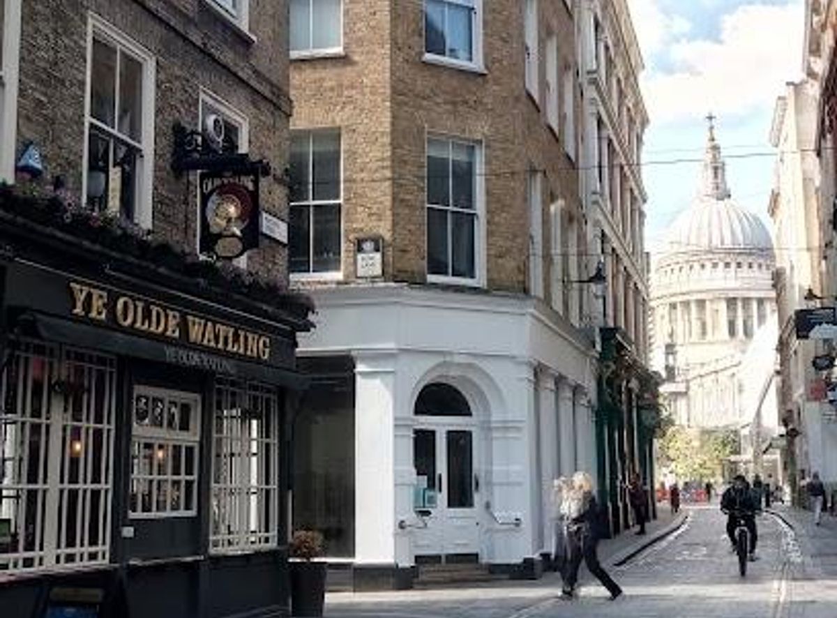
Walk along Watling Street, London’s ancient Roman road linking history, battles, and modern life in a single enduring route.
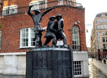
Watling Street is a historic Roman road that runs through London, originally a prehistoric track used by Britons and later paved by the Romans around AD 47-48. It played a crucial role in Roman military and trade movements, witnessed the decisive Battle of Watling Street where Queen Boudica was defeated, and has served as a boundary line throughout history. Today, parts of it remain integrated into modern London streets and roads, offering a direct connection to Britain’s ancient past.
A brief summary to Watling St
- London, GB
- Duration: 0.5 to 2 hours
- Free
-
Outdoor
- Mobile reception: 5 out of 5
Local tips
- Explore sections of Watling Street visible in London’s Old Kent Road and Borough areas to see Roman road construction layers.
- Visit nearby museums or archaeological sites in Southwark for exhibits on Roman London and Watling Street.
- Consider walking parts of the route to appreciate its role as a historic boundary and transport artery.
- Learn about the Battle of Watling Street and Queen Boudica’s rebellion to deepen your historical context.
For the on-the-go comforts that matter to you
- Restrooms
- Drink Options
- Food Options
- Seating Areas
- Information Boards
Getting There
-
London Underground
Take the Northern Line to Borough Station, approximately 10-15 minutes walk to sections of Watling Street near Borough High Street. The service runs frequently with standard London Underground fares applying.
-
Bus
Bus routes 21, 43, and 141 serve stops near Old Kent Road and Borough, with travel times ranging from 15 to 25 minutes from central London. Oyster and contactless payment accepted.
-
Walking
Walking from London Bridge station to the Old Kent Road section of Watling Street takes about 20-25 minutes on mostly flat, urban terrain suitable for most visitors.
Watling St location weather suitability
-
Any Weather
-
Rain / Wet Weather
-
Clear Skies
-
Mild Temperatures
Discover more about Watling St
Origins and Roman Engineering Marvel
Watling Street began as a broad track used by indigenous Britons for centuries before the Roman invasion of Britain in AD 43. By the winter of AD 47-48, the Romans had paved and widened the road, transforming it into a vital artery for military and administrative purposes. Around London, the road was approximately 7.5 to 8.7 meters wide and surfaced with gravel and chalk layers, showcasing advanced Roman engineering techniques such as effective drainage and durable paving. This road connected key Roman settlements including Londinium (London), Verulamium (St Albans), and Wroxeter, facilitating rapid movement of troops, trade goods, and official communications across Roman Britain.Watling Street in Historical Conflicts
Watling Street is famously linked with the Battle of Watling Street (circa 60 or 61 AD), where Roman forces under Governor Suetonius Paulinus decisively defeated the Iceni rebellion led by Queen Boudica. Despite being heavily outnumbered, the Romans secured a pivotal victory that cemented their control over southern Britain. The exact location of this battle remains debated but is generally placed somewhere along Watling Street between London and Wroxeter. In later centuries, the road also served as a boundary between Anglo-Saxon and Danish territories, notably marking the southwestern border of the Danelaw in the 9th century.Evolution Through the Ages and Modern Legacy
After the Roman withdrawal, Watling Street continued to be a major route, evolving through medieval times and into the modern era. It was the site of England’s first turnpike toll road and later improvements during the Victorian era enhanced its condition further. Today, much of the original Roman road lies beneath modern infrastructure, with sections preserved or rediscovered through archaeological excavations, such as those in Southwark, London. Modern roads like the A2 and A5 follow much of Watling Street’s ancient alignment, keeping its legacy alive as a key transport route.Watling Street’s Role in London’s Urban Fabric
Within London, Watling Street’s course is partially visible in street names and alignments, including Old Kent Road and stretches near Borough High Street. Archaeological finds reveal multiple construction layers, illustrating centuries of use and repair. The road’s path historically included a natural ford across the Thames near Westminster, which was vital for trade and military movements. Watling Street also formed boundaries between London boroughs such as Harrow, Brent, Camden, and Barnet, underscoring its continuing importance as a geographical and administrative marker.Cultural and Social Significance
Beyond its military and economic roles, Watling Street has cultural resonance. It was a route for the 1913 Great Pilgrimage, a suffragist march advocating women’s voting rights, highlighting its place in social history. Its mention in treaties and historical documents reflects its enduring role as a symbol of power, control, and connectivity. Walking or driving along Watling Street today offers a tangible link to Britain’s layered history, from prehistoric times, through Roman occupation, to modern urban life.Preservation and Archaeological Insights
Recent excavations have uncovered well-preserved sections of Watling Street beneath modern London roads, revealing construction techniques and usage patterns. These findings deepen understanding of Roman Britain's infrastructure and urban development. The road’s survival beneath bustling city streets is a testament to its foundational role in shaping London’s growth. Efforts to study and preserve Watling Street continue to provide valuable insights into ancient engineering and historical landscapes.For the vibe & atmosphere seeker
- Historic
- Scenic
- Unique
- Tranquil
For the design and aesthetic lover
- Rustic Designs
For the architecture buff
- Historic
- Landmarks
For the view chaser and sunset hunter
- Iconic Views
For the social media creator & influencer
- Instagrammable
- Photo Spots
For the eco-conscious traveler
- Public-Transport Accessible
- Locally Managed
For the kind of experience you’re after
- Cultural Heritage
- Photowalk
- Day Trip
- Weekend Getaway
For how adventurous you want the journey to be
- Easy Access
Location Audience
- Family Friendly
- Senior Friendly
- Child Friendly
- Teen Friendly
- Wheelchair Access
- Solo Friendly
- Couple Friendly
- Vegetarian Friendly
- Vegan Friendly