From Eve
Know before you go
Hi, I'm Eve. Here are a few practical things to know before exploring Mount Obama.
Local know-how to help you travel smarter and make the most of every moment.
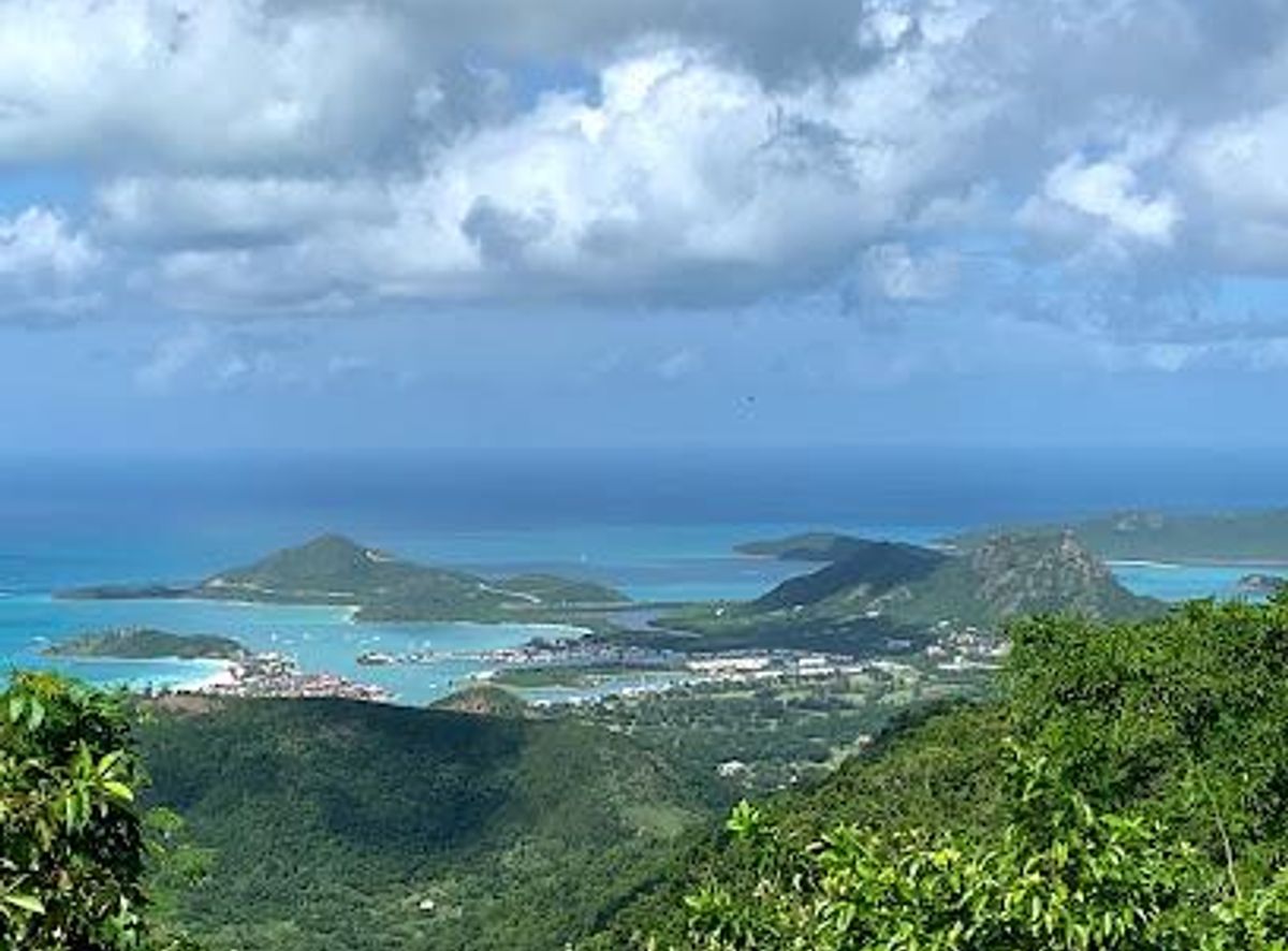
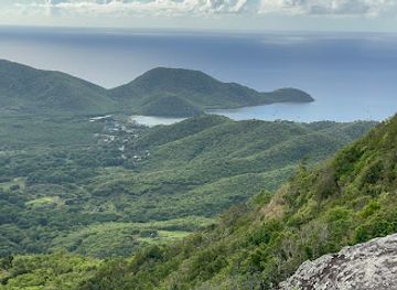
Hike Antigua's highest peak, Mount Obama, for panoramic views, lush trails, and a touch of Caribbean history and culture.
Mount Obama, formerly known as Boggy Peak, is the highest point in Antigua, offering stunning panoramic views and a challenging hike through lush vegetation. Renamed in honor of Barack Obama, it stands as a symbol of pride and natural beauty.
Opening times, essentials, and a few local tips gathered into one calmer, easier-to-scan planning section.
Hi, I'm Eve. Here are a few practical things to know before exploring Mount Obama.
Local know-how to help you travel smarter and make the most of every moment.
Driving
From St. John's, drive south along Valley Road until you reach the village of Jennings. Continue through Jennings on Valley Road, and just as you exit the town, turn left at the first bus stop onto a dirt track. Follow this track for about a mile to a grassy parking area near the Mount Obama Monument Stone. A 4x4 vehicle is recommended due to the rough road conditions. Parking is free.
Public Transport
Take a local bus from St. John's to Liberta (approx. EC$2). From Liberta, it's a walk to the trailhead. Be prepared for infrequent bus schedules and potential waits. Alternatively, from the bus stop in Jennings, a taxi to the trailhead will cost approximately EC$20-30.
Walking
From the parking area near the Mount Obama Monument Stone, the trailhead is a short walk further along the dirt track. Follow the signs for the Mount Obama Hiking Trail. The initial path leads into the undergrowth and becomes a narrower trail. Continue until you reach a sign indicating the South Loop and Mount Obama Hiking Trail, keeping right towards the Mount Obama Hiking Trail.
Use Tower Bridge as your starting point for nearby food, family ideas, nightlife, and more local discoveries.

Explore expert travel guides, compare and book tours, experiences, hotels, and more—all from the palm of your hand. Download now for seamless trip planning wherever your wanderlust takes you.
Discover Codrington, Barbuda’s tranquil capital, where pink sand beaches, rich wildlife, and a charming local culture create the perfect tropical getaway.
Tell me more about Codrington