From Eve
Know before you go
Hi, I'm Eve. Here are a few practical things to know before exploring Devil's Bridge.
Local know-how to help you travel smarter and make the most of every moment.
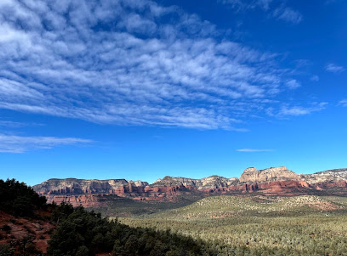
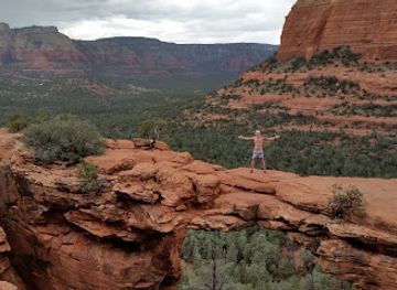
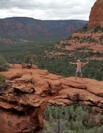
Hike to Sedona's majestic Devil's Bridge, the largest natural sandstone arch, for breathtaking views and an unforgettable photo opportunity.
Devil's Bridge, the largest natural sandstone arch in the Sedona area, offers a thrilling hiking experience with breathtaking red rock scenery. The moderately challenging trail leads to the iconic arch, where visitors can walk across and capture stunning photos.
Opening times, essentials, and a few local tips gathered into one calmer, easier-to-scan planning section.
Hi, I'm Eve. Here are a few practical things to know before exploring Devil's Bridge.
Local know-how to help you travel smarter and make the most of every moment.
Shuttle
Take the free Sedona Shuttle from either the Posse Grounds Park & Ride (20 Carruth Dr, West Sedona) or the West SR 89-A Park & Ride (905 Upper Red Rock Loop Road). Shuttles operate Thursday through Sunday, 7:00 AM to 5:30 PM, every 15-45 minutes. Take the Dry Creek Trailhead Shuttle (Routes 11 or 12) or the Mescal Trailhead Shuttle. From the Dry Creek Trailhead, hike up Dry Creek Trail for about a mile to connect to the Devil's Bridge Trail. From the Mescal Trailhead, the recommended route is Mescal to Chuckwagon to Devils Bridge Trail (4.0 miles round trip). Shuttle service is free. Shuttle riders will not be charged a parking fee at the trailhead.
Driving (4x4)
From the 'Y' intersection of State Route 89A and State Route 179, drive towards Cottonwood for 3 miles. Turn right onto Dry Creek Road and continue for 3 miles. Turn right on FR 152 and proceed for 1.1 miles to the parking area. A high-clearance 4x4 vehicle is required to navigate the rocky dirt road. Parking at the Devil's Bridge Trailhead allows for a 2-mile round trip hike. Note that FR 152 may be closed in winter. Parking is limited.
Walking
From the Dry Creek Vista Trailhead parking lot, walk along Dry Creek Road for 1.3 miles to the Devil's Bridge Trailhead. Alternatively, park at the Mescal Trailhead on Long Canyon Road and walk one mile on a singletrack trail to the Devil's Bridge Trail. From the Dry Creek Trailhead, the hike to Devil's Bridge is 2 miles round trip. From the Mescal Trailhead, the hike is 4.2 miles round trip. Note that a Red Rock Pass is required to park at the Dry Creek Trailhead, costing $5 per day. The America the Beautiful Pass is also accepted.
Use Devil's Bridge as your starting point for nearby food, family ideas, nightlife, and more local discoveries.

Explore expert travel guides, compare and book tours, experiences, hotels, and more—all from the palm of your hand. Download now for seamless trip planning wherever your wanderlust takes you.
Discover the awe-inspiring landscapes, rich cultural heritage, and outdoor adventures that make Coconino County an unforgettable destination in Arizona.
Tell me more about Coconino County