From Eve
Know before you go
Hi, I'm Eve. Here are a few practical things to know before exploring Cocoraque Butte Archaeological District.
Local know-how to help you travel smarter and make the most of every moment.
Discover the ancient stories of the Cocoraque Butte Archaeological District, a historical landmark rich in Native American heritage and stunning desert scenery.
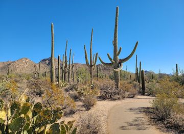
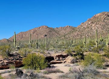
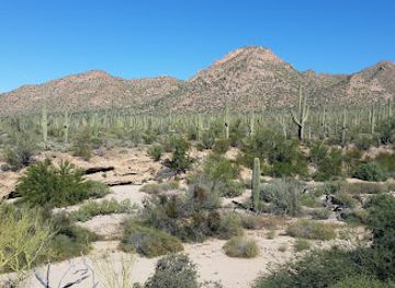
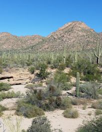
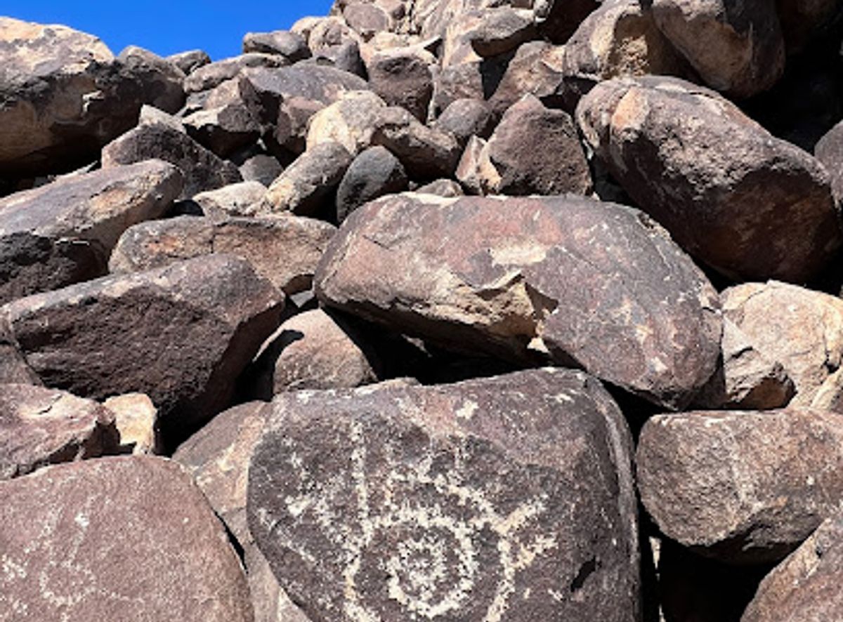
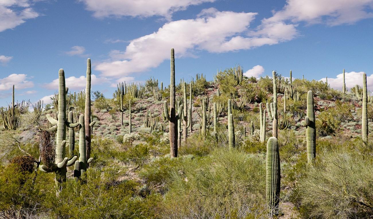
Cocoraque Butte Archaeological District is a captivating historical landmark in Arizona, offering a glimpse into the region's rich Native American heritage. Visitors can explore ancient petroglyphs and stunning desert landscapes, making it a must-visit for history enthusiasts and nature lovers alike.
Opening times, essentials, and a few local tips gathered into one calmer, easier-to-scan planning section.
Hi, I'm Eve. Here are a few practical things to know before exploring Cocoraque Butte Archaeological District.
Local know-how to help you travel smarter and make the most of every moment.
Car
If you are traveling by car, start from downtown Tucson, Arizona. Head west on W Congress St toward N 6th Ave. Merge onto I-10 W and continue for approximately 10 miles. Take exit 260 for AZ-86 W toward Sells. After about 16 miles, take the exit for AZ-87 N and continue for another 12 miles. Turn left onto Picture Rocks Rd and drive for about 4 miles. Finally, turn right onto 6MF5+GM, your destination will be on the right. Make sure to have a GPS or a map to navigate as the area may have limited signage.
Public Transportation
For those using public transportation, start by taking the Sun Tran bus (#1) from downtown Tucson to the Tucson Amtrak Station. From there, take the Amtrak train to the closest station, which is in Maricopa. Use a rideshare service or taxi from Maricopa to Picture Rocks, which is about a 40-minute drive away. Be aware of the costs associated with the Amtrak ticket and the rideshare service; it's advisable to check the schedules in advance.
Bicycle
If you prefer to bike, begin in downtown Tucson and follow the bike lanes on W Congress St. Connect to the Santa Cruz River Park Loop which leads you west toward Picture Rocks. The route is approximately 25 miles and will take around 2-3 hours depending on your pace. Ensure to bring plenty of water and snacks for the journey, and be prepared for some stretches without amenities.
Walking
Walking to Cocoraque Butte Archaeological District is not advisable due to the distance and lack of direct pedestrian paths. If you are in the immediate area, once you reach Picture Rocks Rd, you can walk to the archaeological district from there, but be prepared for rough terrain and ensure you have appropriate footwear.
Use Cocoraque Butte Archaeological District as your starting point for nearby food, family ideas, nightlife, and more local discoveries.


Explore expert travel guides, compare and book tours, experiences, hotels, and more—all from the palm of your hand. Download now for seamless trip planning wherever your wanderlust takes you.
Discover Pima County: A blend of cultural richness, stunning desert landscapes, and vibrant city life in the heart of Southern Arizona.
Tell me more about Pima County