Hawksbill Crag/Whitaker Point, Timberlands Travel Guide
Hike to Hawksbill Crag for unforgettable views of the Ozark Mountains, a natural wonder and iconic Arkansas landmark.
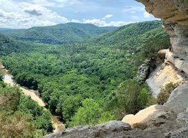
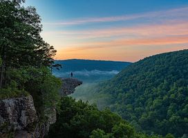
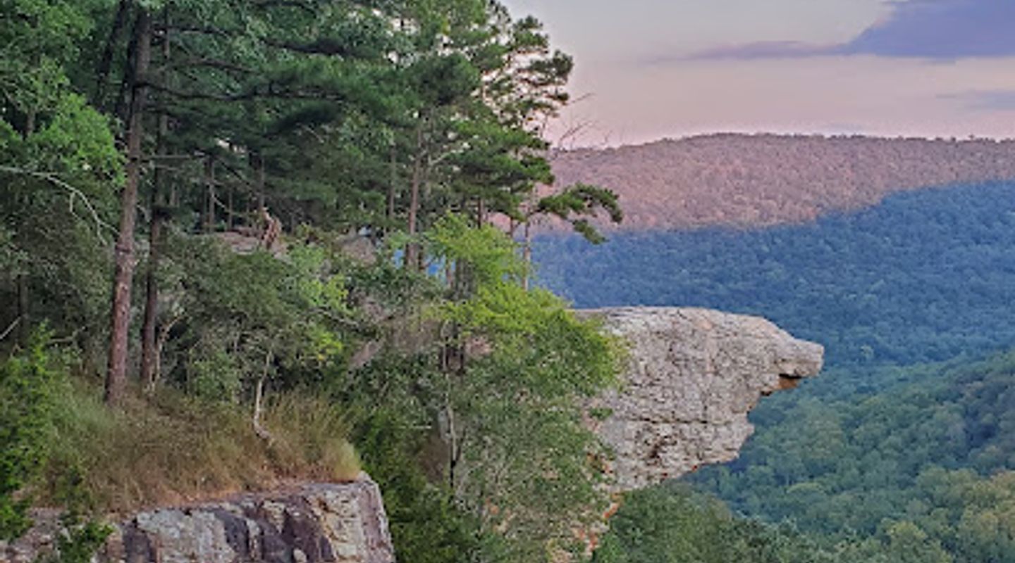
Hawksbill Crag, also known as Whitaker Point, is a renowned rock formation in the Ozark Mountains of Arkansas, offering stunning panoramic views and a popular hiking destination. Its unique shape and scenic beauty make it one of the most photographed spots in the state.
A brief summary to Hawksbill Crag/Whitaker Point
- Co Rd 406, Kingston, Arkansas, 72742, US
- Click to display

Know before you go
Hi, I'm Eve. Here are a few practical things to know before exploring Hawksbill Crag/Whitaker Point.
- Wear sturdy hiking boots as the trail can be rocky and uneven in places.
- Bring plenty of water, especially during warmer months, to stay hydrated on the trail.
- Arrive early, especially on weekends, as the parking area is limited and fills up quickly.
- Be cautious near the bluff edges, as there are steep drop-offs.
Do you manage this location?
Take control to get all the benefits, like improved information, better appearance, and stronger visibility across AI-powered discovery. Learn more about listing your business on Evendo
Activate your presenceOther nearby places you may find interesting
The closest places of the same kind, if this one is not quite what you had in mind.
Explore Hawksbill Crag/Whitaker Point on the Map
A handpicked selection of must-see spots near Hawksbill Crag/Whitaker Point, mapped for you.
Getting There
-
Driving
To reach Hawksbill Crag, navigate to the trailhead located off County Road 5 (Cave Mountain Road). From Ponca, take Highway 43 South to Highway 21, then turn left. Drive approximately two miles to Boxley Bridge, crossing the Buffalo River, and turn right onto Cave Mountain Road (County Road 5). Continue for about 6 miles on this gravel road. The trailhead will be on the left, with a small parking area on the right. Note that the road is unpaved and can be rough, with a steep initial climb. While 4x4 vehicles are recommended, sedans can manage the road under normal conditions by driving slowly. Parking is free but limited, and tickets may be issued for roadside parking that obstructs traffic. Expect a 20-minute drive on the unpaved road.
-
Walking
From the parking area, the Hawksbill Crag trailhead is located across the road. Look for the sign marker and a large rock. The trail is well-marked and easy to follow, with red blazes. The 3-mile round trip hike is considered moderately easy, taking approximately 2-3 hours to complete. The trail descends initially before leveling out, crossing a small stream about a mile in. After the stream, hikers can choose either path, both leading to Hawksbill Crag. The path to the right follows the bluff line. Be cautious near the bluff edges.
Discover more about Hawksbill Crag/Whitaker Point
More to explore near Hawksbill Crag/Whitaker Point













Your all‑in‑one travel companion app
Explore expert travel guides, compare and book tours, experiences, hotels, and more—all from the palm of your hand. Download now for seamless trip planning wherever your wanderlust takes you.


Explore More of Timberlands

Looking beyond Hawksbill Crag/Whitaker Point? Discover Timberlands for broader travel guides, local hot-spots, and regional highlights.
Explore Timberlands