East Aghusar Mountain
East Aghusar Mountain: A Tranquil Armenian Highland Peak

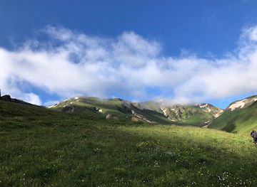
Explore Gegham Ridge: Armenia's volcanic highlands offer stunning views, hiking trails, and a glimpse into the country's rich natural and cultural history.
Gegham Ridge, also known as the Geghama Mountains, is a stunning mountain range in Armenia, characterized by extinct volcanoes, alpine lakes, and panoramic views. Stretching between Lake Sevan and the Ararat Plain, it offers diverse hiking opportunities and a chance to explore Armenia's unique natural beauty.
Opening times, essentials, and a few local tips gathered into one calmer, easier-to-scan planning section.
Public Transport
To reach Gegham Ridge using public transport from Yerevan, take a minibus (marshrutka) from Kilikia Bus Station to Sevan. The journey takes approximately 1 hour and costs around 1,000 AMD. From Sevan, take a taxi to Sevaberd, which costs approximately 3,000-5,000 AMD and takes about 20 minutes. From Sevaberd, hire a local taxi or 4x4 vehicle service to reach Gegham Ridge, which may cost around 10,000-15,000 AMD for the trip. Be prepared to negotiate the price.
Car
If driving from Yerevan, take the M1 highway towards Sevan. After approximately 45 kilometers, turn onto the H1 road towards Sevaberd. Follow the signs to Sevaberd, about 12 kilometers from the H1 junction. Continue to follow signs for Gegham Ridge; a 4x4 vehicle is needed for the final rough, unpaved section. Parking may be limited near the ridge; park in a safe area and walk the last few hundred meters.
Walking
If you are already in the Geghama Mountains, you can hike to Gegham Ridge from a nearby village like Geghard. Follow marked trails heading north towards the ridge. Ensure you have a good map or GPS, as trails can be less defined. The hike may take several hours depending on your fitness level. Make sure to have adequate supplies, including water, snacks, and a first-aid kit.
Use Tower Bridge as your starting point for nearby food, family ideas, nightlife, and more local discoveries.

Explore expert travel guides, compare and book tours, experiences, hotels, and more—all from the palm of your hand. Download now for seamless trip planning wherever your wanderlust takes you.
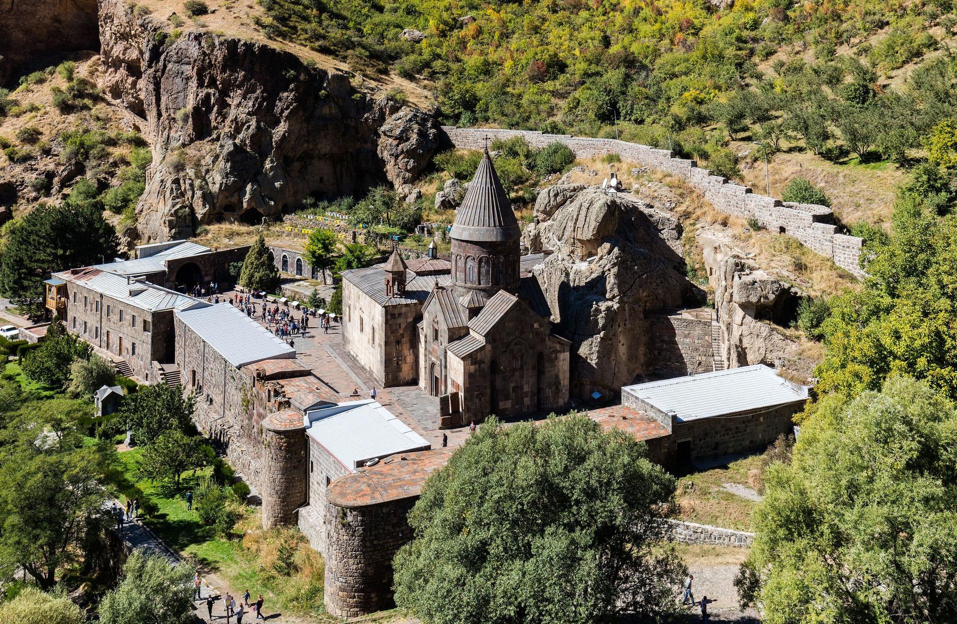
Discover the ancient rock-carved wonders of Geghard Monastery, a UNESCO World Heritage Site nestled in Armenia's picturesque mountains.
Tell me more about Geghard Monastery