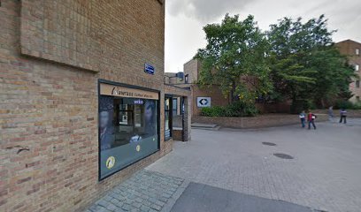
Geographic Center of Belgium
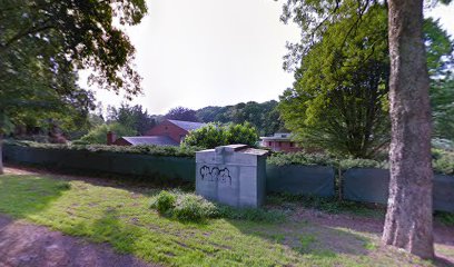
Visit the symbolic heart of Belgium in Walhain, where a modern monument marks the precise geographic center of the country.
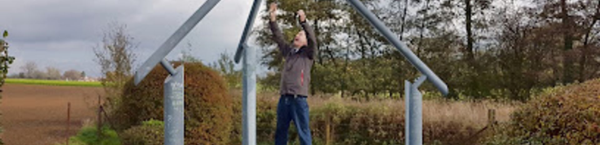
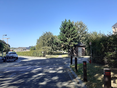
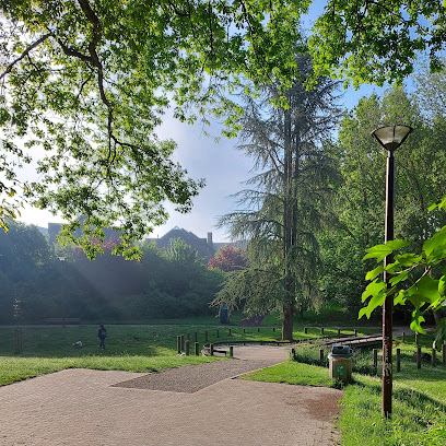
Discover the symbolic heart of Belgium in Walhain, marked by a modern metal structure representing the country's regions and geographical coordinates. A point of national pride since 1998, replacing Ittre after the annexation of eastern cantons.
A brief summary to Centre géographique de la Belgique
- Pl. du Tram, Walhain, 1457, BE
- Visit website
- Monday 12 am-12 am
- Tuesday 12 am-12 am
- Wednesday 12 am-12 am
- Thursday 12 am-12 am
- Friday 12 am-12 am
- Saturday 12 am-12 am
- Sunday 12 am-12 am
Local tips
- Take a walk along the marked trail from Place du Tram to fully experience the serene valley of the Nil.
- Visit the Walhain Tourist Office in the town hall for local maps and walking/cycling routes.
- Explore the nearby village of Nil-Saint-Vincent for a taste of the Walloon Brabant region.
Getting There
-
Walking
From the Place du Tram in Nil-Saint-Vincent, follow the marked path into the valley of the Nil. The walk to the monument is short and offers pleasant views of the surrounding countryside. The path is generally accessible, but may be uneven in places.
-
Public Transport
Arriving by public transport, take bus lines 24, 25, 30, or 34 to the Walhain-Saint-Paul Monument stop. From the bus stop, it's a short walk to the Place du Tram and the path leading to the Geographic Center. A single TEC bus fare costs around €2.50 - €3.00.
-
Taxi
From the center of Walhain-Saint-Paul, a taxi to the Place du Tram will cost approximately €10-€15. Taxis are available in Walhain, but pre-booking is recommended.
Discover more about Centre géographique de la Belgique
Iconic landmarks you can’t miss
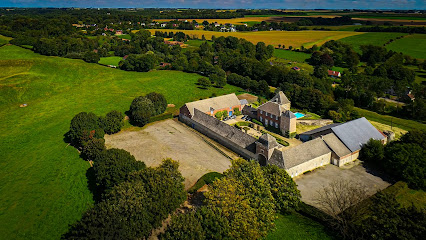
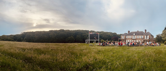
La Ferme du Château de Corroy-le-Grand
3.2 km
Host your event in a historic 17th-century fortified farmhouse near Brussels, offering charming event spaces and a tranquil rural setting.
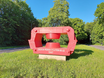
Cœur du premier cyclotron belge
4.3 km
Explore the Cœur du Premier Cyclotron Belge, a serene memorial park celebrating Belgium's innovative contributions to nuclear physics and scientific discovery.
Carmel de Louvain-la-Neuve
4.4 km
Experience tranquility and spiritual reflection at Carmel de Louvain-la-Neuve, a serene monastery in Court-St.-Étienne, Belgium, perfect for peaceful retreats.
Parc du Biéreau
4.4 km
Explore the serene beauty of Parc du Biéureau in Ottignies-Louvain-la-Neuve, a perfect escape for nature lovers and leisurely strolls.
Place Polyvalente
4.5 km
Discover the vibrant culture and community spirit of Ottignies-Louvain-la-Neuve at Place Polyvalente, the heart of this charming Belgian town.

Farm Biéreau
4.5 km
Discover Farm Biéreau in Ottignies-Louvain-la-Neuve, a lively live music venue blending local culture, creativity, and unforgettable performances.
Parking Sciences
4.5 km
Explore Parking Sciences in Ottignies-Louvain-la-Neuve – a serene land mass offering ample parking and tranquil surroundings for a refreshing pause during your travels.
Place Galilée
4.6 km
Experience the vibrant culture and charm of Place Galilée in Ottignies-Louvain-la-Neuve, a must-visit town square filled with life and history.
Church of Our Lady of Hope
4.6 km
Discover the Church of Our Lady of Hope, an architectural gem in Ottignies-Louvain-la-Neuve, inviting serenity and cultural richness in Belgium.
Place des Paniers
4.6 km
Experience the vibrant heart of Ottignies-Louvain-la-Neuve at Place des Paniers, a lively town square filled with shops, cafes, and local charm.
La Tour Infernale
4.6 km
Discover the architectural beauty and spiritual serenity of La Tour Infernale, a must-visit place of worship in the heart of Ottignies-Louvain-la-Neuve.
Chapelle Orthodoxe de Louvain-la-Neuve
4.6 km
Explore the captivating Chapelle Orthodoxe de Louvain-la-Neuve, a serene Orthodox church blending rich tradition and stunning architecture in Belgium.
Chapelle de la Source
4.7 km
Explore the tranquil beauty of Chapelle de la Source, a serene chapel in Ottignies-Louvain-la-Neuve, offering peace and reflection amidst nature's splendor.
Place Louis Pasteur
4.7 km
Experience the charm of Place Louis Pasteur, a vibrant town square in Ottignies-Louvain-la-Neuve, surrounded by cafés, shops, and cultural events.
Couvent Dominicains Fra Angelico
4.8 km
Experience the serene beauty and rich heritage of Couvent Dominicains Fra Angelico, a tranquil retreat in Ottignies-Louvain-la-Neuve, Belgium.
Unmissable attractions to see
Capucines Garden
4.3 km
Discover tranquility and natural beauty at Capucines Garden in Ottignies-Louvain-la-Neuve, a hidden gem perfect for relaxation and exploration.
Parc des Ménétriers
4.4 km
Experience the serene beauty of Parc des Ménétriers, a tranquil city park in Ottignies-Louvain-la-Neuve, perfect for relaxation and leisure.
Parc à Lapins
4.5 km
Experience the tranquility of Parc à Lapins in Ottignies-Louvain-la-Neuve, a perfect escape for nature lovers and families alike.
Botanical Garden
4.5 km
Explore the lush landscapes and vibrant flora of the Botanical Garden in Ottignies-Louvain-la-Neuve, a serene city park ideal for relaxation and discovery.
Musée L
4.5 km
Explore the captivating exhibits at Musé e L, where art, history, and culture come together in Ottignies-Louvain-la-Neuve.
Parc de la Baraque
4.6 km
Explore the serene Parc de la Baraque in Ottignies-Louvain-la-Neuve, a city park perfect for leisurely strolls, picnics, and enjoying nature's beauty.
Les Jardins de Moulinsart
4.7 km
Explore the serene beauty of Les Jardins de Moulinsart, a tranquil city park in Ottignies-Louvain-la-Neuve, perfect for relaxation and outdoor activities.
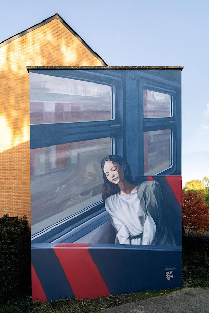
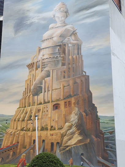
Fresque murale de l'artiste TAROE
4.9 km
Explore the captivating Fresque murale de l'artiste TAROE in Ottignies-Louvain-la-Neuve, a vibrant masterpiece that embodies the city's artistic spirit.
The thinking woman
4.9 km
Discover 'The Thinking Woman' in Ottignies-Louvain-la-Neuve, a captivating monument celebrating women's intellectual achievements and artistic expression.
Parc des Rondes-Bosses
5.0 km
Explore the tranquil beauty of Parc des Rondes-Bosses in Ottignies-Louvain-la-Neuve, a perfect city park for relaxation and family fun.

Parc de la Source
5.0 km
Explore the serene beauty of Parc de la Source, a tranquil city park in Ottignies-Louvain-la-Neuve, perfect for relaxation and family outings.
Grande Place de Louvain-la-Neuve
5.0 km
Discover the vibrant atmosphere of Grande Place in Louvain-la-Neuve, where culture, community, and captivating architecture come together.
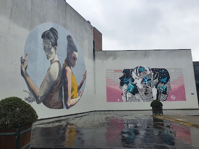
Grandes fresques murales
5.1 km
Explore the stunning Grandes fresques murales in Ottignies-Louvain-la-Neuve, a vibrant open-air gallery celebrating local art and culture.
La tour infinie François Schuiten
5.1 km
Discover the artistic marvel of La Tour Infinie François Schuiten, a unique tower blending imagination and architecture in Ottignies-Louvain-la-Neuve, Belgium.
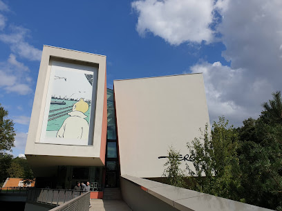
Hergé Museum
5.1 km
Explore the Hergé Museum in Belgium, a captivating tribute to the creator of Tintin, showcasing art, history, and storytelling for all ages.
Essential places to dine
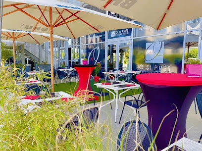
Ô si près Restaurant - Traiteur
3.5 km
Discover exquisite flavors at Ô si près Restaurant in Mont-Saint-Guibert - where culinary artistry meets warm hospitality.
Comme Chez Vous
3.8 km
Experience authentic Belgian flavors at Comme Chez Vous in Mont-Saint-Guibert - where every meal feels like home.
L’arobase
4.1 km
Discover the delightful flavors of Belgium at L’arobase in Ottignies-Louvain-la-Neuve - where exceptional cuisine meets warm hospitality.
Brasserie RN Louvain-La-Neuve
4.3 km
Discover authentic Belgian flavors at Brasserie RN in Louvain-La-Neuve - where delicious cuisine meets local brews in a cozy setting.
La Table L
4.5 km
Experience exquisite flavors at La Table L in Ottignies-Louvain-la-Neuve—where culinary artistry meets local tradition.
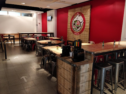
Le Brasse-Temps
4.7 km
Discover the perfect blend of local cuisine and craft beers at Le Brasse-Temps in Ottignies-Louvain-la-Neuve.
Altérez-Vous
4.7 km
Discover Altérez-Vous: A cozy restaurant and coffee shop offering delightful Belgian cuisine and a vibrant atmosphere in Ottignies-Louvain-la-Neuve.
Le Cambodge
4.8 km
Experience authentic Cambodian cuisine at Le Cambodge, where vibrant flavors meet warm hospitality in Ottignies-Louvain-la-Neuve.
La Crêperie Bretonne La Mère Filloux
4.8 km
Savor authentic Breton crepes and delightful sundaes at La Crêperie Bretonne La Mère Filloux in Ottignies-Louvain-la-Neuve.
Les Halles
4.8 km
Discover Les Halles in Louvain-la-Neuve – where delicious Belgian cuisine meets a cozy atmosphere perfect for any occasion.
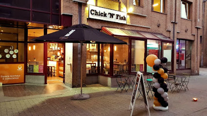
Chick 'N' Fish
4.8 km
Discover Chick 'N' Fish in Ottignies-Louvain-la-Neuve for delicious fish & chips served in a warm and welcoming atmosphere.
Cellule Sush'
4.8 km
Discover exceptional sushi at Cellule Sush', where fresh ingredients meet innovative flavors in Louvain-la-Neuve's vibrant dining scene.
Mex&Go LLN
4.9 km
Experience authentic Mexican flavors at Mex&Go LLN - a vibrant eatery in Ottignies-Louvain-la-Neuve offering healthy fast food options.
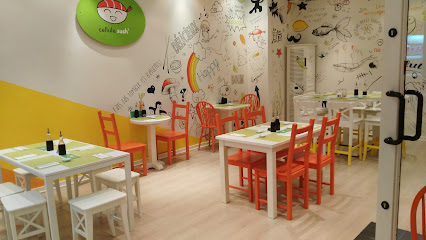
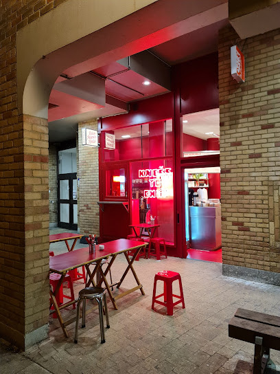
Knees to chin
4.9 km
Discover authentic Asian Fusion flavors at Knees to Chin in Ottignies-Louvain-la-Neuve – where culinary tradition meets modern creativity.
Taverne Le Coup De Foudre
4.9 km
Discover authentic Belgian cuisine at Taverne Le Coup De Foudre in Ottignies-Louvain-la-Neuve – where delicious flavors meet warm hospitality.
Markets, malls and hidden boutiques
Apides
4.8 km
Apides in Ottignies-Louvain-la-Neuve: Your go-to second-hand store for vintage finds and unique treasures.
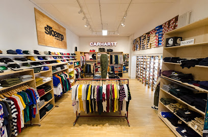
Stoemp - Louvain-la-Neuve - Streetwear & Sneakers
4.8 km
Explore Stoemp in Louvain-la-Neuve for the latest in streetwear and sneakers, a hub for fashion lovers and trendsetters.
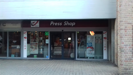
Press Shop
4.8 km
Discover your next favorite book at Press Shop, the charming hub for literature, comics, and sweet treats in Ottignies-Louvain-la-Neuve.
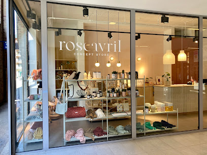
Rose Avril
4.9 km
Experience the essence of Belgian fashion at Rose Avril, where unique accessories meet local flair in Ottignies-Louvain-la-Neuve.
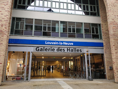
Galerie des Halles
4.9 km
Explore the vibrant shopping scene at Galerie des Halles in Ottignies-Louvain-la-Neuve, where culture and retail blend seamlessly.
Le Cha-Hû-Thé
4.9 km
Discover the enchanting world of tea at Le Cha-Hû-Thé in Ottignies-Louvain-la-Neuve, a must-visit for tea lovers and gift seekers alike.
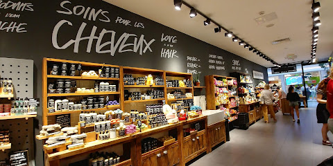
LUSH Cosmetics Louvain-la-Neuve
4.9 km
Discover ethical and vibrant beauty products at LUSH Cosmetics Louvain-la-Neuve, where eco-friendliness meets luxury in every handmade item.
L'esplanade
4.9 km
Discover L'esplanade, a shopping paradise in Ottignies-Louvain-la-Neuve, featuring diverse stores, dining options, and entertainment for all ages.
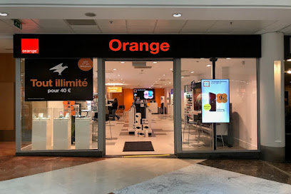
Orange Shop
4.9 km
Discover the latest mobile technology and expert telecommunications services at the Orange Shop in Louvain-la-Neuve.
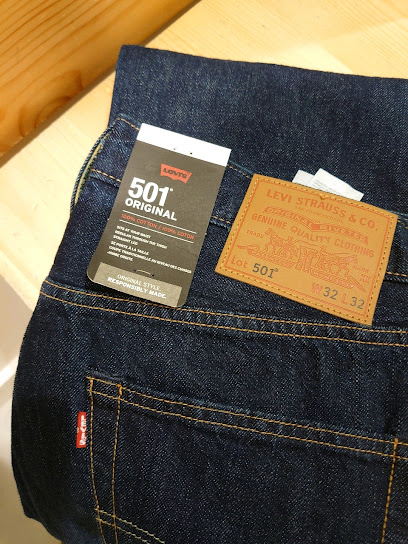
Levi's® Louvain-La-Neuve
4.9 km
Explore Levi's® Louvain-La-Neuve for the latest in stylish denim and fashion accessories, perfect for every fashion-forward traveler.
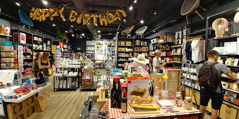
La Chaise Longue
4.9 km
Explore La Chaise Longue, a delightful gift shop in Ottignies-Louvain-la-Neuve, offering unique souvenirs and local treasures to enhance your travel experience.
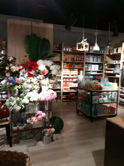
MAISONS DU MONDE
4.9 km
Discover unique home decor and furniture at Maisons du Monde, a must-visit gift shop in Louvain-la-Neuve, perfect for tourists seeking stylish souvenirs.
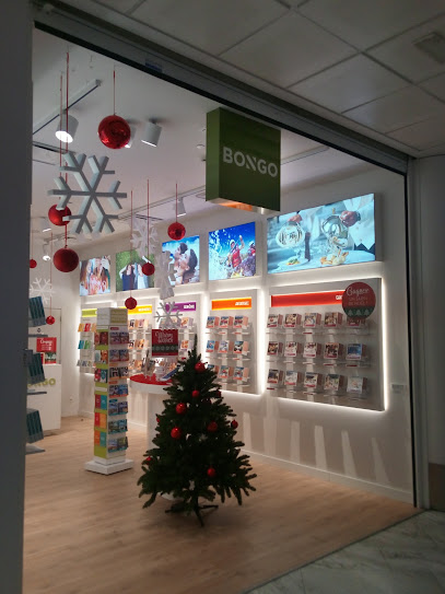
Bongo Louvain-la-Neuve
4.9 km
Explore Bongo Louvain-la-Neuve, your go-to gift shop for unique souvenirs and local treasures in the heart of Belgium.
Citron Grenadine
4.9 km
Explore Citron Grenadine: A charming baby store in Ottignies-Louvain-la-Neuve offering quality products for your little ones.
Le Zèbre à Pois Louvain-la-Neuve (LEZAP) - Magasin de jouets
4.9 km
Explore a magical toy store in Louvain-la-Neuve, where creativity meets adventure for children and families alike.
Essential bars & hidden hideouts
La Moonshine
3.7 km
Discover La Moonshine, a charming bar in Mont-Saint-Guibert, offering a unique atmosphere and a fantastic selection of drinks for every taste.
La Terrasse du Manoir
3.8 km
Discover the charm of La Terrasse du Manoir, a cozy bar in Ottignies-Louvain-la-Neuve, offering delightful drinks and a warm atmosphere.
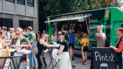
The Irish Pub Truck
4.2 km
Discover the charm of Irish culture at The Irish Pub Truck in Ottignies-Louvain-la-Neuve, a cozy bar perfect for relaxation and socializing.
Citizen Kane - Resto - Bar - Event
4.5 km
Experience the perfect blend of great food and drinks at Citizen Kane, the vibrant resto-bar in Ottignies-Louvain-la-Neuve.
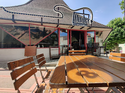
Dude!
4.6 km
Dude! Bar - Your go-to spot for drinks, music, and a vibrant atmosphere in Ottignies-Louvain-la-Neuve.
La Lux
4.6 km
Experience the vibrant nightlife of Ottignies-Louvain-la-Neuve at La Lux, your go-to bar for affordable drinks and lively entertainment.
Good News - Bar
4.6 km
Discover Good News Bar in Louvain-la-Neuve, where vibrant nightlife meets a cozy atmosphere and a diverse drink selection.
Industrial Circle (IC)
4.7 km
Experience the lively atmosphere of the Industrial Circle, a popular bar in Ottignies-Louvain-la-Neuve, perfect for relaxation and socializing.
Fox Owl
4.7 km
Discover the vibrant nightlife at Fox Owl, a lively bar in Louvain-la-Neuve, offering a wide selection of drinks and a welcoming atmosphere.
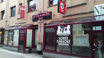
Afterwork bar Louvain-La-Neuve, Karaoké Dancing Bar
4.8 km
Discover the vibrant nightlife at Afterwork Bar Louvain-La-Neuve, where karaoke, cocktails, and dancing create unforgettable memories.
The Blackfriars Pub
4.8 km
Experience the warmth of Irish hospitality at The Blackfriars Pub in Ottignies-Louvain-la-Neuve, where great food and drinks await.
Euro Snooker
4.9 km
Discover the vibrant nightlife at Euro Snooker, a karaoke bar in Ottignies-Louvain-la-Neuve offering fun, games, and unforgettable entertainment.

Ginette Bar
4.9 km
Discover Ginette Bar, the perfect blend of vibrant atmosphere, exquisite drinks, and delightful cuisine in Ottignies-Louvain-la-Neuve.
Régionale Bruxelloise des Etudiants Louvanistes
4.9 km
Discover the lively and inclusive atmosphere of Régionale Bruxelloise des Etudiants Louvanistes - an essential stop for nightlife in Louvain-la-Neuve.
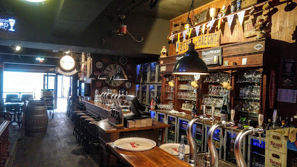
Beer Bar
4.9 km
Experience the vibrant beer culture at Beer Bar in Louvain-la-Neuve – a haven for beer lovers with a vast selection and inviting atmosphere.
Nightclubs & after hour spots
Discokot
4.3 km
Discover the electrifying nightlife at Discokot, Ottignies-Louvain-la-Neuve's premier night club for unforgettable parties and vibrant entertainment.
T'chik boys kot
4.9 km
Dive into the vibrant nightlife of Ottignies-Louvain-la-Neuve at T'chik Boys Kot, where lively beats and an electrifying atmosphere await you.
Club Louvain-la-Neuve
4.9 km
Explore Club Louvain-la-Neuve, a treasure trove of books, CDs, and games in Belgium's vibrant university town, perfect for creative souls and culture seekers alike.
MonkeyKot
5.5 km
Discover the electrifying nightlife of MonkeyKot - a must-visit disco club in Ottignies-Louvain-la-Neuve for unforgettable evenings.

Le Glam
14.1 km
Discover the vibrant nightlife of Sombreffe at Le Glam, a lively night club offering electrifying music and a dynamic atmosphere.
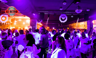
Le RETRO Discothèque
15.7 km
Experience the lively nightlife at Le RETRO Discothèque in Gembloux, Belgium - a must-visit disco club for music and dance lovers.
Abyss Nightclub
19.1 km
Experience unforgettable nights at Abyss Nightclub in Braine-l'Alleud, where vibrant beats and lively ambiance create the ultimate nightlife destination.
Les Arches - Terrasse d'été
19.1 km
Discover the lively atmosphere of Les Arches - Terrasse d'été, the ultimate night club experience in Braine-l'Alleud, where music and summer nights come alive.
Acte 3
19.1 km
Discover Braine-l'Alleud's top nightlife destination at Acte 3, a lively club and concert hall offering unforgettable music and dance experiences.
Piette / Philippe
19.4 km
Dive into the pulsating nightlife of Piette / Philippe, Fleurus's top disco club for an unforgettable night of music and dance.
FLAGDEL
20.4 km
Dive into the electrifying nightlife at FLAGDEL, Namur's premier disco club, where music, dancing, and fun come alive until the early hours.
Chez Yoyo Hamma santé
22.6 km
Discover the tranquil ambiance of Chez Yoyo Hamma Santé, the perfect lounge in Namur for a refreshing drink and a relaxing atmosphere.

Cercle €co UNamur
23.6 km
Experience the vibrant nightlife of Cercle €co UNamur, where fun meets sustainability in the heart of Namur.
Reste-au-kot
23.7 km
Discover Reste-au-kot, Namur's ultimate night club for an unforgettable nightlife experience filled with music, dance, and vibrant atmosphere.
Bunker
23.7 km
Unravel the nightlife of Namur at Bunker, a vibrant club offering pulsating music and an inviting atmosphere for all party enthusiasts.