

Kibira National Forest Travel Guide - Free Web & App
Your ultimate guide to Kibira National Forest. Discover top landmarks, proposed trips, and local tips. Free on the web or via the Evendo companion app.


Kibira National Forest, Burundi, offers montane rainforest, chimpanzee habitat, birdwatching, scenic trails and Congo-Nile Ridge landscapes near Kayanza.
Forest on the Congo-Nile Ridge
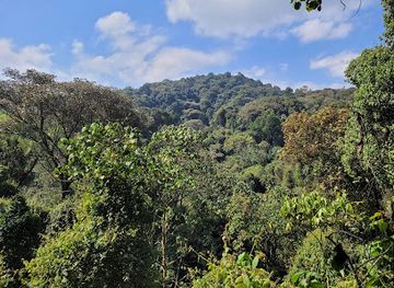
Kibira National Forest occupies a high, humid section of Burundi’s Congo-Nile Ridge, north-west of Bujumbura and close to the Rwandan border. The forest forms part of a wider chain of montane habitats that continues northwards into Rwanda’s Nyungwe landscape, although the international boundary and different management systems separate the two protected areas. Steep slopes, mist-filled valleys, streams and dense evergreen vegetation give Kibira a markedly cooler character than the lowlands around Lake Tanganyika.Read more about Kibira National Forest
Wildlife and Water Catchments
Visiting the Forest
When is the best time to visit Kibira National Forest?
Best: September–November · 29°C| Month | High (°C) | Rainfall (mm) |
|---|---|---|
| January | 28 | 151 |
| February | 28 | 141 |
| March | 28 | 131 |
| April | 28 | 121 |
| May | 28 | 111 |
| June | 29 | 101 |
| July | 29 | 91 |
| August | 29 | 81 |
| September (best) | 29 | 71 |
| October (best) | 29 | 61 |
| November (best) | 29 | 66 |
| December | 30 | 76 |
Getting to and around Kibira National Forest
How to get there
Transportation
Best landmarks in Kibira National Forest
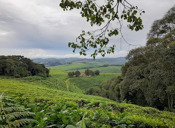
The Congo-Nile Ridge is Kibira’s defining natural landmark, forming a high, steep divide whose humid slopes support one of Burundi’s most important remaining forest ecosystems. The dense montane woodland, misty valleys and headwater streams are landmarks in ecological rather than architectural terms, while the Rwegura reservoir provides a recognisable water feature on the eastern side of the forest landscape. The forest’s importance is heightened by its ecological relationship with Rwanda’s Nyungwe area, although the border separates the two protected landscapes. Around the margins, tea-growing country and heavily cultivated highland slopes show the contrast between managed agricultural land and protected woodland. Kibira has few monumental buildings or formal visitor structures within its boundaries; its significance rests chiefly in its forests, watersheds, wildlife habitat and position on Burundi’s central mountain spine.
-
National park
Kibira National Park
Explore the lush landscapes and rich biodiversity of Kibira National Park, a hidden gem in Burundi perfect for adventure and nature lovers.
Explore Kibira National Forest on the map
Plan your trip on one map. See where the top attractions, landmarks, restaurants and hotels are, and book hotels and experiences in a few clicks.
Best hotels in Kibira National Forest
Best shops in Kibira National Forest
Shopping opportunities in Kibira are very limited and are concentrated in surrounding settlements rather than within the protected forest. Kayanza and other highland towns provide places to buy basic provisions, locally produced food and practical supplies, while Bujumbura offers the broadest range of craft shops, markets and specialist retail. Tea is the most obvious regional product associated with the highlands, although visitors should purchase it through legitimate shops or producers rather than collecting anything from plantations or protected land. Rural markets may offer fresh produce, woven goods and everyday household items, but their scale and operating days vary. There is no established shopping district or souvenir market inside Kibira, so travellers should buy essentials before setting out and treat any local purchase as a direct part of the surrounding community economy.
-
National park
Kibira National Park
Explore the lush rainforests and diverse wildlife of Kibira National Park, a serene oasis in Burundi perfect for nature lovers and adventurers.
Get your free copy of our complete guide to Kibira National Forest, delivered straight to you.
Everything on this page, from attractions and restaurants to essentials and local phrases, in one PDF you can read offline, print or share.
Already have an account? Sign in
Your Kibira National Forest guide is ready.
We'll send it to · Not you? Sign out

Getting your guide ready…
We are putting together a fresh copy of the Kibira National Forest guide. This can take up to a minute.
This can take a few moments. If your browser asks, choose Allow so the download can start. You'll find the guide in your Downloads folder.
Nothing happened? Download it again
Sorry, the guide is taking longer than usual. Please try again in a minute, or get it by email instead.
Kibira National Forest essentials
Currency and Payment
Safety
Emergency Situations
Do's and Don'ts
Local Tips
From Eve
Local phrases worth knowing
You don't need to get them perfect. A few words go a long way, and locals appreciate the effort.
Basics
| English | Local | Say it |
|---|---|---|
| Hello | Amakuru | [ah-mah-koo-roo] |
| Goodbye | Kwaheri | [kwa-heh-ree] |
| Yes | Ego | [eh-go] |
| No | Oya | [oh-yah] |
| Please/You're welcome | Kuhamya | [koo-hahm-yah] |
| Thank you | Murakoze | [moo-rah-koh-zeh] |
| Excuse me/Sorry | Mwihangane | [mwee-hahn-gah-neh] |
| How are you? | Amahoro? | [ah-mah-hoh-roh?] |
| Fine. And you? | Ni meza. Na wewe? | [nee meh-zah. nah weh-weh?] |
| Do you speak English? | Mwaba mutariki Igitabo c'ubwenge? | [mwa-bah moo-tah-ree-kee ee-gee-tah-boh c'oo-bwehn-geh?] |
| I don't understand | Sinumva | [see-noom-vah] |
Eating & Drinking
| English | Local | Say it |
|---|---|---|
| I'd like to see the menu, please | Nifise igikoresho, kubanza | [nee-fee-seh ee-gee-koh-reh-shoh, koo-bahn-zah] |
| I don't eat meat | Simbiyako inyama | [see-mbee-yah-koh ee-nyah-mah] |
| Cheers! | Amahoro! | [ah-mah-hoh-roh!] |
| I would like to pay, please | Nifuza kugurisha, kubanza | [nee-foo-zah koo-goo-ree-shah, koo-bahn-zah] |
Emergencies
| English | Local | Say it |
|---|---|---|
| Help! | Mwakoze! | [mwa-koh-zeh!] |
| Go away! | Bibuka! | [bee-boo-kah!] |
| Call the Police! | Bereka Polisi! | [beh-reh-kah poh-lee-see!] |
| Call a doctor! | Bereka daktari! | [beh-reh-kah dahk-tah-ree!] |
| I'm lost | Nshaka | [n-shah-kah] |
| I'm ill | Nkora | [n-koh-rah] |
Shopping
| English | Local | Say it |
|---|---|---|
| I'd like to buy... | Nifura... | [nee-foo-rah...] |
| I'm just looking | Nshaka kugarukira | [n-shah-kah koo-gah-roo-kee-rah] |
| How much is it? | Ni iki cyane? | [nee ee-kee chyah-neh?] |
| That's too expensive | Iyo ni byinshi | [ee-yoh nee bee-yin-shee] |
| Can you lower the price? | Wibuka gutanga isura? | [wee-boo-kah goo-tahn-gah ee-soo-rah?] |
Time & Numbers
| English | Local | Say it |
|---|---|---|
| What time is it? | Saa ngapi? | [sah-ah ngah-pee?] |
| It's one o'clock | Ni saa ya kane | [nee sah-ah yah kah-neh] |
| Half past (10) | Saa munani | [sah-ah moo-nah-nee] |
| Morning | Igisibo | [ee-ghee-see-boh] |
| Afternoon | Icyumweru | [ee-choom-weh-roo] |
| Evening | Igihe cya saha | [ee-ghee-heh chyah sah-hah] |
| Yesterday | Ejo | [eh-joh] |
| Today | Ejo | [eh-joh] |
| Tomorrow | Ejo | [eh-joh] |
| 1 | Rimwe | [ree-mweh] |
| 2 | Kabiri | [kah-bee-ree] |
| 3 | Gatatu | [gah-tah-too] |
| 4 | Kane | [kah-neh] |
| 5 | Gatanu | [ga-tah-noo] |
| 6 | Gatandatu | [gah-tahn-dah-too] |
| 7 | Kumwe | [koo-mweh] |
| 8 | Nyanya | [nyah-nyah] |
| 9 | Icyenda | [ee-chee-yen-dah] |
| 10 | Icyumweru | [ee-choom-weh-roo] |
Transport & Directions
| English | Local | Say it |
|---|---|---|
| Where's a/the...? | Iki ni heza...? | [ee-kee nee heh-zah...?] |
| What's the address? | Adiresi ni iki? | [ah-dee-reh-see nee ee-kee?] |
| Can you show me (on the map)? | Wibuka kunyereza kuri mape? | [wee-boo-kah koo-nyeh-reh-zah koo-ree mah-peh?] |
| When's the next (bus)? | Iki gihe cyiza iki? | [ee-kee gee-heh chee-zah ee-kee?] |
| A ticket (to ....) | Ikipe (kuri ....) | [ee-kee-peh koo-ree ....] |
History of Kibira National Forest
A Highland Forest Landscape
Kibira occupies an old, elevated landscape on the Congo-Nile Ridge, where humid conditions and high rainfall have supported montane forest over long geological timescales. Its steep terrain and dense vegetation are closely connected with the headwaters and catchments of rivers flowing through Burundi. The forest is therefore significant not only as wildlife habitat but also as a natural water reserve for surrounding highland communities. Human history in the region has developed alongside this difficult terrain, with settlement and cultivation concentrated in more accessible areas around the forest margins.
Royal Forest and Local Communities
Before modern conservation boundaries were established, parts of the forested ridge were associated with the kingship of Burundi and were treated differently from ordinary agricultural land. Local people used surrounding areas for cultivation, grazing, gathering and movement, while the steep interior remained comparatively difficult to farm. The relationship between communities and forest was shaped by customary authority, access to land and the importance of water. Precise traditions vary between localities, so visitors should rely on local guides and community knowledge rather than assuming that the whole forest has one uniform cultural history.
Colonial-Era Forest Protection
Formal forest protection developed during the Belgian colonial period, when authorities began defining reserves and regulating the use of highland forests. Kibira is commonly associated with a protected-forest designation dating from 1933, although later legislation and management arrangements changed its legal framework. These measures reflected both administrative control and growing recognition of the forest’s value for water, timber and climate regulation. They also altered older patterns of access by placing greater emphasis on official boundaries and permitted use.
National Park and Conservation Challenges
In independent Burundi, Kibira became part of the country’s modern protected-area system and is generally described as a national park established in 2000. Conservation has had to contend with population pressure, agricultural expansion, resource use, poverty, political instability and the difficulty of monitoring a large, mountainous forest. The park’s ecological importance is reinforced by its continuity with Rwanda’s Nyungwe landscape, even though the two areas are managed on opposite sides of an international border. Contemporary conservation therefore involves habitat protection, law enforcement, research and relationships with communities living around the forest.
Kibira National Forest in Photos
Browse through our photo collection highlighting the charm and character of the destination.
Cities in Kibira National Forest
The towns and cities of Kibira National Forest, and the easiest places to base yourself.

Swipe for more cities
Neighbouring destination travel guides
The closest destinations to Kibira National Forest, if you have time for more than one.
-

-

-

-

-


Swipe for more destinations
Explore more

Explore more of Bubanza
Discover Bubanza, Burundi's serene province, where lush landscapes, rich cultural heritage, and adventure await amidst tranquil countryside and vibrant local markets.
Explore Bubanza
Explore more of Burundi
Discover the hidden gem of Africa: Burundi, a land of stunning landscapes, rich culture, and warm hospitality. Perfect for adventurers and culture enthusiasts alike.
Explore Burundi