

Dynæs voldsted Travel Guide
Free Guide: Medieval fortress ruin commanding Juulsø lake, where 14th-century power and water strategy converge.


A brief summary of Dynæs voldsted
Medieval fortress ruin commanding Juulsø lake, where 14th-century power and water strategy converge.
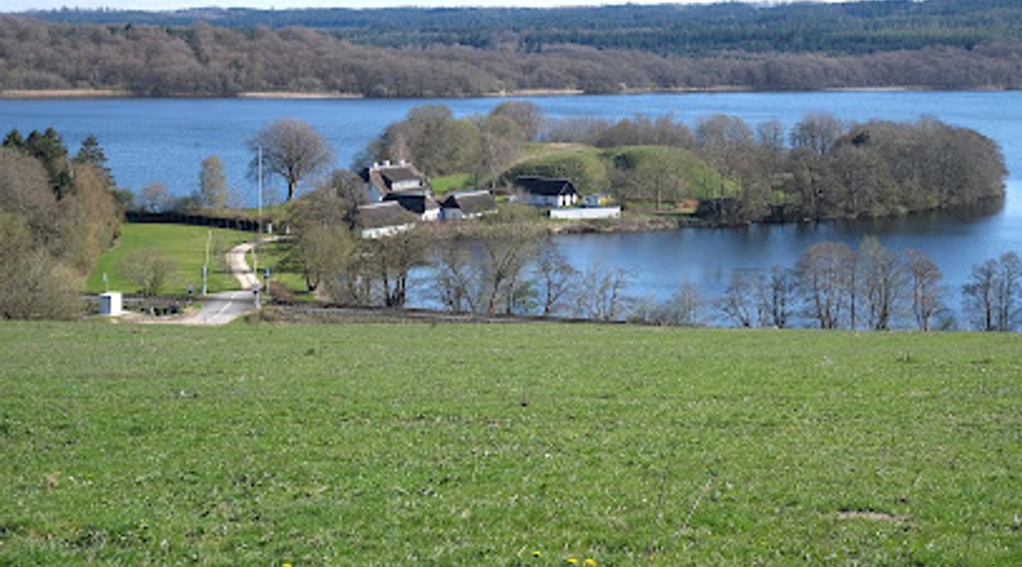
A striking medieval fortress ruin on a peninsula jutting into Juulsø lake near Silkeborg, Denmark. The site features a 12-meter-high rampart bank surrounded by defensive ditches, remnants of a fortified structure that once controlled waterway traffic along the Gudenå river system. Dating to the 14th–15th centuries, Dynæs exemplifies medieval military strategy in Denmark's turbulent post-Valdemar era. Public access via footpath; no facilities nearby.
On-site amenities
 Information boards
- Address
- 8600 Silkeborg
- Phone
Getting there
Bus from Silkeborg Town Centre
Bicycle from Silkeborg Town Centre
Walking from Silkeborg Town Centre
Car via Regional Roads
Discover more about Dynæs voldsted
A Fortress Born from Medieval Conflict
Dynæs Voldsted stands as a tangible reminder of Denmark's tumultuous 14th century, when royal authority fractured and regional strongholds became essential instruments of power. The site's name first appears in written records in 1360, though its construction likely predates this documentation. By the early 1400s, the fortress had come under the control of Silkeborg Castle, and by 1435 it passed to the Bishop of Aarhus. The fortress belonged to King Valdemar Atterdag during his reign (1320–1375), a period marked by internal strife and political instability that followed the death of Valdemar the Conqueror in 1241. The construction of defensive installations along the Gudenå river system must be understood within this broader context of political upheaval, economic decline, and the struggle to maintain territorial control.
Strategic Mastery of Water and Terrain
The location of Dynæs demonstrates sophisticated medieval military thinking. A narrow peninsula extends into Juulsø lake, and upon this natural strongpoint, builders constructed a fortress that was surrounded by water on nearly all sides—a formidable defensive advantage. The main rampart bank measures approximately 60 by 68 meters and rises steeply to a height of 12 meters above the lake's surface. A cross-rampart with an adjoining ditch guarded the vulnerable land approach, while the entire structure was originally encircled by defensive ditches, still visible today as depressions in the landscape. From this elevated position, defenders could monitor and control all water traffic along the Gudenå and its connected waterways, which served as vital transportation routes through the region's marshy, difficult terrain.
Architectural Evidence and Defensive Purpose
Archaeological investigation of the rampart's summit has uncovered both stone and brick fragments, indicating that a substantial masonry structure once stood here—likely a heavily fortified tower. This tower would have served dual purposes: it provided a secure stronghold from which defenders could repel attackers, and it offered commanding views across Juulsø and the surrounding waterways, enabling surveillance and control of navigation. The fortress's design reflects the medieval understanding that water barriers and elevated positions created nearly impregnable defenses when combined with proper fortification. The Gudenå's extensive wetlands and water systems created natural obstacles that made the terrain difficult to traverse and nearly impossible to assault directly.
The Broader Context of Gudenå Fortifications
Dynæs is one of several medieval defensive installations constructed along the Gudenå river system during the 13th and 14th centuries. These fortresses served a critical function during a period when Denmark lacked centralized authority—the country had no king at all from 1332 to 1340. The political fragmentation that followed Valdemar the Conqueror's death created conditions in which local nobles and ecclesiastical authorities needed to defend their territories and interests. The Gudenå's geography, with its numerous wetlands and water barriers, made it an ideal location for establishing strategic control points. By positioning fortresses at key locations like Dynæs, rulers could monitor trade, collect tolls, and prevent unauthorized movement through their domains.
Later History and Cultural Significance
After its military importance declined, Dynæs retained cultural significance for the region. The poet Johan Skjoldborg (1861–1936) held public gatherings at the site from 1907 to 1914, transforming the ancient fortress into a venue for civic discourse and cultural exchange. This repurposing of the medieval ruin reflects how such sites evolved from military installations into symbols of national heritage and community identity. Today, the rampart remains one of the most impressive and well-preserved medieval fortress sites in the Silkeborg region, offering visitors a direct connection to Denmark's medieval past.
Evendo Review Centre
 Google
Guest reviews
Best time to go
Quietest: Jan, Feb & Nov · before 7am or at 8pm
Busy times are Evendo estimates for a typical year, to help you plan. Actual crowds vary with events, school holidays and the weather.
Explore Dynæs voldsted on the map
A handpicked selection of must-see spots near Dynæs voldsted, mapped for you.
Get your free copy of our complete guide to Dynæs voldsted, delivered straight to you.
Everything on this page, from opening hours and how to get there to Eve’s tips and the best time to go, in one PDF you can read offline, print or share.
Already have an account? Sign in
Your Dynæs voldsted guide is ready.
We'll send it to · Not you? Sign out

Getting your guide ready…
We are putting together a fresh copy of the Dynæs voldsted guide. This can take up to a minute.
This can take a few moments. If your browser asks, choose Allow so the download can start. You'll find the guide in your Downloads folder.
Nothing happened? Download it again
Sorry, the guide is taking longer than usual. Please try again in a minute, or get it by email instead.
Other nearby places you may find interesting
The closest places of the same kind, if this one is not quite what you had in mind.
-
-
-
-
-


Swipe for more places
More to explore near Dynæs voldsted

 Best experiences near Dynæs voldsted

 Best hotels near Dynæs voldsted

 Best landmarks near Dynæs voldsted

 Best attractions near Dynæs voldsted

 Best shops near Dynæs voldsted

 Best restaurants near Dynæs voldsted

 Best bars near Dynæs voldsted
Do you manage this location?
Take control to get all the benefits, like improved information, better appearance, and stronger visibility across AI-powered discovery.
Explore more

Explore more of Central Jutland
Explore Central Jutland in Denmark: A perfect blend of natural beauty, cultural heritage, and family-friendly attractions.
Explore Central Jutland
Explore more of Denmark
Discover Denmark: A perfect blend of history, modern design, and the cozy concept of hygge. Explore vibrant cities, serene landscapes, and world-class cuisine.
Explore Denmark
