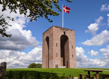
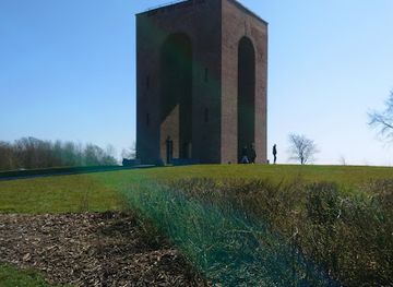
Background

Ejer Bavnehøj

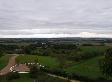
Denmark's third-highest peak crowned by a 1924 monument to national reunification, offering panoramic views and historic significance.

★★★★★3.9 (8)

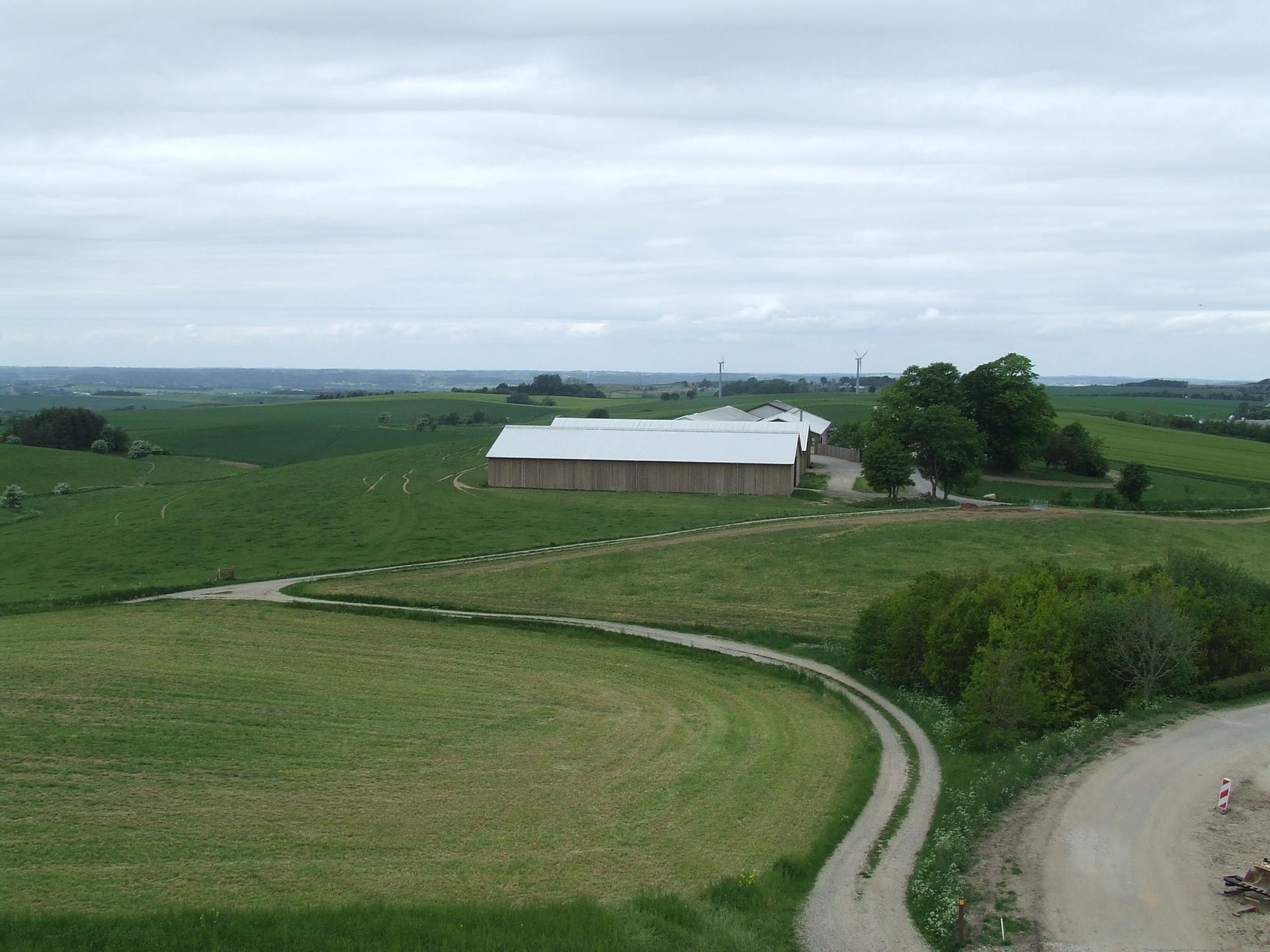
Denmark's third-highest natural point at 170.35 meters, crowned by a 13-meter stone tower built in 1924 to commemorate the reunification of southern Jutland with Denmark after World War I. Located near Skanderborg in East Jutland, this historic summit offers panoramic views across the Danish landscape and serves as a convenient roadside stop along the E45 motorway.

Plan your visit

A brief summary to Ejerbavnehøj MØDESTED

Opening times, essentials, and a few local tips gathered into one calmer, easier-to-scan planning section.

Plan your visit

📍
Østjyske Motorvej 545, Skanderborg, 8660, DK
💷
Budget
🏛
Outdoor
📶
Mobile reception: 4 out of 5

Explore places near Ejerbavnehøj MØDESTED

    See all →

    Unlock the Best of Ejerbavnehøj MØDESTED

    Find tickets, tours with entry, and experiences available for this location.

    Buy tickets

    No tickets available

    Book tours with entry

    No tours with entry available

    Book tours without entry

    No tours without entry available

    Getting There

    By Car

    From Skanderborg town center, drive approximately 8 kilometers south on Route 16 toward Ejer village. Follow signs for Ejer Bavnehøj. Parking is available at the base of the hill near the entrance. Travel time is approximately 15 minutes from central Skanderborg. The site is easily accessible from the E45 motorway, making it a convenient stop for travelers passing through the region.

    By Bicycle

    From Skanderborg, follow regional cycling routes heading south toward Ejer. The journey covers approximately 8–10 kilometers on a mix of minor roads and dedicated cycle paths through the Ejer Bjerge region. Travel time is approximately 30–40 minutes depending on fitness level and route selection. The rolling terrain offers scenic cycling through countryside and forest areas.

    By Public Transport and Walking

    Regional bus services operate from Skanderborg toward the Ejer area; journey time is approximately 20–30 minutes depending on service. From the nearest bus stop, a walking approach of approximately 1.5–2 kilometers leads to the summit, taking 25–35 minutes on accessible paths. Service frequency varies seasonally; check local transport schedules before traveling.

    Hiking from Neighboring Peaks

    A dedicated 1.5-kilometer hiking trail connects Ejer Bavnehøj to the neighboring Møllehøj peak. This scenic route takes approximately 25–35 minutes and allows visitors to experience both summits and the surrounding Ejer Bjerge landscape in a single visit. The trail is well-maintained and suitable for most fitness levels.

    For the on-the-go comforts that matter to you

    Drink Options
    Seating Areas
    Picnic Areas
    Trash Bins
    Information Boards

    Local tips

    Visit on clear days to maximize visibility from the tower—on ideal conditions you can see across to Samsø island and the Great Belt Bridge.
    Combine your visit with the neighboring Møllehøj peak via the 1.5-kilometer hiking trail to experience the region's distinctive glacial topography.
    The summer kiosk (Møllehjulet) operates during warmer months; bring cash or mobile payment capability for refreshments.
    Allow time to explore the surrounding Ejer Bjerge region's hiking trails through forests and countryside before or after climbing the tower.
    The site is wheelchair accessible, making it an inclusive destination for visitors with mobility considerations.

    Discover more about Ejerbavnehøj MØDESTED

    A Summit Steeped in National Memory

    Ejer Bavnehøj stands as Denmark's third-highest natural point, reaching 170.35 meters above sea level. At its summit rises a distinctive 13-meter stone tower, constructed in 1924 to commemorate the reunification of southern Jutland with the rest of Denmark following World War I. This monument transformed the hilltop into a symbol of national pride and territorial restoration, making it far more than a geographical landmark.

    Ancient Beacon and Medieval Vigilance

    Centuries before the tower's construction, Ejer Bavnehøj served a critical defensive purpose. The name itself derives from Old Norse, combining 'bavne' (beacon) and 'høj' (hill), reflecting its historical role as a signal station. During medieval times, fires lit atop the summit warned military forces and local populations of approaching enemy threats, forming part of a coordinated nationwide warning system that stretched across Denmark's landscape. This strategic function shaped the hill's identity for generations.

    The Great Height Controversy

    Ejer Bavnehøj has long been entangled in Denmark's most enduring geographical dispute. For decades, it was believed to be the nation's highest point until 1847, when measurements revealed it was surpassed by Møllehøj. The controversy reignited in 1941 when Yding Skovhøj was declared the highest, only to be resolved in 1953 when the Geodetic Institute confirmed that Ejer Bavnehøj is 6 centimeters higher than Yding Skovhøj when measured on natural ground surface, excluding artificial Bronze Age burial mounds. Møllehøj remains marginally higher at 170.86 meters.

    Vistas and Visitor Experience

    On clear days, visitors ascending the tower enjoy sweeping panoramic views across the rolling Jutland landscape, with sightlines extending to the island of Samsø and the Great Belt Bridge. The summit has hosted generations of gatherings—from constitutional celebrations and public speeches to musical performances and community festivals. A small kiosk operates during summer months, providing refreshments for visitors. The site welcomes wheelchair users and connects to a 1.5-kilometer hiking trail leading to the neighboring Møllehøj peak, allowing exploration of the region's distinctive topography.

    Gateway to the Ejer Bjerge Region

    The surrounding area, known as Ejer Bjerge, encompasses beautiful rolling terrain with well-maintained hiking trails winding through forests and open countryside. The landscape reflects Denmark's glacial heritage, with gentle slopes and varied woodland creating an accessible yet scenic environment. The proximity to the E45 motorway makes Ejer Bavnehøj an ideal roadside stop for travelers seeking a brief break, a packed lunch with a view, or a longer exploration of the region's natural and cultural heritage.

    Plan around the quieter times

    A quick look at seasonal patterns and peak visiting hours.

    Busiest months of the year

    Seasonality

    Busiest hours of the day

    Footfall
    Mobile App
    Get the app

    Your all‑in‑one travel companion app

    Explore expert travel guides, compare and book tours, experiences, hotels, and more—all from the palm of your hand. Download now for seamless trip planning wherever your wanderlust takes you.

    File:Møllehøj from Ejer Bavnehøj.jpg - Wikipedia

    More about Mollehoj

    Experience the serene beauty and panoramic views of Møllehøj, Denmark's highest natural point, perfect for nature lovers and photographers alike.

    Tell me more about Mollehoj

    Select Currency

    Choose the currency you want prices to display in.