From Eve
Know before you go
Hi, I'm Eve. Here are a few practical things to know before exploring Col de Chavière.
Local know-how to help you travel smarter and make the most of every moment.

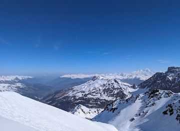
Hike through stunning alpine scenery at Col de Chavière, a mountain pass connecting the Tarentaise and Maurienne valleys in the heart of the Vanoise National Park, offering panoramic views.
Col de Chavière, a high mountain pass at 2796m, serves as a breathtaking crossing point between the Maurienne and Tarentaise valleys in the heart of the Vanoise National Park. This iconic location, accessible primarily by hiking, offers stunning panoramic views of the surrounding glaciers and peaks, including Mont Blanc on a clear day. The pass is known for its diverse terrain, transitioning from lush alpine pastures to a stark, lunar-like mineral landscape as you ascend. While the final climb can be steep and rocky, it's generally considered manageable for experienced hikers. Col de Chavière is a rewarding destination for those seeking natural beauty and a challenging, yet accessible, alpine experience. Keep an eye out for local wildlife, including marmots, chamois and ibex, that call this area home.
Opening times, essentials, and a few local tips gathered into one calmer, easier-to-scan planning section.
Hi, I'm Eve. Here are a few practical things to know before exploring Col de Chavière.
Local know-how to help you travel smarter and make the most of every moment.
Hiking
The final approach to Col de Chavière is primarily on foot. From Pralognan-la-Vanoise, take the trail towards Les Prioux. Continue past Les Prioux, following signs for the Refuge de Péclet-Polset. From the refuge, the trail ascends steeply towards the Col de Chavière. The final section involves navigating rocky terrain and potentially snowfields, depending on the season. Allow ample time for the ascent, as it can be strenuous. Note that there are no costs associated with hiking to the Col itself, but refuge stays are extra.
Public Transport
To reach the trailhead near Pralognan-la-Vanoise using public transport, take a regional bus from Moûtiers-Salins-Brides-les-Bains train station to Pralognan-la-Vanoise. From the village center, a free shuttle bus operates in July and August to the parking des Prioux, the starting point for many hikes to Col de Chavière. Bus fare from Moûtiers to Pralognan is approximately €5-€10. Check local schedules for updated times and availability.
Use Tower Bridge as your starting point for nearby food, family ideas, nightlife, and more local discoveries.

Explore expert travel guides, compare and book tours, experiences, hotels, and more—all from the palm of your hand. Download now for seamless trip planning wherever your wanderlust takes you.
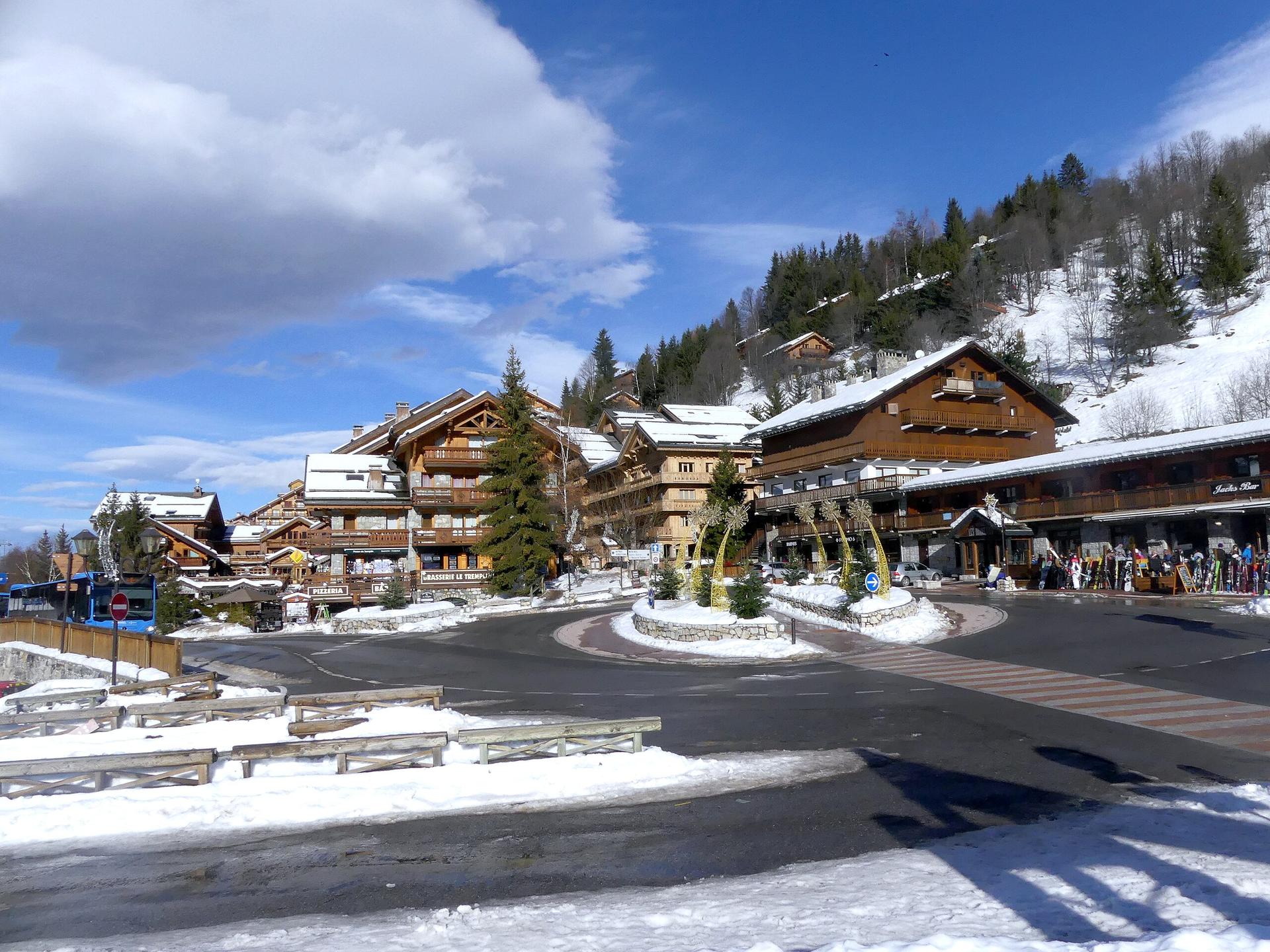
Discover Méribel in the French Alps - a picturesque ski resort with stunning views, family-friendly activities, and a vibrant village atmosphere.
Tell me more about Meribel