Col de Chavière Travel Guide
Free Guide: Hike through stunning alpine scenery at Col de Chavière, a mountain pass connecting the Tarentaise and Maurienne valleys in the heart of the Vanoise National Park, offering panoramic views.


A brief summary of Col de Chavière
Hike through stunning alpine scenery at Col de Chavière, a mountain pass connecting the Tarentaise and Maurienne valleys in the heart of the Vanoise National Park, offering panoramic views.
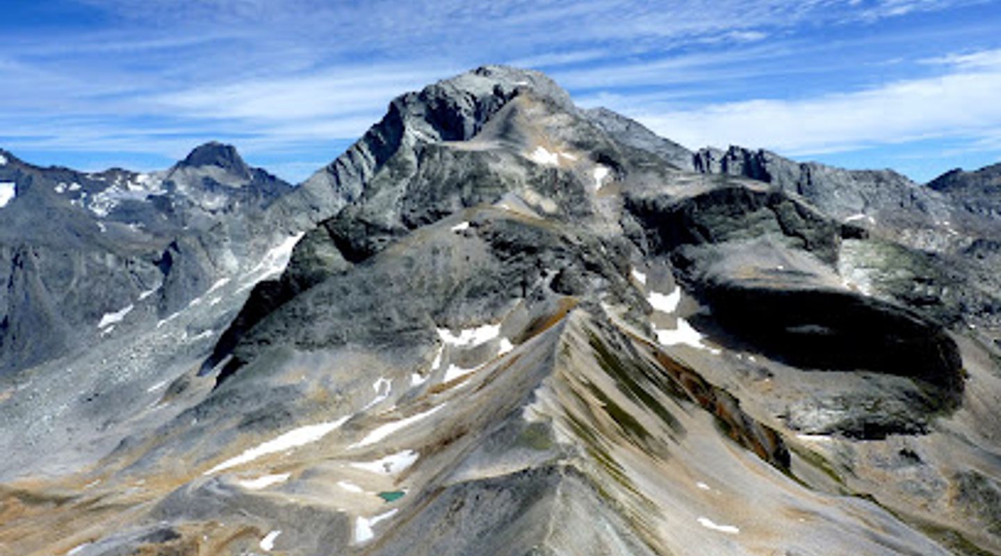
Col de Chavière, a high mountain pass at 2796m, serves as a breathtaking crossing point between the Maurienne and Tarentaise valleys in the heart of the Vanoise National Park. This iconic location, accessible primarily by hiking, offers stunning panoramic views of the surrounding glaciers and peaks, including Mont Blanc on a clear day. The pass is known for its diverse terrain, transitioning from lush alpine pastures to a stark, lunar-like mineral landscape as you ascend. While the final climb can be steep and rocky, it's generally considered manageable for experienced hikers. Col de Chavière is a rewarding destination for those seeking natural beauty and a challenging, yet accessible, alpine experience. Keep an eye out for local wildlife, including marmots, chamois and ibex, that call this area home.
- Address
- 73710 Pralognan-la-Vanoise
Getting there
Hiking
Public Transport
Discover more about Col de Chavière
Overview
Col de Chavière, perched at an elevation of 2796 meters (9173 feet), is a mountain pass of exceptional beauty and strategic importance within the Vanoise National Park in France. It acts as a natural gateway between the Tarentaise and Maurienne valleys, offering hikers and adventurers a challenging yet rewarding experience amidst stunning alpine scenery. Historically, the pass has served as a vital link between the two valleys, though its significance as a trade route has diminished with modern transportation. Today, it is primarily a destination for outdoor enthusiasts seeking to immerse themselves in the pristine wilderness of the Vanoise. The Vanoise National Park, established in 1963, was France's first national park, created to protect the area's unique flora, fauna, and geological features. Col de Chavière lies within this protected zone, ensuring the preservation of its natural beauty for generations to come. The ascent to Col de Chavière is a journey through diverse landscapes. Starting from lower elevations near Pralognan-la-Vanoise or Modane, the trail winds through verdant alpine meadows dotted with wildflowers in the summer months. As you climb higher, the terrain gradually transforms into a more rugged, rocky environment. Patches of forest give way to open pastures, where grazing sheep and the occasional shepherd's chalet add a touch of human presence to the vast wilderness. Above the treeline, the landscape becomes increasingly mineral, with exposed rock formations and scree slopes dominating the scene. The final approach to the pass involves a steeper climb over rocky terrain, which may be snow-covered even in summer. Despite the challenging ascent, the panoramic views from the summit are well worth the effort. On a clear day, you can see Mont Blanc, the highest peak in the Alps, as well as numerous other iconic summits and glaciers of the Vanoise massif. The pass itself is a relatively narrow saddle between the Pointe de l'Échelle and other surrounding peaks. It offers a unique perspective on the geological forces that have shaped the region, with layers of rock folded and contorted by millions of years of tectonic activity. The area around the pass is also home to a variety of alpine wildlife, including marmots, chamois, ibex, and various species of birds. Keep an eye out for these creatures as you hike, but remember to observe them from a distance and avoid disturbing their natural habitat. The flora around Col de Chavière is adapted to the harsh alpine environment. Despite the seemingly barren landscape, you can find a variety of hardy plants clinging to life in the rocky terrain. These include colorful wildflowers, such as gentians, edelweiss, and saxifrages, as well as various species of mosses and lichens. Several hiking routes lead to Col de Chavière, with varying levels of difficulty and duration. One popular option is to start from Les Prioux, near Pralognan-la-Vanoise, and hike via the Refuge de Péclet-Polset. This route takes approximately 4 hours to reach the pass and involves a significant elevation gain. Another option is to approach from Modane, on the Maurienne side, which also involves a challenging but rewarding hike. Col de Chavière is also a key point on the GR55, a long-distance hiking trail that traverses the Vanoise National Park. This trail offers a multi-day adventure through some of the most stunning scenery in the French Alps. Whether you choose to hike to Col de Chavière as a day trip or as part of a longer trek, it is an experience that will leave you with lasting memories of the beauty and grandeur of the Vanoise.
Evendo Review Centre
 Google
Guest reviews
Explore Col de Chavière on the map
A handpicked selection of must-see spots near Col de Chavière, mapped for you.
Get your free copy of our complete guide to Col de Chavière, delivered straight to you.
Everything on this page, from opening hours and how to get there to Eve’s tips and the best time to go, in one PDF you can read offline, print or share.
Already have an account? Sign in
Your Col de Chavière guide is ready.
We'll send it to · Not you? Sign out

Getting your guide ready…
We are putting together a fresh copy of the Col de Chavière guide. This can take up to a minute.
This can take a few moments. If your browser asks, choose Allow so the download can start. You'll find the guide in your Downloads folder.
Nothing happened? Download it again
Sorry, the guide is taking longer than usual. Please try again in a minute, or get it by email instead.
Other nearby places you may find interesting
The closest places of the same kind, if this one is not quite what you had in mind.
-
-
-
-
-


Swipe for more places
More to explore near Col de Chavière

 Best experiences near Col de Chavière

 Best hotels near Col de Chavière

 Best landmarks near Col de Chavière

 Best attractions near Col de Chavière

 Best shops near Col de Chavière

 Best restaurants near Col de Chavière

 Best bars near Col de Chavière
Do you manage this location?
Take control to get all the benefits, like improved information, better appearance, and stronger visibility across AI-powered discovery.
Explore more

Explore more of Rhône-Alpes
Discover the stunning landscapes, historic cities, and world-class ski resorts of Rhône-Alpes, a French region that offers a perfect blend of nature and culture.
Explore Rhône-Alpes
Explore more of France
Explore France: A land of romance, history, and unparalleled beauty, from the iconic streets of Paris to the serene landscapes of Provence and the luxury of the French Riviera.
Explore France