

Keta Travel Guide - Free Web & App
Your ultimate guide to Keta. Discover top landmarks, proposed trips, and local tips. Free on the web or via the Evendo companion app.


Keta, Ghana combines Atlantic beaches, the Keta Lagoon wetlands, Fort Prinzenstein, fishing heritage and Anlo culture in the Volta Region.
A Lagoon-Edged Coastal Landscape
Keta lies on Ghana’s south-eastern coast in the Volta Region, on a narrow Atlantic shoreline shaped by sand, surf, lagoons and wetlands. The town is associated with the Keta Lagoon, part of a wider coastal lagoon system extending through the Anlo area and recognised for its ecological importance. Open water, reed-fringed margins, salt-working areas and low coastal vegetation create a landscape that feels markedly different from Ghana’s busier beach resorts. The meeting of lagoon and ocean also explains Keta’s longstanding relationship with fishing, canoe building, salt production and coastal trade.Read more about Keta
History and Anlo Identity
Exploring Keta and Its Surroundings
When is the best time to visit Keta?
Best: December–February · 31–32°C| Month | High (°C) | Rainfall (mm) |
|---|---|---|
| January (best) | 31 | 11 |
| February (best) | 32 | 22 |
| March | 33 | 55 |
| April | 33 | 110 |
| May | 32 | 220 |
| June | 30 | 330 |
| July | 30 | 330 |
| August | 30 | 330 |
| September | 30 | 220 |
| October | 31 | 110 |
| November | 31 | 55 |
| December (best) | 31 | 11 |
Getting to and around Keta
How to get there
Transportation
Best attractions in Keta
Keta’s principal attractions lie in the contrast between its Atlantic shore and lagoon country. Fort Prinzenstein, the town’s best-known historic site, survives in coastal ruins that recall Danish trade and the wider history of the Gold Coast. The Keta Lagoon and its associated wetlands offer opportunities for quiet landscape observation, fishing-community visits and birdwatching, although access to working areas should be arranged respectfully. Keta Beach and the engineered coastal frontage provide open views across the Gulf of Guinea, while the shoreline also reveals the environmental pressures that have reshaped the town. Nearby Anloga adds cultural depth as an important Anlo centre, and villages around the lagoon show how transport, fishing, salt production and small-scale farming remain connected to the water. The wider Keta Municipality is best explored by road, with local advice needed for lesser-known lagoon edges and community-based experiences.
-
Market
Akodessewa Fetish Market
Experience the cultural heart of Togo at the Akodessewa Fetish Market, where voodoo traditions come alive with vibrant crafts and local stories.
-
Public beach
Ekpeame Beach Resort
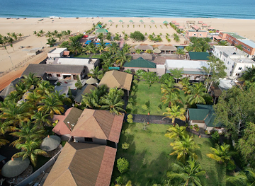
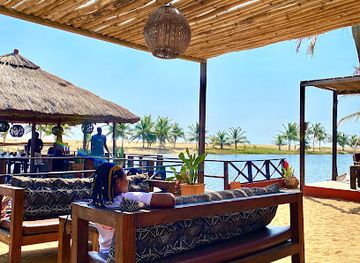
Unwind at Ekpeame Beach Resort, a tranquil public beach in Keta, Ghana, where stunning landscapes meet vibrant local culture.
-
Public beach
Royal Beach Keta
Discover the tranquil beauty of Royal Beach Keta, a perfect blend of relaxation, adventure, and cultural immersion in Ghana.
-
Country park
Torgbui Sri Park
Experience the natural beauty and tranquility of Torgbui Sri Park in Anloga, a perfect getaway for nature lovers and families.
Best landmarks in Keta
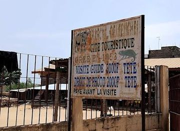
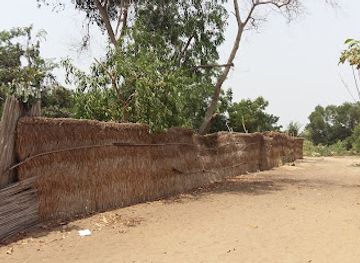
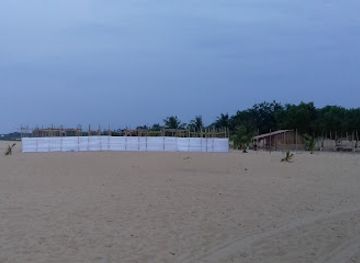
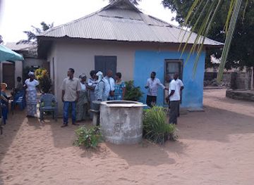
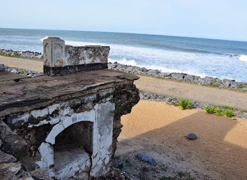
Fort Prinzenstein is Keta’s defining built landmark, its weathered remains marking the town’s place in the history of Danish coastal trade, European rivalry and the Atlantic slave trade. The Keta Lagoon is the principal natural landmark: a broad, shallow wetland landscape of open water, channels, marshy edges and low coastal vegetation that supports fishing, salt production and birdlife. The Atlantic shoreline provides a second defining feature, but it is also a record of the area’s environmental vulnerability, with erosion having changed parts of the historic town and coast. Anloga’s cultural importance comes from its position in the Anlo region and its living traditions rather than from a single monumental structure. Together, the fort, lagoon and shifting coast express Keta’s intertwined history of commerce, community and environmental change.
-
Resort hotel
Aborigines Beach Resort
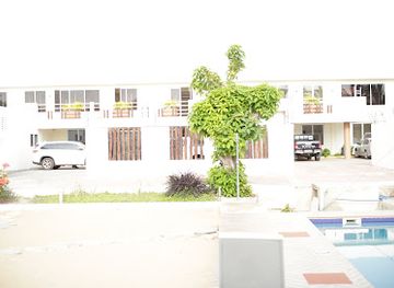
Experience blissful relaxation at Aborigines Beach Resort, a stunning coastal paradise in Keta, Ghana, perfect for unwinding and adventures alike.
-
Resort hotel
Eli Beach Resort
Discover the serene beauty of Eli Beach Resort in Keta, where luxury meets coastal adventure amidst the vibrant culture of Ghana.
-
Hotel
Meet Me There Eco Lodge
Experience the tranquility and cultural richness of Ghana at Meet Me There Eco Lodge, your eco-friendly getaway in the stunning Volta Region.
-
Tourist attraction
Fort Prinzenstein, Keta
Explore Fort Prinzenstein in Keta, a historical gem showcasing Ghana's rich colonial heritage and offering stunning ocean views.
Explore Keta on the map
Plan your trip on one map. See where the top attractions, landmarks, restaurants and hotels are, and book hotels and experiences in a few clicks.
Best hotels in Keta
Best restaurants in Keta
Keta’s food scene is modest and closely connected to the coast, with the most characteristic meals found in local chop bars, market stalls, guesthouses and family-run eateries rather than a concentrated restaurant district. Fresh or smoked fish, often served with banku, kenkey, fried plantain, rice or cassava-based accompaniments, reflects the area’s fishing economy. Pepper sauces, stews and seasonal vegetables add flavour, while grilled fish and simple seafood meals may be available near the waterfront or fishing communities. Keta and Anloga provide the widest choice within the immediate area, although opening times and menus can be informal. Visitors should expect straightforward regional cooking and carry snacks when travelling around the lagoon, where food outlets are more widely spaced. Drinking water should be bought from established vendors or accommodation providers.
-
Restaurant
Grace And Glory Restaurant
Experience authentic Ghanaian cuisine at Grace And Glory Restaurant in Keta—where flavor meets affordability.
-
Restaurant
Mama's Inn Bar And Restaurant
Experience authentic Ghanaian cuisine at Mama's Inn Bar And Restaurant in Keta - where flavors come alive in a vibrant setting.
-
Restaurant
Christyle Locals & Continentals
Experience authentic Ghanaian and continental cuisine at Christyle Locals & Continentals in Keta – a must-visit dining destination for every traveler.
-
Restaurant
Navi Beans
Discover authentic Ghanaian cuisine at Navi Beans in Keta—where delicious flavors meet warm hospitality.
Best bars in Keta
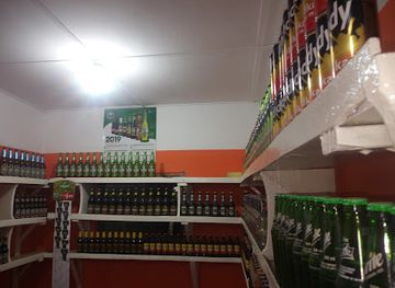
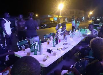
Keta is not a late-night entertainment centre, and evening life is generally quieter than in Accra or Ghana’s larger coastal resorts. Local drinking spots, small bars and informal venues around Keta and Anloga may offer bottled drinks, conversation and occasional music, while guesthouses can provide a relaxed base after dark. Community celebrations, funerals, festivals and other cultural occasions sometimes bring music and dancing, but these are event-dependent rather than a permanent nightlife programme. There is little reason to expect a concentration of nightclubs or formal entertainment venues within the destination. Visitors should ask locally about appropriate places to spend the evening, travel between settlements before it becomes late, and avoid walking alone along isolated beaches or lagoon roads.
-
Pub
Scoops Pub
Discover the lively nightlife and local flavors at Scoops Pub in Keta, the perfect spot for travelers to unwind and socialize.
-
Bar
Ekui's Inn
Discover the charm of Ekui's Inn in Keta, a cozy bar with quick service and a welcoming atmosphere, perfect for unwinding and enjoying local culture.
-
Restaurant
Grace And Glory Restaurant
Experience the rich flavors of Ghana at Grace and Glory Restaurant in Keta, where every dish tells a story of local heritage.
-
Grill
SaltCity Pub
Savor delicious grilled dishes and immerse yourself in the lively atmosphere of Wheta at SaltCity Pub, the perfect spot for tourists to relax.

Best nightclubs in Keta
Keta is not a late-night entertainment centre, and evening life is generally quieter than in Accra or Ghana’s larger coastal resorts. Local drinking spots, small bars and informal venues around Keta and Anloga may offer bottled drinks, conversation and occasional music, while guesthouses can provide a relaxed base after dark. Community celebrations, funerals, festivals and other cultural occasions sometimes bring music and dancing, but these are event-dependent rather than a permanent nightlife programme. There is little reason to expect a concentration of nightclubs or formal entertainment venues within the destination. Visitors should ask locally about appropriate places to spend the evening, travel between settlements before it becomes late, and avoid walking alone along isolated beaches or lagoon roads.
-
Pub
Scoops Pub
Discover the vibrant nightlife of Keta at Scoops Pub, an energetic venue for drinks, snooker, and live entertainment.
-
Night club
Club 3T
Discover the vibrant nightlife at Club 3T in Keta, where music, drinks, and an electric atmosphere come together for an unforgettable experience.
-
Bar
Navi BB
Discover the vibrant atmosphere and unique drink offerings at Navi BB, a must-visit bar in the coastal town of Keta, Ghana.
-
Night club
SKY SPOT
Discover the electrifying nightlife at SKY SPOT, Keta's premier night club, where the rhythm never stops and memories are made.
Best shops in Keta
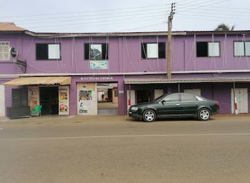
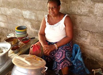
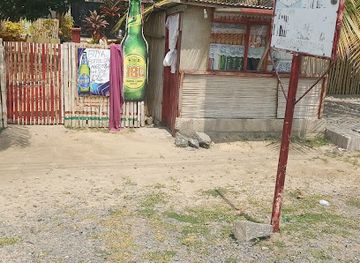
Shopping in Keta is local and practical rather than extensive. Small shops and market traders supply food, household goods, clothing and everyday travel needs, while fish, smoked seafood, maize, cassava products and other ingredients reflect the coastal economy. Anloga and other larger settlements in the surrounding municipality may offer additional basic retail choices, but visitors should not expect a large craft quarter or permanent tourist market. Regional textiles, locally made food products and small handmade items may appear through informal traders or community events, although availability varies. Keta is better suited to buying provisions and observing everyday commerce than to dedicated souvenir shopping. Cash in Ghanaian cedis is useful for small purchases, and visitors should ask permission before photographing market activity or individual sellers.
-
Auto parts store
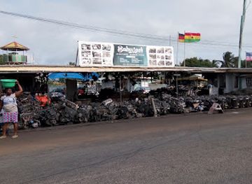
BABY LAST ENTERPRISE
Discover Baby Last Enterprise in Keta, your one-stop destination for all auto parts and accessories, ensuring a smooth journey through Ghana's beautiful landscapes.
-
Book store
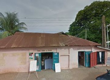
Good Books and Others
Explore the literary treasures of Keta at Good Books and Others, a charming book store with a rich selection of local and international literature.
-
Grocery store
Tomary Ventures
Explore the vibrant flavors of Ghana at Tomary Ventures, Keta's premier grocery store for fresh produce and local delicacies.
-
Store
Dzialet
Explore the heart of Keta at Dzialet, where local culture meets unique shopping experiences.

Get your free copy of our complete guide to Keta, delivered straight to you.
Everything on this page, from attractions and restaurants to essentials and local phrases, in one PDF you can read offline, print or share.
Already have an account? Sign in
Your Keta guide is ready.
We'll send it to · Not you? Sign out

Getting your guide ready…
We are putting together a fresh copy of the Keta guide. This can take up to a minute.
This can take a few moments. If your browser asks, choose Allow so the download can start. You'll find the guide in your Downloads folder.
Nothing happened? Download it again
Sorry, the guide is taking longer than usual. Please try again in a minute, or get it by email instead.
Keta essentials
Currency and Payment
Safety
Emergency Situations
Do's and Don'ts
Local Tips
From Eve
Local phrases worth knowing
You don't need to get them perfect. A few words go a long way, and locals appreciate the effort.
Basics
| English | Local | Say it |
|---|---|---|
| Hello | Ku ɖe ɖe | [Koo deh deh] |
| Goodbye | Blɔ ni | [Blor nee] |
| Yes | Ee | [Eh] |
| No | Awoe | [Ah-woe] |
| Please/You're welcome | Miawo | [Me-ah-wo] |
| Thank you | Akpe | [Ah-kpeh] |
| Excuse me/Sorry | Ɖeŋ ɖeŋ | [Dehng dehng] |
| How are you? | Gɔme ɖeɖe na wo? | [Goh-meh deh-deh nah woh] |
| Fine. And you? | Gɔme me e, na wuwo? | [Goh-meh meh eh, nah woo-woh] |
| Do you speak English? | Ŋlɔ me ɖeŋlɔviwo be wo? | [Nglor meh dehng-loh-vee-wo beh woh] |
| I don't understand | Me ɖeɖeŋ | [Meh deh-dehng] |
Eating & Drinking
| English | Local | Say it |
|---|---|---|
| I'd like to see the menu, please | Mawo me ɖzɔlɔviwo, miawo | [Mah-wo meh dzo-loh-vee-wo, me-ah-wo] |
| I don't eat meat | Me ŋutɔ ɖu | [Meh ngu-toh doo] |
| Cheers! | Bra | [Brah] |
| I would like to pay, please | Mawo me ɖeɖeŋ, miawo | [Mah-wo meh deh-dehng, me-ah-wo] |
Emergencies
| English | Local | Say it |
|---|---|---|
| Help! | Meyɔ | [Meh-yoh] |
| Go away! | Woo | [Woh] |
| Call the Police! | Ŋlɔ me dɔviwo | [Nglor meh doh-vee-wo] |
| Call a doctor! | Ŋlɔ me kɔkɔviwo | [Nglor meh koh-koh-vee-wo] |
| I'm lost | Me mɔwo | [Meh moh-woh] |
| I'm ill | Me gbɔkɔ | [Meh gboh-koh] |
Shopping
| English | Local | Say it |
|---|---|---|
| I'd like to buy... | Mawo me ... | [Mah-wo meh ...] |
| I'm just looking | Me ɖeɖeŋ ɖeŋ | [Meh deh-dehng dehng] |
| How much is it? | Ɖeŋlɔ me ɖa be wo? | [Dehng-loh meh dah beh woh] |
| That's too expensive | Ɖa be nɔnɔ | [Dah beh noh-noh] |
| Can you lower the price? | Ɖeŋlɔ me ɖa be bɔ gɔme? | [Dehng-loh meh dah beh boh goh-meh] |
Time & Numbers
| English | Local | Say it |
|---|---|---|
| What time is it? | Ɖeŋlɔ ɖeɖe na wo? | [Dehng-loh deh-deh nah woh] |
| It's one o'clock | Ame ɖeka | [Ah-meh deh-kah] |
| Half past (10) | Ɖekaŋlɔ | [Deh-kah-ngloh] |
| Morning | ŋutɔ | [Ngu-toh] |
| Afternoon | dada | [dah-dah] |
| Evening | ɖeka | [deh-kah] |
| Yesterday | ɖeka la | [deh-kah lah] |
| Today | ɖeka yi | [deh-kah yee] |
| Tomorrow | ɖeka le | [deh-kah leh] |
| 1 | yi | [yee] |
| 2 | etu | [eh-too] |
| 3 | nɛ | [neh] |
| 4 | nɔ | [noh] |
| 5 | nu | [noo] |
| 6 | vɔ | [voh] |
| 7 | vi | [vee] |
| 8 | ya | [yah] |
| 9 | dze | [zeh] |
| 10 | yɔ | [yo] |
Transport & Directions
| English | Local | Say it |
|---|---|---|
| Where's a/the...? | Ɖeŋlɔ ... be wo? | [Dehng-loh ... beh woh] |
| What's the address? | Ɖeŋ me ɖeɖe be wo? | [Dehng meh deh-deh beh woh] |
| Can you show me (on the map)? | Ɖeŋlɔ me ɖa be ɖeɖeŋ (kple map)? | [Dehng-loh meh dah beh deh-dehng (kpleh map)] |
| When's the next (bus)? | Ŋlɔ me ɖeka (troski)? | [Nglor meh deh-kah (trohs-kee)] |
| A ticket (to ....) | Tiket (kpɔ ...) | [Tee-keht (kpo ...)] |
History of Keta
Coastal and Lagoon Formation
Keta’s physical setting was created by the interaction of the Gulf of Guinea, coastal sands and the shallow lagoons behind the shoreline. The Keta Lagoon forms part of a broader chain of coastal wetlands in south-eastern Ghana, where freshwater and marine influences, seasonal rainfall and evaporation shape habitats and livelihoods. The narrow coastal strip has always been environmentally dynamic. Erosion, shifting sand and changes in the connection between lagoon and sea have affected settlement patterns and the usability of waterfront land, making environmental change an important part of Keta’s modern history.
Anlo Settlement and Cultural Development
Keta belongs to the historic Anlo cultural region, whose communities developed across the coastal and lagoon landscapes of south-eastern Ghana. Anlo history is preserved through oral traditions, chiefly institutions, language, festivals and patterns of settlement linking places such as Keta, Anloga and surrounding villages. Fishing, farming, salt production and lagoon-based trade shaped local economies, while the waterways and coastal routes connected communities with neighbouring areas. The region’s cultural identity remains especially visible in music, dance, family traditions and the continued importance of the Ewe language.
Fort Prinzenstein and the Atlantic Trade
Fort Prinzenstein was built by the Danish in 1784 at Keta as part of the European trading presence along the Gold Coast. The fort was connected to commercial and military competition between European powers, as well as to the Atlantic slave trade, in which coastal forts and trading posts played a deeply destructive role. Its surviving remains are historically significant because they connect Keta with the wider coastal history of Ghana and the Atlantic world. The ruins should be approached as a place of difficult heritage rather than simply as a picturesque monument.
Erosion, Relocation and Conservation
Marine erosion has been one of the defining forces in Keta’s recent history. Sections of the historic town and coastal infrastructure have been damaged or lost as the shoreline retreated, while residents and authorities have had to contend with changing beaches, flooding risks and pressure on land. The Keta Sea Defence Project, completed in the early twenty-first century, reshaped parts of the coast with engineered protection and associated beach areas, although long-term coastal management remains a continuing concern. The Keta Lagoon and adjoining wetlands are also important for conservation, fisheries and migratory birds.
Keta in Photos
Browse through our photo collection highlighting the charm and character of the destination.
Neighbouring destination travel guides
The closest destinations to Keta, if you have time for more than one.
-

-

-

-

-


Swipe for more destinations
Explore more

Explore more of Volta Region
Explore Ghana’s Volta Region for Wli Falls, forested mountains, Ewe heritage, coastal lagoons and memorable journeys near the Togo border.
Explore Volta Region
Explore more of Ghana
Discover Ghana: A vibrant blend of rich history, stunning landscapes, and warm hospitality in the heart of West Africa.
Explore Ghana