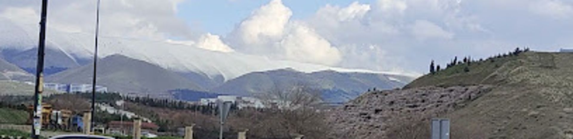
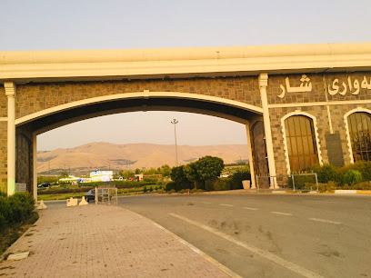
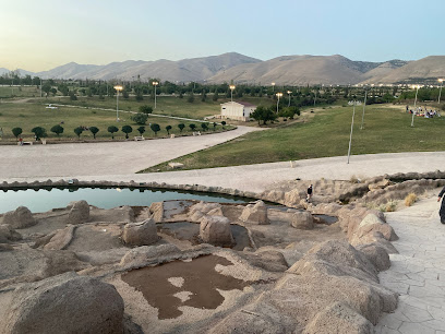
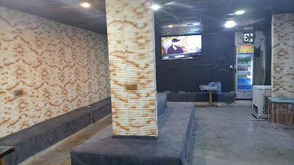
Hawari Shar: Sulaymaniyah's Green Escape
Escape to Hawari Shar, Sulaymaniyah's expansive green oasis, offering nature, culture, and recreation for everyone.
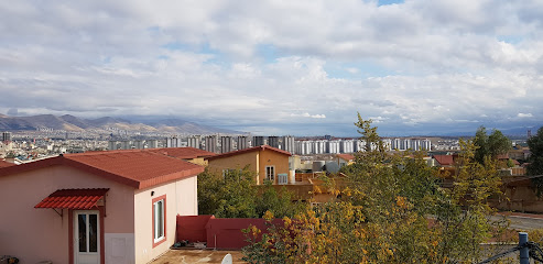
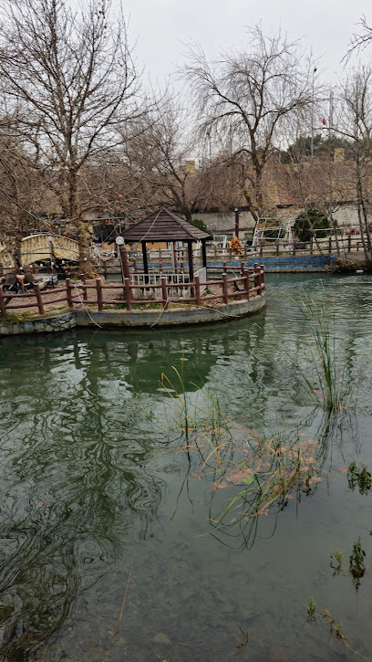
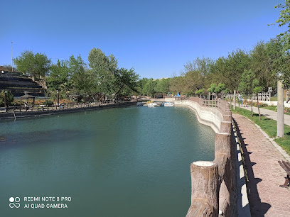
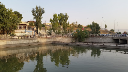
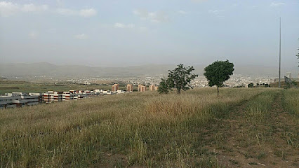
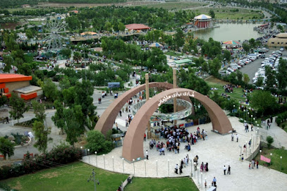
Hawari Shar, the second-largest park in the Middle East and the largest in Iraq, offers a sprawling green space just northwest of Sulaymaniyah. With a Roman-style theater and vast green expanses, it's a refreshing escape for locals and tourists alike.
A brief summary to هواري شار
- H9QX+38C, Sulaymaniyah, Sulaymaniyah Governorate, IQ
Local tips
- Visit during the spring or autumn for the most pleasant weather and vibrant scenery.
- Check local event listings for cultural performances or festivals at the Roman Theatre.
- Bring a picnic to enjoy in the park's extensive green spaces.
Getting There
-
Taxi
From central Sulaymaniyah, a taxi to Hawari Shar is a convenient option. Taxis are readily available throughout the city. A typical ride from the city center to the park will cost approximately 5,000-7,000 IQD. Be sure to agree on the fare before starting your journey.
-
Public Transport
While direct public transport options to Hawari Shar may be limited, you can take a local bus towards the outskirts of the city and then transfer to a taxi for the final leg of the journey. Bus fares are typically around 500 IQD, and the taxi from the bus stop to the park should cost an additional 3,000-4,000 IQD.
-
Walking
While walking from the city center is not recommended due to the distance (10km), if you are in the vicinity of Sulaymaniyah, you can walk to Hawari Shar. From the Azadi Park area, head northwest, following the main road. The walk is approximately 3-4 hours. Ensure you have appropriate footwear and water. There are no costs associated with walking.
Discover more about هواري شار
Iconic landmarks you can’t miss
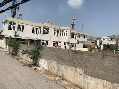
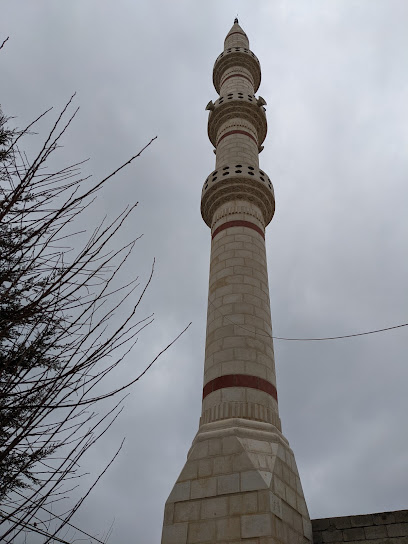
مزگەوتی حاجی سعيدی حاجی حمەسوری کانی سپیکەیی
1.3 km
Experience the tranquility of Haji Saidi Haji Hamasuri Kani Spikayi Mosque, a cultural and spiritual landmark in Sulaymaniyah.
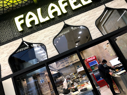
falafelo
1.8 km
Savor authentic Middle Eastern falafel and more at Falafelo in Sulaymaniyah – a local favorite for tasty, budget-friendly eats.
Kurdistan Outdoor Tourism
2.0 km
Discover the stunning landscapes and thrilling adventures at Kurdistan Outdoor Tourism, your gateway to exploring Sulaymaniyah's breathtaking beauty.
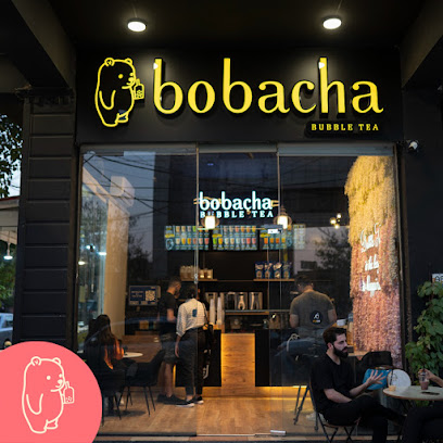
bobacha Bubble Tea
2.1 km
Experience the unique flavors of Bobacha Bubble Tea in Sulaymaniyah, Kurdistan – the region's first and favorite bubble tea destination.
Sulaimany
2.1 km
Experience the heart of Sulaimaniyah at this vibrant park, a green escape offering relaxation and a taste of local Kurdish life.
Picasso Art House Cafe
2.2 km
Experience the fusion of art and coffee at Picasso Art House Cafe in Sulaymaniyah, a must-visit for art lovers and foodies.
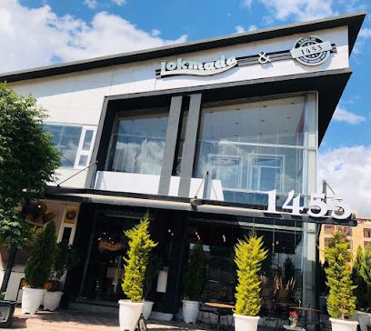
Lokmada
2.8 km
Indulge in sweet treats and aromatic coffee at Lokmada, a cozy cafe in the heart of Sulaymaniyah's vibrant Salim Street.
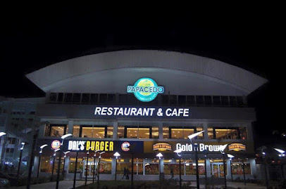
Papacedo
3.2 km
A cozy Sulaymaniyah café offering a blend of Kurdish and international flavors, perfect for relaxing and enjoying local culture.
پارکی کوردسات
3.2 km
Escape to nature in the heart of Sulaymaniyah at Kurdsat Park, a perfect spot for relaxation and family fun.
Kashkol Cafe
3.3 km
Experience Sulaymaniyah's vibrant coffee culture at Kashkol Cafe, a cozy spot blending tradition and modernity.
فولکەی کوردسات
3.3 km
Explore the lush beauty of Folkey Kurdish Garden in Sulaymaniyah, a serene escape that combines nature and culture in a picturesque setting.

Majidi Mall Sulaimaniyah
3.4 km
Experience world-class shopping, dining, and entertainment at Sulaimaniyah's premier retail destination, Majidi Mall.
Xani Cafe & Beakfast
3.4 km
Experience Sulaymaniyah's vibrant flavors at Xani Cafe & Breakfast, a local favorite offering delicious food and a welcoming atmosphere all day long.
Chocolate Sarayi Sulaymaniyah
3.6 km
Indulge in handcrafted chocolates and delightful pastries at Sulaymaniyah's charming Chocolate Sarayi cafe.
Kurdsat Mosque مزگەوتی کوردسات
3.6 km
Experience the spiritual beauty and architectural splendor of the Kurdsat Mosque, a symbol of Kurdish heritage in Sulaymaniyah.
Unmissable attractions to see
تاڤگەی سەرچنار
1.3 km
Discover the serene beauty of Sarjinar Waterfall in Sulaymaniyah, a perfect escape for nature lovers and adventure seekers.
Sarchnar's Waterfall
1.3 km
Experience the natural beauty of Sarchnar's Waterfall, a tranquil escape in the heart of Sulaymaniyah, perfect for relaxation and scenic views.
Sarchnar Park
1.4 km
Escape to Sarchnar Park in Sulaymaniyah: A historic green space with lush gardens, tranquil paths, and a vibrant cultural scene.
مصيف سرجنار
1.5 km
Escape to Sarjanar Resort in Sulaymaniyah: A historic natural spring and river retreat with lush landscapes and recreational activities.
Sarchnar
1.6 km
Escape to Sarchnar Park in Sulaymaniyah: a historic park with natural springs, green spaces, and a tranquil atmosphere for all to enjoy.
status
2.1 km
Explore Sulaymaniyah, Iraq: A vibrant city rich in Kurdish culture, history, and breathtaking landscapes, perfect for every traveler seeking adventure.
Tavga water dam
2.1 km
Escape to Tavga Water Dam in Sulaymaniyah for serene landscapes, outdoor activities, and a peaceful retreat into nature's beauty.
Garden باخچە
2.1 km
Escape to tranquility at Garden باخچە in Sulaymaniyah, a peaceful oasis on Bakhtiari Kon Street.
Liza Tourism- ليزا بو كه شت و گوزار
2.9 km
Explore Sulaymaniyah's beauty with Liza Tourism, your local guide for unforgettable adventures and cultural experiences.
گردی بۆنەکان - زانکۆی سلێمانی
3.3 km
Escape to the serene Girdi Bonekan in Sulaymaniyah, a fragrant park oasis perfect for relaxation, picnics, and cultural appreciation.
Hawari Shar Park
3.5 km
Escape to Sulaymaniyah's largest green space: Hawari Shar Park, offering recreation, relaxation, and cultural events for all ages.
Azadi Amusement Park
3.5 km
Experience thrilling rides and family fun at Azadi Amusement Park in the heart of Sulaymaniyah. Open evenings for entertainment.
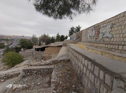
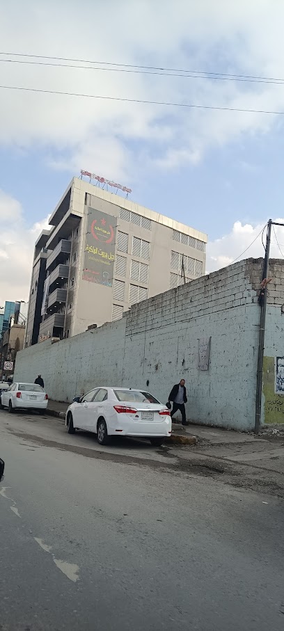
Salim Wall
3.5 km
Explore the majestic Salim Wall in Sulaymaniyah, a historical landmark offering a glimpse into the region's rich cultural heritage and vibrant city life.
Hawary Shar Park
3.7 km
Escape to Sulaymaniyah's Hawary Shar Park: A green sanctuary with walking trails, cultural events, and family-friendly activities.
Amna Suraka, Red Museum
3.7 km
Explore the haunting history of Saddam Hussein's Red Museum in Sulaymaniyah, a memorial to the Kurdish people's resilience and struggle for freedom.
Essential places to dine
Ivy Dining & Co.
1.7 km
Experience exquisite dining at Ivy Dining & Co., where local flavors meet modern culinary artistry in Sulaymaniyah.
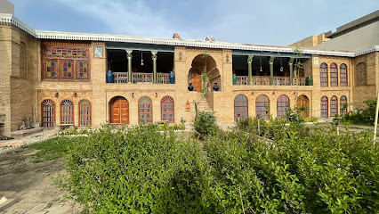
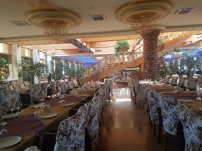
Mali Khatoon Cultural Restaurant چێشتخانەی کلتووری ماڵی خاتوون
1.7 km
Experience authentic Kurdish flavors at Mali Khatoon Cultural Restaurant, where culinary tradition meets vibrant culture in Sulaymaniyah.
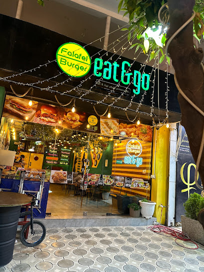
eat & go fast food
2.0 km
Discover delicious fast food and local flavors at Eat & Go in Sulaymaniyah—a perfect dining stop for every traveler.
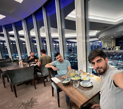
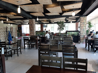
360 Revolving Restaurant
2.0 km
Discover breathtaking views and exquisite cuisine at Sulaymaniyah's premier revolving restaurant, where every meal is a new perspective.
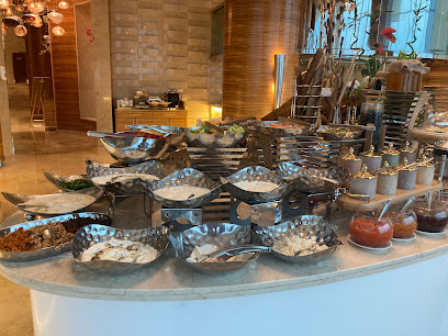
Fenk All Day Dining
2.0 km
Discover culinary excellence at Fenk All Day Dining in Sulaymaniyah - where local flavors meet international cuisine.
Dawa Restaurant
2.1 km
Discover the flavors of Sulaymaniyah at Dawa Restaurant – where culinary traditions meet modern tastes.
MANGAL RESTAURANT
2.2 km
Discover authentic Kurdish cuisine at Mangal Restaurant in Sulaymaniyah – where every dish tells a story of tradition and flavor.
Restaurant
2.4 km
Experience authentic flavors at this charming Sulaymaniyah restaurant, where every meal tells a story of local culinary traditions.
Street Food
2.5 km
Discover authentic Iraqi cuisine at Street Food in Sulaymaniyah – where every dish is a celebration of local flavors and vibrant culture.
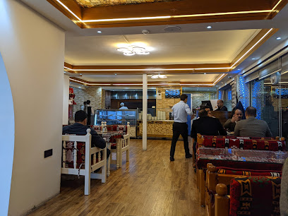
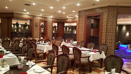
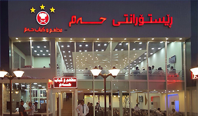
Ham Restaurant
2.5 km
Experience authentic Kurdish cuisine at Ham Restaurant in Sulaymaniyah - where tradition meets taste.
Legends Restaurant & Bar
2.6 km
Discover authentic Kurdish flavors and international cuisine at Legends Restaurant & Bar in Sulaymaniyah - A culinary experience not to be missed.
Qubuly قوبڵی
2.7 km
Experience authentic Iraqi cuisine at Qubuly قوبڵی in Sulaymaniyah - where every dish tells a story.
خواردەمەنی و چێشتخانەی برایان
2.8 km
Discover authentic Asian flavors at خواردەمەنی و چێشتخانەی برایان in Sulaymaniyah – where every dish tells a story.
The Station
3.2 km
Discover The Station in Sulaymaniyah - A must-visit burger haven offering delicious gourmet options in a vibrant atmosphere.
Ninova Restaurant
3.2 km
Discover authentic Iraqi cuisine at Ninova Restaurant in Sulaymaniyah—where traditional flavors meet modern hospitality.
Markets, malls and hidden boutiques
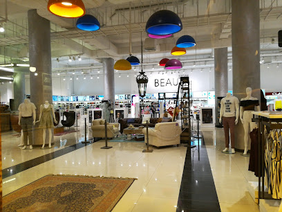
House of Brands
1.7 km
Explore the House of Brands in Sulaymaniyah, where shopping meets local culture in a vibrant atmosphere filled with diverse shops and dining options.
مارکێتی بابۆ
2.0 km
Explore the vibrant culture of Sulaymaniyah through unique gifts and authentic souvenirs at مارکێتی بابۆ.
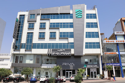
Riva Company
2.1 km
Explore Riva Company in Sulaymaniyah for exceptional bathroom supplies, stylish fixtures, and unparalleled customer service.
LuxoStyle
2.3 km
Explore LuxoStyle in Sulaymaniyah for unique women's fashion blending tradition and modern elegance, perfect for every occasion.
RICH FAMOUS
2.9 km
Explore the great outdoors with top-quality gear from RICH FAMOUS in Sulaymaniyah, your ultimate outdoor adventure shop.
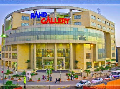
Rand Gallery
2.9 km
Explore Rand Gallery in Sulaymaniyah for an unforgettable shopping experience with local and international brands, dining, and entertainment options.
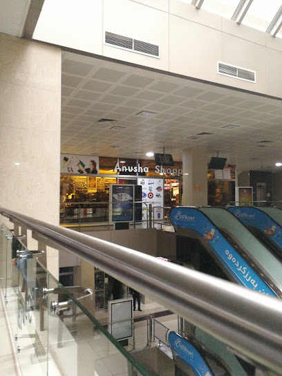
Anusha Shopping
2.9 km
Explore Anusha Shopping in Sulaymaniyah for unique home goods that showcase local craftsmanship and enrich your living space.
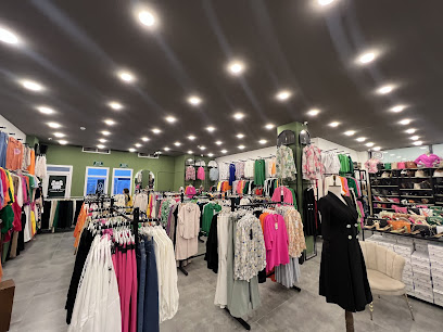
Zada Shopping
3.1 km
Discover unique women's fashion at Zada Shopping in Sulaymaniyah, where local charm meets contemporary style.
AWDER shop
3.1 km
Discover unique styles at AWDER shop, Sulaymaniyah's premier women's clothing store offering a blend of local and contemporary fashion.
Karwan Store
3.2 km
Explore Karwan Store in Sulaymaniyah for unique local goods and a taste of vibrant Iraqi culture.
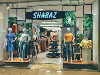
shabaz shopping
3.2 km
Explore the vibrant fashion scene at Shabaz Shopping in Sulaymaniyah, where local styles meet modern trends for an unforgettable shopping experience.
پێشانگای کریازی
3.2 km
Explore Kriazi Store in Sulaymaniyah for a unique shopping experience filled with local crafts and culture.
The white collection
3.3 km
Discover unique women's fashion at The White Collection in Sulaymaniyah, blending modern styles with traditional elegance for every occasion.
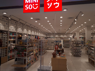
MINISO
3.5 km
Explore MINISO in Sulaymaniyah for trendy, affordable home goods and unique lifestyle products that make perfect souvenirs for your travels.
تەلاری سالم
3.8 km
Discover the essence of Kurdish fashion at تلاری سالم, a clothing store that blends tradition with contemporary styles in the heart of Sulaymaniyah.
Essential bars & hidden hideouts
مطعم الجبل
1.3 km
Discover the vibrant culinary scene at مطعم الجبل in Sulaymaniyah, where traditional flavors meet a lively atmosphere for an unforgettable dining experience.
مطعم سرجنار
1.4 km
Experience the lively ambiance and local flavors at مطعم سرجنار, the heart of nightlife in Sulaymaniyah, Iraq.
Lobby Lounge
1.6 km
Discover the elegance of Lobby Lounge in Sulaymaniyah, a perfect blend of local hospitality and a relaxing atmosphere for tourists.
Vogue Lounge
1.8 km
Discover Vogue Lounge in Sulaymaniyah, where a stylish atmosphere meets delightful drinks and a welcoming vibe for every visitor.
Crystal Champagne Bar
2.0 km
Experience the luxurious charm of Crystal Champagne Bar in Sulaymaniyah, offering exquisite cocktails and a chic atmosphere for unforgettable evenings.
Havana Lounge
2.1 km
Discover the lively Havana Lounge in Sulaymaniyah, where great food, vibrant atmosphere, and friendly service await every visitor.
Caffe
2.9 km
Discover Sulaymaniyah's charm at Caffe, where cozy ambiance meets local culture in the heart of the city.
Chenar
3.1 km
Discover Chenar, the perfect bar in Sulaymaniyah for tourists seeking relaxation and local flavors in a cozy atmosphere.
a7ay ra3a
3.2 km
Discover the vibrant nightlife of Sulaymaniyah at a7ay ra3a, a lively bar where culture and flavor intertwine.
The Piano Bar
3.2 km
Experience the vibrant nightlife of Sulaymaniyah at The Piano Bar, where live music and delightful drinks create an enchanting atmosphere.
Terrace Restaurant
4.0 km
Experience breathtaking views and exquisite cocktails at the Terrace Restaurant in Sulaymaniyah, where every visit is a celebration of taste.
OBO Lounge
4.4 km
Experience the vibrant nightlife of Sulaymaniyah at OBO Lounge, where modern ambiance meets exquisite cocktails in a cozy setting.
BLEND .Marketland for the sale of alcoholic drinks
4.8 km
Discover Sulaymaniyah's nightlife at BLEND Marketland, where exceptional drinks meet a vibrant atmosphere for an unforgettable experience.
Slemani
4.9 km
Experience the vibrant nightlife at Slemani, a bar in Sulaymaniyah offering refreshing drinks and a lively atmosphere for all visitors.
Latino Bar
4.9 km
Discover the vibrant nightlife of Sulaymaniyah at Latino Bar, where local flavors and lively ambiance come together for an unforgettable experience.
Nightclubs & after hour spots
Nask
1.2 km
Experience the vibrant nightlife of Sulaymaniyah at Nask, a premier night club where thrilling music and an energetic crowd await.
پاچنار
1.2 km
Discover the electrifying nightlife at پاچنار, Sulaymaniyah’s premier night club offering unforgettable experiences and vibrant atmosphere.
Bliardy Chall
1.8 km
Discover an electrifying nightlife experience at Bliardy Chall, the premier night club in Sulaymaniyah, featuring diverse music and a vibrant atmosphere.
Lel Night Club
3.1 km
Experience the vibrant nightlife at Lel Night Club in Sulaymaniyah, where great music and a lively atmosphere await every visitor.
جبل بيروت الملكية
4.0 km
Discover the nightlife at جبل بيروت الملكية, a vibrant disco club in Sulaymaniyah blending local culture with exhilarating music and dance.
Night to Night
4.0 km
Experience the charm of Night to Night, a cozy cafe in Sulaymaniyah, offering delightful beverages and a vibrant local atmosphere.
11 Night Club
4.5 km
Unleash your inner party spirit at 11 Night Club, the ultimate nightlife destination in Sulaymaniyah offering vibrant music and an electric atmosphere.
فوتبال دستی شهرام
71.6 km
Discover the lively nightlife at Football Dasti Shahram in Dezli, Kurdistan – where music, dance, and local culture come alive.
سوپرمارکت روسنی
72.0 km
Discover the pulse of Kurdistan's nightlife at سوپرمارکت روسنی, where music, dance, and culture come together for an unforgettable experience.
Shawany bahasht
86.4 km
Discover the pulsating nightlife of Chwarqurna at Shawany Bahasht, a disco club where music and dance come alive till dawn.
هۆڵی وەرزشى باركور
90.1 km
Discover the ultimate sports bar experience at هۆڵی وەرزشى باركور in Kirkuk, where fans unite to celebrate their favorite games.
قاعة اسطنبول للمناسبات
91.7 km
Discover the chic elegance of قاعة اسطنبول للمناسبات in Kirkuk, where modern relaxation meets vibrant local culture.
Night Of Faylaq Café
94.1 km
Discover the cozy ambiance and flavors of Kirkuk at Night Of Faylaq Café, where tradition meets delightful cuisine.
كوفي الملكي
94.6 km
Experience the vibrant nightlife at كوفي الملكي, Kirkuk's premier night club, where music and culture collide for an unforgettable evening.
داود ابو لفات
95.3 km
Discover the lively atmosphere of داود ابو لفات, a premier night club in Kirkuk, where music, dance, and culture come together for an unforgettable experience.


