From Eve
Know before you go
Hi, I'm Eve. Here are a few practical things to know before exploring Mullerthal trail B2.
Local know-how to help you travel smarter and make the most of every moment.

Discover the captivating landscapes and rich nature of the Mullerthal Trail B2 in Luxembourg, perfect for hiking and exploring the great outdoors.
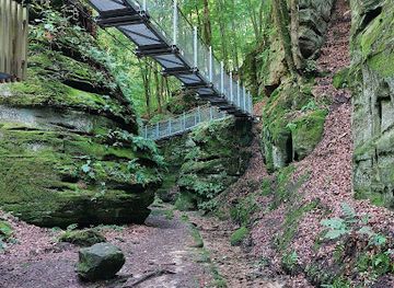
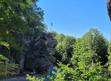
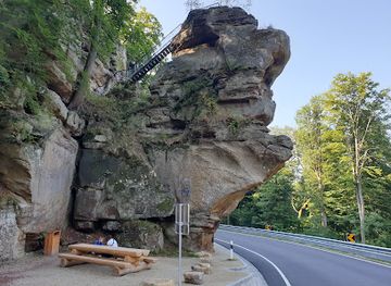
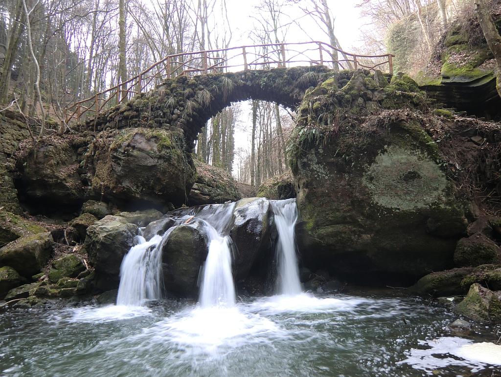
The Mullerthal Trail B2 offers tourists a breathtaking hiking experience through lush forests, stunning rock formations, and picturesque landscapes, perfect for nature enthusiasts and adventurers alike.
Opening times, essentials, and a few local tips gathered into one calmer, easier-to-scan planning section.
Hi, I'm Eve. Here are a few practical things to know before exploring Mullerthal trail B2.
Local know-how to help you travel smarter and make the most of every moment.
Car
If you are driving from the center of Mullerthal, head southeast on Rue de la Gare toward Rue de Berdorf. Continue straight onto Route de Berdorf (N10) for about 3 km. When you reach Berdorf, turn left onto Maartbësch. Follow this road until you reach the trailhead at 1 beim Maartbësch, 6552 Berdorf. There is usually free parking available near the start of the trail.
Public Transportation
If you prefer public transport, take bus line 111 from Mullerthal to Berdorf. The bus stop in Mullerthal is located near the center of the village. Check the local bus schedule for departure times. Once you arrive at the Berdorf stop (Berdorf, Mëllerdall), walk east along Route de Berdorf for about 500 meters, then turn left onto Maartbësch. The trailhead will be on your right at 1 beim Maartbësch, 6552 Berdorf. Note that bus fares may apply, so please have some cash or a transport card ready.
Walking
For those who enjoy a longer walk, you can also walk from the center of Mullerthal to the trailhead. This scenic route is approximately 3 km and will take you about 40 minutes. Head southeast on Rue de la Gare, then follow the signs toward Berdorf. This route will take you through some beautiful countryside before connecting with Maartbësch in Berdorf.
Use Tower Bridge as your starting point for nearby food, family ideas, nightlife, and more local discoveries.

Explore expert travel guides, compare and book tours, experiences, hotels, and more—all from the palm of your hand. Download now for seamless trip planning wherever your wanderlust takes you.
Explore the enchanting Mullerthal region in Luxembourg, known as 'Little Switzerland', with its stunning landscapes, historic sites, and charming villages.
Tell me more about Mullerthal