

Free Denigomodu Travel Guide & Mobile App
Plan your Denigomodu trip with Evendo. Get free guides to top attractions, restaurants, hotels, and bars. Web access or download the mobile app.


Denigomodu, Nauru, offers a close view of island life, phosphate history, Pacific landscapes and easy access to beaches, villages and cultural sights.
Island Community and Industrial Past
Denigomodu lies in the western part of Nauru, a compact Pacific island republic encircled by reef and shaped profoundly by phosphate mining. Rather than a conventional city with a dense commercial centre, it is a district community whose story is closely connected with the island’s former mining economy and the settlements built for workers. Inland, the elevated phosphate fields have left a stark landscape of pinnacles, exposed rock and regenerating vegetation, while the coastal road links Denigomodu with neighbouring districts and the rest of the island.Read more about Denigomodu
Everyday Nauru
Coast, Reef and Central Uplands
When is the best time to visit Denigomodu?
Best: June–August · 29°C| Month | High (°C) | Rainfall (mm) |
|---|---|---|
| January | 30 | 250 |
| February | 30 | 250 |
| March | 30 | 250 |
| April | 30 | 200 |
| May | 29 | 150 |
| June (best) | 29 | 100 |
| July (best) | 29 | 100 |
| August (best) | 29 | 100 |
| September | 29 | 100 |
| October | 30 | 150 |
| November | 30 | 200 |
| December | 30 | 250 |
Getting to and around Denigomodu
How to get there
Best attractions in Denigomodu
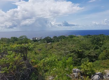
Denigomodu’s principal attraction is the opportunity to encounter Nauru’s settlement landscape and phosphate legacy without the crowds or commercial staging found in larger destinations. Roads through the western districts reveal residential communities, churches, tropical vegetation and views towards the elevated mining plateau, where coral pinnacles and abandoned extraction areas tell the story of an industry that shaped the republic. The district is also conveniently placed for exploring nearby Aiwo and for making an island-wide circuit. Beyond Denigomodu, visitors can reach Buada Lagoon, a freshwater lake surrounded by palms and inland vegetation, and the Pacific shoreline with its reef flats and swimming areas, subject to local conditions. Command Ridge in Yaren offers wartime remnants and elevated views, while Anibare Bay on the eastern coast provides a contrasting seascape. These places are outside Denigomodu itself, but Nauru’s compact road network makes them practical parts of a wider stay.
-
Historical landmark
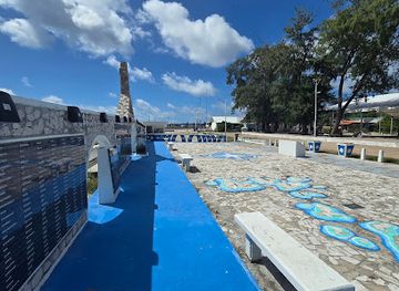
WWII Memorial Monument
Discover the WWII Memorial Monument in Nauru, a historical landmark honoring the sacrifices of heroes during World War II amidst beautiful landscapes.
11 min walk · 0.9 km from city centre
Best landmarks in Denigomodu
Denigomodu’s most significant landmarks are connected less with monumental architecture than with Nauru’s industrial and community history. The district forms part of the western settlement belt shaped by phosphate mining, and the altered interior plateau remains the island’s defining man-made landscape: jagged coral pinnacles, exposed ground and regenerating vegetation mark areas where phosphate was removed. Nearby Aiwo contains the port and industrial infrastructure associated with the export economy, while the broad coastal road links these working landscapes with residential districts. Elsewhere on Nauru, Command Ridge in Yaren preserves wartime traces and provides a tangible reminder of the Japanese occupation, and Buada Lagoon represents the island’s rare inland freshwater environment. Churches and community buildings across the districts are also important markers of everyday Nauruan identity, although they are active local spaces rather than museum monuments. Together, these places reveal a republic shaped by extraction, war, faith and the ocean.
-
Historical landmark
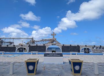
WWII Memorial Monument
Explore the solemn beauty of the WWII Memorial Monument in Orro, a tribute to bravery, sacrifice, and the enduring spirit of those who served during the war.
11 min walk · 0.9 km from city centre
-
Lake
Buada Lagoon
Explore the serene beauty of Buada Lagoon in Nauru, a tranquil escape surrounded by lush nature and vibrant wildlife, perfect for relaxation and photography.
14 min walk · 1.1 km from city centre
Explore Denigomodu on the map
Plan your Denigomodu trip on one map. See where the top attractions, landmarks, restaurants, bars and hotels are, find what's near where you're staying, and book hotels and experiences in a few clicks.
Best hotels in Denigomodu
Best restaurants in Denigomodu
Denigomodu has a modest dining scene rather than a concentration of destination restaurants. Food on Nauru reflects Pacific staples, Australian influence and the practical realities of an isolated island economy, with rice, noodles, fish, chicken, tinned goods, coconut and imported vegetables appearing regularly. Informal eateries, takeaway counters and small shops are generally more relevant to visitors than a formal restaurant district, while accommodation providers may be the most dependable source of prepared meals. Fresh seafood can be available, but supply and menus vary, and it should not be assumed that every meal is locally caught. The island’s social life is closely connected with homes, churches and community gatherings, where food may carry more cultural meaning than a commercial dining venue. Visitors should plan ahead, carry water and avoid expecting late-night food services or the variety available in a larger Pacific capital.
-
Restaurant
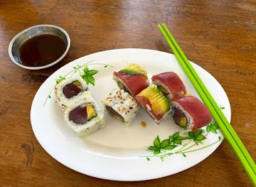
OMG Sushi Restaurant
Experience top-notch sushi dining at OMG Sushi Restaurant in Orro, where freshness meets tradition in every bite.
12 min walk · 1.0 km from city centre
-
Restaurant
Somewhere Else in Nauru
Experience authentic Nauruan cuisine at Somewhere Else in Arijejen – a culinary haven for food lovers visiting Nauru.
5 min walk · 0.4 km from city centre
-
Breakfast
Lucky Tigeress Yum Cha
Experience an authentic breakfast journey at Lucky Tigeress Yum Cha in Arijejen, where every dish tells a story of local flavors and culinary tradition.
5 min walk · 0.4 km from city centre
-
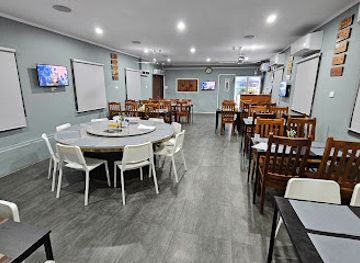
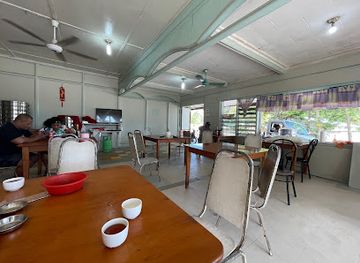
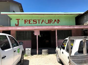
Chinese
J’ RESTAURANT
Discover authentic Chinese cuisine at J’ RESTAURANT in Arijejen - a delightful culinary escape along Waterfront Road.
4 min walk · 0.3 km from city centre
Best bars in Denigomodu
Denigomodu and Nauru do not have a substantial nightlife quarter or a large club scene. Evenings are generally quiet, with social life centred on homes, churches, small gatherings and accommodation venues rather than busy streets lined with bars. Visitors may find limited opportunities for a drink in selected licensed establishments, but opening arrangements and availability can change, and alcohol should be approached with respect for local community standards. The most characteristic evening experience is the island after dark: warm coastal air, subdued roads and the sound of the Pacific rather than organised entertainment. Cultural or community events may provide more meaningful evening contact with Nauruan life than commercial nightlife, but these are local occasions rather than permanent visitor attractions and should be attended discreetly and by invitation or with appropriate local guidance.
-
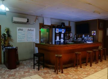
Bar
Jules On The Deck
Discover the vibrant atmosphere and stunning views at Jules On The Deck, Nibok's premier bar for handcrafted cocktails and unforgettable sunsets.
8 min walk · 0.6 km from city centre
Best shops in Denigomodu
Shopping in Denigomodu is practical and small-scale, with local shops and general stores serving everyday needs rather than a concentrated souvenir or fashion district. Visitors should look for locally produced food items, simple Pacific handicrafts and small mementoes where available, while recognising that imported goods dominate much of the retail supply because Nauru is remote and has limited manufacturing. The island’s most distinctive purchase may be a modest locally made craft or artwork obtained directly and respectfully, rather than a standardised tourist product. There is no large traditional market comparable with those in regional capitals, and retail hours and stock can vary. Buying essentials before travelling around the island is sensible, particularly drinking water, snacks and sun protection. Shopping opportunities in nearby districts and around the main settled areas are similarly functional, reflecting daily life more than a developed visitor economy.
-
Grocery store
Pacific store
Discover local flavors and fresh produce at Pacific Store in Nibok – a grocery haven for tourists and locals alike.
4 min walk · 0.3 km from city centre
-
Grocery store
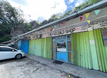
Vim No.1 Store
Explore the vibrant Vim No.1 Store in Arijejen for authentic Nauruan flavors and local essentials, making it a must-visit for tourists.
5 min walk · 0.4 km from city centre
-
 Home goods store
Abwan Warehouse
Discover authentic local crafts and quality home goods at Abwan Warehouse, Arijejen's hidden gem for unique shopping experiences.
4 min walk · 0.3 km from city centre
-
Hardware store
Eigigu Enterprise
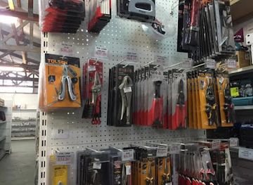
Explore the heart of Arijejen's craftsmanship at Eigigu Enterprise, your go-to hardware store for quality tools and supplies.
3 min walk · 0.2 km from city centre
Get your free copy of our complete guide to Denigomodu, delivered straight to you.
Everything on this page, from attractions and restaurants to essentials and local phrases, in one PDF you can read offline, print or share.
Already have an account? Sign in
Your Denigomodu guide is ready.
We'll send it to · Not you? Sign out

Getting your guide ready…
We are putting together a fresh copy of the Denigomodu guide. This can take up to a minute.
This can take a few moments. If your browser asks, choose Allow so the download can start. You'll find the guide in your Downloads folder.
Nothing happened? Download it again
Sorry, the guide is taking longer than usual. Please try again in a minute, or get it by email instead.
From Eve
Local phrases worth knowing
You don't need to get them perfect. A few words go a long way, and locals appreciate the effort.
Basics
| English | Local | Say it |
|---|---|---|
| Hello | Iaorana | [yo-ra-na] |
| Goodbye | Ka kite | [ka kee-te] |
| Yes | Ae | [ai] |
| No | Kare | [ka-re] |
| Please/You're welcome | Parau | [pa-rau] |
| Thank you | Mauruuru | [mau-ru-ru] |
| Excuse me/Sorry | Pardon | [pa-don] |
| How are you? | E aha ta oe? | [e a-ha ta o-e] |
| Fine. And you? | Maitai. E pehea koe? | [mai-tai e pe-he-a ko-e] |
| Do you speak English? | E haere mai koe i te reo Ingarangi? | [e ha-e-re mai ko-e i te re-o in-ga-ran-gi] |
| I don't understand | Kare au e mohio | [ka-re au e mo-hio] |
Eating & Drinking
| English | Local | Say it |
|---|---|---|
| I'd like to see the menu, please | E hiahia au e kite i te mena, maruru | [e hi-a-hia au e ki-te i te me-na ma-ru-ru] |
| I don't eat meat | Kare au e kai i te kai | [ka-re au e ka-i i te ka-i] |
| Cheers! | Manuia! | [ma-nu-ia] |
| I would like to pay, please | E hiahia au e utu, maruru | [e hi-a-hia au e u-tu ma-ru-ru] |
Emergencies
| English | Local | Say it |
|---|---|---|
| Help! | Awhina! | [a-wi-na] |
| Go away! | Haere atu! | [ha-e-re a-tu] |
| Call the Police! | Karanga ki te Pirihimana! | [ka-ran-ga ki te pi-ri-hi-ma-na] |
| Call a doctor! | Karanga ki te Rata! | [ka-ran-ga ki te ra-ta] |
| I'm lost | I te huarahi au | [i te hua-ra-hi au] |
| I'm ill | I te mate au | [i te ma-te au] |
Shopping
| English | Local | Say it |
|---|---|---|
| I'd like to buy... | E hiahia au e hoko... | [e hi-a-hia au e ho-ko] |
| I'm just looking | Kei te titiro noa au | [kei te ti-ti-ro no-a au] |
| How much is it? | E hia moni? | [e hi-a mo-ni] |
| That's too expensive | He nui rawa te utu | [he nu-i ra-wa te u-tu] |
| Can you lower the price? | Ka taea e koe te whakaiti i te utu? | [ka ta-ea e ko-e te fa-ka-i-ti i te u-tu] |
Time & Numbers
| English | Local | Say it |
|---|---|---|
| What time is it? | He aha te wa? | [he a-ha te wa] |
| It's one o'clock | Ko te tahi karaka | [ko te ta-hi ka-ra-ka] |
| Half past (10) | Tekau ma rua karaka | [te-ka-u ma ru-a ka-ra-ka] |
| Morning | Ahiahi | [a-hi-a-hi] |
| Afternoon | Apongite | [a-po-ngi-te] |
| Evening | Matahiti | [ma-ta-hi-ti] |
| Yesterday | Ine | [i-ne] |
| Today | Nei | [ne-i] |
| Tomorrow | Apopo | [a-po-po] |
| 1 | Tahi | [ta-hi] |
| 2 | Rua | [ru-a] |
| 3 | Toru | [to-ru] |
| 4 | Wha | [fa] |
| 5 | Rima | [ri-ma] |
| 6 | Ono | [o-no] |
| 7 | Whitu | [fi-tu] |
| 8 | Waru | [wa-ru] |
| 9 | Iwa | [i-wa] |
| 10 | Tekau | [te-ka-u] |
Transport & Directions
| English | Local | Say it |
|---|---|---|
| Where's a/the...? | Kei hea te...? | [kei he-a te] |
| What's the address? | He aha te wahi? | [he a-ha te wa-hi] |
| Can you show me (on the map)? | Ka taea e koe te whakaatu mai i ahau (i te mahere)? | [ka ta-ea e ko-e te fa-ka-a-tu mai i a-ha-u i te ma-he-re] |
| When's the next (bus)? | Ahea te waa o te ruma nui? | [a-he-a te wa-a o te ru-ma nu-i] |
| A ticket (to ....) | He tiketi (ki te ....) | [he ti-ke-ti ki te] |
History of Denigomodu
Early Settlement and Island Society
Nauru was settled by Micronesian and Polynesian communities whose social organisation developed around twelve traditional districts, including Denigomodu. Before colonial administration, island life depended on fishing, reef resources, coconut and pandanus, and cultivated food plants. Land and clan relationships remained central to identity, while oral traditions preserved knowledge of ancestry and place. Denigomodu’s later appearance was transformed by mining and imported settlement patterns, but the district remained part of the island’s older territorial and community structure. The surrounding reef, coastal strip and elevated interior reflect the distinctive geography that influenced how Nauruans lived before large-scale commercial extraction began.
German Annexation and Colonial Rule
Germany annexed Nauru in 1888, bringing the island into the German colonial sphere and altering established political relationships. The first Christian missions had already begun changing religious life, and colonial administration introduced new systems of authority and commerce. The decisive economic shift came after phosphate was identified in 1900 by the prospector Albert Fuller Ellis. Mining began soon afterwards under a German company, creating demand for imported labour and establishing the industrial model that would dominate Nauru for much of the twentieth century. Districts such as Denigomodu became increasingly connected to mining settlements, transport routes and the extraction economy.
Phosphate Mining and Imported Labour
After the First World War, Nauru became a League of Nations mandate administered by Australia, with Britain and New Zealand also involved in the phosphate enterprise. The British Phosphate Commissioners controlled mining and exported fertiliser-grade phosphate, bringing revenue but also profound environmental and social change. Workers arrived from other Pacific islands and beyond, and Denigomodu became associated with housing and facilities linked to the industry. Mining removed much of the fertile central plateau, leaving the jagged pinnacles visible today. The profits generated by phosphate supported a distinctive island economy, while control over land and resources remained a lasting political issue.
War, Displacement and Trusteeship
Japanese forces occupied Nauru during the Second World War from 1942 until 1945. The occupation disrupted mining and civilian life, and in 1943 a large proportion of Nauruan residents were deported to Truk, now known as Chuuk, where many died before the survivors returned after the war. Australia subsequently administered Nauru as a United Nations Trust Territory, and phosphate production resumed. The wartime experience, together with the damage caused by extraction and foreign control, strengthened Nauruan demands for self-government. The island’s post-war communities, including Denigomodu, developed against this background of displacement, recovery and political mobilisation.
Independence and the Post-Mining Era
Nauru became an independent republic on 31 January 1968, with Hammer DeRoburt among the leading figures associated with the independence movement and the country’s early political life. Phosphate income initially gave Nauru unusually high revenues for a small island state, but reserves declined and the environmental legacy of mining became increasingly difficult to manage. By the late twentieth and early twenty-first centuries, economic uncertainty, rehabilitation challenges and changing regional relationships shaped national life. Denigomodu today reflects this transition: a settled district on an island whose identity was forged by phosphate, yet whose future depends on community resilience, careful land use and a broader economic base.
Denigomodu in Photos
Browse through our photo collection highlighting the charm and character of the destination.
Cities near Denigomodu
The closest cities to Denigomodu, if you have time for more than one stop.
-
-

-
-

-


Swipe for more cities
Explore more

Explore more of Nauru
Discover Nauru, the serene island nation in Micronesia, offering pristine beaches, rich history, and vibrant marine life for an unforgettable tropical escape.
Explore Nauru