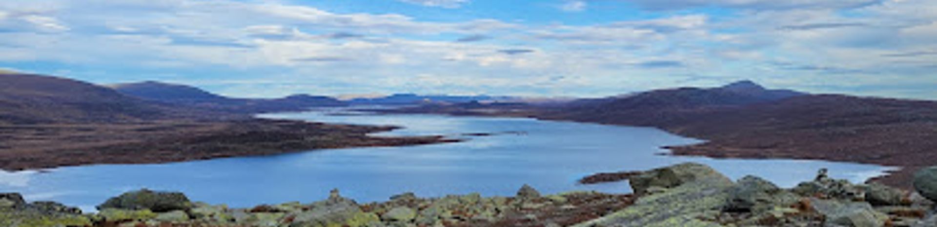
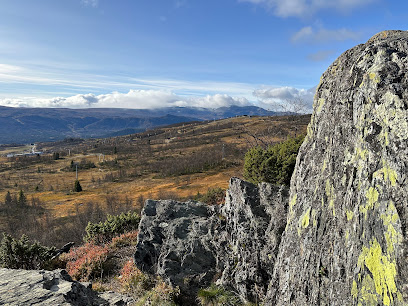
Discover the Majesty of Gravolskampen: A Hiking Paradise
Explore the breathtaking hiking trails of Gravolskampen in Beitostølen, Norway, where stunning landscapes and outdoor adventures await.
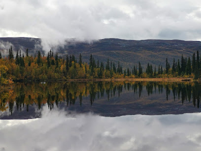
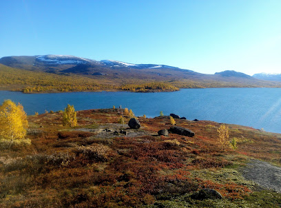
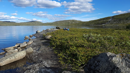
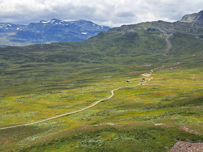
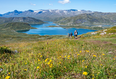
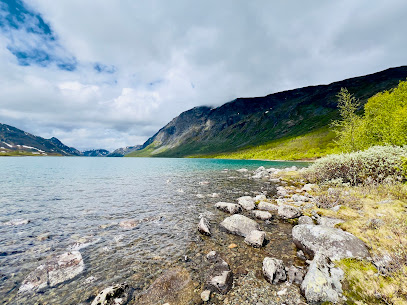
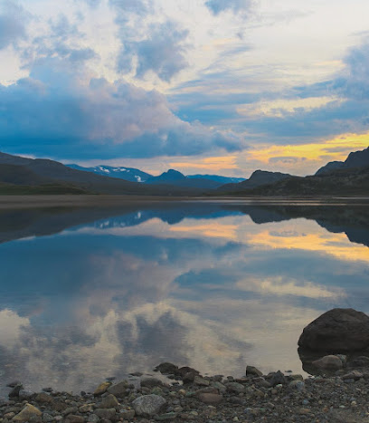
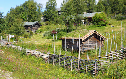
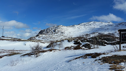
Gravolskampen is a breathtaking hiking area located near Beitostølen, Norway, ideal for outdoor enthusiasts and nature lovers. With stunning views and diverse trails, it promises an unforgettable adventure for tourists seeking the natural beauty of Norway.
A brief summary to Gravolskampen
- Beitostølen, NO
Local tips
- Visit during the early morning for cooler temperatures and fewer crowds.
- Wear sturdy hiking boots to navigate the rocky terrain safely.
- Bring plenty of water and snacks to keep your energy up during the hike.
- Don't forget your camera to capture the stunning views along the trails.
- Check the weather forecast before heading out, as conditions can change rapidly.
Getting There
-
Car
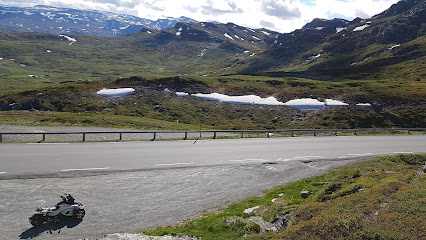
If you are driving from Beitostølen, head northwest on Fagernesvegen (Route 51) from the center of Beitostølen. After approximately 3 kilometers, you will see signs for Gravolskampen. Turn left onto the gravel road leading to the hiking area. Continue on this road for about 1 kilometer until you reach the parking area at the base of Gravolskampen. Parking may be free, but be sure to check for any local signs regarding parking fees.
-
Public Transportation
To reach Gravolskampen using public transportation, start by taking the local bus from Beitostølen to the nearest bus stop that services the area closer to Gravolskampen. The closest bus stop is likely to be a short walk from the hiking area. Check the local bus schedule for routes and times, as services may be limited. Once you disembark, follow the signs directing you to Gravolskampen, which is about a 20 to 30-minute walk uphill on a marked trail.
-
Walking
If you are already in Beitostølen and prefer to walk, you can start at the Beitostølen Tourist Information Center. From there, head northwest along the main road towards Fagernesvegen. After approximately 1.5 kilometers, look for the trailhead to Gravolskampen on your left. The trail is well-marked and will take you directly to the peak, which is about a 1 to 1.5-hour hike depending on your pace. Ensure you wear appropriate hiking shoes and bring water.
Discover more about Gravolskampen
Iconic landmarks you can’t miss
Bitihorn Rest Stop
2.1 km
Experience breathtaking views and serene landscapes at Bitihorn Rest Stop, a must-visit oasis for travelers in Beito, Norway.
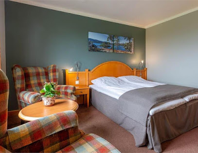
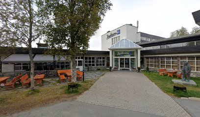
Radisson Blu Mountain Resort, Beitostølen
6.2 km
Discover the perfect blend of luxury and adventure at Radisson Blu Mountain Resort, Beitostølen - your gateway to Norway's breathtaking landscapes.

Riddergaarden
6.2 km
Discover Riddergaarden: A serene holiday apartment rental in Beitostølen, perfect for outdoor adventures and cozy retreats in the heart of Norway.
Beitostølen Tourist
6.3 km
Explore the stunning landscapes and thrilling adventures of Beitostølen, Norway, from the local Tourist Information Center.
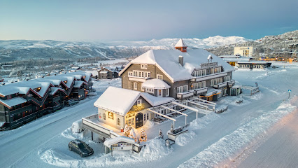
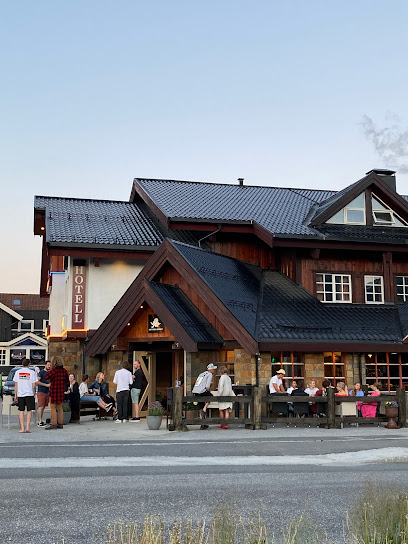
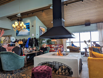
Bergo Hotel
6.4 km
Discover the charm of Bergo Hotel in Beitostølen, your cozy retreat amidst Norway's breathtaking landscapes and outdoor adventures.
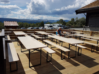
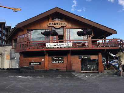
Bryggerihuset AS (Brew House)
6.5 km
Experience the best of Norwegian craft beers and local cuisine at Bryggerihuset AS, the ultimate brew house in Beitostølen.
Beitostølen Mountain Park
6.8 km
Experience the breathtaking beauty of Beitostølen Mountain Park, a perfect blend of adventure and relaxation in Norway's stunning landscapes.
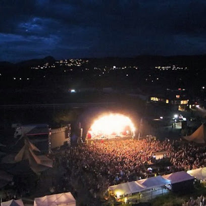
Trollrock
7.6 km
Discover the Trollrock Festival in Beitostølen, Norway, where nature's splendor meets rich cultural celebrations for an unforgettable experience.
Beitostølen stadion
7.8 km
Discover the excitement of Beitostølen Stadion, where sports, nature, and stunning landscapes converge for an unforgettable experience in Norway.
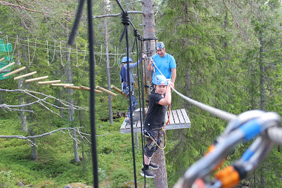
Beitoklatrepark
9.2 km
Explore the thrills of Beitoklatrepark, a high ropes course in Beitostølen offering adventure and excitement for all ages amidst stunning Norwegian landscapes.
Parkering topptur til Heimdalshøe
20.1 km
Explore the breathtaking hiking trails of Heimdalshøe, where stunning landscapes and rich wildlife await every adventurer in Norway.
Knutshøe
20.9 km
Discover the breathtaking heights of Knutshøe, a serene mountain peak in Norway offering stunning views and outdoor adventures for all.
Rasteplass
21.7 km
Discover the breathtaking beauty of Rasteplass, a scenic spot in Norway that offers tranquility and stunning views of the surrounding landscapes.
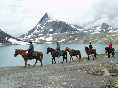
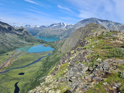
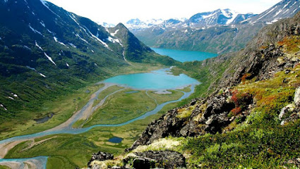
Besseggi
23.8 km
Experience the breathtaking beauty of Besseggi Ridge in Tessanden, Norway, an unmissable destination for nature lovers and adventure seekers.
Bessheim Fjellstue og Hytter
24.1 km
Discover the charm of Bessheim Fjellstue og Hytter, where breathtaking nature meets cozy accommodations in the heart of Norway.
Unmissable attractions to see
Djupevikodden
2.2 km
Explore the stunning Djupevikodden Hiking Area near Beitostølen, where breathtaking views and diverse trails await every adventurer.
Smørkollen Viewpoint
2.2 km
Experience the stunning beauty of Smørkollen Viewpoint, a must-visit destination for nature lovers and adventure seekers in Norway.
Bitihorn
2.5 km
Explore Bitihorn: A breathtaking peak in Jotunheimen National Park, offering stunning views and exceptional hiking trails for all adventurers.
NASJONAL TURISTVEG Valdresflye - SCENIC ROUTE Valdresflye - START/END
3.2 km
Explore the stunning Valdresflye Scenic Route, where breathtaking landscapes and natural beauty await every traveler in Norway.
Start hiking trail Synshorn
4.7 km
Explore Synshorn, a picturesque hiking area in Beitostølen, offering breathtaking views and diverse trails for all adventurers.
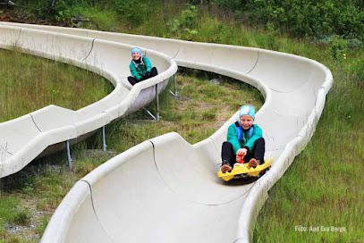
Bobbane
6.0 km
Discover the thrill of bob sledding at Bobbane in Beitostølen, a premier tourist attraction amidst Norway's stunning landscapes.
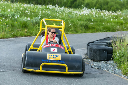
Olabilbane
6.0 km
Explore the stunning landscapes and exhilarating activities at Olabilbane, a premier tourist attraction in Beitostølen, Norway. Nature's beauty awaits you!
Utsiktspunkt
6.0 km
Discover Utsiktspunkt in Beitostølen, where breathtaking views and unforgettable hiking adventures await you amidst Norway's stunning landscapes.
BitihornEkspressen
6.1 km
Explore the breathtaking vistas of BitihornEkspressen in Beitostølen, where nature's beauty and adventure await every visitor.
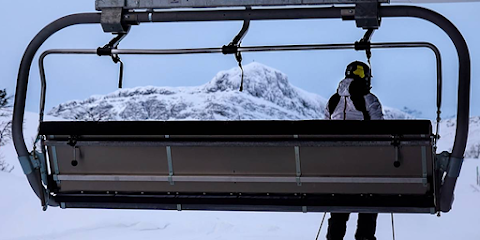
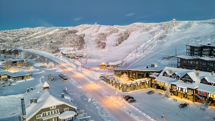
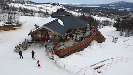
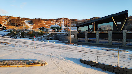
Beitostølen Skiheiser
6.1 km
Explore Beitostølen Skiheiser, Norway's premier ski resort offering thrilling slopes, stunning mountain views, and cozy alpine charm for an unforgettable winter getaway.
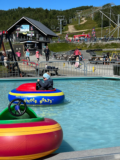
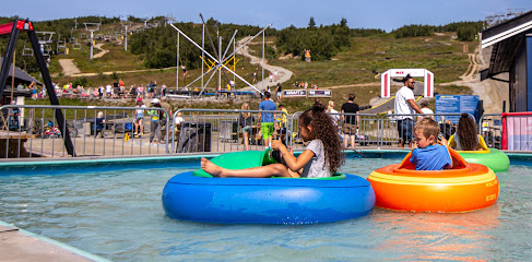
Beitostølen Sommerpark
6.1 km
Discover the thrill of adventure at Beitostølen Sommerpark, where family-friendly activities and stunning Norwegian landscapes come together.
Raudalen Alpin As
6.2 km
Experience winter magic at Raudalen Alpin As in Beitostølen, Norway—where adventure meets breathtaking alpine beauty.
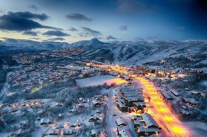
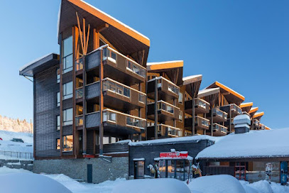
Beitostølen Resort
6.2 km
Discover the enchanting Beitostølen Resort, a perfect blend of winter sports and summer adventures in the breathtaking Norwegian wilderness.
OlaExpressen
6.2 km
Experience the thrill of skiing at OlaExpressen in Beitostølen, Norway; a top destination for winter sports enthusiasts surrounded by stunning alpine scenery.
Beitostølen Aktiv & Skiskole AS
6.2 km
Explore year-round outdoor adventures at Beitostølen Aktiv & Skiskole - skiing, hiking, and rock climbing in Norway's stunning landscapes.
Essential places to dine
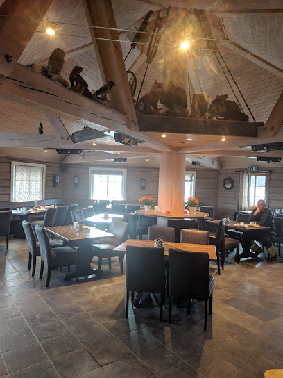
Aasgaard stogo
5.8 km
Discover authentic Norwegian cuisine at Aasgaard Stogo in Beitostølen, where local flavors meet stunning landscapes for an unforgettable dining experience.
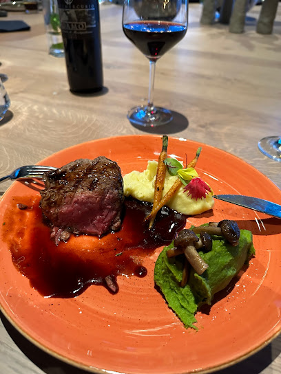
Steaks & Bones - Huset
6.2 km
Experience mouthwatering steaks and warm hospitality at Steaks & Bones - Huset in Beitostølen – perfect for food lovers and adventure seekers alike.
Lodge 900
6.2 km
Discover authentic Norwegian cuisine at Lodge 900 in Beitostølen – where local flavors meet breathtaking mountain views.
Gjestegaarden
6.3 km
Discover the charm of Gjestegaarden in Beitostølen - your perfect holiday apartment surrounded by nature's beauty.
Caféen Beitostølen
6.3 km
Experience authentic Norwegian cuisine amidst stunning mountain views at Caféen Beitostølen—a culinary gem in Norway's beautiful landscape.
Jotunstogo AS
6.3 km
Experience authentic Norwegian cuisine at Jotunstogo AS in Beitostølen, where local flavors meet stunning mountain views.
Grønolen Fjellgard
6.3 km
Experience authentic Norwegian hospitality at Grønolen Fjellgard—your serene escape in Beito's stunning mountain landscape.
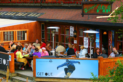
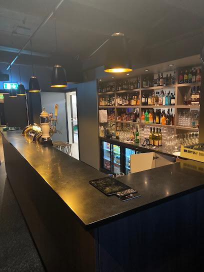
Svingen Pub
6.4 km
Discover the lively ambiance of Svingen Pub in Beitostølen - your go-to spot for local brews and unforgettable nights out.
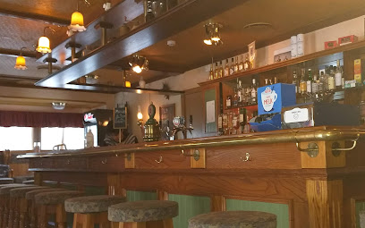
Beitostølen Barcraft AS
6.4 km
Experience lively nights at Beitostølen Barcraft - where great drinks meet vibrant Norwegian culture amidst breathtaking mountain views.
Peppes Pizza - Beitostølen
6.4 km
Savor delicious pizza at Peppes Pizza in Beitostølen - perfect for families and adventurers alike!
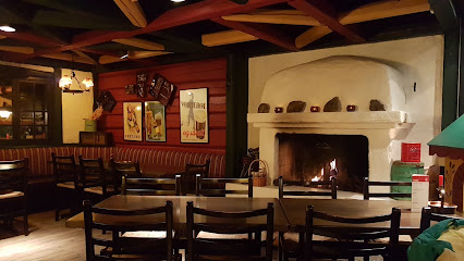
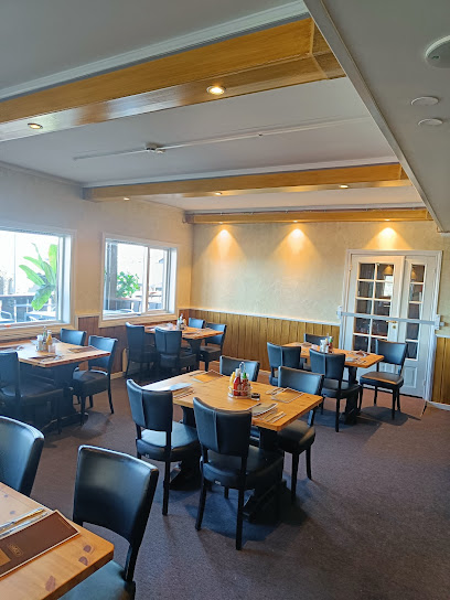
Cesar's Restaurant & bar
6.4 km
Experience authentic Italian cuisine at Cesar's Restaurant & Bar in Beitostølen—where every meal is crafted with passion and quality ingredients.
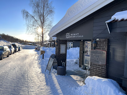
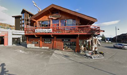
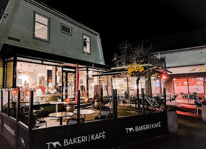
Bakeri Heimatt
6.4 km
Discover delightful pastries at Bakeri Heimatt in Beitostølen—where every bite tells a story of Norwegian baking traditions.
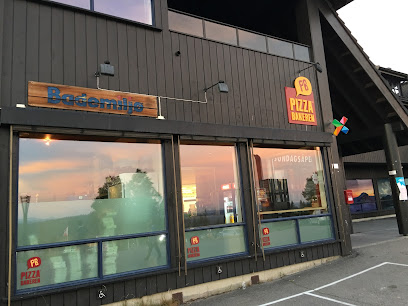
Pizzabakeren Beitostølen
7.3 km
Experience delicious pizza at Pizzabakeren Beitostølen - your perfect dining choice amidst Norway's breathtaking landscapes.
Hytta Mat & Vinhus
7.3 km
Experience authentic Norwegian cuisine amidst stunning mountain views at Hytta Mat & Vinhus in Beitostølen.
DNT Flye 1389
10.4 km
Discover comfort and delicious cuisine at DNT Flye 1389, your perfect café retreat in beautiful Beitostølen.
Markets, malls and hidden boutiques
Den Glade Ugle
6.2 km
Explore Den Glade Ugle, a whimsical novelty store offering unique gifts, local crafts, and delightful surprises that capture the essence of creativity.
Casa Montagna
6.2 km
Discover the flavors of Norway with exquisite dishes and a warm atmosphere at Casa Montagna in Beitostølen.
Motekroken AS
6.2 km
Discover stylish and functional clothing at Motekroken AS in Beitostølen, where fashion meets the great outdoors in stunning Norway.
Beitostølen Rental
6.3 km
Experience the beauty of Norway with Beitostølen Rental, your trusted partner for ski and bicycle adventures in stunning Beitostølen.
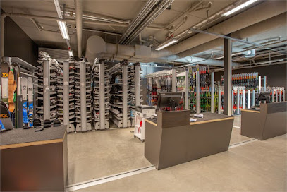
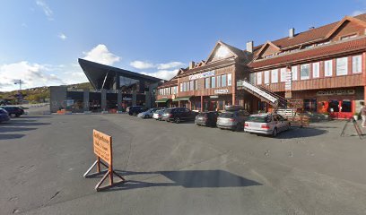
INTERSPORT
6.3 km
Explore Beitostølen with INTERSPORT: Your ultimate hub for quality sports gear and outdoor apparel.
MAKALAUSE
6.3 km
Explore the beauty of Scandinavian design at Makalaus, your go-to home goods store in Beitostølen, Norway.
Beitostølen Gaver & Interiør AS
6.3 km
Explore the charm of Beitostølen with unique gifts and locally crafted decor at Beitostølen Gaver & Interiør AS, a true treasure trove of Norwegian culture.
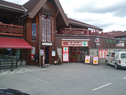
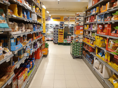
SPAR Beitostølen
6.3 km
Discover the convenience and variety at SPAR Beitostølen, your essential grocery stop in the scenic heart of Norway.
Riddertunet
6.3 km
Discover Riddertunet in Beitostølen: Your gateway to breathtaking nature, modern comforts, and unforgettable adventures in Norway.
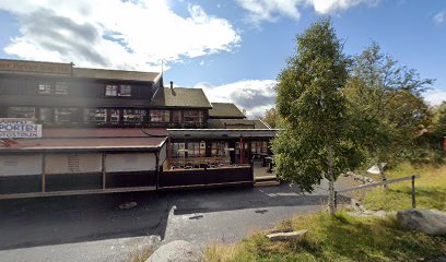
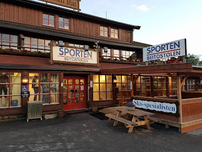
Sporten Beitostølen AS
6.4 km
Explore the great outdoors of Norway with top-quality gear from Sporten Beitostølen AS, your one-stop shop for adventure!
Liastølen
6.5 km
Explore Liastølen, a cultural gem in Beitostølen, where Norwegian heritage comes to life through art, exhibitions, and vibrant local events.
Gourmet stories Beitostølen
6.6 km
Explore the authentic flavors of Italy at Gourmet Stories Beitostølen, home to exquisite cheeses, hams, and gourmet delights in a charming alpine setting.
Stølstunet Kjøpesenter Beitostølen
6.6 km
Discover the charm of Stølstunet Kjøpesenter in Beitostølen, where shopping meets the beauty of the Norwegian mountains.
Extra
6.6 km
Discover the best of Beitostølen at Extra Grocery Store, your local destination for fresh produce, local delicacies, and essential supplies.
Coop Prix Beitostølen
6.6 km
Discover quality groceries and local products at Coop Prix Beitostølen, your essential shopping destination in the heart of Norway's beautiful countryside.
Essential bars & hidden hideouts
Lobby Bar1
6.2 km
Discover the enchanting Lobby Bar1 in Beitostølen, where exquisite cocktails meet a warm, inviting atmosphere for a memorable night out.

Sekskanten Kro og Pub
34.4 km
Discover the flavors and vibrant atmosphere of Sekskanten Kro og Pub in Røn, where every meal is a taste of local culture.
Puben Fagernes
40.2 km
Discover the lively ambiance and local flavors at Puben Fagernes, a must-visit pub for tourists in Norway.
Harahorn Hotel
45.6 km
Experience the natural beauty and cozy comfort of Harahorn Hotel in Hemsedal, your perfect getaway for adventure and relaxation in Norway.
Moen Pizza og Gildehal
49.3 km
Experience the best pizza in Hemsedal at Moen Pizza og Gildehal, where delicious flavors meet warm Norwegian hospitality.
Qvisthaugen
50.6 km
Discover Qvisthaugen Bar: A cozy retreat in Aurdal, Norway, offering local brews and a vibrant atmosphere for travelers seeking relaxation.
Wunderpus
50.9 km
Discover the vibrant atmosphere and vegan delights at Wunderpus, Hemsedal's top bar for relaxation and socializing amidst stunning mountain scenery.
Fyri Resort
51.3 km
Discover the luxury and adventure of Fyri Resort in Hemsedal, your gateway to breathtaking landscapes and outdoor activities in Norway.
Fýri Sports Club
51.5 km
Explore the great outdoors with top-notch gear and expertise at Fýri Sports Club in Hemsedal, Norway's adventure capital.
Skipatrulje Vaktbu
53.1 km
Discover the thrill of skiing and the charm of alpine culture at Skipatrulje Vaktbu in Hemsedal, Norway, for an unforgettable winter escape.
Samhold
55.5 km
Discover the lively atmosphere of Samhold Pub in Øvre Årdal, where local brews and friendly faces await you.
Tya Bakeri, Kafè & Bar & Restaurant
55.6 km
Experience the charm of Tya Bakeri, a delightful cafe and bar in Øvre Årdal, offering fresh baked goods, hearty meals, and live music.
Sans Kafe & Bar
57.5 km
Discover the cozy charm of Sans Kafe & Bar in Vinstra, where delightful flavors and a welcoming atmosphere await every visitor.
Ysteriet
58.1 km
Ysteriet: Your Go-To Sports Bar in Vinstra for an Unforgettable Evening of Fun, Food, and Games!
Postaabneriet pub & cafe AS
58.2 km
Discover the heart of Borgund at Postaabneriet Pub & Cafe, where local charm meets an inviting atmosphere and delightful drinks.