Background

Discover the Breathtaking Heights of the Second Highest Point of the Philippine Highway System

Experience the breathtaking views and cool mountain air at the Second Highest Point of the Philippine Highway System in Benguet, Philippines.

★★★★★4.6 (828)

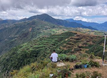
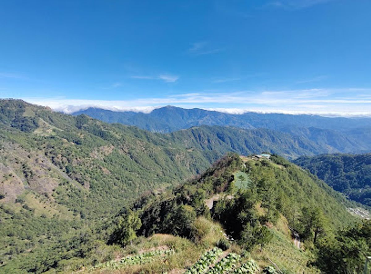
Nestled in the stunning landscapes of Benguet, the Second Highest Point of the Philippine Highway System offers breathtaking views, cool mountain air, and a unique experience for travelers seeking adventure and natural beauty. This remarkable destination, located along the Halsema Highway, serves as a perfect stop for photography enthusiasts and nature lovers alike, making it a must-visit spot in the Cordillera region.

Plan your visit

A brief summary to Second Highest Point: Philippine Highway System

Opening times, essentials, and a few local tips gathered into one calmer, easier-to-scan planning section.

Plan your visit

📍
JQRG+635, Halsema Highway, Atok, Benguet, PH

Explore places near Second Highest Point: Philippine Highway System

    See all →

    Unlock the Best of Second Highest Point: Philippine Highway System

    Find tickets, tours with entry, and experiences available for this location.

    Buy tickets

    No tickets available

    Book tours with entry

    No tours with entry available

    Book tours without entry

    No tours without entry available

    Getting There

    Car

    If you are traveling by car, make your way to Halsema Highway. From the main road, look for the marker 'JQRG+635, Halsema Highway, Atok, Benguet'. This is the location of the Second Highest Point: Philippine Highway System. Make sure to take your time on the winding roads and enjoy the breathtaking views along the way. Parking may be limited, so be prepared to find a safe spot along the highway.

    Public Transportation

    For those using public transportation, head to the nearest bus terminal that services the Atok area. Buses to Atok can be found in Baguio City. Look for buses with routes to Atok or Sagada. The fare typically ranges from PHP 150-200 depending on the bus company. Once you reach Atok, you can either take a tricycle or walk to the Halsema Highway. Ask locals to guide you towards 'JQRG+635, Halsema Highway' as it is a known point in the area.

    Tricycle

    Once you are in Atok, hiring a tricycle is a convenient way to reach the Second Highest Point. You can negotiate the fare, which usually costs around PHP 50-100 per person depending on the distance and the driver's rates. Make sure to tell the driver to take you to 'JQRG+635' on Halsema Highway, which is a well-known landmark.

    Local tips

    Visit early in the morning to catch the sunrise over the mountains.
    Bring a light jacket as it can get chilly even during the day.
    Don't forget your camera to capture the stunning landscape.
    Plan your visit during the dry season for the best weather conditions.

    Discover more about Second Highest Point: Philippine Highway System

    The Second Highest Point of the Philippine Highway System is a captivating destination that beckons tourists with its awe-inspiring natural beauty. Standing at an elevation of over 2,300 meters, this scenic spot offers panoramic views of the surrounding mountains and lush valleys, providing a breathtaking backdrop that is perfect for photography and exploration. Located along the renowned Halsema Highway, which is famous for its winding roads and stunning vistas, this attraction is often frequented by travelers eager to experience the heights of the Cordillera region in the Philippines. As you arrive at this remarkable point, you will be enveloped by the cool, crisp mountain air, a refreshing change from the bustling city life. The area is known for its rich biodiversity, with a variety of flora and fauna that thrive in the high-altitude environment. While visiting, take the time to enjoy the sights and sounds of nature, as well as the local culture that surrounds this beloved landmark. Travelers often stop here to take in the majestic views, capture memorable photos, and even enjoy a picnic amidst the serene surroundings. For those planning to visit, be sure to dress warmly, as temperatures can drop significantly at this elevation. The best time to explore this location is during the dry season, from November to April, when the weather is more favorable for outdoor activities. Whether you are an avid photographer, a nature enthusiast, or simply seeking a serene escape, the Second Highest Point of the Philippine Highway System promises an unforgettable experience that showcases the stunning beauty of the Philippines' mountainous landscapes.
    Mobile App
    Get the app

    Your all‑in‑one travel companion app

    Explore expert travel guides, compare and book tours, experiences, hotels, and more—all from the palm of your hand. Download now for seamless trip planning wherever your wanderlust takes you.

    Hiking in the Hills above the Sea of Clouds on Mount Pulag, Philippines  image - Free stock photo - Public Domain photo - CC0 Images

    More about Mt Pulag

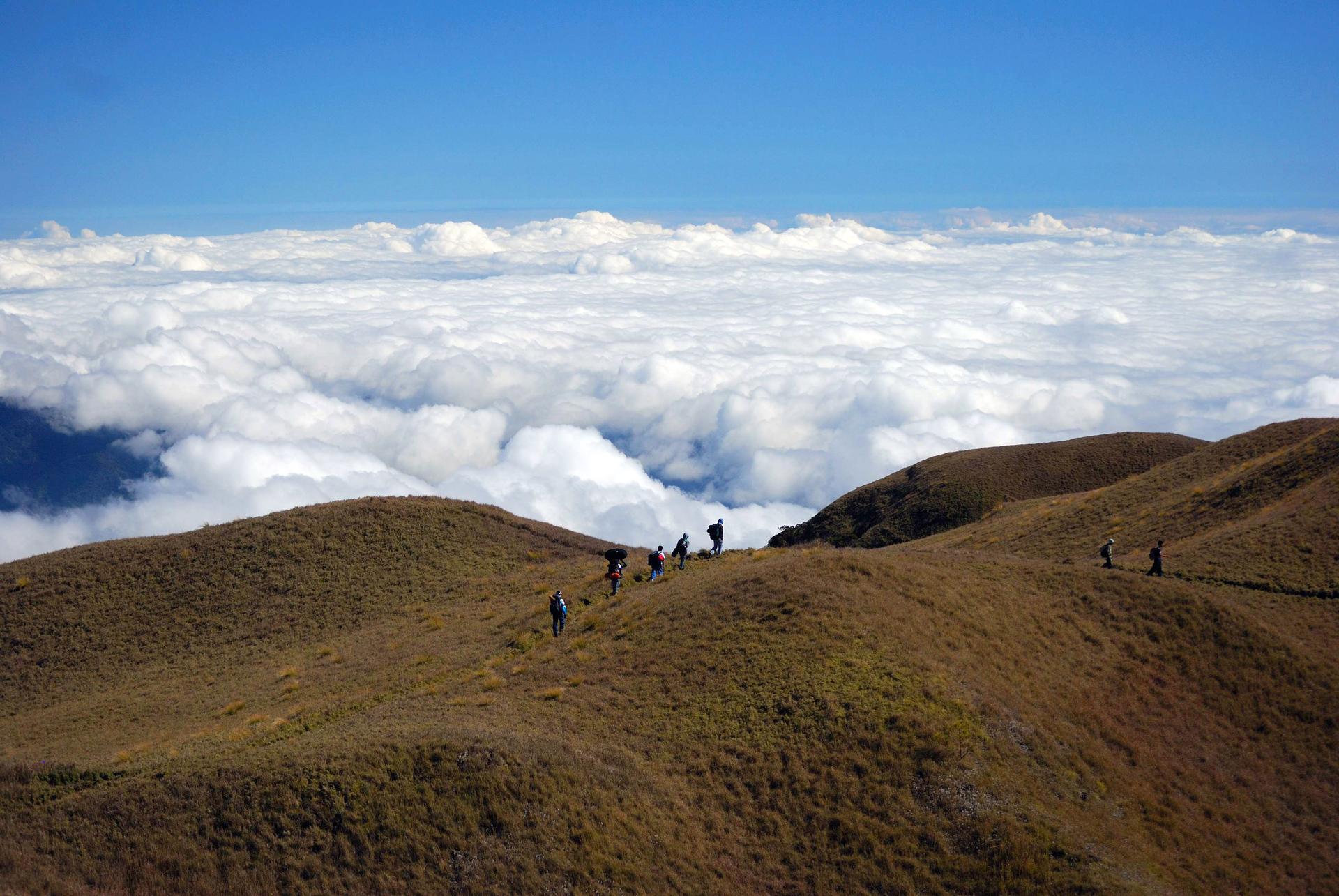
    Discover Mt. Pulag, Luzon’s highest peak, renowned for its stunning sea of clouds, diverse ecosystems, and rich cultural heritage.

    Tell me more about Mt Pulag

    Select Currency

    Choose the currency you want prices to display in.