

Mt. Pulag Travel Guide - Free Web & App
Your ultimate guide to Mt. Pulag. Discover top landmarks, proposed trips, and local tips. Free on the web or via the Evendo companion app.


Mt. Pulag in the Philippines offers sunrise above Luzon, mossy forests, dwarf bamboo, sea of clouds, native wildlife and guided highland treks.
Highland Landscapes
Mt. Pulag rises in the southern Cordillera of northern Luzon, where the provinces of Benguet, Ifugao and Nueva Vizcaya meet. At 2,922 metres, it is the highest mountain in Luzon and the third-highest peak in the Philippines. Its summit lies within Mt. Pulag National Park, a protected upland landscape of mossy forest, open grassland and dwarf bamboo shaped by cool temperatures, frequent mist and exposed mountain weather.Read more about Mt. Pulag
The Summit Experience
Communities and Conservation
When is the best time to visit Mt. Pulag?
Best: January–March · 12–15°C| Month | High (°C) | Rainfall (mm) |
|---|---|---|
| January (best) | 12 | 103 |
| February (best) | 13 | 93 |
| March (best) | 15 | 112 |
| April | 15 | 157 |
| May | 16 | 223 |
| June | 17 | 329 |
| July | 17 | 434 |
| August | 17 | 392 |
| September | 16 | 325 |
| October | 16 | 232 |
| November | 14 | 158 |
| December | 13 | 115 |
Getting to and around Mt. Pulag
How to get there
Transportation
Best attractions in Mt. Pulag
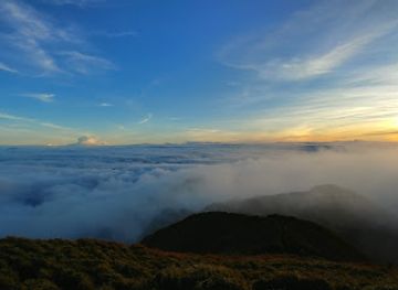
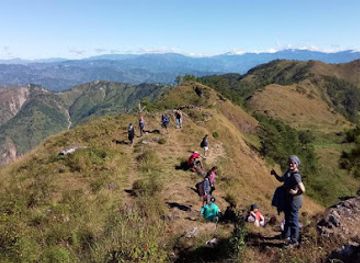
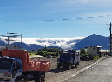
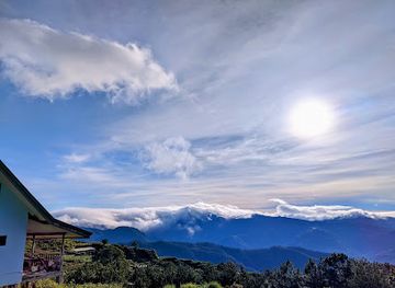
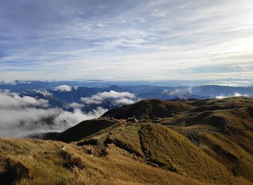
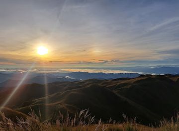
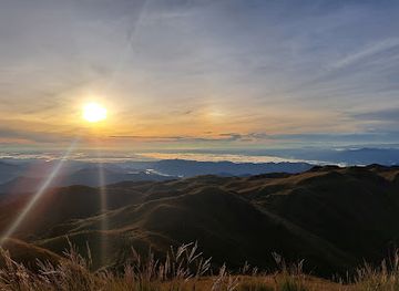
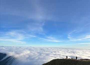
The principal attraction is the summit trek itself, particularly the Ambangeg route across mossy forest, dwarf bamboo and open grassland towards Mt. Pulag’s rounded summit. Early-morning views over the Cordillera may reveal the much-photographed sea of clouds, although visibility depends on weather. The Akiki trail provides a longer and more strenuous approach through changing mountain vegetation, while Tawangan offers another remote route subject to local access arrangements. The park’s forests and upper slopes are valuable for birdwatching and observing highland ecology, though wildlife sightings are never guaranteed. In the surrounding Benguet landscape, Kabayan is an important cultural gateway with links to Ibaloi heritage and the Kabayan mummy caves, which are distinct attractions rather than features of the summit trail. Bokod and nearby communities provide access to local farming landscapes, rivers and mountain roads, but facilities become increasingly limited as visitors travel towards the protected area.
-
Tourist attraction
Second Highest Point: Philippine Highway System
Experience the breathtaking views and cool mountain air at the Second Highest Point of the Philippine Highway System in Benguet, Philippines.
-
Tourist attraction
Mt. Pulag Protected Landscape
Discover the stunning landscapes and diverse wildlife of Mt. Pulag Protected Landscape, a top hiking destination in the Philippines.
-
Visitor center
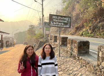
Mount Pulag National Park Protected Area Office
Discover the breathtaking beauty of Mount Pulag National Park, a haven for nature lovers and adventure seekers in the Philippines.
-
Tourist attraction
Babalak/Babadak Ranger Station
Experience the breathtaking landscapes and tranquil hikes at Babalak/Babadak Ranger Station in Benguet, a true nature lover's paradise.
Best landmarks in Mt. Pulag
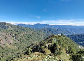
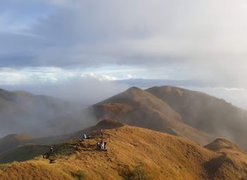
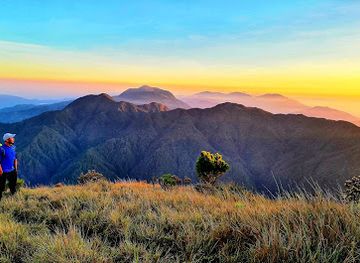
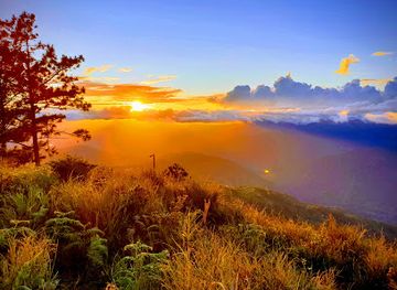
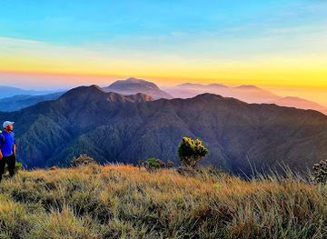
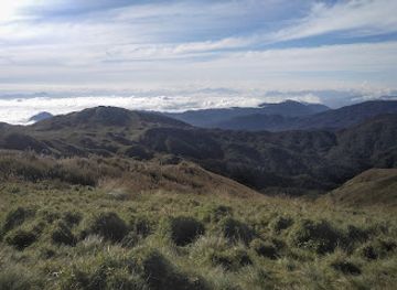
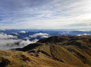
Mt. Pulag’s defining landmark is its 2,922-metre summit, the highest point in Luzon and the central highland feature of Mt. Pulag National Park. The open summit ridge, dwarf bamboo and surrounding grassland create a landscape distinct from the mossy forest below, while the Cordillera valleys form the distant backdrop when cloud allows. The park itself is a significant protected natural landmark spanning parts of Benguet, Ifugao and Nueva Vizcaya. In the wider cultural landscape, Kabayan is associated with Ibaloi heritage and the Kabayan mummy caves, an important set of historic sites that should be visited as a separate excursion rather than presented as part of the summit. The mountain’s forests, watersheds and endemic wildlife also give its physical features ecological importance beyond their scenic value.
-
National park
Mt. Pulag Protected Landscape
Explore the enchanting Mt. Pulag Protected Landscape, a national park with stunning views, diverse wildlife, and unforgettable hiking experiences in the Philippines.
-
Mountain peak
Mount Pulag
Discover the breathtaking beauty of Mount Pulag, a must-visit destination in the Philippines, known for its stunning views and rich biodiversity.
-
Visitor center
Mount Pulag National Park Protected Area Office
Experience the stunning landscapes and biodiversity of Mount Pulag National Park, a top destination for trekking and nature exploration in the Philippines.
-
National park
Mt. Pulag National Park Akiki Trail Jump Off Point
Discover the breathtaking vistas and rich biodiversity of Mt. Pulag National Park along the exhilarating Akiki Trail, a must-visit for nature lovers and adventurers.
Explore Mt. Pulag on the map
Plan your trip on one map. See where the top attractions, landmarks, restaurants and hotels are, and book hotels and experiences in a few clicks.
Best hotels in Mt. Pulag
Best restaurants in Mt. Pulag
Dining around Mt. Pulag is centred on the gateway communities and the meals arranged for trekking groups rather than on restaurants within the national park. Bokod, Kabayan and nearby Benguet settlements offer modest eateries, cafés, sari-sari shops and small food businesses where visitors can find Filipino staples, rice meals, noodles, snacks and hot drinks. Highland agriculture shapes the region’s food culture, with vegetables, rice and other locally grown produce important to everyday cooking, while Baguio is the wider regional centre for a much broader range of dining. Trekkers commonly carry provisions or arrange simple packed meals for the mountain; campsites should not be expected to provide a commercial food service. Visitors should buy supplies before the final approach, respect local food arrangements and avoid leaving packaging or organic waste on the trails.
-
Restaurant
Ricken Star
Discover Ricken Star: A charming restaurant in Atok offering delicious local cuisine amidst stunning mountain views.
-
Restaurant
Loyung's Restaurant
Discover authentic Cordilleran flavors at Loyung's Restaurant on Halsema Highway – where every meal is a journey through Benguet's culinary heritage.
-
Restaurant
Al's Restaurant
Experience authentic Filipino flavors at Al's Restaurant in Buguias - where generous portions and fast service create unforgettable meals.
-
Filipino
Igorot Taste
Discover authentic Filipino flavors at Igorot Taste in Bokod, Benguet – a culinary journey through Cordillera's rich heritage.
Best bars in Mt. Pulag
Mt. Pulag is not a nightlife destination, and evenings are generally quiet in the rural communities used as trekking bases. Bokod and Kabayan may have small local drinking places, eateries or modest videoke-style social venues, but these should not be confused with a concentrated bar or club scene, and availability can vary. Most trekkers spend the evening preparing equipment, eating an early meal and resting before a pre-dawn ascent. Baguio, outside the mountain area, provides the nearest substantially broader choice of pubs, bars, live entertainment and late-evening dining. In villages near the park, visitors should keep noise low, respect residential surroundings and remember that darkness, cold and limited transport make spontaneous late-night travel impractical.
-
Lounge
ROUTE 49 TRANSIENT HOUSE
Discover the serene charm of Route 49 Transient House, your cozy escape in the heart of Benguet, Philippines, perfect for relaxation and adventure.
-
Bar
Yabow garden
Discover tranquility at Yabow Garden, a picturesque bar in Bokod, Benguet, offering refreshing drinks amidst stunning mountain views.
Best nightclubs in Mt. Pulag
Mt. Pulag is not a nightlife destination, and evenings are generally quiet in the rural communities used as trekking bases. Bokod and Kabayan may have small local drinking places, eateries or modest videoke-style social venues, but these should not be confused with a concentrated bar or club scene, and availability can vary. Most trekkers spend the evening preparing equipment, eating an early meal and resting before a pre-dawn ascent. Baguio, outside the mountain area, provides the nearest substantially broader choice of pubs, bars, live entertainment and late-evening dining. In villages near the park, visitors should keep noise low, respect residential surroundings and remember that darkness, cold and limited transport make spontaneous late-night travel impractical.
-
National park
Mt. Pulag Protected Landscape
Explore the breathtaking beauty of Mt. Pulag Protected Landscape - a premier hiking destination in the Philippines with stunning views and rich biodiversity.
-
Mountain peak
Mount Pulag
Discover the breathtaking beauty of Mount Pulag, a stunning mountain peak in the Philippines famous for its sea of clouds and rich biodiversity.
Best shops in Mt. Pulag
Shopping at Mt. Pulag is limited and practical, with small shops in gateway communities supplying snacks, drinks, basic provisions and trekking necessities rather than a substantial retail selection. Bokod and Kabayan are useful places to obtain last-minute food and everyday supplies, while Baguio is the nearest major shopping centre for outdoor equipment, wider grocery choices, regional produce and locally made goods. Visitors may find Benguet vegetables, coffee, woven products, agricultural produce and small handicrafts in the broader Cordillera region, but availability varies by settlement and season. Purchases from local producers can support communities connected with the mountain, provided products are obtained through legitimate businesses. Do not remove plants, rocks or other natural material from the park, and carry reusable containers to reduce waste during the trek.
-
National park
Mt. Pulag Protected Landscape
Explore Mt. Pulag Protected Landscape, a breathtaking national park in the Philippines, famous for its stunning views and diverse ecosystems.
-
Mountain peak
Mount Pulag
Discover the breathtaking beauty of Mount Pulag, a natural wonder in Benguet known for its stunning sea of clouds and rich biodiversity.
-
Hiking area
Mt. Pulag
Explore the breathtaking Mt. Pulag, a hiker's dream with stunning views, diverse ecosystems, and a mesmerizing sea of clouds in the heart of the Philippines.
-
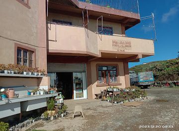
Store
Me-An MG Store and Homestay
Experience the authentic charm of Benguet at Me-An MG Store and Homestay, where local crafts meet warm hospitality amidst stunning landscapes.
Get your free copy of our complete guide to Mt. Pulag, delivered straight to you.
Everything on this page, from attractions and restaurants to essentials and local phrases, in one PDF you can read offline, print or share.
Already have an account? Sign in
Your Mt. Pulag guide is ready.
We'll send it to · Not you? Sign out

Getting your guide ready…
We are putting together a fresh copy of the Mt. Pulag guide. This can take up to a minute.
This can take a few moments. If your browser asks, choose Allow so the download can start. You'll find the guide in your Downloads folder.
Nothing happened? Download it again
Sorry, the guide is taking longer than usual. Please try again in a minute, or get it by email instead.
Mt. Pulag essentials
Currency and Payment
Safety
Emergency Situations
Do's and Don'ts
Local Tips
From Eve
Local phrases worth knowing
You don't need to get them perfect. A few words go a long way, and locals appreciate the effort.
Basics
| English | Local | Say it |
|---|---|---|
| Hello | Kamusta | [ka-mus-ta] |
| Goodbye | Paalam | [pa-a-lam] |
| Yes | Oo | [o-o] |
| No | Hindi | [hin-di] |
| Please/You're welcome | Mangyaring | [man-gya-ring] |
| Thank you | Salamat | [sa-la-mat] |
| Excuse me/Sorry | Pasensya na | [pa-sen-sya na] |
| How are you? | Kamusta ka? | [ka-mus-ta ka] |
| Fine. And you? | Mabuti. Ikaw? | [ma-boo-ti. i-kaw] |
| Do you speak English? | Nagsasalita ka ba ng Ingles? | [nag-sa-sa-li-ta ka ba ng ing-gles] |
| I don't understand | Hindi ko maintindihan | [hin-di ko main-tin-di-han] |
Eating & Drinking
| English | Local | Say it |
|---|---|---|
| I'd like to see the menu, please | Gusto kong makita ang menu, pakiusap | [gus-to kong ma-ki-ta ang me-nu, pa-ki-u-sap] |
| I don't eat meat | Hindi ako kumakain ng karne | [hin-di a-ko ku-ma-ka-in ng kar-ne] |
| Cheers! | Mabuhay! | [ma-boo-hay] |
| I would like to pay, please | Gusto kong magbayad, pakiusap | [gus-to kong mag-ba-yaad, pa-ki-u-sap] |
Emergencies
| English | Local | Say it |
|---|---|---|
| Help! | Tulong! | [tu-long] |
| Go away! | Lumayo ka! | [lu-ma-yo ka] |
| Call the Police! | Tumawag sa Pulis! | [tu-ma-wag sa pu-lis] |
| Call a doctor! | Tawag ka ng doktor! | [ta-wag ka ng dok-tor] |
| I'm lost | Nawawala ako | [na-wa-wa-la a-ko] |
| I'm ill | May sakit ako | [may sa-kit a-ko] |
Shopping
| English | Local | Say it |
|---|---|---|
| I'd like to buy... | Gusto kong bumili ng... | [gus-to kong bu-mi-li ng] |
| I'm just looking | Nagtitignan lang ako | [nag-ti-tig-nan lang a-ko] |
| How much is it? | Magkano ito? | [mag-ka-no i-to] |
| That's too expensive | Masyadong mahal 'yan | [ma-sya-dong ma-hal 'yan] |
| Can you lower the price? | Pwede bang ibaba ang presyo? | [pu-we-de bang i-ba-ba ang pres-yo] |
Time & Numbers
| English | Local | Say it |
|---|---|---|
| What time is it? | Anong oras na? | [a-nong o-ras na] |
| It's one o'clock | Alas-una na | [a-las-u-na na] |
| Half past (10) | Ala-una y medya | [a-la-u-na y med-ya] |
| Morning | Umaga | [u-ma-ga] |
| Afternoon | Hapon | [ha-pon] |
| Evening | Gabi | [ga-bi] |
| Yesterday | Kahapon | [ka-ha-pon] |
| Today | Ngayon | [nga-yon] |
| Tomorrow | Bukas | [bu-kas] |
| 1 | Isa | [i-sa] |
| 2 | Dalawa | [da-la-wa] |
| 3 | Tatlo | [tat-lo] |
| 4 | Apat | [a-pat] |
| 5 | Lima | [li-ma] |
| 6 | Anim | [a-nim] |
| 7 | Pito | [pi-to] |
| 8 | Walo | [wa-lo] |
| 9 | Siyam | [si-yam] |
| 10 | Sampu | [sam-pu] |
Transport & Directions
| English | Local | Say it |
|---|---|---|
| Where's a/the...? | Nasaan ang... | [na-sa-an ang] |
| What's the address? | Anong address? | [a-nong address] |
| Can you show me (on the map)? | Pwede mo ba akong ipakita (sa mapa)? | [pu-we-de mo ba a-kong i-pa-ki-ta (sa ma-pa)] |
| When's the next (bus)? | Kailan ang susunod na (bus)? | [kai-lan ang su-su-nod na (bus)] |
| A ticket (to ....) | Isang tiket (papuntang ...) | [i-sang ti-ket (pa-pun-tang)] |
History of Mt. Pulag
An Upland Cordillera Landscape
Mt. Pulag belongs to the Cordillera Central, a high mountain system formed through the long geological development and uplift of northern Luzon. Its cool, wet summit environment supports vegetation unlike the lowland landscapes surrounding the range. Mossy forest, open grassland and dwarf bamboo reflect altitude, exposure and local climate. The mountain’s rounded upper slopes are particularly associated with broad views across the Cordillera, although cloud and mist frequently obscure the surrounding terrain.
Indigenous Communities and Sacred Country
The slopes and valleys around Mt. Pulag have long been connected with indigenous communities, especially the Ibaloi, Kalanguya and Kankanaey peoples. Mountain forests, grazing areas and cultivated valleys form part of a wider cultural landscape rather than an empty wilderness. Local knowledge continues to shape routes, customary relationships with the land and visitor access. Kabayan, in Benguet, is also known for the Ibaloi cultural heritage of the surrounding area, including the Kabayan mummies, although these heritage sites are distinct from the summit trails.
Farming, Forests and Highland Livelihoods
Human activity around Mt. Pulag has historically been connected with highland agriculture, livestock, forest resources and movement between Cordillera communities. The lower valleys contain cultivated land and settlements, while the upper slopes are more sparsely occupied and environmentally sensitive. Roads and tourism have made the mountain more accessible, but access remains closely tied to local municipalities and community arrangements. The contrast between developed valley farms and protected summit habitats is central to understanding the area’s present character.
National Park Protection
Mt. Pulag National Park was established through Presidential Proclamation No. 75 in 1987, protecting a large area across Benguet, Ifugao and Nueva Vizcaya. The designation reflects the ecological importance of the mountain’s montane forests, grasslands and watersheds. Park administration, visitor registration, guiding and trail management are intended to balance public access with conservation. Regulations and procedures can change, so trekkers should verify current requirements with the park authorities or the municipality used for their approach.
Tourism and Environmental Pressure
Mt. Pulag became increasingly prominent as a trekking destination as domestic outdoor tourism expanded and images of sunrise above the clouds circulated widely. Greater visitation has brought income to guides, porters, transport providers and nearby communities, while also creating pressure on trails, campsites, water sources and waste management. The mountain’s modern history is therefore closely linked with regulated tourism. Responsible trekking, adherence to visitor limits and respect for indigenous communities are important parts of its continuing conservation story.
Mt. Pulag in Photos
Browse through our photo collection highlighting the charm and character of the destination.
Neighbouring destination travel guides
The closest destinations to Mt. Pulag, if you have time for more than one.
-

-

-

-

-


Swipe for more destinations
Explore more

Explore more of Luzon
Explore Luzon in the Philippines for Manila heritage, Cordillera rice terraces, volcanic landscapes, historic towns and regional Filipino cuisine.
Explore Luzon
Explore more of Philippines
Discover the Philippines: A tropical paradise of islands, rich history, and warm hospitality, perfect for adventurers and relaxation seekers alike.
Explore Philippines