Cuenca Alta del Manzanares Regional Park, Madrid Travel Guide
Alpine peaks, granite cliffs, and mountain streams where Madrid's wilderness reveals its raw, uncompromising character.
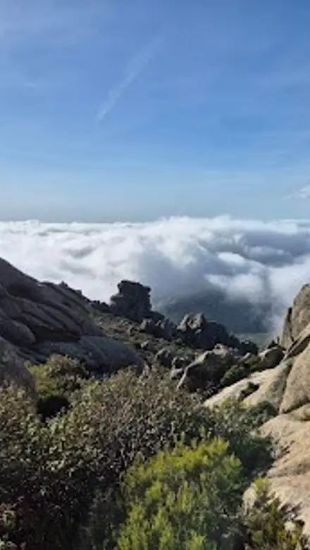
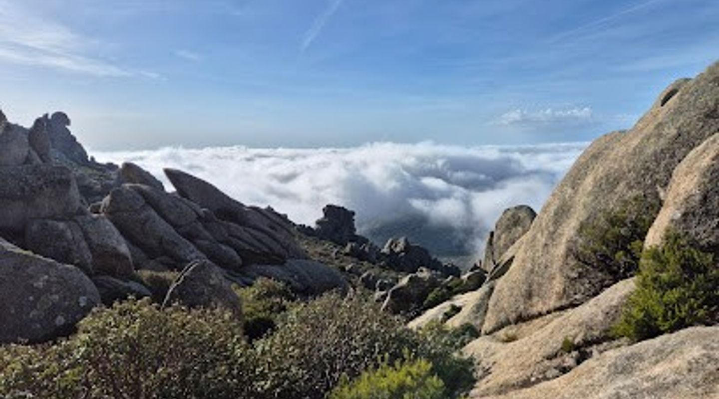
A sprawling regional park northwest of Madrid where granite peaks, pine forests, and crystalline streams converge. This protected mountain landscape offers serious hiking, rock climbing, and alpine meadows—a genuine escape from the city that rewards visitors with sweeping views and genuine wilderness solitude.
A brief summary to Cuenca Alta del Manzanares Regional Park
- Avenida de Chozas, s/n, Soto del Real, Madrid, 28791, ES
- Click to display
- Click to display
- Free
-
 Outdoor
- Mobile reception: 2 out of 5
- Monday 12 am-12 pm
- Tuesday 12 am-12 pm
- Wednesday 12 am-12 pm
- Thursday 12 am-12 pm
- Friday 12 am-12 pm
- Saturday 12 am-12 pm
- Sunday 12 am-12 pm

Know before you go
Hi, I'm Eve. Here are a few practical things to know before exploring Cuenca Alta del Manzanares Regional Park.
- Start hikes early in the day—afternoon thunderstorms are common in summer months and can develop rapidly at higher elevations. Weather changes quickly in mountains; carry rain gear regardless of morning conditions.
- Mobile reception is unreliable throughout most of the park. Download offline maps before visiting and inform someone of your planned route and expected return time.
- Bring adequate water—natural sources exist but are not reliably potable. Mountain refugios offer supplies but operate seasonally; verify hours before relying on them.
- Trails are not always clearly marked. Carry a detailed topographic map and compass or GPS device. Many hikers use established routes; asking at visitor centers about current trail conditions is worthwhile.
- The park is genuinely remote—rescue services have limited access to many areas. This is not a casual walk; come prepared with proper footwear, navigation skills, and physical fitness appropriate to your chosen route.
Do you manage this location?
Take control to get all the benefits, like improved information, better appearance, and stronger visibility across AI-powered discovery. Learn more about listing your business on Evendo
Activate your presenceOther nearby places you may find interesting
The closest places of the same kind, if this one is not quite what you had in mind.
Explore Cuenca Alta del Manzanares Regional Park on the Map
A handpicked selection of must-see spots near Cuenca Alta del Manzanares Regional Park, mapped for you.
Getting There
-
Car
Drive northwest from central Madrid toward Soto del Real (approximately 50 kilometers, 50-60 minutes via M-607 and local roads). The main park entrance and parking area is near Avenida de Chozas in Soto del Real. This is the most practical option for accessing the park's primary trailheads.
-
Public Transport + Hiking
Take a regional train or bus from Madrid to Soto del Real (approximately 1-1.5 hours). From the town center, local buses or taxis can reach the park entrance. This option requires advance research into current schedules and may involve waiting times.
-
Guided Tour
Several Madrid-based outdoor companies offer guided hiking tours to the park, departing from central Madrid. These typically include transportation, guide services, and route planning—ideal for visitors unfamiliar with mountain navigation or wanting expert interpretation of the landscape.
-
Bicycle + Train
Take regional transport to Soto del Real, then use a mountain bike to access park trails. This combines public transport with self-propelled exploration, though it requires fitness and bike-handling skills on mountain terrain.
For the on-the-go comforts that matter to you
-
 Restrooms
-
 Drinking Water
-
 Food Options
-
 Seating Areas
-
 Sheltered Areas
-
 Picnic Areas
-
 Trash Bins
-
 Information Boards
Discover more about Cuenca Alta del Manzanares Regional Park
Gateway to Madrid's Mountain Heart
Cuenca Alta del Manzanares Regional Park protects one of Madrid's most significant natural areas, encompassing over 40,000 hectares of mountain terrain in the Sistema Central range. Located approximately 50 kilometers northwest of central Madrid near Soto del Real, this park represents a dramatic transition from urban sprawl to authentic alpine wilderness. The park's name references the Manzanares River's upper watershed, which originates within these mountains and eventually flows through Madrid itself. Established as a regional park to preserve this ecologically critical area, it now serves as both a conservation zone and a destination for serious outdoor enthusiasts.Landscape and Natural Features
The park's terrain is dominated by granite formations, dense Mediterranean pine forests, and high-altitude meadows that create distinct ecological zones. Elevations range from approximately 900 meters to over 2,000 meters, with the highest peaks including Peñalara and La Maliciosa. The Manzanares River and its tributaries carve through valleys, creating waterfalls, swimming holes, and lush riparian corridors. Alpine meadows burst with wildflowers in spring and early summer, while autumn transforms the landscape into shades of gold and crimson. The park's geology reveals ancient mountain-building processes, with exposed granite faces and boulder fields that attract climbers and geologists alike.Hiking and Mountain Activities
The park offers trails ranging from moderate day hikes to challenging multi-day treks. Popular routes include ascents to Peñalara (the park's highest peak at 2,430 meters), La Maliciosa, and various circular routes through pine forests and alpine terrain. Intermediate hikes typically require 3 to 5 hours, while more ambitious expeditions can span full days or overnight trips. Rock climbing is established on numerous granite faces, with routes for various skill levels. Mountain biking is permitted on designated trails, and in winter, snow transforms the park into a destination for snowshoeing and winter hiking. The park's network of refugios (mountain huts) provides shelter and supplies for extended visits.Flora, Fauna, and Ecological Significance
The park protects critical habitat for species adapted to high-altitude Mediterranean mountains. Iberian ibex, red squirrels, golden eagles, and various alpine birds inhabit the park. The vegetation transitions from Mediterranean scrubland at lower elevations through Scots pine and mountain pine forests to alpine grasslands. Endemic plant species and rare alpine flowers make the park botanically significant. The watershed function is equally important—the park's streams and springs feed the Manzanares River system that supplies water to Madrid and surrounding regions.Visitor Experience and Accessibility
The park operates year-round, though weather conditions significantly impact accessibility. Spring through autumn offers optimal conditions, with summer providing the most stable weather despite occasional afternoon thunderstorms. Winter brings snow to higher elevations, creating hazardous conditions on exposed ridges and steep terrain. The main visitor access point is near Soto del Real, where parking and basic facilities are available. The park maintains marked trails, though navigation requires attention—many routes lack continuous signage. Mobile reception is limited in remote areas. Visitor centers provide information about trails, geology, and ecology, though facilities are minimal compared to urban parks.More to explore near Cuenca Alta del Manzanares Regional Park
-

Best experiences near Cuenca Alta del Manzanares Regional Park
-

Best hotels near Cuenca Alta del Manzanares Regional Park
-

Best landmarks near Cuenca Alta del Manzanares Regional Park
-

Best shops near Cuenca Alta del Manzanares Regional Park
-

Best restaurants near Cuenca Alta del Manzanares Regional Park
-

Best bars near Cuenca Alta del Manzanares Regional Park







Your all‑in‑one travel companion app
Explore expert travel guides, compare and book tours, experiences, hotels, and more—all from the palm of your hand. Download now for seamless trip planning wherever your wanderlust takes you.


Explore More of Madrid
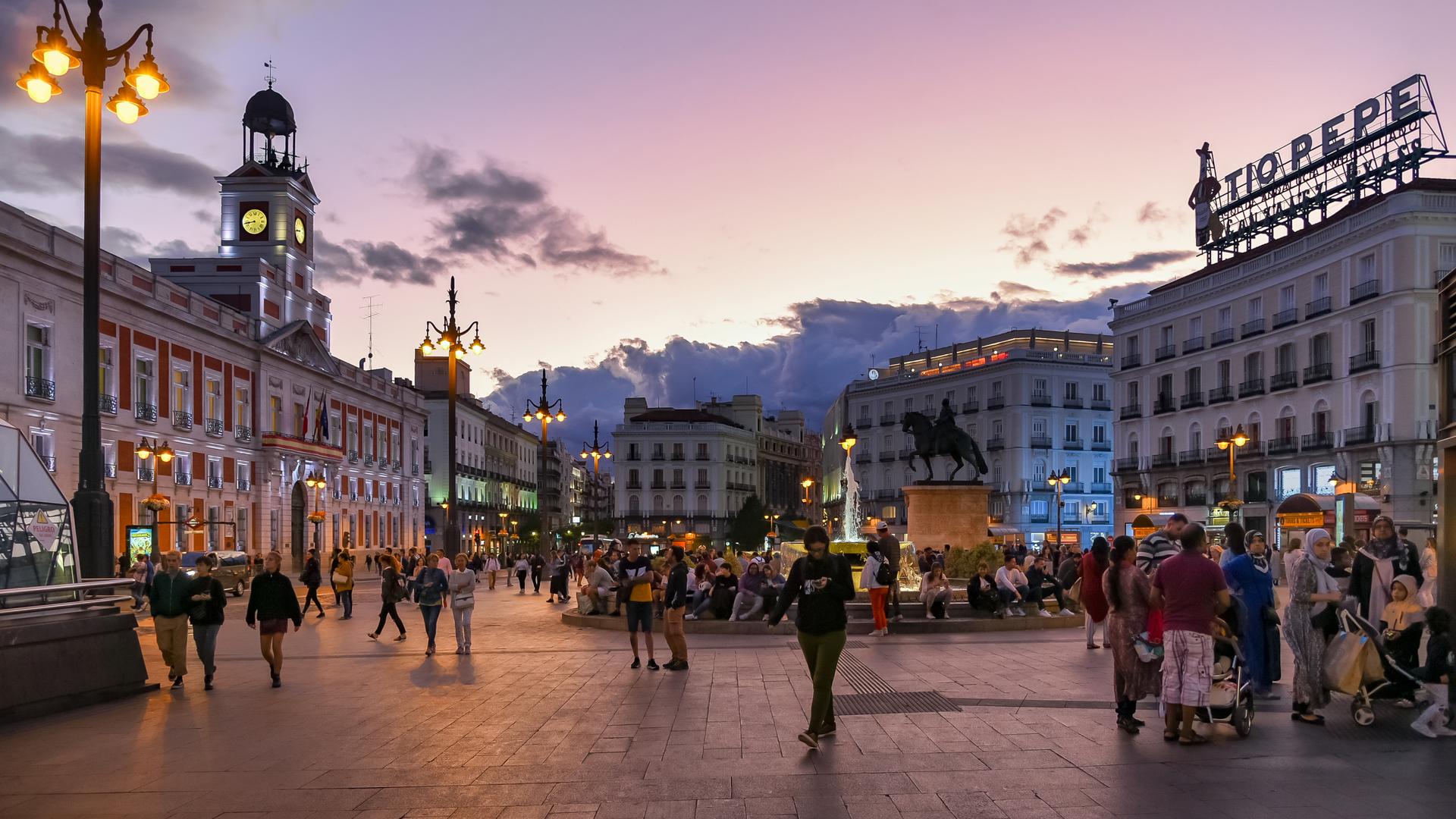
Looking beyond Cuenca Alta del Manzanares Regional Park? Discover Madrid for broader travel guides, local hot-spots, and regional highlights.
Explore Madrid