Antamåla Rör, Blekinge Travel Guide
A 150‑metre long glacial ridge of rounded granite boulders—an evocative natural stone 'wall' tucked into southern Sweden’s woodland.
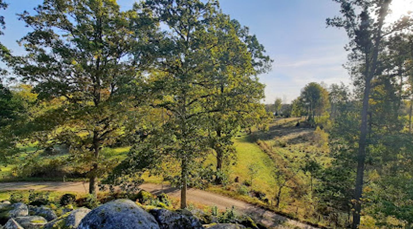
Antamåla Rör is a striking glacial stone ridge near Eremitemåla in southern Sweden: a 150 m long, 50 m wide formation of rounded granite boulders rising to about 11 m that reads like a piled, natural wall in the forest. Designated as a protected natural feature, the site is valued for its dramatic geology, quiet woodland setting and local folklore that frames it as a place of old stories and curious shapes.
A brief summary to Antamåla Rör
- Eremitemåla, SE
- Duration: 0.5 to 2 hours
- Free
-
 Outdoor
- Mobile reception: 3 out of 5

Know before you go
Hi, I'm Eve. Here are a few practical things to know before exploring Antamåla Rör.
- Wear sturdy footwear: ground is uneven with exposed rock and forest debris; some short scrambling may be needed to inspect blocks closely.
- Respect the site: it’s a protected natural feature—avoid moving stones, leave vegetation intact and take any litter away.
- Bring a field guide or app for lichens and woodland plants to appreciate the small-scale biodiversity on and around the rocks.
- Visit in low light (early morning or late afternoon) for the best side-lighting that emphasizes the round forms and textures of the boulders.
Do you manage this location?
Take control to get all the benefits, like improved information, better appearance, and stronger visibility across AI-powered discovery. Learn more about listing your business on Evendo
Activate your presenceOther nearby places you may find interesting
The closest places of the same kind, if this one is not quite what you had in mind.
Explore Antamåla Rör on the Map
A handpicked selection of must-see spots near Antamåla Rör, mapped for you.
Getting There
-
By car (rural roads)
Drive via regional roads from the nearest town in the area; typical travel time from a mid-sized local centre is 20–35 minutes depending on start point and road conditions, with the final approach on a forest gravel road; parking near the site is minimal (space for a few cars) so expect limited capacity and uneven ground—no paid parking fees typically apply.
-
Local bus + short walk
Use regional bus services to a nearby village or stop in the Vissefjärda/Eremitemåla area; typical bus leg takes 25–50 minutes from a larger town with a subsequent walk of 1.5–3.0 km on gravel track and forest path taking 20–45 minutes depending on pace and terrain; bus frequency can be low on weekends and evenings, so consult timetables in advance and note limited shelter at stops.
-
Guided walk or storytelling tour
Join a locally organised guided walk or storytelling event (when offered) which generally lasts 1.5–3 hours including transit within the local area; organised outings may include transfers arranged by the organiser with a small fee typically in the range of 100–300 SEK per person depending on provider and inclusions; check event schedules for seasonal availability.
For the on-the-go comforts that matter to you
-
 Seating Areas
-
 Information Boards
-
 Trash Bins
Discover more about Antamåla Rör
Anatomy of a Stone Ridge
Antamåla Rör is a linear accumulation of large, rounded granite boulders that stretches roughly 150 metres and reaches up to about 11 metres in height; its smallest width is near 50 metres. The blocks—some measuring up to around three metres across—are laid like a vast, irregular dry-stone bank whose curving silhouette reads like an elongated mound within the surrounding mixed woodland. The structure’s scale and sculpted appearance are the result of glacial action: ice transported and deposited the blocks to create a striking morainic ridge rather than human construction.Geological Story and Landscape Context
This feature belongs to a wider pattern of glacial deposits found along the coastal and inland margins of southern Sweden, where ice-flow dynamics and post-glacial shorelines shaped ridges, terraces and stone concentrations. Antamåla Rör’s mass and rounded blocks reflect repeated freezing, transport and settling of hard rock, and its presence influenced the local topography and soil patterns. Around the ridge, the forest floor, thin soils and exposed bedrock offer a cross-section of post-glacial terrain where lichens, moss and hardy understory plants take hold.Cultural Echoes and Local Stories
Antamåla Rör has long featured in local memory and story-telling; the formation’s unusual shape and scale invite myths, place-names and old explanations that sit alongside scientific interpretation. The site is referenced in regional heritage notes and has been the setting for guided walks and storytelling events that explore both natural history and the crust of tales that communities attach to singular landscape features. That cultural layer adds human texture to the stones' austere, geological presence.Visitor Experience and Senses on Site
Approaching the ridge, you move from soft pine-needle carpet and dappled light into a patchwork of stone and forest. The stones present tactile variety—smooth, lichen-patched surfaces, shallow crevices and occasional flat slabs that invite careful exploration. Sound changes too: the wind through trees and birdsong feel amplified by the open rock face, while light and shadow emphasize the blocks’ roundness. The site feels quiet and contained; small clearings and natural pathways allow close viewing without intense infrastructural intrusion.Conservation Status and Natural Importance
Antamåla Rör is identified in regional conservation materials as a geologically important natural feature and lies within an area highlighted for nature conservation interest. Its geodiversity contributes to local habitat variation and to educational value for those studying glacial geomorphology. Management aims to keep the place accessible while maintaining its natural character, with limited facilities so the ridge remains a largely wild encounter in the landscape.Practical Character and Nearby Setting
The ridge sits adjacent to quiet forest tracks and countryside typical of the Emmaboda–Vissefjärda area: small roads, woodland and farmland frame the feature rather than built development. Simple parking and short, unpaved approaches are typical; visitors should expect a natural, minimally serviced site where the emphasis is on experiencing the rock formation, the surrounding trees and the atmosphere of a long-lived landscape rather than on amenities or interpretive infrastructure.












Your all‑in‑one travel companion app
Explore expert travel guides, compare and book tours, experiences, hotels, and more—all from the palm of your hand. Download now for seamless trip planning wherever your wanderlust takes you.


Explore More of Blekinge
Looking beyond Antamåla Rör? Discover Blekinge for broader travel guides, local hot-spots, and regional highlights.
Explore Blekinge