Bike Trail, Zurich Travel Guide
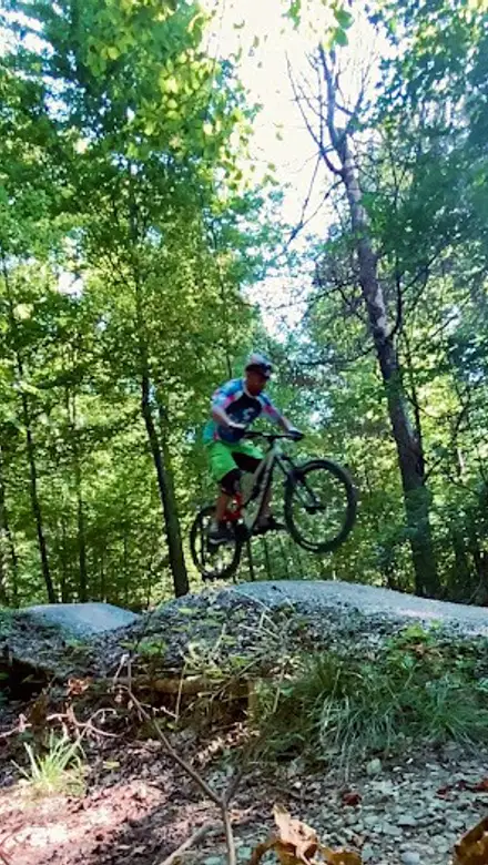
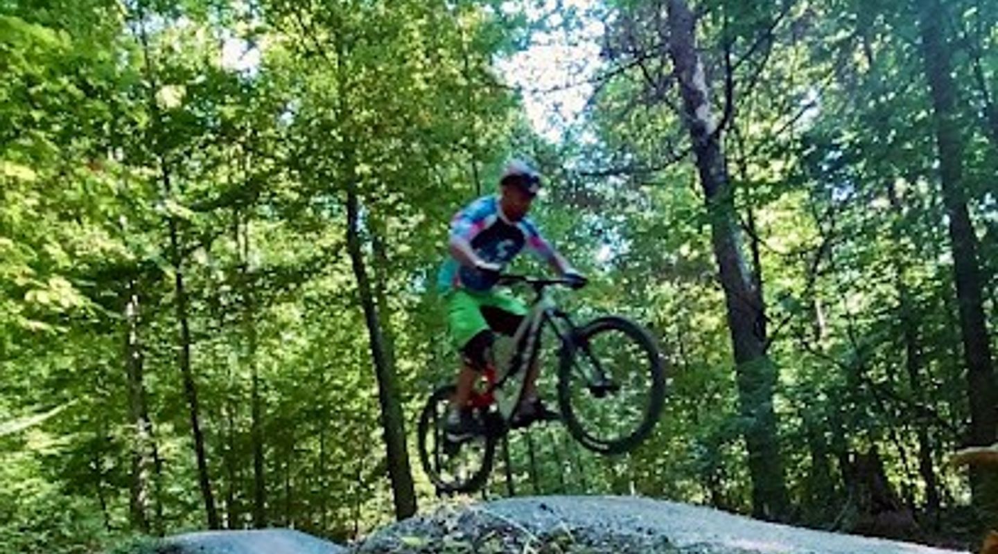
Official Zürich singletrack on Uetliberg’s northern slope, with a technical downhill run through forest and a clay surface that changes fast after rain.
The Triemli Bike Trail, also known as the Antenna Trail, is Zürich’s sanctioned singletrack descent off the northern flank of Uetliberg. It is a narrow, winding forest run with bends, drops and a distinctly local feel. Riders come here for one continuous downhill line rather than a leisurely outing, and the clay-rich surface turns slick after rain.
A brief summary to Bike Trail
- Zürich, 8032, CH
- Click to display
- Duration: 1 to 4 hours
- Budget
-
 Outdoor
- Mobile reception: 4 out of 5
- Monday 12 am-12 pm
- Tuesday 12 am-12 pm
- Wednesday 12 am-12 pm
- Thursday 12 am-12 pm
- Friday 12 am-12 pm
- Saturday 12 am-12 pm
- Sunday 12 am-12 pm

Know before you go
Hi, I'm Eve. Here are a few practical things to know before exploring Bike Trail.
- Ride it in dry weather if possible; the clay surface becomes slippery and harder to control after rain.
- Expect a downhill singletrack, not a sightseeing path; the trail rewards confident handling and steady braking.
- Plan your food, water and toilet stops before you start, as on-trail facilities are limited.
Do you manage this location?
Take control to get all the benefits, like improved information, better appearance, and stronger visibility across AI-powered discovery. Learn more about listing your business on Evendo
Activate your presenceOther nearby places you may find interesting
The closest places of the same kind, if this one is not quite what you had in mind.
Explore Bike Trail on the Map
A handpicked selection of must-see spots near Bike Trail, mapped for you.
Getting There
-
Public Transport
Reach the Uetliberg or Triemli area by train or tram from central Zürich in roughly 20 to 40 minutes, then continue by bike or on foot to the trail start.
-
Bike Approach
If you are already riding in the city, the trail works well as part of a longer uphill approach before a single downhill run.
-
Car
Driving is possible, but parking near access points can be limited; transit is usually simpler for riders without a bike shuttle.
For the on-the-go comforts that matter to you
-
 Seating Areas
-
 Sheltered Areas
-
 Picnic Areas
-
 Trash Bins
-
 Information Boards
Discover more about Bike Trail
What it is
The Triemli Bike Trail is an official mountain bike singletrack on the northern side of Uetliberg, descending toward Triemli on Zürich’s edge. It is also called the Antenna Trail. This is not a sightseeing promenade or a casual park path: it is a purpose-used downhill route for riders who are comfortable with narrow lines, quick turns and changing surface grip. Most visitors ride it as a single run, then either climb back for another lap or continue out of the area.Riding character and setting
The trail cuts through wooded hillside terrain above the city, so the atmosphere is more forest sport than urban leisure. Expect a narrow ribbon of singletrack with frequent bends, a moderate-to-technical feel and a steady downhill rhythm. The surface is clay-rich, which gives the trail a firm, fast character in dry weather but makes it slippery after rain and slow to recover. The broader Uetliberg area can open out to city and lake views, but the trail itself is mostly enclosed by trees, roots and hillside contours.How a visit unfolds
A typical visit starts with transit or a bike approach to the Uetliberg/Triemli area, then a short climb or ride to the trailhead near the antenna zone. Once on the trail, the experience is concentrated and physical: you commit to the descent, stay alert for bends and surface changes, and manage speed rather than scenery. There is little reason to linger on the trail itself unless you are stopping at Hohensteinplatz, where a large grilling and meeting area offers a practical pause point. The outing usually feels short and purposeful, more like a training run or local recreation session than a half-day excursion.Practical expectations
This trail suits confident mountain bikers best. Beginners may find the line narrow and the turns demanding, especially when the ground is wet or leaf-covered. The route is part of Zürich’s managed outdoor recreation network, so signage and trail guidance are part of the experience, along with the usual need to share the wider area with walkers and other users. Food, drink, toilets and staffed services should not be assumed on the trail, so riders should arrive self-sufficient. In dry conditions, it is one of the city’s more direct ways to turn a forested hillside into a fast, technical ride close to the centre of Zürich.












Your all‑in‑one travel companion app
Explore expert travel guides, compare and book tours, experiences, hotels, and more—all from the palm of your hand. Download now for seamless trip planning wherever your wanderlust takes you.


Explore More of Zurich
Looking beyond Bike Trail? Discover Zurich for broader travel guides, local hot-spots, and regional highlights.
Explore Zurich
A large hillside zoo in Zürich with forested paths, conservation-focused habitats, and the immersive Masoala Rainforest under one roof.
A short Zürich hillside walk with educational stops, quiet greenery, and an easy pace above Hirslanden, suited to casual walkers and families.