

Tunisian Sahara Travel Guide - Free Web & App
Your ultimate guide to Tunisian Sahara. Discover top landmarks, proposed trips, and local tips. Free on the web or via the Evendo companion app.


Explore the Tunisian Sahara for vast salt lakes, palm oases, Grand Erg dunes, ksour, desert culture and dramatic southern landscapes.
Desert Landscapes and Oases
The Tunisian Sahara is not a single administrative area but a broad southern region whose landscapes range from immense salt lakes and palm-filled oases to rocky plateaux, sandy dunes and fortified hill villages. Its northern gateway is often associated with Tozeur and Nefta, where date palms grow around spring-fed oasis settlements beside the vast Chott el-Jerid. Further east, Douz provides access to the dunes of the Grand Erg Oriental, while Kebili, Matmata, Tataouine and the settlements of the Dahar represent different aspects of the south's arid geography and cultural history. Distances are substantial, and the experience changes markedly between the salt flats, dune fields, mountain escarpments and coastal-influenced settlements.Read more about Tunisian Sahara
History and Living Culture
Exploring the Region
When is the best time to visit Tunisian Sahara?
Best: December–February · 23–26°C| Month | High (°C) | Rainfall (mm) |
|---|---|---|
| January (best) | 23 | 3 |
| February (best) | 25 | 3 |
| March | 28 | 2 |
| April | 35 | 1 |
| May | 40 | 1 |
| June | 46 | 0 |
| July | 49 | 0 |
| August | 48 | 0 |
| September | 46 | 0 |
| October | 39 | 1 |
| November | 32 | 2 |
| December (best) | 26 | 3 |
Getting to and around Tunisian Sahara
How to get there
Transportation
Best attractions in Tunisian Sahara
The western Sahara centres on the palm oases of Tozeur and Nefta, where shaded paths, traditional brick architecture and cultivated gardens contrast with the open expanse of Chott el-Jerid. Around Douz, the sands of the Grand Erg Oriental provide the setting for guided walks, camel journeys and four-wheel-drive excursions, subject to local conditions and arrangements. Further east, Matmata is known for its courtyard dwellings excavated into the ground, while the Dahar around Tataouine contains a scattered sequence of ksour, mountain villages and dramatic escarpment scenery. Chenini and Douiret are among the most recognisable historic settlements in this area, though access and preservation vary. Film enthusiasts may also recognise locations associated with productions made around Matmata and the desert. The region's appeal lies in the contrast between salt basin, oasis, dune and upland landscapes rather than in a single concentrated attraction.
-
Tourist attraction
Amphitheater of El Jem
Explore the breathtaking Amphitheater of El Jem, a UNESCO World Heritage Site showcasing Roman architectural brilliance in Tunisia.
-
Tourist attraction
Friguia Park
Experience the charm of Friguia Park, a premier zoo in Tunisia featuring captivating animal shows and a commitment to wildlife conservation.
-
Tourist attraction
Djerbahood
Discover the captivating Djerbahood, an open-air museum showcasing vibrant street art and local culture in the heart of Djerba, Tunisia.
-
Tourist attraction
Ribat of Sousse
Explore the Ribat of Sousse, a historical fortress and museum that encapsulates Tunisia's rich heritage and offers stunning views of the Mediterranean.


Best landmarks in Tunisian Sahara
The defining natural landmark of the western Sahara is Chott el-Jerid, a vast salt depression whose pale crust and mirage-like horizons stretch between the oasis region and the interior. The Grand Erg Oriental provides the south's great field of wind-shaped dunes, while the Dahar escarpment forms a contrasting rocky backbone in the east. Tozeur's old quarter is notable for its patterned brick façades, and Nefta's oasis and religious heritage give the town a distinct cultural identity. Around Matmata, excavated courtyard homes demonstrate an unusual adaptation to heat and limited building materials. The ksour of the Tataouine region, including those associated with Chenini, Douiret and surrounding mountain settlements, are important communal granaries and symbols of southern architectural heritage, though their condition and accessibility differ from site to site.
-
Historical landmark
Amphitheater of El Jem
Explore the grandeur of the Amphitheater of El Jem, a UNESCO World Heritage site showcasing ancient Roman architecture and rich history in Tunisia.
-
 Historical landmark
Baths of Antoninus
Experience the grandeur of the Baths of Antoninus, a historical landmark in Carthage that offers a glimpse into the luxurious Roman lifestyle.
-
Zoo
Friguia Park
Explore the wonders of Friguia Park, a delightful zoo in Tunisia with diverse wildlife, interactive exhibits, and family-friendly attractions for all ages.
-
Open air museum
Djerbahood
Explore Djerbahood, Tunisia's vibrant open-air museum, where contemporary art meets local culture in a colorful artistic journey.


Explore Tunisian Sahara on the map
Plan your trip on one map. See where the top attractions, landmarks, restaurants and hotels are, and book hotels and experiences in a few clicks.
Best hotels in Tunisian Sahara
Best restaurants in Tunisian Sahara
Dining in the Tunisian Sahara is concentrated in gateway towns, oasis settlements and accommodation properties rather than spread through remote desert landscapes. Tozeur, Nefta, Douz, Kebili, Matmata and Tataouine provide the broadest choice, with cafés, simple restaurants, hotel dining rooms and family-run establishments serving Tunisian staples such as couscous, brik, stews, grilled meats, salads and bread. Dates are central to oasis agriculture, while olive oil, locally grown produce and regional spices shape everyday cooking. In rural areas, meals may be arranged through guesthouses or excursion providers rather than found spontaneously, and desert camps often serve food as part of an overnight experience. Visitors should carry provisions between settlements and remember that small establishments may operate with limited menus and cash-based payment.
-
Restaurant
Fondouk El Attarine
Experience authentic Tunisian cuisine at Fondouk El Attarine - where tradition meets flavor in the heart of La Medina.
-
Restaurant
El Ali Restaurant & Cafe
Discover the rich flavors of Tunisia at El Ali Restaurant & Cafe - your gateway to authentic Tunisian cuisine in La Medina.
-
Restaurant
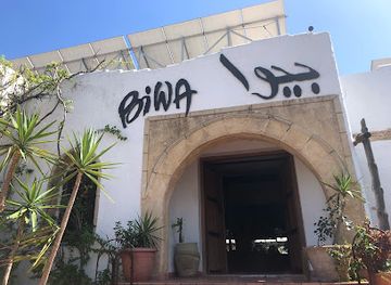
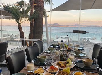
Salon de Thé Restaurant Biwa
Discover authentic Tunisian cuisine at Salon de Thé Restaurant Biwa - where tradition meets modernity in every dish.
-
Turkish
Le Safran
Discover authentic Turkish cuisine at Le Safran in Tunis – where every dish tells a story of rich flavors and warm hospitality.


Best bars in Tunisian Sahara
The Tunisian Sahara is not a nightlife destination in the conventional clubbing sense. Evening life is generally quiet and social, centred on cafés, hotel lounges, family restaurants and traditional gathering places in towns such as Tozeur, Nefta, Douz and Tataouine. Alcohol is available in some licensed hotels and tourist establishments, but it should not be assumed to be offered in local cafés, rural guesthouses or desert camps. After dark, the desert itself becomes the principal setting: organised camps may provide a meal, conversation and an opportunity to observe the stars, while oasis towns offer an unhurried evening atmosphere. Seasonal cultural programmes and local festivals can add music or performances, but dates and availability vary and should be checked locally.
-
Bar
Le Carpe Diem - Tunis
Discover the lively atmosphere and exquisite tapas at Le Carpe Diem, La Marsa's premier destination for cocktails and live music.
-
Gastropub
The Factory La soukra
Discover gastronomic excellence at The Factory La Soukra, where local flavors meet international cuisine in a vibrant gastropub setting.
-
Restaurant
Le Comptoir De Tunis
Discover the essence of Tunisian cuisine at Le Comptoir De Tunis, where every dish tells a story of tradition and flavor.
-
Lounge
Sahara Lounge
Discover the tranquil oasis of Sahara Lounge in Tozeur, where relaxation meets the rich culture of Tunisian tea traditions.


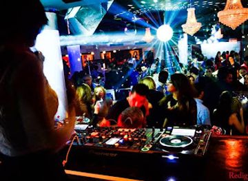
Best nightclubs in Tunisian Sahara
The Tunisian Sahara is not a nightlife destination in the conventional clubbing sense. Evening life is generally quiet and social, centred on cafés, hotel lounges, family restaurants and traditional gathering places in towns such as Tozeur, Nefta, Douz and Tataouine. Alcohol is available in some licensed hotels and tourist establishments, but it should not be assumed to be offered in local cafés, rural guesthouses or desert camps. After dark, the desert itself becomes the principal setting: organised camps may provide a meal, conversation and an opportunity to observe the stars, while oasis towns offer an unhurried evening atmosphere. Seasonal cultural programmes and local festivals can add music or performances, but dates and availability vary and should be checked locally.
-
Bar
Le Carpe Diem - Tunis
Discover the lively ambiance of Le Carpe Diem in Tunis, a cocktail bar and restaurant offering exquisite tapas and live music in a vibrant setting.
-
Pub
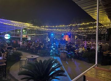
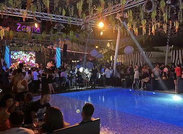
Zebra Club
Experience the vibrant nightlife at Zebra Club in Gammarth, where music, dance, and socializing come together for an unforgettable evening.
-
Disco club
El Pacha Club
Experience the electrifying nightlife of El Pacha Club in Hammamet Sud, where vibrant music and delicious cuisine create unforgettable nights.
-
Night club
REDIGUANA Night Club
Discover the pulsating nightlife of Hammam Sousse at REDIGUANA Night Club, where music, dance, and excitement come alive.

Best shops in Tunisian Sahara
Shopping opportunities are modest outside the main gateway towns, but the region offers products closely connected with oasis life and southern craft traditions. Tozeur and Nefta are places to look for dates, date-based products, woven goods, pottery and locally produced food items, while Douz has a long association with desert travel and the craft economy of the south. Tataouine and the Dahar settlements offer access to regional foods, textiles and handmade items, although retail choice is limited in smaller villages. Markets and souks are useful for everyday goods as well as souvenirs, but product quality and provenance vary. In remote areas, carry essentials from a larger town and do not expect permanent shops near salt flats, dune routes, isolated ksour or desert camps.
-
Shopping mall
Tunisia Mall
Explore Tunisia Mall in Tunis for an unforgettable shopping and dining experience amidst vibrant local culture.
-
Shopping mall
Mall of Sousse
Explore the Mall of Sousse, a premier shopping destination in Tunisia featuring a variety of stores, dining options, and entertainment for all ages.
-
Hypermarket
Géant
Discover Géant, the premier hypermarket and shopping mall in Tunis City, where shopping, dining, and entertainment come together in a vibrant atmosphere.
-
Shopping mall
AZUR CITY
Discover AZUR CITY, Tunisia's premier shopping mall, where retail therapy meets culinary delights in a vibrant atmosphere.


Get your free copy of our complete guide to Tunisian Sahara, delivered straight to you.
Everything on this page, from attractions and restaurants to essentials and local phrases, in one PDF you can read offline, print or share.
Already have an account? Sign in
Your Tunisian Sahara guide is ready.
We'll send it to · Not you? Sign out

Getting your guide ready…
We are putting together a fresh copy of the Tunisian Sahara guide. This can take up to a minute.
This can take a few moments. If your browser asks, choose Allow so the download can start. You'll find the guide in your Downloads folder.
Nothing happened? Download it again
Sorry, the guide is taking longer than usual. Please try again in a minute, or get it by email instead.
Tunisian Sahara essentials
Currency and Payment
Safety
Emergency Situations
Do's and Don'ts
Local Tips
From Eve
Local phrases worth knowing
You don't need to get them perfect. A few words go a long way, and locals appreciate the effort.
Basics
| English | Local | Say it |
|---|---|---|
| Hello | سلام | [Salam] |
| Goodbye | وداعا | [Wada'an] |
| Yes | نعم | [Naam] |
| No | لا | [La] |
| Please/You're welcome | من فضلك | [Min fadlik] |
| Thank you | شكرا | [Shukran] |
| Excuse me/Sorry | عذرا | [A'dhra] |
| How are you? | كيف حالك؟ | [Kif halak?] |
| Fine. And you? | بخير. وأنت؟ | [Bikhayr. Wa ant?] |
| Do you speak English? | هل تتحدث الإنجليزية؟ | [Hal tatahadath al-inglizia?] |
| I don't understand | لا أفهم | [La afham] |
Eating & Drinking
| English | Local | Say it |
|---|---|---|
| I'd like to see the menu, please | أريد رؤية القائمة، من فضلك | [Aridu ru'ya al-qaimah, min fadlik] |
| I don't eat meat | أنا لا أتناول اللحم | [Ana la atnawal al-lahm] |
| Cheers! | في صحتك! | [Fi sahtak!] |
| I would like to pay, please | أريد أن أدفع، من فضلك | [Aridu an adfa', min fadlik] |
Emergencies
| English | Local | Say it |
|---|---|---|
| Help! | النجدة! | [Al-najdah!] |
| Go away! | انصرف! | [Insarif!] |
| Call the Police! | اتصل بالشرطة! | [Itasal bil-shurta!] |
| Call a doctor! | اتصل بالطبيب! | [Itasal bil-tabib!] |
| I'm lost | ضاعت طريقي | [Da'at tariqi] |
| I'm ill | أنا مريض | [Ana mariid] |
Shopping
| English | Local | Say it |
|---|---|---|
| I'd like to buy... | أريد أن أشتري... | [Aridu an ashtari...] |
| I'm just looking | أنا فقط أتفرج | [Ana faqat atfarij] |
| How much is it? | كم سعره؟ | [Kam si'ruh?] |
| That's too expensive | هذا غالي جدا | [Hatha ghalin jiddan] |
| Can you lower the price? | هل يمكنك خفض السعر؟ | [Hal yumkinuka khafd al-si'ur?] |
Time & Numbers
| English | Local | Say it |
|---|---|---|
| What time is it? | كم الساعة؟ | [Kam al-sa'ah?] |
| It's one o'clock | الساعة الواحدة | [Al-sa'ah al-wahidah] |
| Half past (10) | العاشرة والنصف | [Al-'ashirah wa al-nisf] |
| Morning | الصباح | [Al-sabah] |
| Afternoon | الظهر | [Al-dhuhur] |
| Evening | المساء | [Al-masa'] |
| Yesterday | البارحة | [Al-barihah] |
| Today | اليوم | [Al-yawm] |
| Tomorrow | غدا | [Ghadan] |
| 1 | واحد | [Wahid] |
| 2 | اثنين | [Ithnayn] |
| 3 | ثلاثة | [Thalatha] |
| 4 | أربعة | [Arba'ah] |
| 5 | خمسة | [Khamsah] |
| 6 | ستة | [Sittah] |
| 7 | سبعة | [Sab'ah] |
| 8 | ثمانية | [Thamaniah] |
| 9 | تسعة | [Tis'ah] |
| 10 | عشرة | [Asharah] |
Transport & Directions
| English | Local | Say it |
|---|---|---|
| Where's a/the...? | أين... | [Ayna...] |
| What's the address? | ما هو العنوان؟ | [Ma huwa al-anaan?] |
| Can you show me (on the map)? | هل يمكنك أن تريني (على الخريطة)؟ | [Hal yumkinuka an tarini (ala al-kharitah)?] |
| When's the next (bus)? | متى القادم (الحافلة)؟ | [Mata al-qadim (al-hafilah)?] |
| A ticket (to ....) | تذكرة (إلى ...) | [Tazkirah (ila ...)] |
History of Tunisian Sahara
Desert Formation and Ancient Water Landscapes
The landscapes of the Tunisian Sahara were shaped over geological timescales by sedimentation, erosion, changing drainage patterns and the retreat of ancient inland waters. The Chott el-Jerid and neighbouring salt depressions are among the clearest expressions of this arid environment: broad basins where evaporation leaves mineral crusts and seasonal water can gather after rain. To the south and east, wind has worked loose sediment into dune fields, while the Dahar is defined by resistant uplands, escarpments and deeply cut valleys. These physical contrasts explain the region's distinctive settlement pattern, with communities historically concentrated around dependable water sources, cultivated depressions and routes across otherwise difficult terrain.
Early Communities and Trans-Saharan Routes
Human occupation of southern Tunisia extends deep into prehistory, although the surviving archaeological record varies considerably from place to place. By antiquity, the region formed part of a wider network linking the Mediterranean coast with Saharan routes and communities farther south. Water points and oasis agriculture supported settled life, while movement through the desert depended on knowledge of wells, seasonal conditions and established tracks. Roman influence was strongest in the more accessible northern and central margins, where frontier management and communications connected the southern approaches with the provinces of North Africa. The Sahara was never an empty barrier: it was a zone of exchange, pastoral movement, farming and cultural contact.
Oasis Towns and Islamic Heritage
After the spread of Islam across North Africa, oasis settlements and caravan centres developed within new political, religious and commercial networks. Tozeur and Nefta became important centres of scholarship, trade and religious life, while date cultivation provided both food and an economic foundation. Their traditional quarters are recognised for patterned brickwork and shaded streets adapted to intense sunlight. In the mountain country farther east, fortified ksour served as communal storage and defensive structures, preserving grain and other goods in a region where farming was constrained by water and terrain. These buildings reflect practical responses to the environment as much as they express local architectural traditions.
Mountain Villages and Troglodyte Architecture
The Dahar and Matmata areas preserve a distinctive built heritage associated with Amazigh-speaking communities and long-established mountain settlement. At Matmata, homes were excavated downwards from the surface to create central courtyards surrounded by chambers, providing shade and shelter from temperature extremes. Around Tataouine, hilltop and valley ksour were used for the communal storage of harvests, particularly cereals, and some were linked to seasonal movement between cultivated land and upland pasture. The forms and histories of individual sites differ, and not every ruin carries a single definitive interpretation, but together they reveal how architecture, agriculture, security and social organisation were adapted to the southern environment.
Colonial Rule and Modern Transport
French colonial rule altered administration, transport and economic connections across southern Tunisia, bringing the region more firmly into systems centred on coastal ports and government towns. Older caravan routes did not disappear immediately, but roads and modern communications gradually changed the movement of people and goods. After Tunisian independence in 1956, state investment, improved roads and expanding public services connected oasis and desert communities more closely with the national economy. Tourism later gave Tozeur, Douz, Matmata and Tataouine new prominence, while agriculture, seasonal work and regional trade remained important to local livelihoods.
Tourism, Film and Conservation
Desert tourism expanded during the late twentieth century through oasis visits, dune excursions, cultural itineraries and overnight stays in desert settings. The south also became internationally recognisable through films and television productions, especially around Matmata and the sandy landscapes used for fictional desert worlds. Tourism has provided income and visibility but operates within an environmentally fragile region where groundwater, vegetation, waste and vehicle movement require care. Protected landscapes, including Jebil National Park in the Grand Erg Oriental, reflect efforts to conserve desert ecosystems and wildlife. Contemporary travel therefore takes place alongside continuing questions about water management, conservation, local livelihoods and responsible access.
Tunisian Sahara in Photos
Browse through our photo collection highlighting the charm and character of the destination.
Cities in Tunisian Sahara
The towns and cities of Tunisian Sahara, and the easiest places to base yourself.
-

-
-

-

-
-


Swipe for more cities
Neighbouring destination travel guides
The closest destinations to Tunisian Sahara, if you have time for more than one.
-

-

-

-

-


Swipe for more destinations
Explore more
Explore more of The Gulf of Gabes
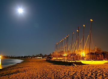
Explore Tunisia’s Gulf of Gabes for tidal wetlands, Djerba’s heritage, Kerkennah fishing villages, oasis landscapes, seafood and Mediterranean history.
Explore The Gulf of Gabes
Explore more of Tunisia
Discover Tunisia: A captivating blend of ancient history, stunning Mediterranean beaches, and vibrant cultures. Explore the wonders of Carthage, the beauty of Sousse, and the allure of the Sahara.
Explore Tunisia