Dinas Rock, Waterfall Country
A dramatic limestone cliff in Waterfall Country, where ancient hillforts, roaring gorges and cascading waterfalls meet in the heart of the Bannau Brycheiniog National Park.
Dinas Rock is a dramatic limestone promontory in the heart of Waterfall Country, within the Bannau Brycheiniog National Park near Pontneddfechan. Rising between the rivers Mellte and Sychryd, this striking cliff offers a mix of natural beauty, ancient history, and outdoor adventure. Walkers can follow well-marked trails to cascades and waterfalls, including the famous Sgwd yr Eira, while climbers and gorge walkers are drawn to its rugged faces and gorges. The site is managed for both conservation and recreation, making it a key destination in the Neath Valley.
A brief summary to Dinas Rock
- Coed-Y-Rhaidyr, Neath, Pontneddfechan, SA11 5NU, GB
- Duration: 1 to 4 hours
- Free
-
 Outdoor
- Mobile reception: 3 out of 5
- Monday 12 am-12 am
- Tuesday 12 am-12 am
- Wednesday 12 am-12 am
- Thursday 12 am-12 am
- Friday 12 am-12 am
- Saturday 12 am-12 am
- Sunday 12 am-12 am
Local tips
- Visit early in the day to avoid crowds and secure a parking spot, especially on weekends and in dry weather when gorge walking is popular.
- Wear sturdy footwear and waterproof clothing; paths can be slippery and muddy, and gorge walking requires appropriate gear and guidance.
- Follow all safety signs and stay on marked paths, particularly near cliff edges and fast-flowing rivers, to ensure a safe visit.
- Bring a map or use an offline navigation app; the postcode covers a wide area and may not lead directly to the car park entrance.
- Respect the environment by taking all litter home and avoiding disturbance to wildlife, especially in the designated conservation woodlands.
For the on-the-go comforts that matter to you
- Restrooms
- Drinking Water
- Food Options
- Seating Areas
- Picnic Areas
- Trash Bins
- Information Boards
Getting There
-
By car
From Neath, take the A465 northeast towards Merthyr Tydfil, then leave at the exit for Glynneath and the A4109. Follow signs for the B4242 and Pontneddfechan, then brown and white signs for Dinas Rock through the village. After the former Dinas Inn, take the right fork and continue about one kilometre; the car park is just beyond a narrow bridge over the river. The postcode SA11 5NU covers a wide area, so using an OS grid reference or map app is recommended for accurate navigation.
-
By public transport
The nearest mainline station is in Aberdare; from there, take a local bus or taxi to Pontneddfechan and then walk to the Dinas Rock car park. Journey times vary depending on connections, but allow at least 1–1.5 hours from Aberdare. Services are less frequent on evenings and weekends, so check timetables in advance.
-
On foot
From the centre of Neath, it is possible to walk to Dinas Rock along the A465 and local roads, but this is a long route of around 13 miles (21 km) with significant elevation gain and busy sections. A more practical walking option is to start from Pontneddfechan village and follow the waymarked trails up to the rock and waterfalls, which takes about 30–60 minutes depending on fitness and route.
-
By bike
Cyclists can reach Dinas Rock via the A465 and B4242, but the final approach involves a narrow bridge and steep, winding lanes. Mountain bikes are better suited for the rougher forest tracks and trails around the area. Secure bike parking is available near the car park, but facilities are basic.
Dinas Rock location weather suitability
-
 Any Weather
-
 Rain / Wet Weather
-
 Clear Skies
-
 Mild Temperatures
Discover more about Dinas Rock
Where rock and river meet
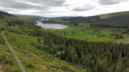
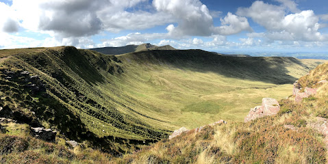
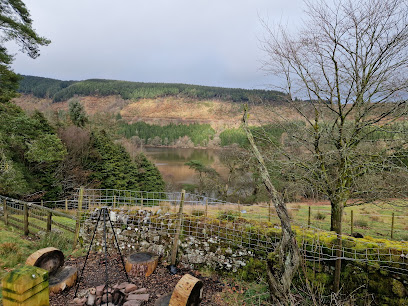
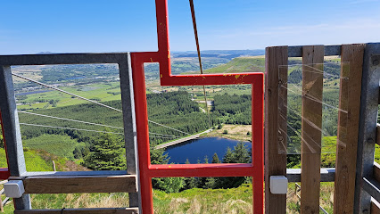
Dinas Rock, known in Welsh as Craig y Ddinas or 'Fortress Rock', is a high limestone promontory carved by the rivers Mellte and Sychryd in the upper Neath Valley. This imposing cliff rises dramatically between deep, tree-lined gorges, forming a dramatic natural gateway into the heart of Waterfall Country. The rock itself is part of the Neath Disturbance, a major geological fault line that has shaped the landscape over millions of years, creating steep cliffs, hidden caves, and a network of waterfalls that tumble through the woodland. The area lies within the Bannau Brycheiniog National Park and the Fforest Fawr Geopark, recognised for its outstanding natural beauty and ecological importance.Trails, waterfalls and woodland walks
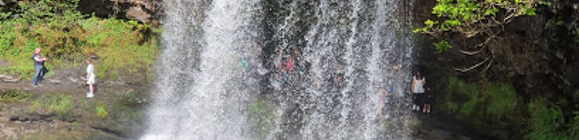
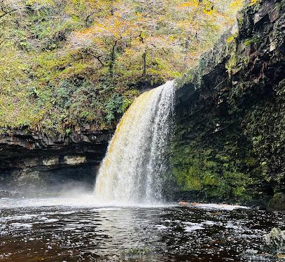
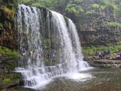
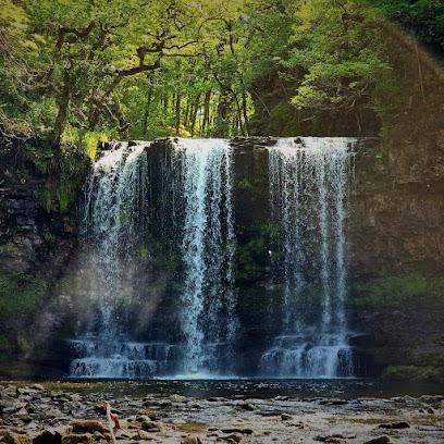
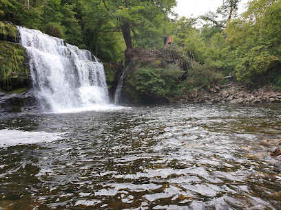
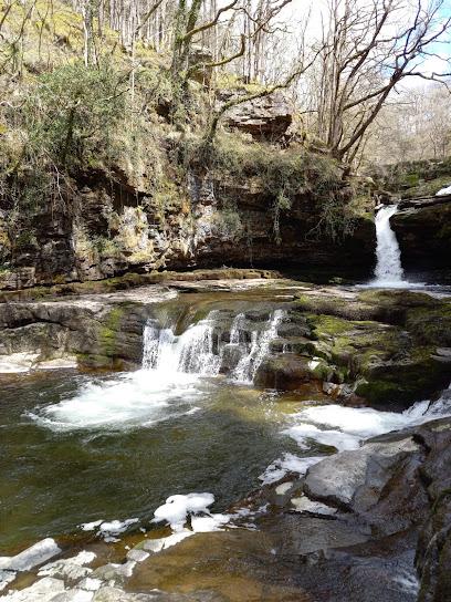
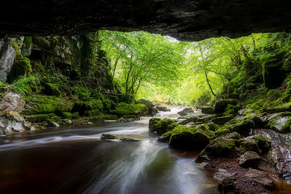
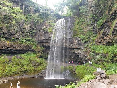
From the car park at Coed-y-Rhaidyr, a short accessible trail leads to cascades on the Afon Mellte, making it a great introduction for families and casual walkers. A more substantial waymarked path heads to Sgwd yr Eira, the famous 'fall of snow' waterfall where you can walk behind the curtain of water. The trail passes the remains of Dinas Rock hillfort and the old gunpowder works, linking natural beauty with human history. For longer adventures, the Four Falls Trail connects Dinas Rock with several other spectacular waterfalls, winding through ancient oak and ash woodlands that are part of a Special Area of Conservation. These paths offer everything from a gentle hour’s stroll to a full day’s exploration through some of Wales’ most dramatic gorge scenery.Climbing, caving and gorge walking
Dinas Rock is a magnet for outdoor enthusiasts. Its steep, overhanging southern faces are a popular sports climbing venue, often described as one of the best inland cliffs in South Wales, with around 75 routes across a range of grades. At the western end, easier routes in the former quarry attract clubs and beginners. The river beds and rocky sides of the Mellte and Sychryd are among Wales’ most popular spots for gorge walking, where adventurers scramble, slide and swim through the gorges. Nearby caves, including Ogof Pont Sychryd and Will’s Hole (also known as Arthur’s Cave), add a caving dimension, with some linked to Arthurian legends of sleeping knights waiting to defend Britain.Conservation and quiet beauty
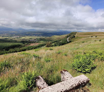
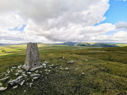
The deep gorges around Dinas Rock are designated as part of the Coedydd Nedd a Mellte Special Area of Conservation, protecting rich bryophyte communities and ancient woodland. Natural Resources Wales manages the site to balance recreation with conservation, working with adventure providers to minimise impact on this sensitive environment. The woodland is thick with moss, ferns and lichens, and the sound of rushing water is a constant companion. Even on busy days, a short walk from the car park brings a sense of seclusion and immersion in nature, with the rock itself standing as a silent witness to millennia of geological and human history.Practical access and local context
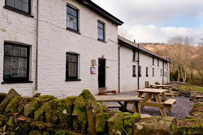
The main access is via a car park at Coed-y-Rhaidyr, reached by road from Neath or Glynneath. The postcode SA11 5NU covers a wide area, so using an OS grid reference or a map app is recommended for accurate navigation. There are picnic tables near the car park, and basic facilities are available in the nearby village of Pontneddfechan. Public transport options are limited; the nearest mainline station is in Aberdare, with onward connections by bus or taxi. The area is popular with outdoor groups, so the car park can fill up, especially on weekends and in good weather, making an early start advisable for a more peaceful experience.Iconic landmarks you can’t miss
YHA Brecon Beacons
15.8 km
Rustic farmhouse hostel offering clean, cozy accommodation and a warm communal atmosphere in the heart of Brecon Beacons National Park.
Fan y Bîg
17.7 km
Discover the breathtaking beauty of Fan y Bêg in Brecon Beacons National Park, where stunning hikes await in the heart of nature.
Gwaun Cerrig Llwydion
17.9 km
Discover the breathtaking beauty of Gwaun Cerrig Llwydion, a hiker's paradise in Merthyr Tydfil, where nature and tranquility converge.
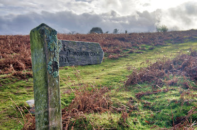
Mountain Centre
19.4 km
Discover the breathtaking beauty and outdoor adventures waiting for you at the Mountain Centre in the stunning Brecon Beacons National Park.
Cefn Llechid
19.8 km
Explore Cefn Llechid in Brecon Beacons National Park for breathtaking views, outdoor adventures, and a rich tapestry of history.
Tours of Wales
20.2 km
Discover Wales’ rich history and stunning landscapes on small-group, expertly guided day tours with Tours of Wales.
Y Bwlwarcau
20.7 km
Explore Y Bwlwarcau, a serene Iron Age hillfort nestled on Mynydd Margam’s slopes, revealing ancient Welsh heritage amidst tranquil countryside.

Castell Du
20.8 km
Discover the enchanting ruins of Castell Du in Brecon, Wales, where history meets breathtaking natural beauty amid the serene landscapes of the Brecon Beacons.
A Welsh Coal Mining Experience
21.2 km
Explore the rich history of Welsh coal mining at Rhondda Heritage Park, a captivating local history museum with engaging exhibits and a charming café.
Parc Bryn Bach
21.4 km
Experience the natural beauty and recreational fun of Parc Bryn Bach in Tredegar, a perfect destination for outdoor enthusiasts and families.
Dramatic Heart of Wales
22.9 km
Discover the breathtaking landscapes and vibrant culture of the Dramatic Heart of Wales, a must-visit destination for every traveler.
Cantref - Adventure Farm in South Wales
22.9 km
Experience family fun at Cantref Adventure Farm in South Wales, where children can connect with animals and enjoy exciting outdoor activities.
Bedwellty House and Park
23.0 km
Experience the tranquility and charm of Bedwellty House and Park, a historic gem in Tredegar offering beautiful gardens and serene landscapes.
Theatr Brycheiniog
24.3 km
Experience the vibrant performing arts scene at Theatr Brycheiniog in Brecon, where culture meets scenic beauty along the canal.
Brecon Canal Basin
24.3 km
Breathe in the beauty of Brecon Canal Basin, a serene escape in Wales perfect for leisurely walks, local cuisine, and outdoor adventures amidst stunning landscapes.
Unmissable attractions to see
Waterfall Country
1.2 km
Discover the enchanting cluster of waterfalls and ancient woodlands in Wales’ Brecon Beacons National Park, where rivers carve dramatic gorges.
Sgwd Gwladys
1.2 km
Discover the enchanting 7-meter cascade of Sgwd Gwladys, a legendary waterfall nestled in South Wales’ scenic Waterfall Country.
Sgwd Gwladys Waterfall
2.1 km
Discover the serene beauty of Sgwd Gwladys, a graceful 7-meter waterfall nestled in Wales’ scenic Waterfall Country.
Sgwd y Pannwr
2.6 km
Discover the serene tiered cascade of Sgwd y Pannwr, a scenic highlight of the Four Waterfalls Walk in Wales’ Brecon Beacons National Park.
Sgwd Yr Eira Waterfall
2.6 km
Walk behind the stunning 50-foot curtain of water at Sgwd yr Eira, the enchanting Waterfall of Snow in Wales’ Brecon Beacons.
Sgwd Isaf Clun-Gwyn
2.9 km
Discover the serene multi-tiered cascades of Sgwd Isaf Clun-Gwyn, a tranquil jewel on the Four Waterfalls Walk in Wales’ Brecon Beacons.
Sgwd Clun-Gwyn Waterfall
3.3 km
Discover the cascading beauty of Sgwd Clun-Gwyn, a serene multi-step waterfall nestled in the lush woodlands of South Wales’ Brecon Beacons.
Four Waterfalls Walk
3.5 km
Discover the enchanting Four Waterfalls Walk, a scenic 9 km trail through ancient woodland and cascading falls in Wales’ Brecon Beacons National Park.
Zip World Tower
3.9 km
Experience the world’s fastest seated zip line and Europe’s unique coaster track on the historic Tower Colliery site in scenic South Wales.
Penderyn Brecon Beacons Distillery - Visitor Centre and Shop
3.9 km
Discover the home of Welsh whisky in the Brecon Beacons – tour the original Penderyn Distillery, see the Faraday still, and taste award-winning single malts.

Zip World Top
4.7 km
Experience breathtaking zip-lining thrills and stunning Welsh countryside views at Zip World Top, Port Talbot’s ultimate adventure destination.
Porth yr Ogof
4.8 km
Explore Wales’ largest cave entrance, a thrilling limestone labyrinth carved by the Afon Mellte in the heart of Brecon Beacons National Park.
Henrhyd Falls
7.1 km
Discover South Wales’ tallest waterfall with a thrilling walk behind the cascading curtain at Henrhyd Falls in the Brecon Beacons.
Cadair Fawr
7.9 km
Accessible mountain views across South Wales' rolling landscape, perfect for all abilities.
Wales Ape & Monkey Sanctuary
8.8 km
A compassionate refuge in Swansea Valley offering rescued primates a peaceful home and visitors a unique, heartfelt wildlife experience.

Essential places to dine
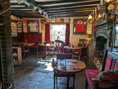
The Red Lion Inn, Penderyn
3.3 km
A cozy Welsh gastropub blending traditional charm, local flavors, and legendary roasts in the scenic village of Penderyn.
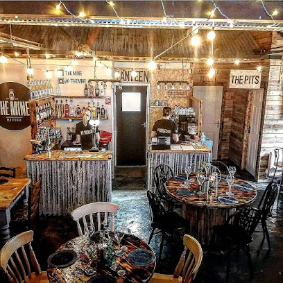
Carnivore By The Mine
5.1 km
A cozy meat-lover’s haven in Neath, blending hearty dishes with heartfelt mining heritage and warm local charm.
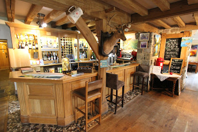
Penycae Inn Ltd
8.9 km
Cozy gastropub in the heart of South Wales offering fine Welsh cuisine, scenic mountain views, and a unique family-friendly atmosphere.
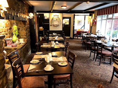
Abercrave Inn
10.0 km
A rustic Welsh country inn offering hearty home-cooked meals, cozy charm, and a peaceful rural retreat in Abercraf.
Mango House Restaurant
11.9 km
Experience authentic Indian cuisine with warm hospitality in the heart of Merthyr Tydfil’s Cefn-coed-y-cymmer.
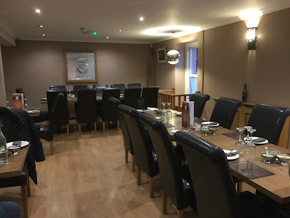
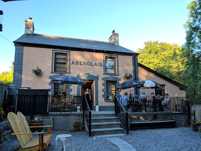
Aberglais Inn
13.2 km
Cozy pub and restaurant in Merthyr Tydfil offering hearty British classics, vegan and gluten-free options, with a warm, friendly atmosphere.
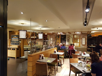
Rhydycar Harvester
13.9 km
Casual family dining with classic British flavors and welcoming amenities in Merthyr Tydfil’s Rhydycar Leisure Park.
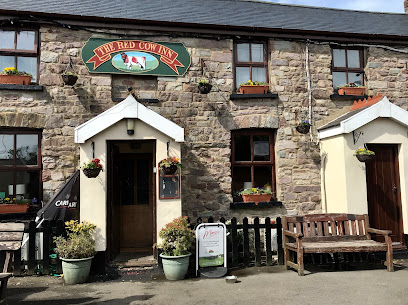
Red Cow Inn
14.9 km
A charming traditional Welsh pub in Pontsticill offering hearty home-cooked meals, award-winning ales, and a warm, welcoming atmosphere.
The Pantyscallog Inn
15.3 km
A beloved steakhouse in Pant, Merthyr Tydfil, known for hearty portions, friendly service, and a warm, welcoming atmosphere.
Pentrebach House Table Table
15.4 km
Classic British pub dining with family-friendly charm and hearty meals in the heart of Merthyr Tydfil.
The Colliers Arms
17.7 km
Discover the charm of The Colliers Arms – where delicious food meets friendly faces in Port Talbot's welcoming atmosphere.
T Bones
18.4 km
Rustic British dining with hearty portions and warm service at a charming farm location in Pontrhydyfen, Port Talbot.
The Welsh House
19.0 km
Experience authentic Welsh flavors and warm hospitality in a cozy Neath setting with a charming beer garden and locally sourced dishes.
The Coach House
19.6 km
Historic charm and scenic gardens combine at The Coach House, Neath’s premier wedding venue and steakhouse restaurant.

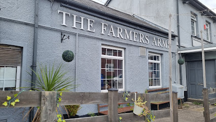
The Farmers Arms
19.7 km
Historic farmhouse pub in Rhymney offering scratch-cooked Welsh cuisine, a full bar, and a warm, welcoming atmosphere for all occasions.
Markets, malls and hidden boutiques
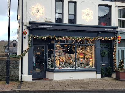
Kindle House
12.7 km
Whimsical Victorian boutique where curated rooms and creative collections inspire joy and discovery.
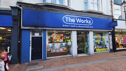
The Works
19.0 km
Explore The Works in Neath for a unique shopping experience filled with books, art supplies, and delightful gifts for all ages.
Zoar's Ark Pet Superstore
19.1 km
Family-run since 1949, Zoar's Ark Pet Superstore offers expert pet care, equestrian supplies, and country living essentials in a welcoming Neath setting.
Welcome Stores - Skewen
21.3 km
Discover Skewen’s friendly local supermarket offering fresh essentials, Welsh treats, and a welcoming community atmosphere.
C & C Stores
21.4 km
A welcoming family-run supermarket in Skewen offering fresh local products and everyday essentials with friendly service.
Skewen Local Store
21.5 km
Experience local shopping at Skewen Local Store, where fresh produce meets friendly service, perfect for all your grocery needs during your visit.
S & S Stores Skewen
21.8 km
A welcoming local supermarket in Skewen offering groceries, confectionery, and soft drinks with friendly service and convenient hours.
The Aloe Shop
22.6 km
Natural wellness products and organic beauty essentials in Swansea's Birchgrove neighborhood.
Premier
22.7 km
Discover convenience and quality at Premier Convenience Store in Birchgrove, Swansea, offering an array of essentials for every traveler.

Birchgrove Supermarket & Birchgrove Post office
22.7 km
Experience the charm of Birchgrove Supermarket & Post Office, your local stop for groceries and community vibes in Swansea.
West View Stores
22.7 km
Experience the warmth of Trelewis at West View Stores - your local supermarket for fresh produce and unique Welsh delicacies.
Birchgrove Convenience Store
22.7 km
Discover the local charm and convenience at Birchgrove Convenience Store, your one-stop shop in Swansea for all essentials and delights.
Izzy Roo's
22.9 km
Explore Izzy Roo's in Tredegar for unique gifts and local crafts, capturing the essence of the region's charm and creativity.
SPAR - Park Avenue
22.9 km
Discover convenience at SPAR - Park Avenue, your essential stop for snacks, local products, and travel supplies in Port Talbot.

CK's Supermarket
22.9 km
A friendly, well-stocked local supermarket in Birchgrove, Swansea, open long hours for your everyday grocery needs.

Essential bars & hidden hideouts
The Dyffryn Arms
18.4 km
A classic Welsh pub in Neath offering hearty meals, warm hospitality, and a welcoming atmosphere for locals and visitors alike.
Pontardawe Inn
19.2 km
Lively, dog-friendly pub in Pontardawe offering hearty food, real ales, live music, and a warm Welsh welcome in a cozy setting.
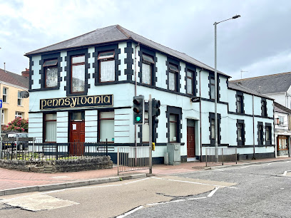
The Pennsylvania
19.6 km
A welcoming traditional pub on Briton Ferry Road, The Pennsylvania offers a classic Welsh community gathering spot with a friendly and relaxed atmosphere.
The Tyn
22.1 km
A charming Baglan pub blending Welsh hospitality, local ales, and lively events in a cozy setting with a popular beer garden.
The Globe Inn
22.1 km
A welcoming village pub and restaurant in Glais, Swansea, serving classic dishes with a friendly atmosphere and affordable prices.
The Bridgend Inn
22.7 km
A traditional Swansea pub offering hearty fare, friendly vibes, and a lively social scene in Birchgrove.
Village Tavern
22.8 km
A friendly and affordable local pub in Clydach, Swansea, offering classic British pub charm with good music and a welcoming atmosphere.
Bowens Arms
23.0 km
A friendly and affordable pub in Birchgrove offering hearty meals, quality ales, and a welcoming local atmosphere in Swansea.
The Overdraft
23.0 km
A boutique cocktail bar in Clydach blending heritage charm with expertly crafted drinks and a warm, welcoming vibe.
Drovers Arms
23.8 km
A welcoming Welsh village pub blending historic charm with hearty fare and friendly hospitality in the heart of Llanfaes, Brecon.
The Three Horseshoes Inn
24.1 km
A cosy Welsh village pub blending traditional charm with refined British cuisine and a warm, welcoming atmosphere.
The Millers Arms
24.1 km
A cozy, dog-friendly pub in Ynystawe offering hearty homemade meals and a warm community atmosphere just outside Swansea.
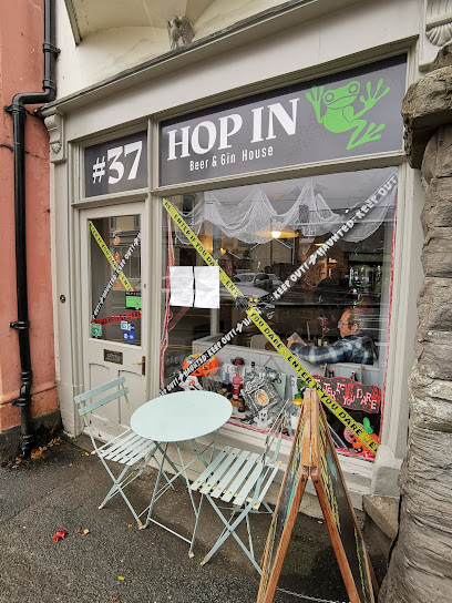
hop in beer and gin
24.4 km
Discover Brecon’s quirky bar with top-quality craft beers, artisanal gins, and delicious tapas in a cozy, historic setting.
The Rorkes Drift
24.5 km
Historic Welsh pub in Brecon offering local ales, lively music, and a warm atmosphere inspired by the legendary Rorke’s Drift battle.
The Sarah Siddons
24.5 km
Experience authentic Welsh hospitality with local ales and lively atmosphere at The Sarah Siddons, Brecon’s beloved town centre pub.
Nightclubs & after hour spots
The Kirkhouse Nightclub (Koolers)
13.4 km
Experience the vibrant and friendly nightlife of Merthyr Tydfil at The Kirkhouse Nightclub, known locally as Koolers.

Pure Bar & Nightclub Ltd
13.8 km
A lively nightclub and cocktail bar in Merthyr Tydfil offering vibrant music, crafted drinks, and late-night entertainment in South Wales.

The Top Club
14.8 km
Experience Blaengarw’s vibrant nightlife at The Top Club, where electrifying entertainment meets community spirit in the heart of South Wales.

The Arch Bar & Nightclub
19.2 km
A lively Neath hotspot blending nightclub energy, live music, pub charm, and Thai cuisine in one vibrant venue.
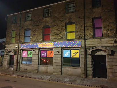
Squares Night club
20.1 km
Experience Porth’s vibrant nightlife at Squares Nightclub, where music, dance, and unforgettable evenings come alive every weekend.
Jimmy's Bar
23.2 km
Experience the vibrant nightlife and live music scene at Jimmy's Bar, Port Talbot’s lively local hotspot with a welcoming atmosphere.
Northcote Conservative Club
24.4 km
Discover the lively ambiance of Northcote Conservative Club, Brecon's premier destination for nightlife, music, and local culture.
Brecon Working Mens Club
24.5 km
Experience authentic Welsh hospitality at Brecon Working Mens Club, where locals gather for drinks and camaraderie in a charming setting.
Brecon Jazz Club (Muse Arts Centre)
24.5 km
Discover the heart of jazz in Brecon at the Brecon Jazz Club, where live music and a vibrant atmosphere collide for an unforgettable night.
BRECON JAZZ
24.5 km
Experience the soulful sounds of Brecon Jazz, an intimate venue celebrating the rich heritage of jazz music in the heart of Wales.
Eclipse Nightclub
25.7 km
Experience Pontypridd’s vibrant midweek nightlife at Eclipse Nightclub, where music, dancing, and community come alive every Wednesday night.

Popworld - Swansea
29.5 km
Experience Swansea’s energetic retro nightclub with affordable cocktails, themed events, and a lively dance floor in the heart of the city.

PlanB
29.8 km
Swansea’s energetic two-floor nightclub with a focus on dance music, lively DJs, and great drink deals for a night to remember.

Cuba Escape
29.8 km
Experience Swansea’s vibrant nightlife at Cuba Escape, where live music, energetic crowds, and a colorful atmosphere come together for unforgettable nights.

Sin City
30.1 km
Energetic Swansea nightclub with live music, affordable drinks, and a lively atmosphere on Dillwyn Street.

For the vibe & atmosphere seeker
- Adventurous
- Relaxing
- Tranquil
- Scenic
- Unique
For the design and aesthetic lover
- Rustic Designs
For the architecture buff
- Historic
- Landmarks
- Parks & Gardens
- Heritage Neighborhoods
For the view chaser and sunset hunter
- Panoramas
- Waterfront
For the social media creator & influencer
- Photo Spots
- Selfie Spots
- Aesthetic Corners
- Architectural Shots
For the eco-conscious traveler
- Protected Area
- Nature Reserve
- National Park
- Public-Transport Accessible
- Leave-No-Trace Critical
- Locally Managed
- Wildlife Habitat
For the kind of experience you’re after
- Adventure Photo Shoot
- Nature Escape
- Day Trip
- Weekend Getaway
- Myth & Legends
- Cultural Heritage
- Photowalk
For how adventurous you want the journey to be
- Easy Access
- Requires Hike
Location Audience
- Family Friendly
- Child Friendly
- Teen Friendly
- Senior Friendly
- Solo Friendly
- Couple Friendly
- Solo Female Friendly
- Pet Friendly
- Vegetarian Friendly
- Vegan Friendly


