

Brecon Beacons National Park Travel Guide - Free Web & App
Your ultimate guide to Brecon Beacons National Park. Discover top landmarks, proposed trips, and local tips. Free on the web or via the Evendo companion app.


Brecon Beacons National Park in Wales offers mountain walks, waterfalls, dark skies, market towns and living heritage across the Bannau Brycheiniog.
Mountain Landscapes and Waterways
Brecon Beacons National Park occupies a broad swathe of central South Wales, stretching from the Black Mountain range in the west through the Brecon Beacons and Fforest Fawr to the Black Mountains near the English border. The park is officially known as Bannau Brycheiniog National Park, while Brecon Beacons remains widely used by visitors. Its landscapes combine rounded uplands, dramatic escarpments, broad valleys, reservoirs, rivers, waterfalls and open moorland. Pen y Fan, the highest summit in southern Britain, is among its best-known peaks, while the Waterfall Country around Pontneddfechan is celebrated for wooded gorges and cascades.Read more about Brecon Beacons National Park
History and Living Landscapes
Outdoor Culture and Dark Skies
When is the best time to visit Brecon Beacons National Park?
Best: June–August · 21–23°C| Month | High (°C) | Rainfall (mm) |
|---|---|---|
| January | 8 | 100 |
| February | 8 | 90 |
| March | 9 | 80 |
| April | 13 | 70 |
| May | 18 | 60 |
| June (best) | 21 | 50 |
| July (best) | 23 | 50 |
| August (best) | 22 | 50 |
| September | 20 | 60 |
| October | 16 | 70 |
| November | 12 | 80 |
| December | 8 | 100 |
Getting to and around Brecon Beacons National Park
How to get there
Transportation
Best attractions in Brecon Beacons National Park
The park's attractions are spread across several distinct landscapes. Pen y Fan and Corn Du form the best-known mountain group, while the ridges of the Black Mountains and the broad uplands of Fforest Fawr offer contrasting walking environments. Waterfall Country, reached chiefly around the communities of Pontneddfechan and Ystradfellte, contains wooded ravines and a series of notable cascades, including Sgwd-yr-Eira and Sgwd Henrhyd, although paths and access conditions can vary. Brecon provides a cathedral, canal basin, museum collections and an urban base for exploring the central park. The Monmouthshire and Brecon Canal follows a tranquil route through the eastern valleys, and the western landscape reveals limestone features, caves and sinkholes. The National Showcaves Centre for Wales lies near the southern edge of the park area, while Craig-y-nos Country Park and the Dan-yr-Ogof cave complex offer organised visitor experiences nearby. Hay-on-Wye, Crickhowell, Abergavenny and Talgarth add market-town character, independent shops and historic streets to the natural itinerary.
-
National park
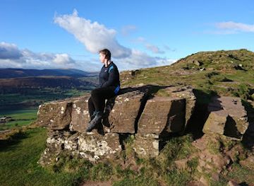
Bannau Brycheiniog National Park (Brecon Beacons)
Explore Wales’ breathtaking Bannau Brycheiniog National Park, where majestic peaks, cascading waterfalls, and rich heritage await every adventurer.
-
History museum
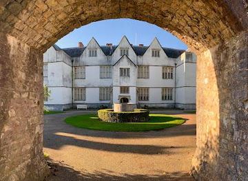
St. Fagans National Museum of History
Discover Wales’s rich heritage through historic buildings, traditional crafts, and scenic parkland at St Fagans National Museum of History.
-
Visitor centre
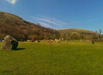
National Showcaves Centre for Wales
Explore ancient caves, giant dinosaurs, and rich history at Wales’ premier underground adventure in the stunning Brecon Beacons National Park.
-
Historical landmark
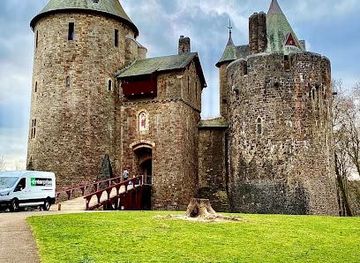
Castell Coch
Discover the whimsical charm and lavish Victorian fantasy of Castell Coch, Wales’ enchanting fairytale castle nestled in ancient woodland.
Best landmarks in Brecon Beacons National Park
Pen y Fan is the park's most recognisable natural landmark, rising above the central Beacons with a broad summit and extensive views when weather permits. The Black Mountain escarpments and the limestone scenery of Fforest Fawr reveal different geological character, while the gorges and cascades of Waterfall Country are shaped by rivers cutting through wooded valleys. Y Garn Goch and other hillforts preserve traces of prehistoric occupation, and the Roman fort of Y Gaer near Brecon marks the area's strategic importance in antiquity. Brecon Cathedral, the ruins and remains of medieval castles around the borderlands, and the Monmouthshire and Brecon Canal represent later religious, political and industrial history. In the south, the coal and iron landscapes associated with Merthyr Tydfil connect the mountains with Wales's industrial past, while the park's dark skies have become a modern environmental landmark.
-
Hotel
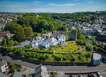
The Brecon Castle Hotel
Historic Wales’ oldest hotel blending timeless charm with modern comforts near Brecon Beacons National Park.
-
Historical landmark
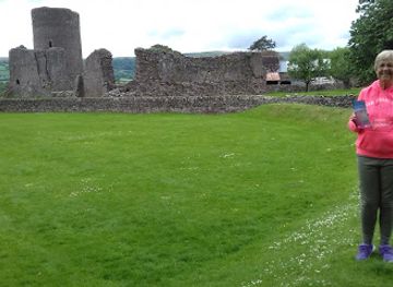
Llys a Chastell Tre-tŵr / Tretower Court and Castle
Medieval fortress and magnificent manor house where 900 years of Welsh power and prestige converge in one extraordinary site.
-
Tourist attraction
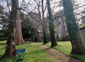
Brecon Cathedral
Nine centuries of faith and heritage in Wales's most unique cathedral close
-
Hostel
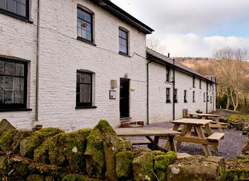
YHA Brecon Beacons
Rustic farmhouse hostel offering clean, cozy accommodation and a warm communal atmosphere in the heart of Brecon Beacons National Park.
Explore Brecon Beacons National Park on the map
Plan your trip on one map. See where the top attractions, landmarks, restaurants and hotels are, and book hotels and experiences in a few clicks.
Best hotels in Brecon Beacons National Park
Best restaurants in Brecon Beacons National Park
Dining is concentrated in gateway towns and villages rather than on the remote mountains. Brecon, Abergavenny, Crickhowell, Hay-on-Wye, Llandovery, Merthyr Tydfil and smaller communities around the park provide cafés, traditional pubs, tearooms and restaurants, while rural inns offer a setting for meals after walking. Welsh produce commonly associated with the region includes lamb, beef, farmhouse cheeses, seasonal vegetables, cakes and locally made beers or ciders, although menus vary by establishment and season. Abergavenny has a particularly strong food identity through its culinary events, independent producers and market traditions, while farm shops and bakeries appear in several gateway settlements. Visitors heading into upland country should not assume that refreshments will be available near a trailhead, and carrying food and water is sensible for longer routes. Reservations may be useful for popular rural dining rooms, especially at weekends and during festivals.
-
Pub
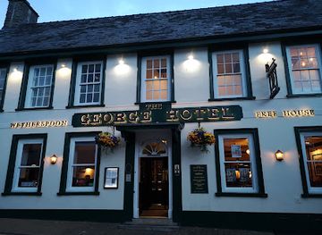
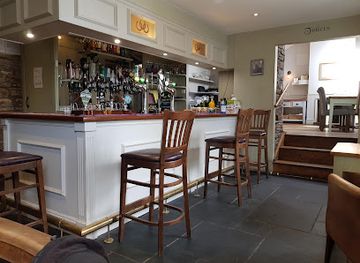
The George Hotel - JD Wetherspoon
A welcoming traditional pub and hotel in Brecon, offering hearty British fare and comfortable rooms near the Brecon Beacons.
-
Gastropub
Penycae Inn Ltd
Experience authentic Welsh hospitality and fine dining in a cozy gastropub with stunning mountain views in Pen-y-cae, Swansea.
-
Restaurant
Hills
Contemporary British dining with local Welsh flavors in a modern, welcoming setting at the gateway to the Brecon Beacons.
-
Gastropub
The Red Lion Inn, Penderyn
A cozy Welsh gastropub blending traditional charm, local flavors, and legendary roasts in the scenic village of Penderyn.
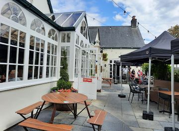
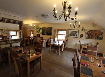
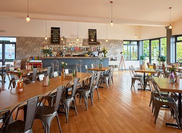
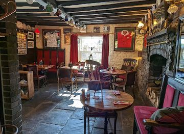
Best bars in Brecon Beacons National Park
Evenings in Bannau Brycheiniog are generally quiet and community-oriented rather than centred on clubs. Traditional pubs and hotel bars in Brecon, Crickhowell, Abergavenny, Hay-on-Wye and other gateway settlements provide places for local ales, Welsh cider, conversation and occasional live music, while village inns may offer a more intimate rural atmosphere. Brecon and Abergavenny have the broadest choice of evening venues, with cultural events and performances sometimes taking place in established arts or community settings. Hay-on-Wye's literary identity can bring talks and festival activity, but event programmes are seasonal and should be checked locally. Away from settlements, the defining evening experience is the dark sky: clear nights can reveal an impressive field of stars, provided visitors respect residents, avoid blocking lanes and use carefully directed, low-level lighting.
-
Pub
The George Hotel - JD Wetherspoon
A welcoming Wetherspoon pub and hotel in Brecon, blending traditional charm with modern comfort and great value dining.
-
Pub
Three Horseshoes Inn
Award-winning gastro-pub in Groesffordd offering seasonal Welsh cuisine, cozy ambiance, and scenic beer garden with private beach huts.
-
Pub
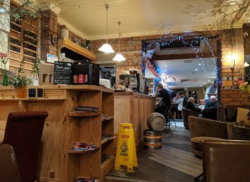
Brecon Tap
Cozy Welsh pub in Brecon offering real ales, homemade pies, live music, and a friendly atmosphere in the heart of the Brecon Beacons.
-
Pub
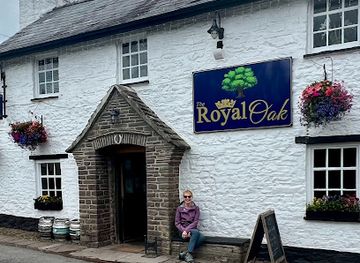
Royal Oak
A traditional Welsh country pub with hearty food, real ales, and a peaceful canalside garden in the heart of the Brecon Beacons.
Best nightclubs in Brecon Beacons National Park
Evenings in Bannau Brycheiniog are generally quiet and community-oriented rather than centred on clubs. Traditional pubs and hotel bars in Brecon, Crickhowell, Abergavenny, Hay-on-Wye and other gateway settlements provide places for local ales, Welsh cider, conversation and occasional live music, while village inns may offer a more intimate rural atmosphere. Brecon and Abergavenny have the broadest choice of evening venues, with cultural events and performances sometimes taking place in established arts or community settings. Hay-on-Wye's literary identity can bring talks and festival activity, but event programmes are seasonal and should be checked locally. Away from settlements, the defining evening experience is the dark sky: clear nights can reveal an impressive field of stars, provided visitors respect residents, avoid blocking lanes and use carefully directed, low-level lighting.
-
Night Club
The Kirkhouse Nightclub (Koolers)
Experience the vibrant and friendly nightlife of Merthyr Tydfil at The Kirkhouse Nightclub, known locally as Koolers.
-
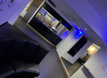
Nightclub
Pure Bar & Nightclub Ltd
A lively nightclub and cocktail bar in Merthyr Tydfil offering vibrant music, crafted drinks, and late-night entertainment in South Wales.

Best shops in Brecon Beacons National Park
Shopping is focused on the park's gateway settlements and is often connected with food, books, craft and rural life rather than large-scale retail. Hay-on-Wye is internationally associated with bookshops and literary events, while Brecon, Abergavenny and Crickhowell offer independent shops, galleries, outdoor equipment, cafés and locally produced goods. Farmers' markets, farm shops and delicatessens may stock Welsh cheeses, preserves, baked goods, cider and other regional produce, with exact availability varying by day and season. Craft traditions represented in the wider area can include textiles, pottery, woodwork, jewellery and contemporary art, often sold through small galleries or studios rather than a single dedicated shopping quarter. Remote valleys have limited retail provision, so visitors staying in rural accommodation should buy essentials in a larger town and treat village shops as important community services rather than guaranteed sources of specialist supplies.
-
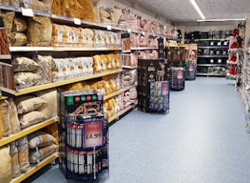
Discount shop
B&M Home Store with Garden Centre
Affordable shopping meets gardening passion at Brecon’s versatile B&M Home Store with Garden Centre.
-
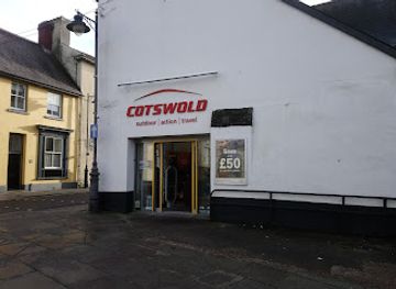
Outdoor clothing and equipment shop
Cotswold Outdoor Brecon
Essential outdoor gear and expert advice in Brecon for hiking, camping, and running enthusiasts exploring the Brecon Beacons.
-
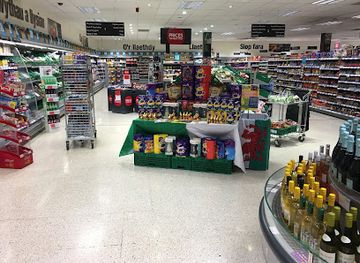
Convenience Store
Co-op Food - Brecon - Lion Street
Your friendly local Co-op Food store in Brecon’s town centre, offering fresh groceries and essentials with convenient hours.
-
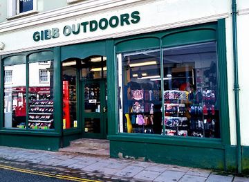
Outdoor clothing and equipment shop
Gibb Outdoors
Trusted outdoor gear and expert advice in the heart of Brecon for all your Welsh adventures.
Get your free copy of our complete guide to Brecon Beacons National Park, delivered straight to you.
Everything on this page, from attractions and restaurants to essentials and local phrases, in one PDF you can read offline, print or share.
Already have an account? Sign in
Your Brecon Beacons National Park guide is ready.
We'll send it to · Not you? Sign out

Getting your guide ready…
We are putting together a fresh copy of the Brecon Beacons National Park guide. This can take up to a minute.
This can take a few moments. If your browser asks, choose Allow so the download can start. You'll find the guide in your Downloads folder.
Nothing happened? Download it again
Sorry, the guide is taking longer than usual. Please try again in a minute, or get it by email instead.
Brecon Beacons National Park essentials
Currency and Payment
Safety
Emergency Situations
Do's and Don'ts
Local Tips
From Eve
Local phrases worth knowing
You don't need to get them perfect. A few words go a long way, and locals appreciate the effort.
Basics
| English | Local | Say it |
|---|---|---|
| Hello | Helo | [heh-lo] |
| Goodbye | Hwyl fawr | [hoyl vowr] |
| Yes | Ie | [yay] |
| No | Na | [nah] |
| Please/You're welcome | Os gwelwch yn dda | [oss gwel-ookh un thah] |
| Thank you | Diolch | [dee-olkh] |
| Excuse me/Sorry | Mae'n ddrwg gennyf | [my-yn droog gen-iv] |
| How are you? | Sut wyt ti? | [sit weet tee] |
| Fine. And you? | Iawn. A ti? | [yown. ah tee] |
| Do you speak English? | Wyt ti'n siarad Saesneg? | [weet teen sha-rad sighs-nehg] |
| I don't understand | Dydw i ddim yn deall | [dih-doo ee thihm un deh-ahl] |
Eating & Drinking
| English | Local | Say it |
|---|---|---|
| I'd like to see the menu, please | Hoffwn i weld y fwydlen, os gwelwch yn dda | [hoff-oon ee weld uh voo-id-len, oss gwel-ookh un thah] |
| I don't eat meat | Dydw i ddim yn bwyta cig | [dih-doo ee thihm un boo-ee-tah keeg] |
| Cheers! | Iechyd da! | [yeh-khid dah] |
| I would like to pay, please | Hoffwn i dalu, os gwelwch yn dda | [hoff-oon ee tal-ee, oss gwel-ookh un thah] |
Emergencies
| English | Local | Say it |
|---|---|---|
| Help! | Cymorth! | [kum-orth] |
| Go away! | Dewch yma! | [day-ukh uh-ma] |
| Call the Police! | Galwch am y plismon! | [gal-ookh am uh plism-on] |
| Call a doctor! | Galwch am feddyg! | [gal-ookh am ved-ig] |
| I'm lost | Dw i wedi colli | [doo ee weh-dee koh-lee] |
| I'm ill | Dw i'n sâl | [doo een sah-l] |
Shopping
| English | Local | Say it |
|---|---|---|
| I'd like to buy... | Hoffwn i brynu... | [hoff-oon ee brin-ee] |
| I'm just looking | Dw i jyst yn edrych | [doo ee just un ed-rikh] |
| How much is it? | Faint mae'n costio? | [vaynt mine kaws-tee-oh] |
| That's too expensive | Mae hynny'n rhy drud | [my huh-nee un hree drid] |
| Can you lower the price? | Allwch chi leihau'r pris? | [ahl-kh choo lay-hai'r prees] |
Time & Numbers
| English | Local | Say it |
|---|---|---|
| What time is it? | Pa amser ydy hi? | [pah am-ser eh-dee hee] |
| It's one o'clock | Mae'n un o'r gloch | [mine een or gloch] |
| Half past (10) | Hanner wedi (10) | [han-er weh-dee (ten)] |
| Morning | Bore | [bore-eh] |
| Afternoon | Pryd dydd | [prid dhee] |
| Evening | Prynhawn | [prin-hown] |
| Yesterday | Ddoe | [thoy] |
| Today | Heddiw | [hed-ee] |
| Tomorrow | Yfory | [uh-vor-ee] |
| 1 | Un | [een] |
| 2 | Dau | [dye] |
| 3 | Tri | [tree] |
| 4 | Pedair | [ped-eye] |
| 5 | Pum | [peem] |
| 6 | Chwech | [khwech] |
| 7 | Saith | [sighth] |
| 8 | Wyth | [wee-th] |
| 9 | Naw | [now] |
| 10 | Deg | [dayg] |
Transport & Directions
| English | Local | Say it |
|---|---|---|
| Where's a/the...? | Ble mae'r...? | [bleh my-are...?] |
| What's the address? | Beth yw'r cyfeiriad? | [beth ee-oo'r kuh-veh-ree-ad?] |
| Can you show me (on the map)? | Allwch chi ddangos i mi (ar y map)? | [ahl-kh choo than-gos ee mee (ar uh map)?] |
| When's the next (bus)? | Pryd mae'r (bws) nesaf? | [prid my-are (boos) ness-av?] |
| A ticket (to ....) | Tocyn (i ....) | [toh-kin (ee ....)] |
History of Brecon Beacons National Park
A Landscape Shaped by Ice and Water
The uplands of Bannau Brycheiniog were formed through long geological processes, including the deposition and erosion of rocks that now create the area's distinctive ridges, escarpments and valleys. Later glacial activity helped shape broad mountain forms and steep-sided landscapes, while rivers continued to cut through limestone and sandstone. In the west, Fforest Fawr contains extensive limestone scenery, including caves, sinkholes and underground drainage. These geological characteristics explain the contrast between open moorland, wooded gorges, waterfalls and fertile valley floors, providing the physical foundation for both settlement and later quarrying, mining and tourism.
Early Communities and Roman Frontiers
People have lived in and travelled through the region since prehistoric times, leaving evidence such as burial monuments, standing stones and hillforts across the uplands and valleys. The Roman presence brought roads, forts and a more formalised frontier to this part of Wales. The Roman fort at Y Gaer, near modern Brecon, was an important military installation, while roads connected the interior with wider networks. Although many prehistoric and Roman remains survive as archaeological traces rather than complete monuments, they show that the mountains were long used as routes, pasture and places of strategic importance.
Brycheiniog and Medieval Wales
The park's Welsh name, Bannau Brycheiniog, refers to the historic kingdom of Brycheiniog, associated with the early medieval ruler Brychan. Medieval political change brought the area into the orbit of Norman lordships, and castles were established at strategic points around the valleys and borderlands. Brecon grew as a centre of administration and trade, while nearby settlements such as Hay-on-Wye, Crickhowell and Abergavenny developed around markets, crossings and fortified sites. Religious foundations, parish churches and surviving castle remains reflect the complex relationship between Welsh rulers, Anglo-Norman lordships and the Marcher border.
Farming, Canals and Industrial Change
For centuries, upland sheep farming and valley agriculture shaped the communities and open character of the region. From the eighteenth and nineteenth centuries, industrial expansion transformed the southern valleys, where coal, iron and limestone were extracted and processed. The Monmouthshire and Brecon Canal, together with tramroads and railways, linked interior resources with industrial centres and markets. Merthyr Tydfil became one of the most important iron-producing towns in Britain, while the surrounding mountains supplied water, minerals and pasture. Abandoned workings, quarries, embankments and engineered waterways remain visible reminders of this period.
Tourism, Conservation and the National Park
Improved roads, railways and the growth of recreational walking brought increasing interest from visitors during the nineteenth and twentieth centuries. Brecon Beacons National Park was designated in 1957, joining a national movement to protect important landscapes while supporting communities and traditional land uses. Conservation work has since addressed habitats, rivers, peatlands, water quality, archaeological remains and visitor pressure. The park's identity has continued to evolve, including the adoption of the official Welsh name Bannau Brycheiniog National Park. Its designation as an International Dark Sky Reserve also reflects a modern commitment to reducing light pollution and valuing the night-time environment.
Brecon Beacons National Park in Photos
Browse through our photo collection highlighting the charm and character of the destination.
Cities in Brecon Beacons National Park
The towns and cities of Brecon Beacons National Park, and the easiest places to base yourself.

Swipe for more cities
Neighbouring destination travel guides
The closest destinations to Brecon Beacons National Park, if you have time for more than one.
-
-

-

-

-


Swipe for more destinations
Explore more

Explore more of Brecknockshire
Explore Brecknockshire in mid-Wales for mountain trails, market towns, castles, bookshops, waterfalls and Welsh food in Bannau Brycheiniog.
Explore Brecknockshire
Explore more of United Kingdom
Discover the United Kingdom: A blend of rich history, stunning landscapes, and vibrant cities, offering a unique travel experience for every visitor.
Explore United Kingdom