Background

Devorgilla Bridge

Medieval bridge spanning the River Nith, named after Lady Devorgilla of Galloway and rebuilt after 17th-century floods.

★★★★★4.6 (217)

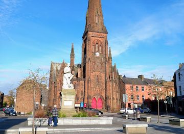
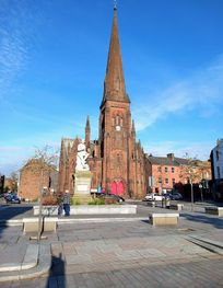
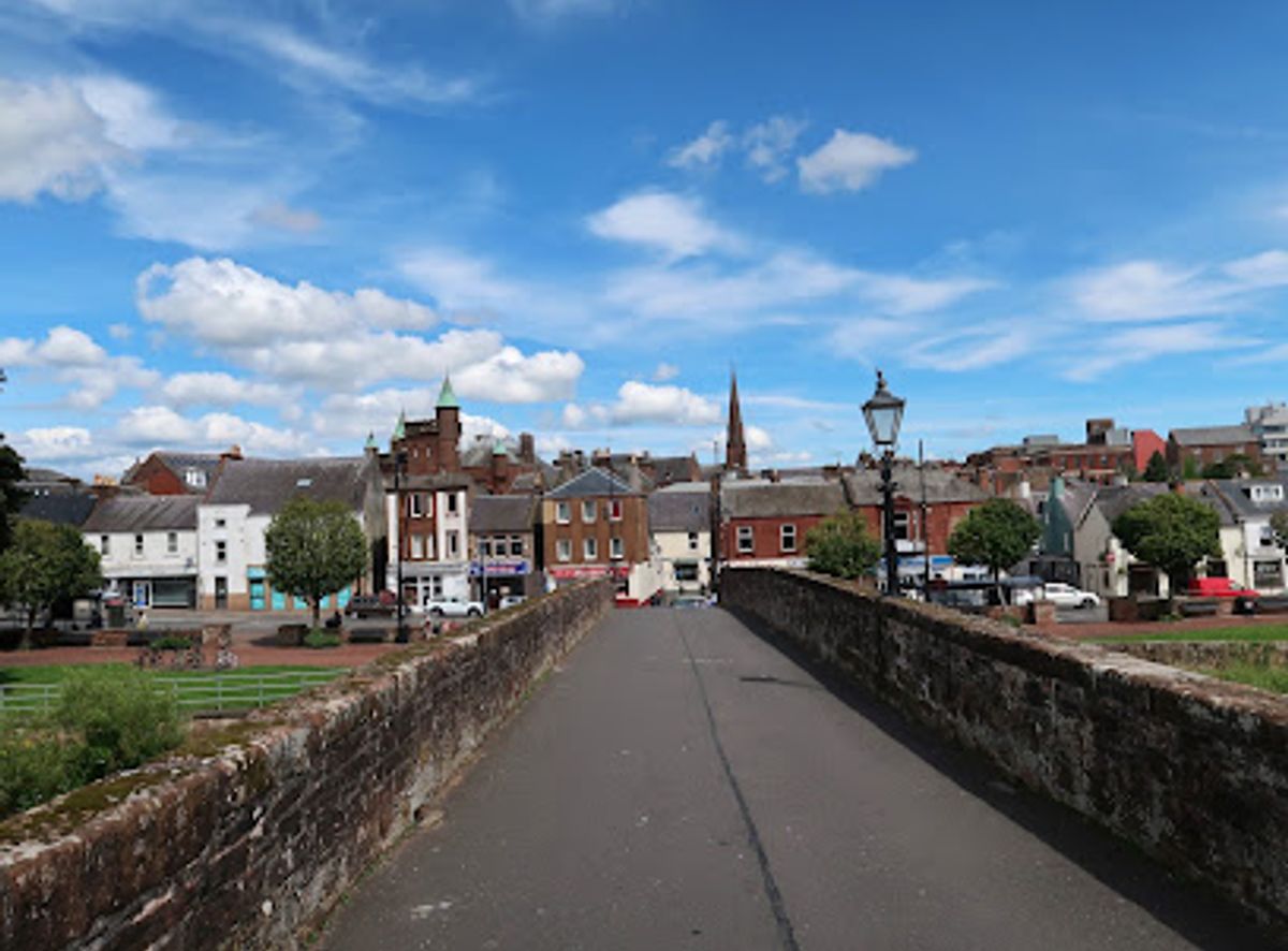
One of Scotland's oldest surviving bridges, Devorgilla Bridge spans the River Nith in Dumfries with six elegant sandstone arches. Named after Lady Devorgilla of Galloway, the mother of King John Balliol, this 17th-century reconstruction replaced an earlier medieval bridge destroyed by floods. The bridge remains a pedestrian crossing today, offering picturesque views of the river and access to the historic Old Bridge House Museum built into its western end.

Plan your visit

A brief summary to Devorgilla Bridge

Opening times, essentials, and a few local tips gathered into one calmer, easier-to-scan planning section.

Plan your visit

📍
Dumfries, GB
💷
Free
🏛
Outdoor
📶
Mobile reception: 5 out of 5

Explore places near Devorgilla Bridge

    See all →

    Unlock the Best of Devorgilla Bridge

    Find tickets, tours with entry, and experiences available for this location.

    Buy tickets

    No tickets available

    Book tours with entry

    No tours with entry available

    Book tours without entry

    No tours without entry available

    Getting There

    Walking from Dumfries Town Centre

    From the High Street in central Dumfries, walk south toward the River Nith. The bridge is approximately 400 meters from the town centre and is clearly signposted. The walk takes about 8–10 minutes on level, paved streets. The bridge is accessible via the town's main pedestrian routes and connects directly to Whitesands, a riverside promenade with free parking.

    By Car with Parking

    Drive to Whitesands car park, located immediately adjacent to the bridge on the eastern bank of the River Nith. Free parking is available with a 2-hour limit. The car park is well-signposted from the town centre and main roads. Journey time from the town centre is approximately 5 minutes. The bridge itself is pedestrian-only; vehicles cannot cross.

    Public Transport

    Dumfries is served by regular bus services from surrounding towns and cities. The main bus station is approximately 600 meters north of the bridge, a 7–9 minute walk downhill to the river. Local buses operate throughout the day; journey times from nearby towns such as Annan (20 minutes) or Stranraer (60 minutes) are typical. Check local timetables for current schedules.

    Cycling

    The bridge is accessible via the River Nith cycle path, which connects Dumfries to surrounding areas. Cycle parking is available near Whitesands. The approach is flat and suitable for all cycling abilities. Journey time from the town centre by bicycle is approximately 5–8 minutes.

    For the on-the-go comforts that matter to you

    Restrooms
    Food Options
    Drinking Water
    Seating Areas
    Information Boards
    Trash Bins

    Local tips

    Visit the Old Bridge House Museum built into the bridge's western end to explore Victorian domestic life and learn about Dumfries's oldest house, including an early dentist's surgery.
    Walk downstream to see the Caul, a historic weir constructed around 1705 that once diverted water to Dumfries Mill and features fish ladders for salmon passage.
    The bridge offers stunning views of the River Nith and surrounding landscape; the best light for photography occurs in late afternoon when the red sandstone glows warmly.
    Combine your visit with a walk to the nearby Robert Burns Centre, located in an 18th-century watermill on the western bank, which tells the story of Scotland's national poet's final years in Dumfries.
    The bridge is a pedestrian-only crossing; the surrounding Whitesands area offers free parking and pleasant riverside walks with abundant birdwatching opportunities.

    Discover more about Devorgilla Bridge

    A Bridge Born from Medieval Vision

    Devorgilla Bridge carries the name of one of medieval Scotland's most influential women. Lady Devorgilla of Galloway, a deeply religious noblewoman and great-niece of William the Lion, ordered the first bridge to be constructed across the River Nith around 1270. This original wooden structure served a crucial purpose: it provided a direct crossing point for pilgrims traveling to Whithorn and for merchants conducting trade between Galloway and the established Royal Burgh of Dumfries, which had been granted its charter in 1186. The bridge became so associated with Devorgilla's legacy that all subsequent stone structures built on the same site inherited her name, cementing her place in Dumfries's enduring history.

    Stone Construction and Medieval Prosperity

    By the 15th century, Dumfries had grown sufficiently prosperous to warrant a permanent stone bridge. Construction began around 1430, and by 1432, Pope Eugenius IV granted a papal indulgence to encourage donations for the bridge's completion. This remarkable ecclesiastical endorsement speaks to the bridge's importance not only locally but across Christendom. The bridge that emerged from this effort stood for nearly two centuries, serving as a vital artery for commerce and pilgrimage until catastrophe struck in 1620 or 1621, when a devastating flood swept away the eastern half of the structure, leaving the remaining sections severely damaged.

    Reconstruction and Resilience

    Following the disaster, the townspeople of Dumfries petitioned King James VI for assistance in rebuilding their bridge. Their eloquent plea, known as the Brig Petition, described how local barons and gentlemen had refused to contribute, forcing the community to undertake the reconstruction themselves. The result was a nine-arch sandstone bridge spanning over 200 feet, built with massive triangular cutwaters on both upstream and downstream sides—a deliberate engineering response to the river's unpredictable temperament. The bridge was constructed from the same distinctive red sandstone that characterizes so many Dumfries buildings, giving it a harmonious appearance within the townscape. Maintenance tolls were introduced in 1681 to fund ongoing repairs, levied on all goods and livestock crossing the bridge or attempting to bypass it.

    Adaptation and Modern Form

    In 1794, reclamation work on the eastern riverbank fundamentally altered the bridge's relationship to the landscape. As the river narrowed and Whitesands was created, three of the eastern arches became redundant and were removed. Access from the eastern side was thereafter provided by a flight of twelve steps, and the bridge's span was reduced to 163 feet. This modification left the bridge in its present six-arch configuration, which remains in use today as a pedestrian crossing. The parapets were rebuilt in 1725, and a tollgate house that once stood at the central refuge was demolished in 1769 to reduce structural weight. When the military road to Portpatrick and Ireland was constructed in 1763, Devorgilla Bridge was incorporated as a key strategic crossing, underscoring its continued importance to regional connectivity.

    The Old Bridge House and Living History

    Built into the south side of the bridge's western end in 1660, the Old Bridge House represents Dumfries's oldest surviving domestic building. Originally constructed as a residence, it later served as an inn during the 18th century and may well have hosted Robert Burns during his time in Dumfries. Today, the house functions as a museum of everyday life, preserving Victorian-era rooms including a family kitchen, nursery, and bedroom, alongside a fascinating recreation of an early dentist's surgery. Interpretive panels and museum trails guide visitors through the intimate domestic spaces and the broader story of life in Dumfries across centuries.

    A Living Monument to Scottish Heritage

    Devorgilla Bridge stands as one of Scotland's most historically significant structures, embodying nearly eight centuries of continuous use and adaptation. From its origins as a wooden crossing commissioned by a noblewoman whose son became King of Scotland, through medieval prosperity and catastrophic flood, to its modern role as a beloved pedestrian bridge, the structure tells the story of Dumfries itself. The bridge's red sandstone arches, graceful proportions, and dramatic setting above the River Nith make it not merely a functional crossing but a cherished landmark that connects visitors physically and imaginatively to Scotland's medieval past.

    Plan around the quieter times

    A quick look at seasonal patterns and peak visiting hours.

    Busiest months of the year

    Seasonality

    Busiest hours of the day

    Footfall
    Mobile App
    Get the app

    Your all‑in‑one travel companion app

    Explore expert travel guides, compare and book tours, experiences, hotels, and more—all from the palm of your hand. Download now for seamless trip planning wherever your wanderlust takes you.

    File:3 of 'The Siege of Caerlaverock Castle. (A poem.)' (11293239115).jpg -  Wikimedia Commons

    More about Dumfriesshire

    Discover Dumfriesshire: Immerse yourself in Scotland's rich history, stunning landscapes, and vibrant arts scene, all nestled in the serene southwest.

    Tell me more about Dumfriesshire

    Select Currency

    Choose the currency you want prices to display in.