
Great Polish Map of Scotland
A life-sized concrete map of Scotland, built by Polish veterans in the Scottish Borders – a unique blend of history, geography, and art in the open air.
Hidden in the grounds of Barony Castle Hotel near Peebles, the Great Polish Map of Scotland is a remarkable, life-sized concrete relief map of Scotland, built in the 1970s by Polish veterans. This unique outdoor monument offers a fascinating blend of history, geography, and art, set within peaceful Scottish countryside. It’s a captivating stop for families, history buffs, and anyone drawn to unusual landmarks.
A brief summary to Great Polish Map of Scotland
- Barony Castle Hotel UK, Peebles, Eddleston, GB
- +441721730395
- Visit website
- Duration: 0.5 to 1.5 hours
- Budget
-
 Outdoor
- Mobile reception: 4 out of 5
- Monday 12 am-12 am
- Tuesday 12 am-12 am
- Wednesday 12 am-12 am
- Thursday 12 am-12 am
- Friday 12 am-12 am
- Saturday 12 am-12 am
- Sunday 12 am-12 am
Local tips
- Visit in dry weather if possible, as the concrete surface can become slippery when wet and some areas may be temporarily closed for safety.
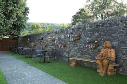
- Combine your visit with a coffee or meal at Barony Castle Hotel, just steps away, to make a relaxed half-day trip out of the experience.
- Bring sturdy shoes and a light jacket, as the site is fully outdoors and exposed to the elements, even on mild days.
For the on-the-go comforts that matter to you
- Restrooms
- Drink Options
- Food Options
- Seating Areas
- Sheltered Areas
- Trash Bins
- Information Boards
Getting There
-
By car
From Peebles, follow the A72 towards Eddleston for about 3 km. The Great Polish Map of Scotland is located within the grounds of Barony Castle Hotel, clearly signposted from the main road. Free parking is available on-site.
-
On foot
From central Peebles, a walking route of approximately 45–60 minutes leads through the countryside to Barony Castle Hotel and the map. The path is on quiet country roads and footpaths, suitable for sturdy footwear but not recommended in poor weather or for those with limited mobility.
-
By local taxi
Taxis from Peebles town centre can reach the map in about 10 minutes. This is a practical option for those without a car, especially in wet or cold weather, with a typical fare of around 15–20 GBP each way.
Great Polish Map of Scotland location weather suitability
-
 Any Weather
-
 Mild Temperatures
-
 Clear Skies
Discover more about Great Polish Map of Scotland
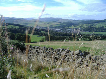
A Giant in the Grass
Tucked into the rolling hills near Peebles, the Great Polish Map of Scotland is a striking, life-sized concrete relief map of the entire country, laid out at a scale of about 1:10,000. Standing at ground level, you can walk around and even step into the map itself, tracing the outline of Scotland with your feet. Rivers, lochs, and mountain ranges are all clearly modelled, with water once flowing through the map’s channels to represent Scotland’s major waterways. The sheer scale and ambition of this outdoor sculpture make it feel like a secret geography lesson brought vividly to life.Forged in Exile
The map was created in the 1970s by Jan Tomasik, a Polish veteran who had fought with the Allies during the Second World War and later settled in Scotland. For him, the map was both a tribute to his adopted homeland and a way to keep his homeland’s story alive. It reflects the deep connection many Polish ex-servicemen and their families felt toward Scotland, where they found refuge and a new life after the war. Over the decades, the map fell into disrepair, but a dedicated restoration project brought it back to life, preserving this poignant piece of cross-cultural history for future generations.Exploring the Map
Today, the Great Polish Map of Scotland is an open-air attraction that invites close inspection and playful exploration. Visitors can walk the length of the country from the Borders to the Highlands, spot familiar landmarks like Ben Nevis and Loch Ness, and imagine what it would be like to travel across this concrete Scotland. Information panels explain the map’s history and construction, and the surrounding grounds offer pleasant paths and views over the surrounding countryside. It’s especially engaging for children, who often treat it as a giant puzzle or game board, but it also holds a quiet, reflective charm for adults.A Quiet Corner of the Borders
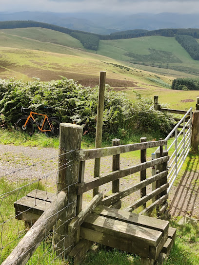
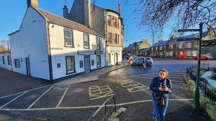
The map sits within the peaceful grounds of Barony Castle Hotel, a few miles from the town of Peebles in the Scottish Borders. The setting is rural and tranquil, with open fields and woodland nearby, making it a pleasant stop on a Borders road trip. The area is known for its walking trails, historic castles, and gentle hills, and the map fits perfectly into this landscape of quiet discovery. Whether you’re passing through or staying nearby, the map offers a memorable pause, combining fresh air, light exercise, and a touch of historical curiosity in one compact site.Iconic landmarks you can’t miss
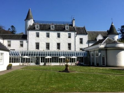
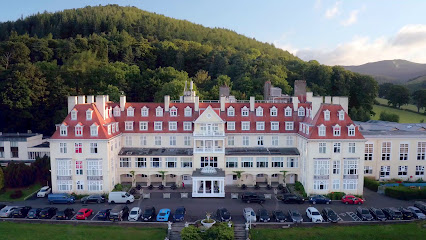
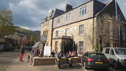
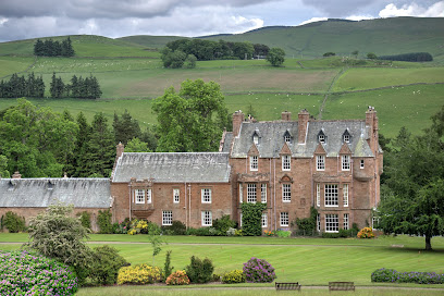
Barony Castle Hotel
0.1 km
Historic 16th-century castle hotel near Peebles with luxury spa, acclaimed dining, and scenic grounds featuring the Great Polish Map of Scotland.
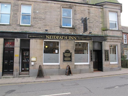
The Neidpath Inn
6.8 km
Experience authentic Scottish hospitality at The Neidpath Inn, featuring cozy accommodations, local cuisine, and vibrant live music in the heart of Peebles.
Peebles Mercat Cross
6.9 km
Historic octagonal stone monument marking Peebles’ medieval market rights and civic heritage, adorned with unique carvings and a 17th-century sundial.
Blackwood & Smith LLP, Solicitors & Estate Agents
6.9 km
Explore Peebles with Blackwood & Smith LLP, your trusted experts in legal services and estate agency for a seamless property experience.
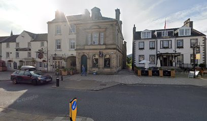
The Tontine Hotel
6.9 km
Historic charm meets modern comfort in the heart of Peebles, with excellent dining and a welcoming atmosphere for all visitors.

The Park
7.0 km
Historic charm and modern comfort meet in the heart of Peebles, with local dining and scenic walks just steps away.
Peebles Hydro Hotel
7.1 km
Historic 4-star hotel with scenic Tweed Valley views, family-friendly leisure, spa, and classic Scottish hospitality in Peebles.
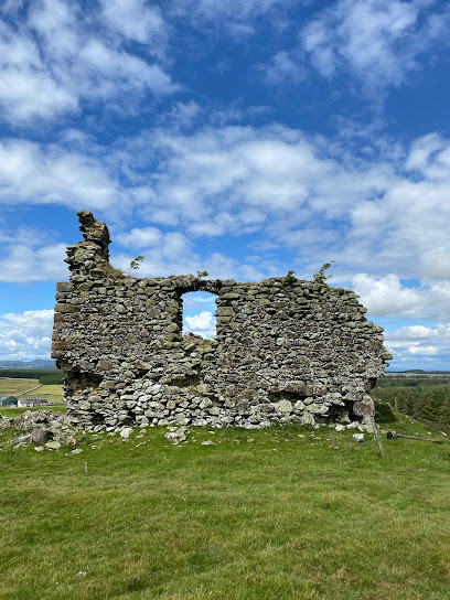
Hirendean Castle
7.4 km
Discover the evocative ruins of Hirendean Castle, a 16th-century peel tower nestled in Scotland’s serene Moorfoot Hills with rich history and haunting legends.
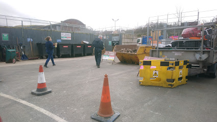
Eshiels Community Recycling Centre
8.2 km
Discover Eshiels Community Recycling Centre: A sustainable initiative in Peebles promoting responsible waste management and eco-friendly practices.
Macdonald Cardrona Hotel
9.9 km
Experience unparalleled luxury and breathtaking views at Macdonald Cardrona Hotel, your perfect Scottish retreat in Peebles.
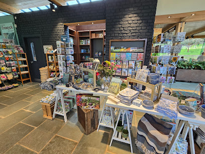
The Dawyck Cafe
13.8 km
A warm, light-filled cafe in the heart of Dawyck Botanic Garden, serving seasonal soups, sandwiches, and excellent home baking with views over 65 acres of woodland.
Biking In The Borders
13.9 km
A spacious, cyclist-friendly holiday home in Innerleithen, perfect for exploring the iconic trails of the Scottish Borders.
Traquair Arms Hotel
14.1 km
Historic 200-year-old coach house hotel and gastro pub offering cozy rooms, hearty local cuisine, and warm hospitality in scenic Innerleithen.
Roslin Parish Church
16.3 km
Explore the historic Roslin Parish Church, a serene haven of spirituality and stunning architecture in the heart of Roslin village.

Roslin Memorial
16.4 km
A serene memorial honoring the 1303 Battle of Roslin, a pivotal Scottish victory during the Wars of Independence.
Unmissable attractions to see
The Horseshoe Inn
0.6 km
Charming gastropub and boutique inn offering refined Scottish dining and cozy stays in the heart of Eddleston near Peebles.
Cringletie Estate
2.6 km
A grand Scottish Baronial house set in 28 acres of gardens and woodland near Peebles, now a luxurious country house hotel with an award‑winning restaurant.
The Meldons
5.1 km
Explore the tranquil twin hills of The Meldons near Peebles, where scenic views and peaceful nature await outdoor lovers and families.
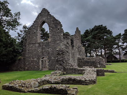
Cross Kirk
6.6 km
Explore the evocative ruins of Cross Kirk, a medieval pilgrimage church in Peebles steeped in sacred relics and centuries of Scottish history.
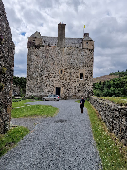
Neidpath Castle
6.7 km
Discover Neidpath Castle, a majestic 14th-century tower house overlooking the River Tweed, rich in history, legends, and stunning medieval architecture.
Peebles Cemetery
6.7 km
Discover Peebles Cemetery, a serene historic burial ground featuring the ancient St Andrew's Tower amidst evocative gravestones in scenic Scottish Borders.
Hay Lodge Park
6.7 km
Peebles’ largest riverside park, blending scenic walks, historic views, and family-friendly spaces along the tranquil Tweed.

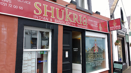
Shukria Indian Cuisine
6.8 km
Authentic Indian and Bangladeshi takeaway in Peebles, serving freshly prepared halal dishes with friendly service and rich flavors.
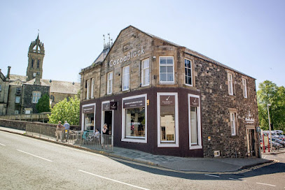
Cocoa Black
6.9 km
Indulge in handcrafted chocolates and exquisite cakes at Peebles’ beloved Cocoa Black boutique and café.
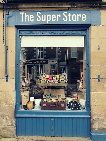
The Super Store
6.9 km
Peebles’ beloved natural foods shop offering organic, vegan, and free-from products in a friendly, community-focused setting.
The Oven Door
6.9 km
Charming courtyard café in Peebles offering homemade bakes, fresh sourdough, and a warm, inviting atmosphere in the heart of the Scottish Borders.
Eastgate Theatre
6.9 km
A vibrant community arts venue in Peebles offering theatre, music, film, and creative workshops in a stunning historic setting.

John Buchan Story Museum
6.9 km
Explore the life and legacy of John Buchan, Scotland’s famed author, in this intimate museum nestled in the heart of Peebles.
Peebles Library
6.9 km
Explore Peebles’ historic Chambers Institution with its vibrant library, museum, and gallery showcasing Borders heritage and art.
Peebles Old Parish Church
6.9 km
A majestic Gothic Revival church standing proudly on Peebles’ historic High Street, blending centuries of heritage and stunning artistry.
Essential places to dine
Scots Pine Restaurant
1.1 km
Cozy English fare and charming afternoon teas served with warmth on the scenic A703 near Peebles.
The Sutherland Restaurant
2.7 km
French fine dining in a historic Scottish country house, where exceptional cuisine meets impeccable service.
From Scratch Restaurant
6.5 km
A family-run dining gem at Peebles Golf Club, serving hearty British and Scottish fare with warm hospitality and lovely course views.
Lychee Chinese Restaurant in Peebles
6.7 km
Authentic Chinese flavors and friendly service come together in Peebles’ cozy Lychee Chinese Restaurant, perfect for evening dining and takeaway.
The Cross Keys - Peebles
6.8 km
A historic and welcoming hotel in Peebles offering cozy rooms, a lively pub, and a perfect base for exploring the Scottish Borders.
The Cozy Kitchen
6.8 km
Exceptional homemade bakes and specialty coffee in Peebles' most welcoming Old Town sanctuary.

Jim Jack's Fish & Chips - Peebles
6.8 km
Classic Scottish fish and chips served fresh and crispy in the heart of Peebles with friendly, made-to-order service.
The Crown Hotel
6.9 km
Historic charm meets modern comfort at The Crown Hotel, Peebles’ cozy and welcoming base in the Scottish Borders.
Green Tree Hotel
6.9 km
Experience comfort and warmth at Green Tree Hotel in Peebles – your ideal base for exploring Scotland's breathtaking landscapes.
Prince of India
6.9 km
Experience authentic Indian and Bangladeshi flavors in the heart of Peebles with warm hospitality and a diverse menu.
Coltman's Kitchen, Deli & Bar
6.9 km
Fresh seasonal fare and relaxed dining with scenic River Tweed views in the heart of Peebles’ historic High Street.
The County
6.9 km
A cozy, dog-friendly pub in Peebles serving hearty food and warm hospitality in the heart of the Scottish Borders.
Franco’s
6.9 km
Cozy family-run Italian restaurant in Peebles offering authentic pizzas, pasta, and vegan-friendly dishes with scenic riverside views.
Bridge Inn
6.9 km
Experience authentic Scottish hospitality at Bridge Inn, Peebles' cozy pub with local ales and hearty meals.
Mandarin Garden
7.0 km
Experience authentic Cantonese and Hong Kong flavors with generous portions and warm hospitality in the heart of Peebles.

Markets, malls and hidden boutiques
Peebles Comics & Games
6.7 km
Discover a vibrant world of comics, games, and collectibles at Peebles Comics & Games, your friendly local hub for nerd culture in the Scottish Borders.
Inis
6.8 km
Discover elegant ladies' fashion in the heart of Peebles at Inis, a boutique blending style, quality, and personalized service.
On A Shoestring
6.8 km
Affordable quality footwear in the historic heart of Peebles’ Old Town, blending style, comfort, and local charm.

The Couchee Righ
6.8 km
Discover authentic Scottish craftsmanship and local treasures in Peebles' most charming gift shop.
Castle Warehouse Ltd
6.8 km
Family-run independent department store in Peebles offering diverse clothing, homeware, and gifts in a historic setting.
Out & About
6.8 km
Discover the best outdoor gear at Out & About in Peebles, where adventure meets quality clothing and equipment for every explorer.
Castle Warehouse Cookshop
6.8 km
Discover a treasure trove of kitchen gadgets, quality cookware, and unique bakeware hire in the heart of Peebles at Castle Warehouse Cookshop.
The Perfect Style
6.9 km
Discover unique ladies' fashion and personal styling in a welcoming boutique setting on Peebles’ historic High Street.
A Wee Treat
6.9 km
Discover quality gifts and local crafts at A Wee Treat, a beloved gift shop in the heart of Peebles, Scotland’s charming Borders town.
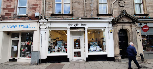
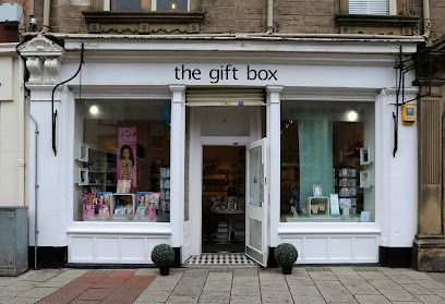
The Gift Box
6.9 km
Discover unique gifts and local crafts in a bright, friendly boutique nestled in the heart of historic Peebles.
The Perfect Fit
6.9 km
A welcoming boutique on Peebles High Street offering quality baby and youth clothing, shoes, and toys with a personal touch.

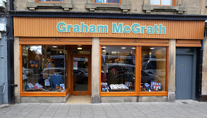
Graham McGrath
6.9 km
Discover timeless menswear and personalized style advice at Graham McGrath, Peebles’ charming boutique for quality fashion.
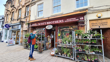
Scott Brothers
6.9 km
A beloved family-run hardware shop in Peebles offering a vast range of home, garden, and DIY essentials with expert local service since 1891.
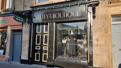
Steffy's Boutique
6.9 km
Vintage elegance and preloved treasures, carefully restored for those who appreciate timeless style.
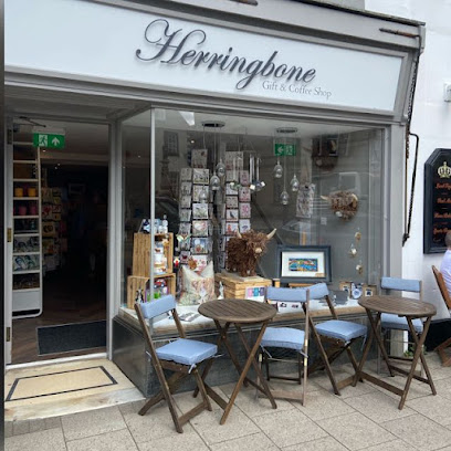
Herringbone Gift Shop and Number Fifty Six Tea & Coffee House
6.9 km
Artisan coffee and curated gifts in a charming Peebles townhouse.
Essential bars & hidden hideouts
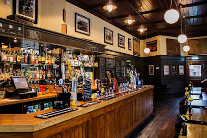
The Central Bar
6.9 km
A cozy and friendly bar in Peebles offering a warm welcome, local drinks, and lively social nights in the heart of the Scottish Borders.
Wild Bean Cafe
7.0 km
Cozy cafe in Peebles serving fresh coffee, pastries, and light meals daily from dawn till late evening.

The Handlebar & Grill Glentress
9.0 km
A cyclist-friendly grill in Glentress offering hearty local dishes, craft beers, and scenic outdoor dining amidst the Tweed Valley’s stunning trails.
Durty Brewing
14.2 km
Discover Innerleithen’s vibrant microbrewery with exclusive craft beers, a cozy taproom, and a welcoming atmosphere for all drink lovers.
The Royal Oak
19.2 km
A cozy and affordable British pub in Bonnyrigg, offering hearty meals, friendly service, and a warm local atmosphere.
The Dean Tavern
19.7 km
A traditional Scottish pub in Newtongrange offering great food, excellent beer, and a warm, welcoming atmosphere for locals and visitors alike.
Laird & Dog Inn
20.1 km
A charming traditional inn in Lasswade offering hearty Scottish fare, friendly service, and a cozy base near Edinburgh.
The Riccarton Inn
21.3 km
Traditional Scottish pub and cozy inn offering real ales, homecooked food, and convenient lodging near Edinburgh in Currie.
Cross Keys
21.9 km
A traditional Scottish pub in Biggar offering hearty fare, quality drinks, and a warm, welcoming atmosphere where friendships are forged.
Ship Inn
22.2 km
A welcoming traditional pub on Dalkeith’s High Street offering hearty fare, local ales, and a friendly community atmosphere.
Old Colliery
22.8 km
Friendly family pub near Edinburgh with hearty food, dog-friendly perks, and a proud mining heritage in a welcoming community setting.
The Hermitage Bar
23.7 km
A welcoming gastropub in Edinburgh’s Morningside offering classic British comfort food, local brews, and a vibrant neighborhood atmosphere.
The Argyle and Cellar Bar
25.2 km
A vibrant Edinburgh pub with cozy cellar music, quality ales, and a welcoming atmosphere in the heart of Argyle Place.
Salisbury Arms Edinburgh
25.3 km
A stylish gastropub blending traditional charm with fresh British fare and vibrant local atmosphere in Edinburgh’s southside.
The Blackbird
25.5 km
Discover the vibrant atmosphere of The Blackbird in Edinburgh, where craft beers and gourmet bites meet in a lively beer garden setting.
Nightclubs & after hour spots
Union Club
14.1 km
A friendly, community-run social club with snooker and events, offering a welcoming and affordable night out in Innerleithen.
The Vale Of Leithen Social Club
14.1 km
A friendly members' club in Innerleithen offering live music, affordable drinks, and a warm community atmosphere.
Club Tropicana
26.3 km
Experience Edinburgh’s vibrant retro nightlife with classic disco hits and lively dance floors at Club Tropicana on Lothian Road.

The Bongo Club
26.3 km
Edinburgh’s underground hotspot blending eclectic music, live art, and a vibrant late-night scene in the historic Old Town.

Legends
26.3 km
Edinburgh’s only 24/7 rock nightclub, Legends pulses with raw energy and live alternative music in the heart of Cowgate.

Sneaky Pete's
26.3 km
Intimate live music and club nights in Edinburgh’s Old Town, where emerging talent meets vibrant nightlife.
The Liquid Room
26.3 km
Edinburgh's multi-level nightlife gem: techno thumps, live gigs, and warehouse vibes on historic Victoria Street.

The Mash House
26.3 km
A vibrant Edinburgh nightclub and live music venue blending folk, electronic, and techno in a lively, casual setting.

La Belle Angele
26.4 km
Edinburgh’s intimate nightclub and live music venue blending historic charm with vibrant themed nights and diverse performances.
Cabaret Voltaire
26.4 km
Vaulted live-music rooms and a relaxed upstairs bar—Cabaret Voltaire is Edinburgh’s atmospheric hub for alternative gigs and late-night clubbing.
PDT Please Don’t Tell
26.4 km
Edinburgh’s intimate speakeasy-style nightclub offering expertly crafted cocktails and a cozy, conversation-friendly atmosphere.

The Hive Nightclub & Venue
26.5 km
Edinburgh's gritty Cowgate nightclub: cheap drinks, multi-room beats, and non-stop energy until 3am in the heart of Old Town.

The Paraffin Lamp
26.5 km
Discover the charm of The Paraffin Lamp in Livingston, where great food, drinks, and local culture come together in a cozy pub setting.

The Shack Retro Bar & Club
26.7 km
Edinburgh's retro dance den blasting 60s-90s hits amid quirky decor and sweaty dance floors—pure nostalgic escapism on Rose Street.

The NewYearField - JD Wetherspoon
26.7 km
Experience the essence of British pub culture at The NewYearField - JD Wetherspoon in Livingston, with delicious food and a vibrant atmosphere.
For the vibe & atmosphere seeker
- Unique
- Scenic
- Tranquil
- Relaxing
For the design and aesthetic lover
- Rustic Designs
- Vintage Styles
For the architecture buff
- Landmarks
- Art & Design
- Parks & Gardens
For the view chaser and sunset hunter
- Panoramas
- Iconic Views
For the social media creator & influencer
- Photo Spots
- Instagrammable
- Aesthetic Corners
For the eco-conscious traveler
- Public-Transport Accessible
- Low Impact
- Protected Area
For the kind of experience you’re after
- Cultural Heritage
- Photowalk
- Roadtrip Stop
- Day Trip
For how adventurous you want the journey to be
- Easy Access
Location Audience
- Family Friendly
- Child Friendly
- Teen Friendly
- Senior Friendly
- Wheelchair Access
- Solo Friendly
- Couple Friendly
- Pet Friendly


